• Skip to primary navigation
  • Skip to main content
  • Skip to primary sidebar

Earth Wise

A look at our changing environment.

  • Home
  • About Earth Wise
  • Where to Listen
  • All Articles
  • Show Search
Hide Search
You are here: Home / Archives for waves

waves

Natural solutions for disappearing islands

June 12, 2025 By EarthWise Leave a Comment

Natural solutions to preserve and protect disappearing atoll islands

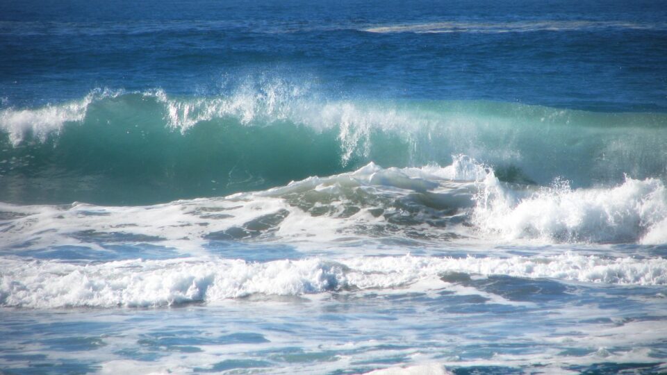
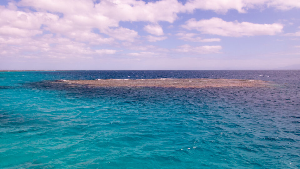
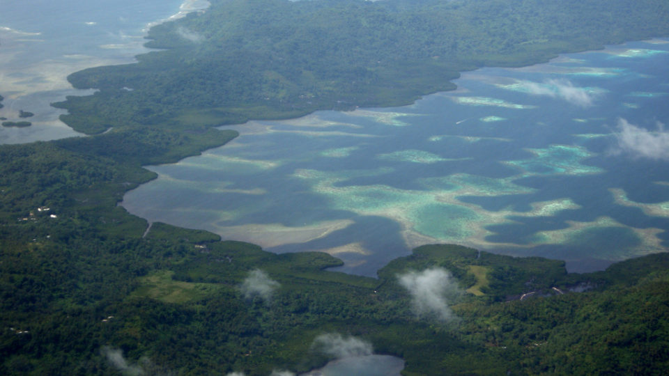
Atoll islands are made from sediment produced by corals, clams, snails, and varieties of algae that secrete carbonate.  Under the right conditions, over time, fragments of coral skeletons, shells, and other sediments made by marine life are piled up by waves.  Eventually, islands are formed – some large and some small.  Atoll islands are home to a diversity of human cultures and are important refuges for a quarter of the world’s seabirds as well as numerous nesting sea turtles and tropical plants.

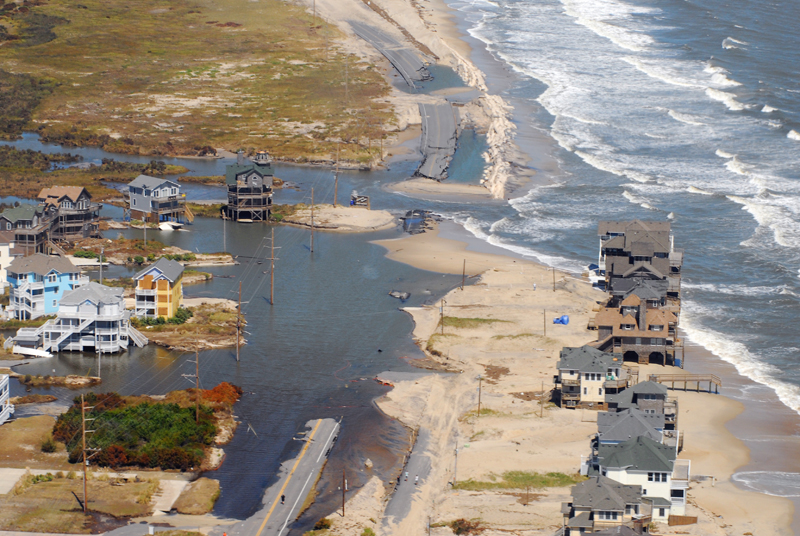
Rising sea levels – the rate of which has more than doubled over the past 30 years – are a mounting challenge for atoll islands.  And by the end of this century, sea level is projected to rise between 11 and 40 inches, depending on the world’s actions with regard to greenhouse gas emissions.

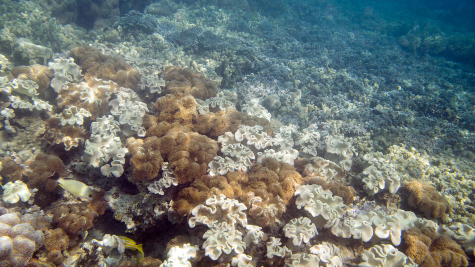
The ability of atoll islands to persist depends on the health of their ecosystems and the extent to which their natural processes have been disrupted by human activity.  To protect the most vulnerable islands, some researchers now propose using nature-based solutions – like restoring and protecting coral reefs and native forests.

Reclaiming seabird habitat can help reefs persist and restore the resilience of atoll islands.  Seabird guano washes off islands and into reefs, providing nutrients that boost coral growth and fish populations. 

Nature-based solutions cannot help the most urbanized atoll islands.  These islands have already irreversibly lost their natural adaptive capacity.  For those places, engineered approaches such as concrete seawalls are needed.

**********

Web Links

How Natural Solutions Can Help Islands Survive Sea Level Rise

Photo, posted July 3, 2014, courtesy of Roderick Eime / MG Media via Flickr.

Earth Wise is a production of WAMC Northeast Public Radio

Wave energy in LA

March 6, 2025 By EarthWise Leave a Comment

Ocean waves form as wind blows over the surface of open water.  Globally, waves contain tremendous amounts of energy.  Theoretically, the energy generating potential of waves off the coasts of the U.S. would meet more than 60% of the country’s electricity needs.  There are a variety of methods and technologies for tapping into this energy source, but none have reached the point of commercial adoption to date.  There are many problems that remain to be solved.

Eco Wave Power, a wave energy company, announced that it has received the necessary permit from the U.S. Army Corps of Engineers to operate the first onshore wave energy installation in the United States.  The installation will be at the Port of Los Angeles at the facilities of AltaSea, a public-private ocean institute that conducts research on food and energy supply, climate change, and ocean exploration.

The system will utilize eight of Eco Wave Power’s energy floaters that will be installed on the piles of an existing concrete wharf structure on Municipal Pier One.  The system will also include an energy conversion unit enclosed in two shipping containers and connected to the floaters.  The installation is expected to be completed by the end of the first quarter of this year.

Floaters draw energy from waves by using their rising and falling motion to generate electricity. The bobbing motion of the floaters compresses and decompresses hydraulic pistons.  These transmit hydraulic fluid into land-based accumulators that build up pressure.  The pressure rotates a hydraulic motor, which then operates a generator, producing electricity.

The project is a collaboration on the development of wave energy in the Port of Los Angeles between Eco Wave Power and Shell Marine Renewable Program.

**********

Web Links

Eco Wave Power secures final USACE permit for its first U.S. wave energy project

Photo courtesy of Eco Wave Power.

Earth Wise is a production of WAMC Northeast Public Radio

Artificial reefs

May 8, 2024 By EarthWise Leave a Comment

The coral reefs that surround tropical islands are a refuge for a wide variety of marine life and also form a natural buffer against stormy seas.  The changing climate is bleaching coral reefs and breaking them down.  Extreme weather events are becoming more common and are threatening coastal communities with flooding and erosion.

Researchers at MIT are designing architected reefs – sustainable offshore structures that mimic the wave-buffering effects of natural reefs and can also provide habitats for fish and other marine life.

There are already artificial reefs in a number of places used to protect coastlines.  These are typically made from sunken ships, retired oil and gas platforms, and even assemblies of concrete, metal, car tires, and stones.  Generally, it takes quite a lot of material to form an effective barrier to waves.

The MIT group has developed a cylindrical structure surrounded by four rudder-like slats.  Their experiments have shown that when this structure stands in the way of a wave, it efficiently breaks the wave and creates turbulent jets that dissipate the energy in the wave.  The engineers calculated that the new design could reduce as much wave energy as existing artificial reefs but use 10 times less material.

Based on the initial experiments with lab-scale prototypes, these artificial reefs would reduce the energy of incoming waves by more than 95%.

Coral reefs are only found in tropical waters, whereas these artificial reefs don’t depend on temperature and could be placed along any coastline for protection.  In a time of rising seas and increasingly frequent storms, these artificial reefs may be just what coastlines need.

**********

Web Links

Artificial reef designed by MIT engineers could protect marine life, reduce storm damage

Photo, posted December 9, 2010, courtesy of Phoenix Wolf-Ray via Flickr.

Earth Wise is a production of WAMC Northeast Public Radio

An ice-free Arctic

April 9, 2024 By EarthWise Leave a Comment

A future ice-free Arctic is very likely as the climate warms

According to a new study by Colorado University, Boulder, the Arctic could see summer days with practically no sea ice as soon as sometime in the next few years.  Earlier predictions for when the first ice-free day in the Arctic could occur were sometime well into the 2030s.

By mid-century, the Arctic is likely to see an entire month without floating sea ice.  This would likely be in September, when ice coverage is at its minimum.  By the end of the century, the ice-free season could last for many months during the year.

Technically, an ice-free Arctic does not mean zero ice in the water.  The working definition is less than 386,000 square miles of ice, which represents less than 20% of what the minimum ice coverage was in the 1980s. In recent years, the coverage has been about 1.25 million square miles.

Sea ice coverage is a big deal because many Arctic animals rely on sea ice for survival, including seals and polar bears.  With warmer ocean water, invasive fish species could move into the Arctic Ocean, upsetting local ecosystems.  Sea ice loss also is a risk for coastal communities because the ice buffers the impact of ocean waves on the coastal land.  As the ice retreats, ocean waves would get bigger, eroding the coasts.

At this point, an ice-free Arctic is basically inevitable, but its annual duration will depend on society’s efforts to reduce carbon emissions.  Lengthy periods of minimal sea ice would transform the Arctic into a completely different environment with global effects that are mostly highly undesirable.  However, Arctic sea ice is resilient and could return fairly quickly if the atmosphere cools down.

**********

Web Links

The Arctic could become ‘ice-free’ within a decade

Photo, posted July 9, 2022, courtesy of Reiner Ehlers via Flickr.

Earth Wise is a production of WAMC Northeast Public Radio

Otters to the rescue

February 23, 2024 By EarthWise Leave a Comment

Otters to the rescue in California

California sea otters were hunted almost to extinction in the 19th century.  Only a small number survived along California’s central coast.  But over time, the otters recovered and increasingly recolonized their former habitats.

Sea otters are playing an important role in safeguarding California’s kelp forests and marshlands against the harmful effects of climate change.

Over much of the 20th century, increasing ocean heat had devastated underwater kelp forests by driving a population explosion of sea urchins that devour kelp.  But sea otters eat urchins and as the sea otter population has grown, kelp has flourished.  According to a new study published in PLOS Climate, the underwater kelp canopy along the central coast increased by 56% since 2016.  Kelp forests have become more extensive and resilient to climate change wherever sea otters have reoccupied the California coastline.

At the same time, sea otters started recolonizing their former habitat in a central California estuary several decades ago and erosion has slowed by as much as 90%.  The main reason is that otters love to eat the marsh crabs that were devouring the plants in this coastal ecosystem.  The marsh plants establish dense root systems that can withstand waves and flooding.  It would cost millions of dollars for humans to rebuild creekbanks and restore these coastal marshes.  Instead, sea otters have been stabilizing them for free in exchange for a crab feast.

Sea otters are playful creatures that people enjoy watching.  It turns out that they are also very valuable ecosystem engineers that are helping to mitigate the effects of the warming climate.

**********

Web Links

How Sea Otters Are Protecting the California Coast Against Climate Change

Photo, posted May 17, 2021, courtesy of Michael L. Baird via Flickr.

Earth Wise is a production of WAMC Northeast Public Radio

Marine Heat Waves | Earth Wise

August 17, 2023 By EarthWise Leave a Comment

Marine heat waves are devastating

In late July, the ocean temperature measured in Florida Bay, between the southern end of the Florida mainland and the Florida Keys, was 101.1 degrees Fahrenheit, a possible world record for sea surface temperature.  There is no official record keeping for ocean temperatures, but the highest previous reading ever reported was 99.7 degrees in the middle of Kuwait Bay in 2020. 

What is going on is a marine heat wave and marine heat waves can last for weeks, months, or even years.  The current Gulf of Mexico marine heat wave has been present for several months, beginning in February or March.  Experimental forecasts by the National Oceanic and Atmospheric Administration say the extreme ocean temperatures in the area may persist through at least October.

The ocean absorbs 90% of the excess heat associated with global warming.  Therefore, marine heat waves all over the planet are becoming warmer over time.  The current marine heat wave would likely have occurred even without climate change, but because of it, the event is extraordinarily warm.

Marine heat waves cause stress to corals and other marine ecosystems.  Exposure to extreme temperatures for long periods of time causes corals to eject the algae that live inside of them, resulting in white or pale coral.  This coral bleaching leaves the coral without food and will ultimately kill it.

In general, extreme heat can be destructive and deadly for marine ecosystems.  A massive marine heat wave known as “the Blob” took hold in 2013-2016 in the northeastern Pacific Ocean and led to an ecological cascade of fishery collapses, toxic algal blooms, and record numbers of humpback whale entanglements.

**********

Web Links

The ongoing marine heat waves in U.S. waters, explained

Photo, posted December 25, 2016, courtesy of Paul Asman and Jill Lenoble via Flickr.

Earth Wise is a production of WAMC Northeast Public Radio

California Flooding | Earth Wise

February 2, 2023 By EarthWise Leave a Comment

Devastating flooding kicks off the new year in California

Starting in December, a series of “atmospheric rivers” brought record storms to California producing as much rain in three weeks in some areas as they normally have in an entire year.  The historic levels of rain (and snow in the mountains) have swollen rivers, flooded roads and homes, forced evacuations, knocked out electric power for millions of people, and resulted in more than 20 deaths.

Atmospheric rivers are air currents that carry large amounts of water vapor through the sky.  They are not unusual for California but recurrent waves of them like those that have happened recently are very infrequent.  Studies by the U.S. Geological Survey have shown that such a phenomenon recurs in California every 250 years.  There were a series of storms causing disastrous floods in California in 1861-62.

The atmospheric rivers are born in the warm waters of the tropical Pacific.  During La Nina phases, the atmospheric rivers typically make landfall on the northern West Coast. During El Nino phases, atmospheric rivers are more likely to end up in Southern and Central California. During transitions between the phases, as is happening now, the storms can cover large parts of the state.

Modern forecasting is pretty good at predicting the forthcoming occurrence of these storms and has led to some helpful actions, such as reservoir operators preventing dams from overflowing or bursting.  But there is a gap between science and decision-making.  It is pretty clear what needs to be done when tornados or hurricanes are on the way.  It is less clear what actions are appropriate when there are going to be repeated heavy rainstorms.

These storms will have an effect on California’s megadrought, but just how much of an effect remains to be seen.

**********

Web Links

Flooding in California: What Went Wrong, and What Comes Next

Photo, posted January 5, 2023, courtesy of Sarah Stierch via Flickr.

Earth Wise is a production of WAMC Northeast Public Radio

Prospects For Floating Solar | Earth Wise

October 10, 2022 By EarthWise Leave a Comment

Floating solar may power the future

Countries are trying to figure out how to get enough energy from solar and wind generation to completely decarbonize their economies.  According to some estimates, nations might have to devote between half a percent and five percent of their land area to solar panels to get the job done.  Half a percent is about the amount of the U.S. that is covered by paved roads.  While there is lots of open land in many parts of the country, covering it with solar panels might not be acceptable to farmers, conservationists, or other interested parties.

One way to deploy more solar panels without using up land is the use of floating solar panels.  Floating photovoltaic systems – also known as floatovoltaics – are becoming increasingly common, especially in Asia.  This year, China installed one of the largest floatovoltaic systems in the world on a reservoir near the city of Dezhou.

Floating solar panels stay cooler and run more efficiently than those on land.  The panels also help prevent evaporation from their watery homes and the shading they provide also help to minimize algal blooms.  Solar installations on reservoirs generally puts them near cities, making it easier to feed power into urban grids.

On the other hand, floating solar systems need to be able to withstand water and waves and are generally more expensive to build than land-based systems.

At present, the installed global capacity of floating solar is only about 3 gigawatts, compared with more than 700 gigawatts of land-based systems. However, reservoirs around the world collectively cover an area about the size of France.  Covering just 10 percent of them with floating solar could produce as much power as all the fossil-fuel plants in operation worldwide.

**********

Web Links

Solar Takes a Swim

Photo, posted March 7, 2019, courtesy of Hedgerow INC via Flickr.

Earth Wise is a production of WAMC Northeast Public Radio

Some Good News For The Great Barrier Reef | Earth Wise

September 5, 2022 By EarthWise Leave a Comment

It seems like there has been nothing but dire news from Australia’s Great Barrier Reef.  Earlier this year, there was yet another mass bleaching event – the fourth in seven years and the first ever to strike during a cooler La Niña phase in the Pacific.  But this bleaching event was less severe than other recent ones, which makes it possible for parts of the reef to bounce back.

In particular, in the northern and central stretches of the reef, scientists have recorded the most extensive coral cover seen in 36 years of study.  In areas where coral cover has expanded, it is mostly fast-growing Acropora corals driving the growth.  That isn’t the best outcome, given that Acropora are particularly vulnerable to strong waves, highly susceptible to bleaching, and are the preferred target of crown-of-thorns starfish.

Those creatures are a major problem for the Great Barrier Reef.  In contrast to the upper stretches of the reef, the southern third actually saw coral cover drop from 38 to 34 percent over the course of the past year.  Scientists blame the decline on an outbreak of crown-of-thorns starfish, which prey on corals.  The starfish grow faster and eat more in warmer, more acidic waters.   Carbon emissions are both raising ocean temperatures and turning waters more acidic.

The large increases in hard coral cover in the reef are certainly good news, but it is important to understand that they can be quickly negated by disturbance on reefs where Acropora corals predominate.  Warming temperatures and mass bleaching events continue to pose a critical threat to all reefs, especially when there are crown-of-thorns starfish outbreaks and increasing frequency of tropical cyclones.

**********

Web Links

Parts of Great Barrier Reef See Most Extensive Coral Cover In 36 Years

Photo, posted July 15, 2019, courtesy of Kenneth Lu via Flickr.

Earth Wise is a production of WAMC Northeast Public Radio.

Trouble For The Outer Banks | Earth Wise

August 9, 2022 By EarthWise Leave a Comment

Rising seas are threatening the Outer Banks

The Outer Banks are a series of barrier islands off the coast of North Carolina that separate the Atlantic Ocean from the mainland.  They are a very popular tourist destination featuring open-sea beaches, state parks, shipwreck diving sites, and historic locations such as Roanoke Island, the site of England’s first settlement in the New World. There is also Kitty Hawk, the site of the Wright Brothers’ first flights.

The ribbon of islands is nearly 200 miles long.  Some of them are low and narrow and are only a few feet above sea level.  Many are especially vulnerable to Nor’easters in the winter and hurricanes in the summer.  The collision of warm Gulf Stream waters and the colder Labrador current helps to create dangerous shoals and some of the largest waves on the East Coast.

Over the years, developers have added billions of dollars’ worth of real estate to the Outer Banks.  Rising sea levels and increasingly frequent storms threaten the barrier islands of the Outer Banks.  Beach-front cottages have tumbled into the ocean for as long as people have built them in the Outer Banks but now they are falling at a greater rate and more and more are in danger.

The Department of Transportation has spent nearly $100 million dollars to keep NC12, the highway connecting the string of islands, open to traffic.  Three new bridges built to traverse inlets opened by storms and bypassing rapidly eroding shorelines raised the cost by another half a billion dollars.

There are many other measures such as pumping sand into eroded areas going on in the Outer Banks, but ultimately, all of the measures may not be enough to deal with rising sea levels and more powerful storms.

**********

Web Links

Shifting Sands: Carolina’s Outer Banks Face a Precarious Future

Photo, posted August 31, 2011, courtesy of NCDOT Communications via Flickr.

Earth Wise is a production of WAMC Northeast Public Radio.

The Hunt For Marine Plastic | Earth Wise

December 21, 2021 By EarthWise Leave a Comment

How to detect and track floating plastic in the oceans

Estimates are that about 10 million tons of plastic enter the ocean every year.  This is equivalent to a truckload of plastic being dumped into the sea every minute and the stuff is not easy to keep track of.  Some of it ends up in the  infamous ocean garbage patches.  But overall, researchers only know what happens to about 1% of it.

The European Space Agency has decided to find out whether it might be possible to detect and track floating plastic in the oceans using satellite monitoring.  Researchers have a variety of ideas about how best to do this and now the agency is testing some of those ideas.

The ESA maintains something called the Atlantic Basin Facility which is a 7000 square-foot tank equipped to simulate various types of waves and tidal currents.  It is the largest facility of its kind in the world.

Researchers place plastic in the basin consisting of typical items found at sea, such as bags, bottles, marine nets and ropes, plastic cutlery, and Styrofoam balls.  The plastic used in the study included material previously recovered from the sea through ocean cleanup campaigns.  Multiple research groups from European universities used specialized instrumentation to monitor the basin from above.  Techniques included radar remote sensing, something called GNSS reflectometry, and specialized optical instrumentation.

Initial results look promising in that under some circumstances teams received useable signals.  It will take further analysis to determine the ultimate utility of space-based monitoring of plastic entering the ocean.  Marine litter is a large and growing problem.  Figuring out where it all is and where it is going is a necessary part of any solution.

**********

Web Links

Hunting for marine plastic

Photo, posted March 24, 2017, courtesy of Holly Richards/USFWS via Flickr.

Earth Wise is a production of WAMC Northeast Public Radio.

The Most Powerful Tidal Turbine Is Generating Power | Earth Wise

October 1, 2021 By EarthWise Leave a Comment

The movement of waves, tides, and currents in the ocean carry enormous amounts of energy that in principle could be harnessed and converted into electricity to help power our homes, buildings, and cities.  Oceans cover nearly three-quarters of our planet, and the most populated areas of the world are located near oceans.

Ocean energy technologies lag far behind solar and wind power and remain mostly undeveloped.  This is a result of the unique challenges standing in the way of widespread deployment.  There are the considerable expenses of early-stage development, the wide variety of technical approaches from which winning strategies have yet to emerge, and the substantial challenges of operating in the ocean environment that include the physical impact of waves and tides, powerful and unpredictable weather, and corrosion and bio-fouling from the ocean and its inhabitants.

Despite these challenges, there is ongoing progress on ocean energy.   The world’s most powerful tidal turbine has come online this past April.  Known as the Orbital O2, the floating turbine is anchored in Scotland’s Fall of Warness, where a subsea cable connects it to the European Marine Energy Center.

The turbine produces enough electricity to meet the demand of about 2,000 homes in the UK.  It is expected to operate for the next 15 years.

Built by the Scottish engineering company Orbital Marine, the O2 was financed by the ethical investment platform Abundance Investment as well as being supported by the Scottish government and the European Union.   Orbital Marine’s goal is to commercialize this technology to play a role in tackling climate change using this new green energy technology.

**********

Web Links

The world’s most powerful tidal turbine is now generating power

Photo, posted June 12, 2015, courtesy of David Stanley via Flickr.

Earth Wise is a production of WAMC Northeast Public Radio.

Tracking Ocean Plastics | Earth Wise

July 30, 2021 By EarthWise Leave a Comment

Using a new technology to track ocean plastics across the globe

Plastic pollution in the oceans is a major problem.  An estimated 8 million tons of plastic trash enters the ocean every year.  Most of it is broken up by sun and waves into microplastics, which are tiny bits that ride currents for hundreds or thousands of miles.  All of this debris is harmful to marine ecosystems, and it is both challenging to track and very difficult to clean up.

University of Michigan researchers have developed a new technique for spotting and tracking ocean microplastics across the globe.  The approach relies on the Cyclone Global Navigation Satellite System, or CYGNSS, which is a constellation of eight microsatellites launched in 2016 to monitor weather near large storm systems.  It turns out that the radar systems on CYGNSS that measure surface roughness to calculate the wind speed near the eyes of hurricanes can also be used to detect the presence of microplastics.

With the satellite measurements, the researchers have found that global microplastic concentrations tend to vary by season, peaking during the summer months.  For example, June and July are the peak months for the Great Pacific Garbage Patch.  The data also showed spikes in microplastic concentration at the mouth of China’s Yangtze River, long suspected to be a chief source of plastic pollution.  The researchers produced visualizations that show microplastic concentrations around the world.

The information provided by the new technique could help organizations that clean up microplastics to deploy ships and other resources more efficiently.  Data of single-point release of plastics, such as from rivers, may also be useful to UNESCO, which has sponsored a task force to find new ways to track the release of microplastics into the world’s waters.

**********

Web Links

Ocean microplastics: First global view shows seasonal changes and sources

Photo, posted April 3, 2018, courtesy of Rey Perezoso via Flickr.

Earth Wise is a production of WAMC Northeast Public Radio.

The World’s Largest Tidal Device | Earth Wise

June 18, 2021 By EarthWise Leave a Comment

the world's largest tidal power device will be operational soon

Most of the world’s activity in renewable energy is focused on solar and wind power.  The use of both is expanding rapidly. But there is also marine energy to be exploited.  Ocean waves and tidal movements hold huge amounts of energy.  Estimates are that the European Union could get 15% of its power from marine sources.  But ocean energy is currently expensive and there are significant technical challenges still to be overcome.

The world’s largest tidal power device will soon begin testing off the coast of Scotland.  The 680-ton, 240-foot-long, airplane-shaped device will be connected to the European Marine Energy Center for testing. 

The device, built by the Scottish company Orbital Marine Power, is designed to produce 2 megawatts of electricity, enough to power 2,000 homes.   It has a pair of 52-foot-long turbines attached to two wings.

Compared to wind and solar power, the marine energy sector has been much slower to develop because of the many difficulties of working in harsh marine environments as well as the technical challenges associated with harnessing power from waves and tides. But ocean waves and tidal movements hold enormous amounts of energy and have the advantage that they are available at all times, unlike wind and solar energy, which are variable in nature. 

Experts say that the future of tidal energy lies with arrays of floating or sea-bottom-mounted turbines that capture the energy of tidal currents in unobstructed waters.  There are various places around the world where this is an attractive opportunity, most notably in Nova Scotia’s Bay of Fundy, where the world’s most extreme tides – rising and falling more than 50 feet – contain vast amounts of power.

**********

Web Links

The World’s Largest Tidal Power Device Will Soon Begin Testing Off Scotland

Photo, posted May 18, 2017, courtesy of Chris via Flickr.

Earth Wise is a production of WAMC Northeast Public Radio.

Solar Cell Greenhouses | Earth Wise

April 21, 2021 By EarthWise Leave a Comment

Using solar panel technology for greenhouses

A recent study at North Carolina State University has shown that it can be feasible to use see-through solar panels in greenhouses to generate electricity.  The idea is to use semi-transparent solar panels on greenhouses that allow some of the light to get in for the plants to grow while making the greenhouses energy neutral or even allowing them to generate more power than they use.

The question is how the semi-transparent solar panels might affect greenhouse crops.  To investigate this issue, researchers grew crops of red leaf lettuce from seed to full maturity under a standard set of growing conditions – temperature, water, fertilizer, and CO2 concentration – but varied the light they get. 

A control group was exposed to the full spectrum of white light while three experimental groups were exposed to light through different types of filters that absorbed the particular wavelengths of light that would be absorbed by different types of semitransparent solar cells.

The researchers paid close attention to characteristics of the lettuce that are important to growers, grocers, and consumers:  general appearance, leaf number, leaf size, and weight.  The results were that the lettuce produced using all three kinds of filtered light was essentially identical to that produced in the control group.    Further research is underway looking at how harvesting various wavelengths of light affects biological processes for lettuces, tomatoes, and other crops.

Getting growers to use solar-powered greenhouses would be very difficult if doing so would result in a loss of productivity.  But given these experimental results, it appears as though the decision will boil down to a simple economic argument about whether the investment in new greenhouse technology would be offset by energy production and its resultant savings.

**********

Web Links

Study Finds Plants Would Grow Well in Solar Cell Greenhouses

Photo, posted April 8, 2008, courtesy of Brian Boucheron via Flickr.

Earth Wise is a production of WAMC Northeast Public Radio.

Tracking Locust Swarms | Earth Wise

June 12, 2020 By EarthWise Leave a Comment

Plagues of locusts have been reported since the times of the Egyptian pharaohs.  In recent history, there have been desert locust plagues during multiple decades of the 20th century.  Since January, a very large population of locusts gathered in Kenya and has destroyed over 2,000 square miles of pasture and crop land.  Swarms have since reached portions of Ethiopia, Somalia, Uganda, and South Sudan.  Apart from East Africa, there are locust swarms in Yemen and other Middle East countries and in Pakistan as well.  The current situation continues to represent an unprecedented threat to food security and livelihoods in East Africa.  Locust swarms can range in size from less than half a square mile to hundreds of square miles, each containing 20 to 40 million locusts.

The National Oceanic and Atmospheric Administration uses a powerful air quality model to track the movement and deposition of pollution from wildfires, volcanoes and industrial accidents.  Called the HYSPLIT dispersion model, it has now been refined for the purpose of tracking swarms of locusts.

Because desert locusts are passive fliers that drift with the wind, the model’s high-quality data on wind speed and direction can lead to accurate predictions of where the locusts will go and when.

NOAA is working with the United Nations Food and Agriculture Organization – the FAO.  The new web application based on HYSPLIT is being used by the FAO to issue forecasts and warnings to affected countries about forthcoming waves of locust swarms.  Such forecasts enable local officials to conduct aerial spraying to reduce the impact of desert locusts which can destroy grains, grasses and other greens that are life-sustaining foods for entire regions.

**********

Web Links

NOAA teams with United Nations to create locust-tracking application

Photo, posted November 20, 2004, courtesy of Niv Singer via Flickr.

Earth Wise is a production of WAMC Northeast Public Radio.

Harvesting Blue Energy | Earth Wise

February 7, 2020 By EarthWise Leave a Comment

researchers closer to harvesting osmotic energy

There are various ways to generate renewable energy from the world’s oceans, most obviously from the power of tides and waves.  But there is also an oceanic energy source called osmotic or “blue” energy.  Osmotic energy uses the differences in pressure and salinity between freshwater and saltwater to generate electricity. 

When freshwater and saltwater are mixed together, large amounts of energy are released. If the freshwater and seawater are then separated via a semi-permeable membrane, the freshwater will pass through the membrane and dilute the saltwater due to the chemical potential difference. This process is called osmosis. If the salt ions are captured completely by the membrane, the passing of water through the membrane will create a pressure known as osmotic pressure. This pressure can be used to generate electricity by using it to drive a turbine.  This has been demonstrated to work as far back as the 1970s, but the materials we have to use are not adequate to withstand ocean conditions over the long term and tend to break down quickly in the water.

New research, published in the journal Joule, looked to living organisms for inspiration to develop an improved osmotic energy system.  Scientists from the U.S. and Australia combined multiple materials to mimic the kind of high-performance membranes that are found in living organisms.  They created a hybrid membrane made from aramid microfibers (like those used in Kevlar) and boron nitride.  The new material provides both the flexibility of cartilage and the strength and stability of bone.

The researchers believe that the low cost and high stability of the new hybrid membrane will allow it to succeed in volatile marine environments.  They also expect the technology will be both efficient and scalable. 

**********

Web Links

Inspired by the Tissues of Living Organisms, Researchers Take One Step Closer to Harvesting “Blue Energy”

Photo, posted February 14, 2017, courtesy of Marian May via Flickr.

Earth Wise is a production of WAMC Northeast Public Radio.

Climate Change And Harsh Winters

July 15, 2019 By EarthWise Leave a Comment

In recent years, there have been some unusually harsh winters in North America and Central Europe. This past January, the Midwestern US experienced extreme cold temperatures. We have all become familiar with the term ‘polar vortex’ and its role in sending cold air to middle latitudes and it is generally agreed that unusual behavior by the jet stream is the primary cause of the extreme winter weather.

For years, climate researchers around the world have been investigating the question as to whether the increasingly common wandering of the jet stream is a product of climate change or is a random phenomenon associated with natural variations in the climate system.

The jet stream is a powerful band of westerly winds over the middle latitudes that push major weather systems from west to east.  These days, the jet stream is increasingly faltering.  Instead of blowing along a straight course parallel to the equator, it sweeps across the Northern Hemisphere in massive waves, producing unusual intrusions of Arctic air into the middle latitudes.

Atmospheric researchers at the Alfred Wegener Institute in Germany have now developed a climate model that can accurately predict the frequently observed winding course of the jet stream.  The breakthrough combines their global climate model with a new machine learning algorithm on ozone chemistry.  Using their new combined model, they can now show that the jet stream’s wavelike course in winter and subsequent extreme weather outbreaks are the direct result of climate change.  The changes in the jet stream are to a great extent caused by the decline in Arctic sea ice, according to the results of the investigations.  The results are not surprising but there is now a detailed model to support the hypothesis.

**********

Web Links

A warming Arctic produces weather extremes in our latitudes

Photo, posted January 11, 2011, courtesy of Carl Wycoff via Flickr.

Earth Wise is a production of WAMC Northeast Public Radio.

Drowning Atolls

June 15, 2018 By EarthWise Leave a Comment

https://earthwiseradio.org/wp-content/uploads/2018/06/EW-06-15-18-Drowning-Atolls.mp3

The rising seas represent an existential threat to low-lying atoll islands and that threat now appears to the more imminent than previously thought.

[Read more…] about Drowning Atolls

Tsunami And Invasive Species

November 13, 2017 By EarthWise Leave a Comment

https://earthwiseradio.org/wp-content/uploads/2017/10/EW-11-13-17-Tsunami-and-Invasive-Species.mp3

According to a new study published in the journal Science, scientists have discovered that hundreds of Japanese marine species have been swept across the Pacific Ocean to the United States following the deadly Tsunami in 2011.        

[Read more…] about Tsunami And Invasive Species

  • Page 1
  • Page 2
  • Go to Next Page »

Primary Sidebar

Recent Episodes

  • An uninsurable future
  • Clean energy and jobs
  • Insect declines in remote regions
  • Fossil fuel producing nations ignoring climate goals
  • Trouble for clownfishes

WAMC Northeast Public Radio

WAMC/Northeast Public Radio is a regional public radio network serving parts of seven northeastern states (more...)

Copyright © 2026 ·