• Skip to primary navigation
  • Skip to main content
  • Skip to primary sidebar

Earth Wise

A look at our changing environment.

  • Home
  • About Earth Wise
  • Where to Listen
  • All Articles
  • Show Search
Hide Search
You are here: Home / Archives for flooding

flooding

Two Lost Lakes Return To California | Earth Wise

May 10, 2023 By EarthWise Leave a Comment

Two lost lakes return to California following recent rains

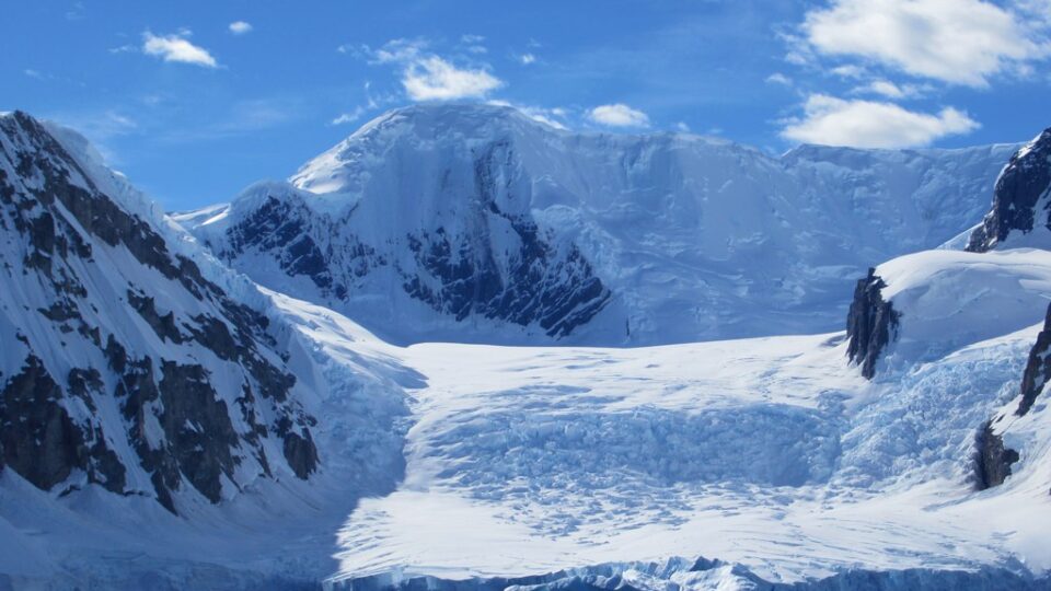
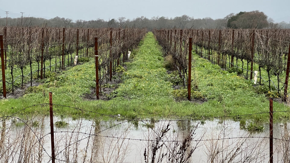
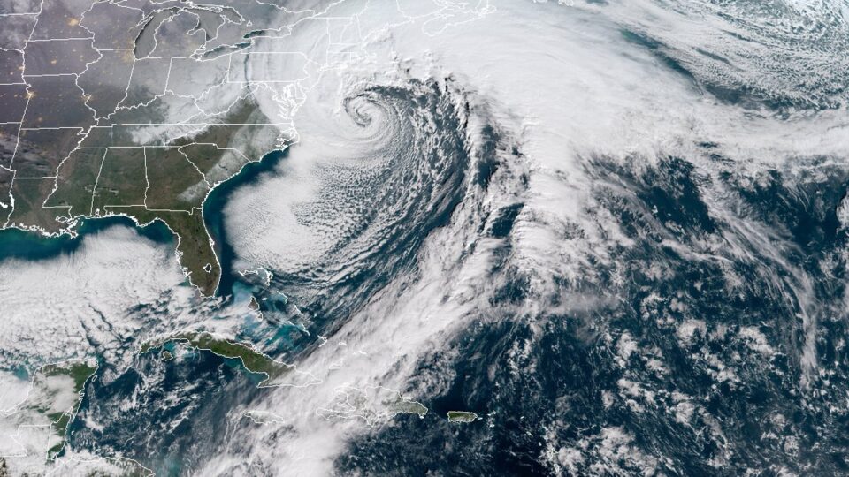
The recent siege of powerful storms in California driven by a series of atmospheric rivers has had a significant effect on the severe drought that has plagued most of the state for many years.  Many of the state’s reservoirs are at the highest level they have been for decades.   The snowpack in the Sierras is well over 200% of its historical average.  Many parts of the state are no longer considered to be in drought conditions, and, in fact, flooding has been a serious problem in some areas.  This flooding has had some surprising results.

Two California lakes that drained a century ago have reappeared as a result of floodwaters from the recent storms.

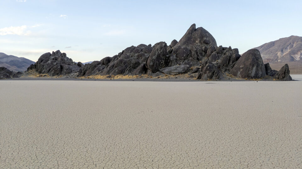
Tulare Lake, in California’s Central Valley used to be fed by rain and snowmelt from the Sierras.  A system of dams and canals constructed in the early 20th century to support regional agriculture diverted water away from the lake.  It used to be the largest freshwater lake in the West but farmers ultimate planted crops in the dried lakebed.

The atmospheric river events in March inundated that farmland and once again there is water in Tulare Lake.

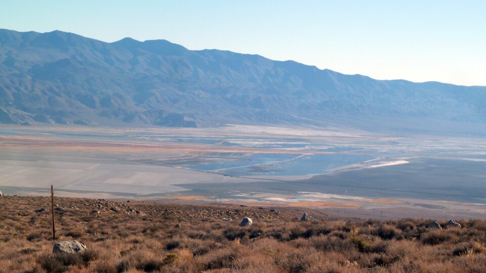
Owens Lake, on the eastern side of the Sierra Nevada, was long fed by mountain streams.  The 1913 construction of the Los Angeles Aqueduct redirected water to that city and desiccated the lake.   Floodwaters in March caused a partial collapse of the aqueduct and when the spill gates on the aqueduct were opened to drain the damaged areas, floodwaters poured in and partially refilled the lake.

California has suffered from drought for many years.  With its massive snowpack, as the weather warms, the state may face even more flooding.

**********

Web Links

Two Long-Drained California Lakes Refilled by Floodwaters, Satellite Images Show

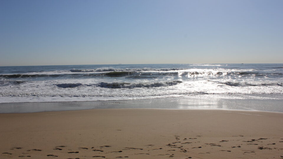
Photo, posted November 10, 2014, courtesy of CN via Flickr.

Earth Wise is a production of WAMC Northeast Public Radio

Protecting New York City From Flooding | Earth Wise

April 21, 2023 By EarthWise Leave a Comment

Hurricane Sandy flooded Lower Manhattan in October 2012, closing Wall Street, blacking out power for 250,000 people, and killing 44 New Yorkers.  Within a year, plans were in motion to build berms, floodwalls, and water gates along the city’s Lower East Side in a $770 million first phase of an overall plan to defend New York City from future floodwaters.

Plans got more and more complicated, and the price tag reached $1.45 billion before the existing plan was scrapped by former Mayor Bill de Blasio’s administration in 2018 without involving the community groups that were instrumental in creating the original plan.  After years of lawsuits and court actions, the revised East Side Coastal Resiliency Project is finally proceeding, now at a price tag approaching $3 billion. The project will include 18 moveable floodgates and will protect 110,000 New Yorkers, including 28,000 low-income public-housing residents and is expected to be completed in 2026.

The original larger overall plan was halted in 2020 after former President Trump mocked it and claimed that it would cost $200 billion.  The current plan, created by the U.S. Army Corps of Engineers and known as the 3B alternative, calls for a combination of deployable flood barriers, floodwalls, seawalls, and elevated promenades wrapping around the lower part of Manhattan.  The cost of the project is estimated to be $61 billion. 

In the meantime, over 10 years after Sandy, a similar storm would have almost the same effect today as Sandy had back then.

**********

Web Links

New York City Begins Its Climate Change Reckoning on the Lower East Side, the Hard Way

Photo, posted January 19, 2013 courtesy of Andres Alvarado via Flickr.

Earth Wise is a production of WAMC Northeast Public Radio

Dangers Of Melting Glaciers | Earth Wise

March 31, 2023 By EarthWise Leave a Comment

The dangers posed by melting glaciers

Some of most dramatic evidence that the Earth’s climate is warming is the retreat and even disappearance of mountain glaciers around the world.  2022 was the 35th year in a row that glaciers tracked by the World Glacier Monitoring Service lost rather than gained ice.  Glaciers gain mass through snowfall and lose mass through melting and sublimation (water evaporating directly from solid ice.)  Some glaciers that terminate in lakes or the ocean lose mass through iceberg calving.

In the warming climate, glaciers retreat and meltwater collects at the front of the glacier forming a lake.  Such lakes can suddenly burst and create a fast-flowing Glacier Lake Outburst Flood that can spread over a large distance from the original site – in some cases over 70 miles.  These floods can damage property, infrastructure, and agricultural land and can also be deadly.

The number of glacial lakes has grown rapidly since 1990 as a result of climate change.  According to research by an international team of scientists led by Newcastle University in the UK, the number of people living in glacial lake catchments has increased significantly.

According to the study, 15 million people live within 30 miles of a glacial lake.  The highest danger is in High Mountain Asia – which encompasses the Tibetan Plateau.  That area, which spans from Kyrgyzstan to parts of China, has 9.3 million people potentially at risk.  India and Pakistan have around 5 million exposed people.

Detailed analysis shows that it is not the areas with the largest number or most rapidly growing lakes that are most dangerous.  It is the number of people in proximity to the lakes and their ability to cope with potential floods.

**********

Web Links

Glacial flooding threatens millions globally

Photo, posted February 12, 2022, courtesy of David Stanley via Flickr.

Earth Wise is a production of WAMC Northeast Public Radio

California Flooding | Earth Wise

February 2, 2023 By EarthWise Leave a Comment

Devastating flooding kicks off the new year in California

Starting in December, a series of “atmospheric rivers” brought record storms to California producing as much rain in three weeks in some areas as they normally have in an entire year.  The historic levels of rain (and snow in the mountains) have swollen rivers, flooded roads and homes, forced evacuations, knocked out electric power for millions of people, and resulted in more than 20 deaths.

Atmospheric rivers are air currents that carry large amounts of water vapor through the sky.  They are not unusual for California but recurrent waves of them like those that have happened recently are very infrequent.  Studies by the U.S. Geological Survey have shown that such a phenomenon recurs in California every 250 years.  There were a series of storms causing disastrous floods in California in 1861-62.

The atmospheric rivers are born in the warm waters of the tropical Pacific.  During La Nina phases, the atmospheric rivers typically make landfall on the northern West Coast. During El Nino phases, atmospheric rivers are more likely to end up in Southern and Central California. During transitions between the phases, as is happening now, the storms can cover large parts of the state.

Modern forecasting is pretty good at predicting the forthcoming occurrence of these storms and has led to some helpful actions, such as reservoir operators preventing dams from overflowing or bursting.  But there is a gap between science and decision-making.  It is pretty clear what needs to be done when tornados or hurricanes are on the way.  It is less clear what actions are appropriate when there are going to be repeated heavy rainstorms.

These storms will have an effect on California’s megadrought, but just how much of an effect remains to be seen.

**********

Web Links

Flooding in California: What Went Wrong, and What Comes Next

Photo, posted January 5, 2023, courtesy of Sarah Stierch via Flickr.

Earth Wise is a production of WAMC Northeast Public Radio

Deforestation-Free Pledges | Earth Wise

December 12, 2022 By EarthWise Leave a Comment

Deforestation pledges are not enough

Deforestation is the purposeful clearing of forested land. Forests are cut down to make space for animal grazing, agriculture, and to obtain wood for fuel, manufacturing, and construction. Deforestation has greatly altered landscapes around the world and continues to do so today. 

Deforestation is the second largest contributor to global greenhouse gas emissions, trailing only fossil fuel use. Deforestation can lead to all sorts of problems, including biodiversity loss, soil erosion, desertification, and flooding.  Deforestation also threatens peoples’ livelihoods and increases inequality and conflict.

As a result, many companies around the world have made pledges to remove deforestation from their supply chains.  In fact, more than 94 companies had adopted zero-deforestation commitments by 2021.  But while these companies are talking the talk, they don’t seem to be walking the walk. 

According to a new study recently published in the journal Environmental Research Letters, companies’ deforestation-free supply chain pledges have barely impacted forest clearance in the Amazon. 

The research team from the University of Cambridge, Boston University, ETH Zurich, and New York University found corporate pledges to not purchase soybeans grown on land deforested after 2006 have only reduced tree clearance in the Brazilian Amazon by 1.6% between 2006 and 2015.  The researchers found that if these pledges had been implemented, the current levels of deforestation in Brazil could be reduced by approximately 40%.  

According to the research team, the findings of the study indicate that private sector efforts are not enough to stop deforestation. Political leadership will also be vital to forest conservation efforts.

**********

Web Links

Companies’ ‘deforestation-free’ supply chain pledges have barely impacted forest clearance in the Amazon, researchers say

Photo, posted November 18, 2020, courtesy of Ivan Radic via Flickr.

Earth Wise is a production of WAMC Northeast Public Radio

The Bengal Water Machine | Earth Wise

October 31, 2022 By EarthWise Leave a Comment

Over the past three decades, the owners of 16 million small farms in the Bengal Basin of Bangladesh have been pumping shallow groundwater during dry seasons to irrigate rice paddies.  By lowering groundwater levels in this way during the dry season, the ability of leakage from rivers, lakes, and ponds to replenish the groundwater was greatly enhanced.   Capturing surface water not only improved the recovery of groundwater levels but only helped to reduce flooding during monsoons.

The net result of this enormous collective groundwater pumping by millions of farmers has been the creation of vast natural reservoirs underground that are comparable to what is contained by many of the world’s largest dams.   This system of sustaining irrigation has transformed what was previously a famine-prone country into a food-secure nation.

The details of this remarkable transformation have been laid out in a study by University College London recently published in the journal Science.  According to the study, over the course of 30 years, more than 75 cubic kilometers of fresh water was captured by this process, which is equivalent to the combined reservoirs of China’s Three Gorges Dam and the Hoover Dam in the U.S.

The authors of the study described the water cycling process as “The Bengal Water Machine” and argue that it can be a sustainable alternative to conventional approaches to seasonal river flow storage for irrigation, which typically involve dams and reservoirs.  Such approaches are difficult to implement in densely populated alluvial plains where sand, silt, and clay are laid down by annual floodwaters. 

**********

Web Links

Millions of farmers “replumb” world’s largest delta

Photo, posted February 2, 2010, courtesy of Melanie Ko via Flickr.

Earth Wise is a production of WAMC Northeast Public Radio

Death Valley Flooding | Earth Wise

September 13, 2022 By EarthWise Leave a Comment

Flooding in Death Valley

Furnace Creek in Death Valley is the driest place in North America.  Its average annual rainfall is under two inches.  On August 5th, a thousand-year rainfall event dropped 1.46 inches of rain – about three-quarters of a year’s precipitation.  The all-time record for a single day is 1.47 inches, set in April 1988.  The storm did break the record for the most rain ever recorded in August, which averages just over a tenth of an inch of rain for the entire month.

The flash flood washed debris over roads, swept away and buried cars, knocked a water facility offline, damaged buildings, and stranded about a thousand visitors and staff in Death Valley National Park. By the next day, the flood water had mostly receded, and stranded visitors could be escorted out of the park by National Park personnel.

Death Valley sits at 282 feet below sea level.  If it were not for the extremely arid climate there, Death Valley would likely be filled with water.  However, humid air masses traveling east from the Pacific Ocean have to cross four mountain ranges before they reach the desert valley.  Those air masses lose their moisture in the form of rain on the western slopes of the mountain, leaving a dry area, or rain shadow, on the eastern sides.  By the time the air masses reach Death Valley, they are bone dry.  On rare occasions, the lowest spot in the valley fills with water forming a wide, shallow lake, known as Lake Badwater. 

The extreme heat and aridity of Death Valley evaporates the temporary lake quickly, returning the valley to its usual state.  Furnace Creek still holds the record for the highest air temperature ever recorded:  134 degrees Fahrenheit.

**********

Web Links

Death Valley Flash Flooding

Photo, posted April 7, 2021, courtesy of Matthew Dillon via Flickr.

Earth Wise is a production of WAMC Northeast Public Radio.

Carbon Dioxide Levels Higher Again | Earth Wise

July 5, 2022 By EarthWise Leave a Comment

The National Oceanic and Atmospheric Administration reported that carbon dioxide levels measured in May at the Mauna Loa Observatory reached a value of 421 parts per million.  This is 50% greater than pre-industrial levels and is in a range not seen on earth for millions of years.

Before the Industrial Revolution, CO2 levels fairly steadily measured around 280 parts per million, pretty much for all 6,000 years of human civilization.  Since the Industrial Revolution began in the 18th century, humans have generated an estimated 1.5 trillion tons of CO2 pollution, much of which will continue to warm the atmosphere for thousands of years.

The present levels of carbon dioxide are comparable to those of an era known as the Pliocene Climatic Optimum, which took place over 4 million years ago. 

The bulk of the human-generated carbon dioxide comes from burning fossil fuels for transportation and electrical generation, from cement and steel manufacturing, and from the depletion of natural carbon sinks caused by deforestation, agriculture, and other human impacts on the natural environment.

Humans are altering the climate in ways that are dramatically affecting the economy, infrastructure, and ecosystems across the planet.  By trapping heat that would otherwise escape into space, greenhouse gases are causing the atmosphere to warm steadily, leading to increasingly erratic weather episodes ranging from extreme heat, droughts, and wildfires, to heavier precipitation, flooding, and tropical storm activity.

The relentless increase of carbon dioxide measured at Mauna Loa is a sober reminder that we need to take serious steps to try to mitigate the effects of climate change.

**********

Web Links

Carbon dioxide now more than 50% higher than pre-industrial levels

Photo, posted December 20, 2016, courtesy of Kevin Casey Fleming via Flickr.

Earth Wise is a production of WAMC Northeast Public Radio.

Sand From Mining Waste | Earth Wise

May 10, 2022 By EarthWise Leave a Comment

The natural resources people use the most are air and water.  It may come as a surprise that in third place is sand.  Sand is used to make glass, computer chips, toothpaste, cosmetics, food, wine, paper, paint, plastics, and more.  It is estimated that 50 billion tons of sand are used each year.

Concrete is 10% cement, 15% water, and 75% sand.  The concrete required to build a house takes on average 200 tons of sand, a hospital uses 3,000 tons, and a mile of a highway requires 15,000 tons.

One would think that there is no shortage of sand, but we are using it up faster than the planet can make it and the extraction of sand from seas, rivers, beaches, and quarries has negative impacts on the environment and surrounding communities.  For example, removing sand leads to erosion in riverbanks, significantly increasing the risk of flooding in some places.

A potential strategy to reduce the impact of extracting sand to meet society’s growing need for is also a strategy for helping to reduce the production of mineral mining waste, which is the largest waste stream on the planet.  Mining produces between 33 and 66 billion tons of waste material each year.

A new study by researchers in Switzerland and Australia looked at the potential for using mining waste as a source of so-called ore-sand.  Sand-like material left over from mining operations could be used for many current applications for sand.  Separating and repurposing these materials before they are added to the waste stream would not only reduce the volume of waste being generated by mining operations but would also create a responsible new source of sand.

**********

Web Links

Solution to world’s largest waste stream: Make sand

Photo, posted October 22, 2005, courtesy of Alan via Flickr.

Earth Wise is a production of WAMC Northeast Public Radio.

Climate Change And Hurricanes In The Northeast | Earth Wise

February 9, 2022 By EarthWise Leave a Comment

Climate change making hurricanes in the Northeast more likely

According to a new study led by Yale University, more hurricanes are likely to hit Connecticut and the northeastern U.S. as global warming continues to increase temperatures in the region.

Hurricane Henri made landfall in August as a tropical storm on the Connecticut/Rhode Island border.  In September 2020, subtropical storm Alpha made landfall in Portugal, the first subtropical or tropical cyclone ever observed to make landfall in the mainland of that country.

Tropical cyclones, hurricanes, and typhoons are typically intense and destructive in the lower latitudes. 

The study concludes that violent storms could migrate northward in our hemisphere and southward in the southern hemisphere as a result of warming caused by greenhouse gas emissions.

The research predicts that tropical cyclones will likely occur over a wider range of latitudes than has been the case on Earth for the last 3 million years.

In Connecticut, Hurricane Henri was not the only tropical storm to affect the region in 2021.  The remnants of Hurricane Ida brought damaging winds and torrential rain that felled trees and flooded streets and basements.

The northern expansion of such violent storms is going on as water levels in the Atlantic Ocean and Long Island Sound keep rising.  Because of melting glaciers thousands of miles away, water levels in Long Island Sound could rise by as much as 20 inches by 2050, enough to submerge parts of Groton’s shore and cause regular flooding in roads and neighborhoods.

Future hurricane prediction is an inexact science, but the ongoing trends do not bode well for the region.

**********

Web Links

More hurricanes likely to slam Connecticut and region due to climate change, says study

Photo, posted October 29, 2012, courtesy of Rachel via Flickr.

Earth Wise is a production of WAMC Northeast Public Radio.

Keeping Venice From Flooding | Earth Wise

January 6, 2022 By EarthWise Leave a Comment

Venice can hold back the Adriatic Sea

Since 2003, Venice Italy has been building a system of mobile gates at three inlets to its famous lagoon.  The project is called MOSE, the Italian word for Moses, but is actually an acronym for the Italian words meaning Experimental Electromechanical Module.  

The 78 mobile gates are metal box structures that sit at the bottom of inlet channels.  When a high tide is predicted, compressed air is pumped into the structures.  The air causes the barriers to rise up to the surface and block the flow of the tide, thereby preventing water from flowing into the lagoon.

The system had an important test on November 3 when water levels were predicted to rise four-and-a-half feet above normal at high tide and strong winds were blowing.  Water at that level is enough to flood 60% of the city, including the famous St. Mark’s Square, which is unfortunately the lowest part of the city.

Activating the flood gates proved to be successful.  Even though high tide water levels in fact rose 4.3 feet in the surrounding Adriatic Sea, they only reached 2.7 feet in Venice, which was enough to prevent significant flooding.

Rising sea levels have led to increasingly frequent floods in Venice.  In 2019, before the MOSE system was available for use, there were more than 25 high-water events swamping Venice, including one in November of that year that was the second worst on record.

Some researchers have calculated that the system will need to be closed for as much as 3 weeks a year by the end of the century even if emission reductions are reasonably effective.  If they aren’t, the gates may be closed for at least two months a year by 2080.

After many years of delays, setbacks and controversies, the system is finally operational.

**********

Web Links

Venice Holds Back the Adriatic Sea

Photo, posted October 25, 2014, courtesy of Pedro Szekely via Flickr.

Earth Wise is a production of WAMC Northeast Public Radio.

Bomb Cyclones | Earth Wise

December 2, 2021 By EarthWise Leave a Comment

Extreme weather phenomena becoming increasingly common

It seems like we are hearing about new weather phenomena pretty frequently these days.  One name that has popped up lately is “bomb cyclones.”  Bomb cyclones, it turns out, are storms that undergo “bombogenesis.”  What that means is a low-pressure area (in other words, a storm) that undergoes rapid strengthening and can be described as a weather bomb, or popularly, a bomb cyclone.

These things usually take place over remote tropical ocean areas but a really intense one struck the Pacific Northwest on October 24th.  The storm off the coast of Washington, with a barometric pressure reading equivalent to a category 4 hurricane, was the second extreme low-pressure storm in the North Pacific in a single week.  Both storms involved pressure drops of more than 24 millibars in 24 hours, making them bomb cyclones.

These storms brought high winds and extreme precipitation that doused wildfires and provided some relief to the extreme drought in Central and Northern California.  Along with these positive effects, however, the storms also caused power outages, flooding, landslides, and mud and debris that washed out roads.

The October 24-25 event brought 16.55 inches of rain to Mount Tamalpais in Marin County, California in a 48-hour period.  Sacramento got 5.44 inches of rain, breaking a 140-year-old record.  And the city had just broken another extreme weather record for the longest dry spell in history.

The storms directed streams of moisture from north of Hawaii toward the West Coast in long, narrow bands of moisture known as atmospheric rivers.  We are learning about all sorts of unfamiliar weather phenomena as extreme weather events become increasingly common.

**********

Web Links

Extratropical Cyclones Drench West Coast

Photo, posted January 4, 2018, courtesy of NOAA/CIRA via Flickr.

Earth Wise is a production of WAMC Northeast Public Radio.

Coastlines and Climate Change | Earth Wise

August 16, 2021 By EarthWise Leave a Comment

Scientists predict how climate change will affect coastlines

Climate change poses a fundamental threat to life on earth and has already left observable effects on the planet.  For example, glaciers have shrunk, oceans have warmed, heatwaves have become more intense, and plant and animal ranges have shifted. 

As a result of the changing climate, coastal communities around the world are confronting the increasing threats posed by a combination of extreme storms and the predicted acceleration of sea level rise. 

Scientists from the University of Plymouth in England have developed a simple algorithm-based model to predict how coastlines could be affected by climate change.  This model allows coastal communities to identify the actions they need to take in order to adapt to their changing environment.

The Forecasting Coastal Evolution (or ForCE)  model has the potential to be a game-changer because it allows adaptations in the shoreline to be predicted over timescales of anything from days to decades. As a result, the model is capable of predicting both the short-term impact of extreme storms as well as predicting the longer-term impact of rising seas.   

The ForCE model relies on past and present beach measurements and data showing the physical properties of the coast.  It also considers other key factors like tidal, surge, and global sea-level rise data to assess how beaches might be impacted by climate change.  Beach sediments form the frontline defense against coastal erosion and flooding, and are key in preventing damage to valuable coastal infrastructure.

According to the study, which was recently published in the journal Coastal Evolution, the ForCE model predictions have shown to be more than 80% accurate in current tests in South West England.

**********

Web Links

New model accurately predicts how coasts will be impacted by storms and sea-level rise

Photo, posted April 17, 2016, courtesy of Nicolas Henderson via Flickr.

Earth Wise is a production of WAMC Northeast Public Radio.

Rising Seas And Wastewater Leakage | Earth Wise

April 28, 2021 By EarthWise Leave a Comment

Rising seas will further damage coastal wastewater infrastructure

Global mean sea level has risen nearly 9 inches since 1880, with over two inches of that over just the last 25 years.  The rising water level is primarily due to two factors:  additional water in the oceans coming from melting glaciers and ice sheets; and the thermal expansion of seawater as it warms.  Climate models estimate that over the course of the century, global sea levels will rise at least a foot even if efforts to reduce greenhouse gas emissions are quite successful and, in the worst case, levels could rise as much as 8 feet.

Faced with this situation, the greatest concerns are, initially, increasing amounts of coastal flooding and erosion and, as things get worse, inundation of coastal regions making many places uninhabitable and creating millions of climate refugees.

Recently, computer modeling studies have focused on an additional imminent problem:  the flooding of coastal wastewater infrastructure, which includes sewer lines and cesspools.

A new study by the University of Hawaii at Manoa is the first to provide direct evidence that tidally driven groundwater inundation of wastewater infrastructure is already occurring in urban Honolulu.  The study shows that higher ocean water levels are leading to wastewater entering storm drains and the coastal ocean.  The result is degradation of coastal water quality and ecological health.

The researchers used chemical tracers to detect groundwater discharge and wastewater present at multiple low-lying areas during spring tides.  During high tides, storm drains become channels for untreated wastewater to flood streets and sidewalks. 

People tend to think of sea-level rise as a future problem, but there are already serious effects going on today that are only going to get worse.

**********

Web Links

Sea-level rise drives wastewater leakage to coastal waters

Photo, posted August 23, 2011, courtesy of Eric Tessmer via Flickr.

Earth Wise is a production of WAMC Northeast Public Radio.

Global Warming Could Stabilize | Earth Wise

February 19, 2021 By EarthWise Leave a Comment

Reducing emissions could stabilize global temperatures

The world has been heading toward climate disaster with the effects of greenhouse gas-induced warming looming larger and larger.  But recent analysis published in Nature Climate Change offers hope that rapidly eliminating emissions could stabilize global temperatures just within a couple of decades.

For quite some time, it has been assumed that further global warming would be locked in for generations regardless of the extent of emissions reductions going forward.  This conclusion was based on having a certain carbon dioxide concentration in the atmosphere which would linger for hundreds of years even if emissions were reduced.

Recent analysis takes into account the dynamism of the Earth’s natural systems which could actually reduce atmospheric CO2 content because of the huge carbon absorption capacity of oceans, wetlands, and forests.  The key requirement is to drastically reduce emissions so that these natural systems can take over.

More than 100 countries have pledged to get to net zero emissions by 2050.  That means they will emit no more carbon dioxide than is removed from the atmosphere by such actions as restoring forests.   The UK, Japan, and the European Union are among the countries that have set this zero target, and the United States is joining the club.

Climate models show that a global temperature rise of 2 degrees Celsius over that of the pre-industrial period would lead to global calamities that include punishing heatwaves, flooding, and mass displacement of people.  The world has already heated up by 1.1 degrees and governments have committed to restrain the rise to less than 1.5 degrees under the Paris Climate Agreement.

**********

Web Links

Global Warming Could Stabilize Faster than Originally Thought If Nations Achieve Net Zero

Photo, posted September 10, 2017, courtesy of Ron Cogswell via Flickr.

Earth Wise is a production of WAMC Northeast Public Radio.

Once In A Lifetime Floods And Climate Change | Earth Wise

January 8, 2021 By EarthWise Leave a Comment

Climate change is worsening flooding

Superstorm Sandy was the deadliest hurricane of 2012 and one of the most destructive hurricanes ever to hit the United States.  According to the National Oceanic and Atmospheric Administration, Superstorm Sandy caused an estimated $74.1 billion dollars in damages.  That figure made it the fourth-costliest storm in U.S. history, trailing only Hurricane Katrina in 2005 and hurricanes Harvey and Maria in 2017.  Superstorm Sandy affected 24 states and all of the eastern seaboard.  

New York was one of the states pummeled by Superstorm Sandy.  The storm brought flood-levels to the region that had not been seen in generations.  But according to a new study published in the journal Climatic Change, those flood levels could become much more common. 

Researchers at Stevens Institute of Technology have found that 100-year and 500-year flood levels could become regular occurrences by the end of the century for the thousands of homes surrounding Jamaica Bay, NY.  The researchers say climate change is the culprit.  

Using anticipated greenhouse gas concentration levels, the research team created simulations to find the probability of different flood levels being reached by the end of the century.  The researchers found that the historical 100-year flood level would become a one-year flood level by the year 2100.  500-year floods, like Superstorm Sandy, would become a four-year flood level by the end of the century. 

While this particular study is specific to Jamaica Bay, it does serve as an example of just how severe and costly the consequences of climate change will be.   

*********

Web Links

Once in a lifetime floods to become regular occurrences by end of century

Photo, posted October 29, 2012, courtesy of Rachel via Flickr.

Earth Wise is a production of WAMC Northeast Public Radio.


Fall Safety Tips | Earth Wise

November 4, 2020 By EarthWise Leave a Comment

Tips for fall safety

The fall season has its own weather-related hazards, such as raging wildfires across the West and a busy hurricane season in the Atlantic.  There might even be snow in some places.  The National Weather Service issued a set of four broad safety tips for being prepared for the dangers of fall weather.

With regard to wildfires, it is important for smokers to properly discard cigarettes, for people to avoid activities with open flames or sparks, and to use fire-resistant landscaping around our homes. The Weather Service issues Red Flag Warnings when conditions are ripe for wildfires.

In this busy hurricane season, even people who don’t live in hurricane surge evacuation areas need to know their home’s vulnerability to damage from high winds and inland flooding.  People should have a plan that includes an emergency kit and a safe place to shelter should they need to evacuate.

It is important to have a plan in case strong winds pose a threat.  When preparing for an extreme wind event, secure objects that can be tossed or rolled, trim trees near homes, and have a plan in case of an extended power failure.  Strong winds can even happen on a clear day.

The key advice in case you encounter flood waters is “turn around, don’t drown.”  It is never safe to walk or drive into a flooded roadway.  It is best to delay travel until roads are clear.

Fall can be the most beautiful season of the year, but it also has its dangers.  Following advice such as that provided by the Weather Service is prudent and potentially life-saving.

**********

Web Links

Four safety tips for fall hazards: Small actions can have big impacts

Photo, posted October 30, 2014, courtesy of Virginia State Parks via Flickr.

Earth Wise is a production of WAMC Northeast Public Radio.

Saharan Dust And The Amazon | Earth Wise

October 23, 2020 By EarthWise Leave a Comment

Saharan dust and the amazon

We talk about globalization primarily in the context of how human activities connect up distant parts of the world.  But there are natural processes that are global in scope as well.  One of these is the transportation of mineral-rich dust from the Sahara Desert in North Africa to the Amazon Basin in South America.

Every year, this dust is lifted into the atmosphere by winds and carried on a 5,000-mile journey across the North Atlantic.  It turns out that this dust plays a critical role in the Amazon basin ecosystem.  The Amazon Basin in turn plays a major role in global climate.  Its trees and plants remove huge quantities of carbon dioxide from the atmosphere and stores the carbon in vegetation.

The transcontinental journey of dust is important because of what is in the dust.  The dust picked up from ancient lake beds in Chad comes from rock minerals formed by dead microorganisms and is loaded with phosphorus.  Phosphorus is an essential nutrient for plant growth and is in short supply in Amazonian soils.  Local nutrients like phosphorus in the Amazon mostly come from fallen, decomposing leaves and organic matter but tend to be washed away by rainfall into streams and rivers. 

Studies have shown that the phosphorus that reaches Amazon soils from Saharan dust is essential to replace the amounts lost to rain and flooding.

Recent research has found that the quantities of dust transported to South America are inversely linked to rainfall in North Africa and is likely to be affected by climate change.  Changes in dust transport could affect plant growth in the Amazon and the amount of CO2 removed from the atmosphere.  The forces that affect the climate are truly global in nature.

**********

Web Links

Study quantifies Saharan dust reaching Amazon

Photo, posted April 19, 2011, courtesy of CIAT via Flickr. Photo credit: ©2011CIAT/NeilPalmer.

Earth Wise is a production of WAMC Northeast Public Radio.

The Changing Climate Is Changing Insurance

October 21, 2020 By EarthWise Leave a Comment

Climate Change is Changing Insurance

As the climate changes, wildfires get bigger and more destructive and hurricanes and powerful storms are more frequent and damaging.  In places where these things are occurring, it is getting harder and more expensive for many homeowners to get insurance.  The affordability of home insurance in the face of climate change has become a huge issue in many states.

In California, the number of homeowners who got non-renewal notices from their insurance companies rose by 6% between 2017 and 2018.  In areas directly affected by wildfires between 2015 and 2017, that number jumped by 10%. Similar things have happened in Florida, Louisiana, Mississippi, and Texas, where hurricanes and flooding have caused extensive damage.  Because of this, many homeowners have been forced to turn to bare-bone plans such as the California Fair Access to Insurance Plan, which can cost two or three times as much as normal insurance policies.

According to a 2019 survey of insurance companies, more than half of insurance regulators said that climate change was likely to have a high impact or an extremely high impact on the availability of insurance coverage and the assumptions used for underwriting.  In the past, governments have been able to mandate coverage in certain areas or even provide coverage themselves in some cases.  As the occurrence of climate-related damage becomes increasingly frequent, homeowners have to face up to a grim reality.

The challenges of dealing with wildfires, floods, powerful storms, and the like are significant enough for people who live in high-risk areas.  Increasingly, home insurance in these places is becoming much more expensive, harder to find, and is worth less.

**********

Web Links

As Climate Impacts Worsen, Homeowners Struggle to Find Affordable Insurance

Photo, posted September 1, 2020, courtesy of The National Guard via Flickr.

XXXXXXXXXXXXXXXXX

Land Use Change And Flooding | Earth Wise

September 30, 2020 By EarthWise Leave a Comment

Land use change leads to increased flooding

Land use change refers to the conversion of a piece of land’s use by humans from one purpose to another. Land use change is commonly associated with biodiversity loss and increased greenhouse gas emissions.  But how does land use change impact water cycles? 

According to researchers from the University of Göttingen in Germany, IPB University, and BMKG (both in Indonesia), the expansion of monocultures, such as rubber and oil palm plantations, leads to more frequent and more severe flooding.  The researchers explain the increase in flooding “with a complex interplay of ecohydrological and social processes, including soil degradation in monocultures, the expansion of oil palm plantations into wetlands, and the construction of flood protection dams.” 

For the study, which was recently published in the journal Ecology & Society, the research team interviewed nearly 100 Indonesian farmers, villagers, and decision-makers in Sumatra.  The team supplemented its research with data on precipitation, river and groundwater levels, soil properties, and regional mapping. 

During large-scale land use change – like plantation expansions – newly-compacted soil causes rainwater to runoff as opposed to being absorbed.  As more plantations are established in floodplains, the owners try to control flooding on their land by building barriers.  But these dams often lead to increased flooding on neighboring lands.  This understandably triggers social tensions between other farmers and plantation owners.     

In order to reduce the negative impact of land use change on the water cycle, the research team suggests soil protection and improved planning – especially in floodplains – would be a good place to start.  

**********

Web Links

Land use change leads to increased flooding in Indonesia

Photo, posted October 8, 2018, courtesy of Artem Beliaikin via Flickr.

Earth Wise is a production of WAMC Northeast Public Radio.

  • « Go to Previous Page
  • Page 1
  • Page 2
  • Page 3
  • Page 4
  • Go to Next Page »

Primary Sidebar

Recent Episodes

  • An uninsurable future
  • Clean energy and jobs
  • Insect declines in remote regions
  • Fossil fuel producing nations ignoring climate goals
  • Trouble for clownfishes

WAMC Northeast Public Radio

WAMC/Northeast Public Radio is a regional public radio network serving parts of seven northeastern states (more...)

Copyright © 2026 ·