• Skip to primary navigation
  • Skip to main content
  • Skip to primary sidebar

Earth Wise

A look at our changing environment.

  • Home
  • About Earth Wise
  • Where to Listen
  • All Articles
  • Show Search
Hide Search
You are here: Home / Archives for dams

dams

Tearing down small dams to restore rivers

March 11, 2025 By EarthWise Leave a Comment

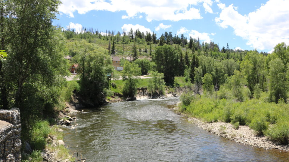
There are more than 31,000 dams in the northeastern United States.  More than 4,000 of them are in the Hudson River watershed.  Most of these dams are quite small and were built in the 19th century to form ponds and to power grist, textile, paper, saw, and other kinds of mills as the region developed its industrial infrastructure.  The nonprofit organization American Rivers estimates that 85% of U.S. dams are unnecessary at best and pose risks to public safety at worst. 

Dam removals have been occurring for over 100 years, but the vast majority have taken place since the mid-2010s and have increased dramatically since the 2021 Bipartisan Infrastructure Law, which provided funding for such projects.

So far, 806 Northeastern dams have come down and hundreds more are in the pipeline.

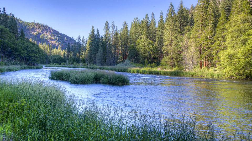
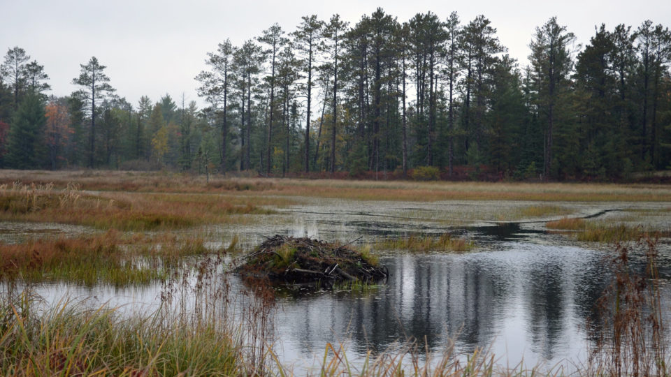
Dam removals improve aquatic fish passage, water quality, watershed resilience, and habitat for all the organisms in river ecosystem food chains, ranging from insects to fish to otters to eagles.  Small dams have degraded habitat and altered downstream hydrology and sediment flows.  They have created warm, stagnant, low-oxygen pools that trigger algal blooms and favor invasive species.

But removing even small dams is not an easy matter.  Projects range in cost from $100,000 to $3 million and qualifying for funding – whether federal or state – requires projects to meet a variety of requirements including community support.  Not all dams can be removed, but many more should.

**********

Web Links

How Tearing Down Small Dams Is Helping Restore Northeast Rivers

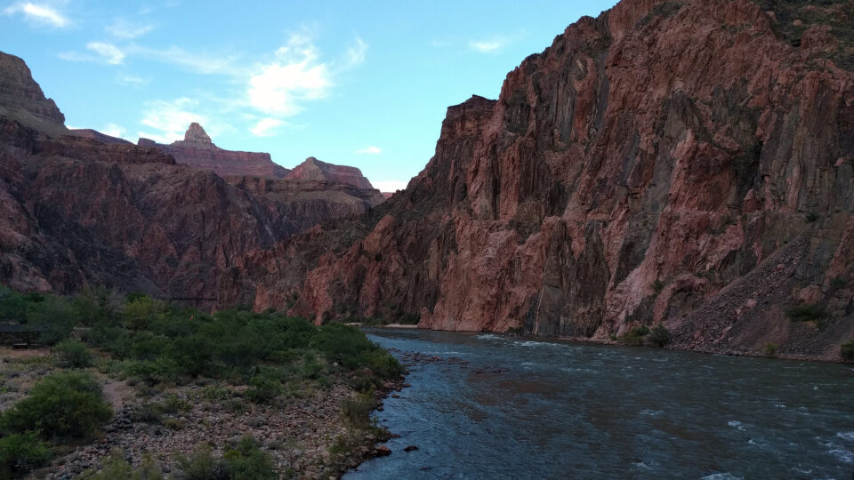
Photo, posted September 20, 2010, courtesy of Doug Kerr via Flickr.

Earth Wise is a production of WAMC Northeast Public Radio

Drying rivers and hydropower

February 7, 2025 By EarthWise Leave a Comment

Drying rivers threaten hydropower around the world

A decade ago, Ecuador began a major transition to using hydroelectric power.  Like in many other South American countries, the presence of abundant rivers could supply large amounts of energy and drive economic expansion and lead to a new era of prosperity.

This ambitious plan has run into the impacts of climate change.  An extraordinary drought has engulfed much of South America, drying rivers and reservoirs, and has put Ecuador’s power grid on the brink of collapse. 

Since September, daily energy cuts in Ecuador have lasted as long as 14 hours.  An industry group says that the nation is losing $12 million in productivity and sales for every hour the power is out.  Just a few years ago, Ecuador was making great strides in reducing poverty.  Now, as the energy crisis has increased its grip on the country, much of what was achieved is being lost.

Ecuador’s situation is not unique.  In recent years, abnormally dry weather in multiple places has resulted in extreme low water levels in rivers, reducing hydropower resources in Norway, Canada, Turkey, and even rainforest-rich Costa Rica.

Overall, more than one billion people live in countries where more than half of their energy comes from hydroelectric plants.  With a warming climate and increasing incidence of extreme weather events like drought, it is likely that hydropower will become a less reliable energy source.  More than a quarter of all hydroelectric dams are in places with a medium to high risk of water scarcity by 2050. 

**********

Web Links

The Rivers Run Dry and the Lights Go Out: A Warming Nation’s Doom Loop

Photo, posted January 15, 2020, courtesy of Pedro Szekely via Flickr.

Earth Wise is a production of WAMC Northeast Public Radio

Natural solutions for coastal defense

May 30, 2024 By EarthWise Leave a Comment

Nature-based coastal defense systems have a role to play

Protecting coastal cities and towns from the dangers of tsunamis, storm surges, and sea-level rise has become an ever-increasing challenge.  There are so-called hard coastal defenses as well as nature-based solutions.  A new study by the University of Tokyo has found that combining the two types of defenses may be the most effective way to protect, support, and enrich coastal communities.

Sea walls, dikes, dams, and breakwaters are the traditional hard measures.  They are popular and have proven track records but are facing challenges to keep pace with increasing climate risks.  They are expensive to build and require continuous upgrades and repairs.  While they do provide protection from many disaster risks, they also can cause significant disruption to coastal ecosystems as well as to coastal communities.

Nature-based coastal defenses include such things as mangroves and coral reefs.  So-called soft measures involve restoring, rehabilitating, reforesting, and nourishing natural ecosystems that protect coastal areas.

The Tokyo researchers analyzed the defense strategies in terms of risk reduction, climate change mitigation, and cost-effectiveness over a 20-year period. The results of the study were that among all coastal defense options in lower-risk areas, hybrid measures provide the highest risk reduction and can harness the advantages of both hard and soft measures. 

The findings provide strong evidence for integrating nature-based components into coastal defenses, but these approaches have not yet been adequately tested in circumstances of extreme events and high-risk urgency.  Research in this area has important implications for policy makers, coastal planners, and communities looking to make evidence-based decisions.

**********

Web Links

A natural touch for coastal defense

Photo, posted October 22, 2021, courtesy of Kevin Dooley via Flickr.

Earth Wise is a production of WAMC Northeast Public Radio

Beaver Believers | Earth Wise

August 18, 2023 By EarthWise Leave a Comment

Believing in beavers as ecosystem engineers

Beavers are ecosystem engineers based on their ability to construct dams and create ponds.  By doing so, they create wetland habitat for other species.  They create biodiversity by allowing plant species to emerge in new places as they clear out existing trees and other plants.  Beavers improve water quality and their dams store water during droughts.  Their handiwork minimizes flood risk and mitigates flooding impacts.

Before beavers were widely trapped, there were beaver dams just about everywhere in the American west.  Now beaver rewilding is trying to restore many western ecosystems. In places like Idaho, ranchers have gone from seeing beavers as a nuisance to actually recruiting them onto their land.  One cattle rancher began stream restoration on his land with beaver rewilding in 2014.  By 2022, he was a firm “beaver believer”.  There are now over 200 beaver dams along Birch Creek near Preston, Idaho, and the stream now flows 40 days longer into the year.

NASA has established a team to investigate the extent to which beavers can have an outsized and positive impact on local ecosystems.  The team is using NASA’s Earth Observation satellites to observe the effects beavers are having.  Satellites can collect data from large areas and can pass over the same areas regularly and across seasons.  The goal is to support people on the ground who are implementing beaver rewilding efforts to increase water availability and to increase habits for fish and other species.  NASA’s project will run through 2025 and it plans to expand it to other states with similar terrain and water management strategies.

**********

Web Links

Researchers Become “Beaver Believers” After Measuring the Impacts of Rewilding

Photo, posted February 23, 2021, courtesy of Deborah Freeman via Flickr.

Earth Wise is a production of WAMC Northeast Public Radio

Keeping The Colorado River Flowing | Earth Wise

July 5, 2023 By EarthWise Leave a Comment

The Colorado River supplies drinking water to 40 million Americans in seven states as well as to many Mexicans and provides irrigation to 5.5 million acres of farmland.  Electricity generated by dams on the Colorado powers millions of homes and businesses in the West.

A combination of drought, population growth, and climate change has reduced the river’s flows by a third in recent years compared with historical averages.  Further reductions could trigger a water and power catastrophe across the Western states.

California, Arizona, and Nevada all get water from Lake Mead, the reservoir formed by the Colorado at Hoover Dam.  The Interior Department determines how much water each of these three states receives.  The other states that use Colorado River water get it directly from the river and its tributaries.  Last summer, water levels in Lake Mead and Lake Powell fell enough that officials feared that the hydroelectric turbines at the Colorado’s dams would soon cease functioning.

The three states have recently struck an agreement with the federal government to take less water from the Colorado.  The reductions amount to about 13% of the total water use in the lower Colorado.  The government will pay about $1.2 billion to irrigation districts, cities, and Native American tribes for temporarily using less water.  The states have also agreed to make additional cuts to generate the total reductions needed to prevent the collapse of the river.

The agreement runs only through the end of 2026.  At that point, all seven states that rely on the river – which includes Colorado, New Mexico, Utah, and Wyoming – may well be facing a deeper reckoning.  The forces driving the decline of the Colorado are not going away.

**********

Web Links

A Breakthrough Deal to Keep the Colorado River From Going Dry, for Now

Photo, posted June 16, 2017, courtesy Karen and Brad Emerson via Flickr.

Earth Wise is a production of WAMC Northeast Public Radio

Two Lost Lakes Return To California | Earth Wise

May 10, 2023 By EarthWise Leave a Comment

Two lost lakes return to California following recent rains

The recent siege of powerful storms in California driven by a series of atmospheric rivers has had a significant effect on the severe drought that has plagued most of the state for many years.  Many of the state’s reservoirs are at the highest level they have been for decades.   The snowpack in the Sierras is well over 200% of its historical average.  Many parts of the state are no longer considered to be in drought conditions, and, in fact, flooding has been a serious problem in some areas.  This flooding has had some surprising results.

Two California lakes that drained a century ago have reappeared as a result of floodwaters from the recent storms.

Tulare Lake, in California’s Central Valley used to be fed by rain and snowmelt from the Sierras.  A system of dams and canals constructed in the early 20th century to support regional agriculture diverted water away from the lake.  It used to be the largest freshwater lake in the West but farmers ultimate planted crops in the dried lakebed.

The atmospheric river events in March inundated that farmland and once again there is water in Tulare Lake.

Owens Lake, on the eastern side of the Sierra Nevada, was long fed by mountain streams.  The 1913 construction of the Los Angeles Aqueduct redirected water to that city and desiccated the lake.   Floodwaters in March caused a partial collapse of the aqueduct and when the spill gates on the aqueduct were opened to drain the damaged areas, floodwaters poured in and partially refilled the lake.

California has suffered from drought for many years.  With its massive snowpack, as the weather warms, the state may face even more flooding.

**********

Web Links

Two Long-Drained California Lakes Refilled by Floodwaters, Satellite Images Show

Photo, posted November 10, 2014, courtesy of CN via Flickr.

Earth Wise is a production of WAMC Northeast Public Radio

The Bengal Water Machine | Earth Wise

October 31, 2022 By EarthWise Leave a Comment

Over the past three decades, the owners of 16 million small farms in the Bengal Basin of Bangladesh have been pumping shallow groundwater during dry seasons to irrigate rice paddies.  By lowering groundwater levels in this way during the dry season, the ability of leakage from rivers, lakes, and ponds to replenish the groundwater was greatly enhanced.   Capturing surface water not only improved the recovery of groundwater levels but only helped to reduce flooding during monsoons.

The net result of this enormous collective groundwater pumping by millions of farmers has been the creation of vast natural reservoirs underground that are comparable to what is contained by many of the world’s largest dams.   This system of sustaining irrigation has transformed what was previously a famine-prone country into a food-secure nation.

The details of this remarkable transformation have been laid out in a study by University College London recently published in the journal Science.  According to the study, over the course of 30 years, more than 75 cubic kilometers of fresh water was captured by this process, which is equivalent to the combined reservoirs of China’s Three Gorges Dam and the Hoover Dam in the U.S.

The authors of the study described the water cycling process as “The Bengal Water Machine” and argue that it can be a sustainable alternative to conventional approaches to seasonal river flow storage for irrigation, which typically involve dams and reservoirs.  Such approaches are difficult to implement in densely populated alluvial plains where sand, silt, and clay are laid down by annual floodwaters. 

**********

Web Links

Millions of farmers “replumb” world’s largest delta

Photo, posted February 2, 2010, courtesy of Melanie Ko via Flickr.

Earth Wise is a production of WAMC Northeast Public Radio

Beavers As Climate Change Fighters | Earth Wise

October 25, 2022 By EarthWise Leave a Comment

California is fighting the effects of climate change on multiple fronts.  The state has been grappling with relentless drought, record heat waves, and persistent wildfires.  The California Department of Fish and Wildlife is enlisting the help of beavers in its battle against climate change.

The state has created a beaver restoration unit charged with developing methods for nature-based restoration solutions involving beavers as well as artificial beaver dams. The agency plans to spend at least $3 million over the next two years to oversee a restoration program for the North American beaver.

A 2020 study showed that beaver-dammed corridors were relatively unharmed by wildfires compared with other areas that lacked beaver damming.  The study highlighted the differences between two adjacent corridors – one without a beaver population with a landscape scarred by a recent wildfire and another with beavers that remained a lush wetland after a fire.   The differences in burn severity, air temperature, humidity, and soil moisture between the beaver complex and the adjacent landscape were huge. 

From the 1920s through the 1950s, California actively exported beavers to other parts of the state and country so they could build dams in eroded areas where beaver dams could help evenly distribute water.  Now, the state wants to reintroduce beavers into watersheds where they once flourished.

The Department of Fish and Wildlife’s proposal to the California Legislature called beavers an important keystone species that can be used to combat climate change.   The state has spent enormous amounts of money on wildfire measures with minimal results.  Now they are going to see if beavers can make a difference.

**********

Web Links

California says the beaver can be superhero in fighting climate change

Photo, posted September 19, 2021, courtesy of Larry Lamsa via Flickr.

Earth Wise is a production of WAMC Northeast Public Radio

The Scourge Of Salt | Earth Wise

June 10, 2022 By EarthWise Leave a Comment

Salt will plague many communities and countries in the future

Rising seas are increasing saltwater intrusion on land and rising temperatures are causing greater evaporation.   The result is mounting levels of salt in waters and in soils.

Rising sea levels cause salty ocean water to push further into river deltas.  There is already a surge in saltiness across all inhabited continents.   Seawater works its way further upstream when dams hold back water.  Pumps that remove fresh water from underground sources for irrigation and drinking supplies add to the problem.  In dry regions, irrigation systems delivering water to crops increasingly bring salt onto fields.

People add to the problem by pouring saline drainage water from mines into rivers and by using salt to de-ice roads in the winter.

A modeling study pinpointed hotspots for climate change-induced salinization in numerous locations including the U.S. Southwest, wide areas of Australia, Mexico, South Africa, Brazil, central India, northern China, and more.

Some ecosystems are adapted to saline environments but major alterations in the balance between saline and fresh water is creating growing problems for ecosystems, lake fisheries, crop growing, and even human health.

The damage caused by salt is likely to be so severe that salinization will become a major cause of environmental refugees when the land they live on can no longer sustain them. 

Salt will be a growing threat to the world’s food supplies, especially where farmers depend on artificial irrigation.  About a third of the world’s food is grown in irrigated fields, and a fifth of those fields are deemed to already be salt-contaminated.  Ultimately, only a halt to climate change will be capable of combatting the scourge of salt.

**********

Web Links

Salt Scourge: The Dual Threat of Warming and Rising Salinity

Photo, posted June 3, 2017, courtesy of Jason Jacobs via Flickr.

Earth Wise is a production of WAMC Northeast Public Radio.

Antarctic Ice Collapse | Earth Wise

March 2, 2022 By EarthWise Leave a Comment

Warming temperatures are causing Antarctic ice collapse

In Antarctica, a huge chunk of the Larsen B Ice Shelf collapsed suddenly and spectacularly in January.

The Larsen Ice Shelf is located on the northeastern side of the Antarctic Peninsula on the Weddell Sea.  It was formed over the course of more than 12,000 years.  The Weddell Sea used to be a completely frozen body of water.  The famous Ernest Shackleton expedition in 1915 was trapped in its ice.  But the Antarctic Peninsula has been steadily warming in recent decades.

The Larsen A Ice shelf collapsed in 1995 and the 1,250-square-mile Larsen B Ice Shelf collapsed in 2002.  After that event, a portion of the detached ice shelf refroze in 2011 and was attached to the Scar Inlet Ice Shelf.  The refrozen ice was called the Larsen B embayment.

In January, the embayment broke apart, taking with it a portion of the Scar Inlet Ice Shelf.  It disintegrated within a matter of days.  The combined Larsen Ice Shelves – called A, B, C, and D – once extended along a 1000-mile stretch of the eastern Antarctic Peninsula.  Since 1995, it has shrunk from 33,000 square miles to 26,000 square miles.

These ice shelves float on the ocean, so their loss does not actually increase global sea levels.   However, the shelves act as dams that hold back glaciers located on the land behind them.  The loss of Antarctic ice shelves dramatically increases the rate at which glaciers flow into the sea, and that does increase global sea levels. 

Now that the sea ice from the Larsen B embayment is gone, it is likely that there will be additional inland ice losses from the newly exposed glaciers.

**********

Web Links

Remnant of Antarctica’s Larsen B Ice Shelf Disintegrates

Photo, posted February 13, 2018, courtesy of NASA/Nathan Kurtz via Flickr.

Earth Wise is a production of WAMC Northeast Public Radio.

Rivers Changing Color | Earth Wise

February 10, 2021 By EarthWise Leave a Comment

Why do rivers change colors?

A recent study, published in Geophysical Research Letters, found that one-third of large American rivers have had significant changes of color over the past 30 years.  Rivers can appear to be shades of blue, green, and yellow and we tend to expect healthy rivers to have colors in shades of blue.  According to the new study, only 6% of American rivers are dominantly blue.

The study looked at 235,000 Landsat images taken from 1984 to 2018.  The results are that 56% of rivers studied were dominantly yellow, 38% dominantly green, and 6% blue.  Over the 34 years studied, 33% of the rivers had significant changes in color. About 21% became greener and 12% more yellow. 

The chief causes of color changes in rivers are farm fertilizer runoff, dams, efforts to fight soil erosion, and climate change.  Climate change increases water temperature and rain-related runoff.

Color changes are not necessarily a sign of poor river health, but dramatic changes could point to issues that need attention.  A river can change color based on the amount of sediment, algae, or dissolved organic carbon in the water.   If a river becomes greener, it can often mean large algae blooms are present that cause oxygen loss and can produce toxins.  On the other hand, rivers that are getting less yellow demonstrate the success of regulations to prevent soil erosion.

The study of river colors can pinpoint which rivers are undergoing rapid environmental change.  What the study does not provide is information on water quality.  Water quality measurements will be important to determine the health of many of the rapidly changing rivers.

**********

Web Links

One Third of U.S. Rivers Changed Their Color, Three Decades of Satellite Images Show

Photo, posted July 6, 2016, courtesy of Jeffrey Beall via Flickr.

Earth Wise is a production of WAMC Northeast Public Radio.

A New Fishway Technology | Earth Wise

February 5, 2021 By EarthWise Leave a Comment

A new fishway technology to improve passageways for fish

Freshwater fish populations have declined by more than 80% over the past forty years across the globe.  This is in part due to hundreds of thousands of dams, weirs, and barriers stopping their movements.  These river barriers have disrupted fish reproduction cycles the world over by preventing river fish from migrating to spawn.

Fishways or fish ladders are waterways constructed on or around obstructions in order to provide passageways for fish and other aquatic species.  Often, they consist of a series of small overflow weirs and pools constructed in the form of steps.  Fish need to jump from one pool to another to migrate to the upstream.  Such fish ladders require a large space to construct.  These and several other types of fishways tend to be expensive to install and maintain and are not always successful in allowing fish to get to where they need to go.

Researchers at the University of New South Wales in Australia have come up with an ingenious new type of fishway.  Called a “tube fishway”, it is a low-cost and low-energy installation that works by pumping fish at high velocity – protected by a cushion of bubbly water – through a tube running over the obstructing barrier to deliver them safely into the water on the other side.

They successfully demonstrated a prototype system on a rugged slope behind a campus building that transported fish from one tank to another about 25 feet up the slope.

Fish are attracted into the chamber by suitable geometry and the system uses the energy available from the upper reservoir to lift the fish.  Modeling shows that the system will work for pipes as large as three feet in diameter and could lift fish more than 300 feet vertically. 

**********

Web Links

New fishway technology to get fish up and over those dam walls

Photo, posted October 19, 2019, courtesy of Andrew Harvey via Flickr.

Earth Wise is a production of WAMC Northeast Public Radio.

Land Use Change And Flooding | Earth Wise

September 30, 2020 By EarthWise Leave a Comment

Land use change leads to increased flooding

Land use change refers to the conversion of a piece of land’s use by humans from one purpose to another. Land use change is commonly associated with biodiversity loss and increased greenhouse gas emissions.  But how does land use change impact water cycles? 

According to researchers from the University of Göttingen in Germany, IPB University, and BMKG (both in Indonesia), the expansion of monocultures, such as rubber and oil palm plantations, leads to more frequent and more severe flooding.  The researchers explain the increase in flooding “with a complex interplay of ecohydrological and social processes, including soil degradation in monocultures, the expansion of oil palm plantations into wetlands, and the construction of flood protection dams.” 

For the study, which was recently published in the journal Ecology & Society, the research team interviewed nearly 100 Indonesian farmers, villagers, and decision-makers in Sumatra.  The team supplemented its research with data on precipitation, river and groundwater levels, soil properties, and regional mapping. 

During large-scale land use change – like plantation expansions – newly-compacted soil causes rainwater to runoff as opposed to being absorbed.  As more plantations are established in floodplains, the owners try to control flooding on their land by building barriers.  But these dams often lead to increased flooding on neighboring lands.  This understandably triggers social tensions between other farmers and plantation owners.     

In order to reduce the negative impact of land use change on the water cycle, the research team suggests soil protection and improved planning – especially in floodplains – would be a good place to start.  

**********

Web Links

Land use change leads to increased flooding in Indonesia

Photo, posted October 8, 2018, courtesy of Artem Beliaikin via Flickr.

Earth Wise is a production of WAMC Northeast Public Radio.

Beavers And The Warming Arctic | Earth Wise

August 5, 2020 By EarthWise Leave a Comment

Beavers are accelerating climate change

Beavers have a remarkable ability to transform landscapes.  Using their sharp teeth, they fell trees and shrubs and build dams, which cause small valleys to fill with water and form new lakes.  Some of these lakes measure five or ten acres in size, or even more.  And beavers are very efficient builders; they often build their dams at precisely those points where can they have the greatest effect with the least effort.

Scientists studying beaver activity in the Arctic regions of Alaska have found that the changing climate is leading to a substantial increase in beaver populations and their effect on the landscape.

In 2018, researchers found that the beavers living in a 7,000 square-mile area in northwest Alaska had created 56 new lakes in just five years.  Thanks to rising temperatures, more and more habitats offer the shrubs that beavers need for food and building material.  In addition, the lakes, which used to freeze solid, now offer beaver-friendlier conditions.  Also, beavers are not hunted as intensively as in the past.

The scientists were surprised that beavers have seized the opportunity so intensively.  There is basically an exponential growth in beaver dams.  This is actually a worrisome situation.  Forming all these new lakes degrades ice-rich permafrost in the area.  In the Kotzebue region of Alaska, the overall water area has increased by more than 8% over the past 17 years, and roughly two-thirds of that is due to beavers.

The degradation of the Arctic’s permafrost is a dangerous situation and it appears that anyone who wants to predict its future has to keep the activity of beavers in mind.

**********

Web Links

Beavers gnawing away at the permafrost

Photo, posted June 23, 2018, courtesy of Becky Matsubara via Flickr.

Earth Wise is a production of WAMC Northeast Public Radio.

Wind Power Overtakes Hydroelectric Power | Earth Wise

April 10, 2020 By EarthWise Leave a Comment

wind power is now top renewable

In 2019, the amount of electricity generated by wind power surpassed hydroelectric power for the first time, making wind the largest renewable source of electricity generation in the country.

Total wind generation in 2019 was 300 million MWh, which was 26 million MWh more than was produced by hydroelectric plants.

Hydroelectric generation has fluctuated between 250 and 320 million MWh over the past decade.  The capacity base has been stable, so the fluctuations were a result of variable annual precipitation.   Hydroelectric generation is generally greatest in the spring when rain and melting snow pack increase water runoff.

The growth in wind power is primarily a result of increasing capacity rather than any major fluctuations in wind caused by changing weather.  The U.S. added about 10 GW of wind capacity in 2019, making it the second largest year for capacity additions ever, second only to 2012.

Wind energy is an intermittent source, meaning that it isn’t windy all the time.  The average annual capacity factor for the U.S. wind fleet over the past decade has been 28 to 35%, meaning that is the amount of energy actually produced compared with the systems running at continuous full power all the time.  By comparison, the U.S. hydroelectric fleet operated at 35 to 43% of capacity during that period.  So, wind power is actually not that much less a steady source than hydroelectric power.

According to the U.S. Energy Information Administration, the government’s production tax credit, which was extended through this year, means that wind power capacity in the U.S. will continue to grow at a robust pace.  Meanwhile, some dams are being decommissioned and there is little new construction in the hydropower sector.

**********

Web Links

Wind has overtaken the top position for renewable generation in the U.S., EIA says

Photo courtesy of Flickr.

Earth Wise is a production of WAMC Northeast Public Radio.

Removing Dams Restores Ecosystems

November 1, 2019 By EarthWise Leave a Comment

In many parts of the country, dams that sometimes date back as much as 100 years are being removed and are giving way to the revival of migratory fish and their river ecosystems.  Since 1912, more than 1,600 dams have been removed in the U.S., but the pace of dam removal has greatly picked up in recent years.  2017 and 2018 were the highest years ever with 91 and 99 dams removed, respectively.

When dams are removed, the response from migratory fish can be almost immediate.  A large dam removal project on the Penobscot River in Maine in 2012 opened up 1,000 miles of habitat with a quick return of shad and alewives, followed by salmon.

In 2022, four large dams across the Klamath River will be removed.  The dams, which are located at the California and Oregon border, were facing an expensive re-licensing process and, because of their age, could no longer be run at a profit.

Re-licensing the dams along the Klamath was going to cost as much as $400 million.  On the other hand, uncapping the Klamath River has tremendous commercial and tourism potential.  Two states, tribal nations, and other stakeholders have all seen the virtues of restoring the landscape to its original form.

Opposition to dam removal is typically driven by aesthetics or recreational preferences.  But dam economics are getting increasingly worse.  Now that electricity can be produced far more cheaply with wind and solar power, many American dams have become artifacts of an older manufacturing era.  Meanwhile, rural towns near decommissioned dams are likely to now have more robust fishing industries.

In rivers big and small, migratory fish and river ecosystems surge back to life as old energy structures are taken down.

**********

Web Links

Take Down That Dam: River Ecosystems Bounce Back As Removals Soar

Photo, posted June 11, 2016, courtesy of the Bureau of Land Management via Flickr.

Earth Wise is a production of WAMC Northeast Public Radio.

Beavers And Biodiversity

October 10, 2019 By EarthWise Leave a Comment

Beavers are large, semi-aquatic rodents known best for their ability to construct dams, canals, and lodges (their homes).  They are among the largest rodents in the world.  With powerful jaws and strong teeth, beavers fell trees to use as building materials, often changing their environment in ways few other animals can. But in a good way.  As it turns out, beavers are important for biodiversity. 

According to new research from the Faculty of Natural Sciences at the University of Stirling in Scotland, reintroducing beavers to their native habitats is an important step towards solving the freshwater biodiversity crisis. 

Researchers surveyed water plants and beetles in 20 wetlands in Sweden – 10 created by beavers and 10 that were not – in order to understand what impact beavers might have on the variety of plant and animal life around them. 

The research team’s findings build on previous work that has shown that beavers have an important impact on biodiversity.  This latest study discovered that the number of species found only in beaver-built ponds was 50% higher than in other non beaver-built wetlands in the same region. 

Beavers are known to be profound engineers of the environment. They use wood to build dams across rivers in order to form ponds behind them.  They do this to raise the water level in order to avoid predators, like bears and wolves. But it turns out many other plants and animals, like water plants and beetles, also benefit from their work.

According to the research team, reintroducing beavers to their native habitats should benefit the wider biodiversity and be seen as an important step towards solving the freshwater biodiversity crisis. 

**********

Web Links

Beaver reintroduction key to solving freshwater biodiversity crisis

Photo, posted October 2, 2014, courtesy of USFWS Midwest Region via Flickr.

Earth Wise is a production of WAMC Northeast Public Radio.

The Decline Of Earth’s Largest Freshwater Creatures

September 23, 2019 By EarthWise Leave a Comment

While nearly 70% of the globe is covered by water, only 2.5% of it is freshwater.  The rest is saline and ocean-based.  And only 1% of our freshwater is easily accessible, with much of it locked away in snowfields and glaciers.  

Despite freshwater only making up a small fraction of all water on the planet, it’s home to one third of all vertebrate species.  Some have survived hundreds of millions of years, but many of the world’s largest freshwater creatures – including fish, reptiles, amphibians, and mammals – may soon find themselves on the brink of extinction.

According to a study recently published in the journal Global Change Biology, scientists from the Leibniz-Institute of Freshwater Ecology and Inland Fisheries and international colleagues have quantified the global decline of freshwater megafauna for the first time.  In four decades since 1970, the global populations of these freshwater giants have declined 88% – twice as much as the loss of vertebrate populations on land or in the oceans. 

Freshwater megafauna include all freshwater animals that weigh 30 kilograms (about 66 pounds) or more, such as certain dolphins, beavers, crocodiles, turtles and sturgeons.

Overexploitation is one of the main threats to freshwater megafauna.  (These animals are often targeted for their meat, eggs, and skin).  The other main threat is the loss of free-flowing rivers. Many of the world’s large rivers are already highly fragmented, which impacts access to spawning and feeding grounds.  The research team says another 3700 large dams are planned or under construction, including 800 in habitats rich with freshwater megafauna, including the Amazon, Congo, and Ganges river basins.

Current conservation measures are clearly failing our freshwater creatures. 

********** 

Web Links

88 percent decline of big freshwater animals

Earth’s largest freshwater creatures at risk of extinction

Photo, posted March 25, 2012, courtesy of the U.S. Fish and Wildlife Service via Flickr.

Earth Wise is a production of WAMC Northeast Public Radio.

Hoover Dam As A Giant Battery

September 7, 2018 By EarthWise Leave a Comment

https://earthwiseradio.org/wp-content/uploads/2018/09/EW-09-07-18-Hoover-Dam-As-A-Giant-Battery.mp3

Back in the 1930s, building Hoover Dam was a public works project likened to the pyramids.  Hoover Dam helped transform the American West, harnessing the force of the Colorado River to power millions of homes and businesses.

[Read more…] about Hoover Dam As A Giant Battery

Wastewater Instead Of Dams

July 2, 2018 By EarthWise Leave a Comment

https://earthwiseradio.org/wp-content/uploads/2018/07/EW-07-02-18-Wastewater-Instead-of-Dams.mp3

The era of dam building is coming to an end in much of the developed world.  Dams are very expensive, environmentally harmful, and as the climate warms and droughts become more common, are not that reliable.

[Read more…] about Wastewater Instead Of Dams

  • Page 1
  • Page 2
  • Go to Next Page »

Primary Sidebar

Recent Episodes

  • An uninsurable future
  • Clean energy and jobs
  • Insect declines in remote regions
  • Fossil fuel producing nations ignoring climate goals
  • Trouble for clownfishes

WAMC Northeast Public Radio

WAMC/Northeast Public Radio is a regional public radio network serving parts of seven northeastern states (more...)

Copyright © 2026 ·