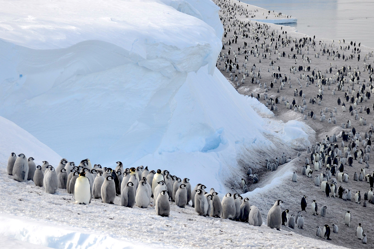
• Skip to main content
  • Skip to primary sidebar

Earth Wise

A look at our changing environment.

Hide Search
You are here: Home / Archives for satellites

satellites

Permafrost Thaw | Earth Wise

March 18, 2022 By EarthWise Leave a Comment

We’ve talked about permafrost before.  It is the frozen soil, rock, or sediment piled up in the Arctic that has been there at least for two years but, for the most part, for millennia or even over a million years.  Permafrost holds the carbon-filled remains of vegetation and animals that froze before they could start decomposing.   Estimates are that there are nearly 2,000 billion tons of carbon trapped in Arctic permafrost.  To put that in perspective, annual global carbon emissions are less than 40 billion tons.

Keeping all that carbon frozen plays a critical role in preventing the planet from rapidly heating. The ongoing warming of the Arctic is causing the subsurface ground to thaw and release long-held carbon to the atmosphere.

Scientists from Europe and the US are working together to better track permafrost carbon dynamics.  They are trying to understand the mechanisms that lead to abrupt thaws in the permafrost that have taken place in some locations.  These rapid thawing events are not well understood.  Researchers are also studying the effects of the increasingly frequent wildfires in the Arctic on the permafrost.

Researchers are using satellites to better understand the effects climate change is having on the Arctic environment and how these changes, in turn, are adding to the climate crisis.  Permafrost cannot be directly observed from space, so that its presence has to be inferred from measurements like land-surface temperature and soil moisture readings.  Terrestrial observations are also necessary for understanding how greenhouse gases – both CO2 and methane – are being emitted from the Arctic.

Thawing permafrost is a ticking timebomb for the environment that demands the growing attention of the scientific community.

**********

Web Links

Permafrost thaw: it’s complicated

Photo, posted January 24, 2014, courtesy of Brandt Meixell / USGS via Flickr.

Earth Wise is a production of WAMC Northeast Public Radio.

Global Light Pollution

October 14, 2021 By EarthWise 1 Comment

Light pollution increasing globally

Light pollution is excessive or obtrusive artificial light. It’s a consequence of industrial civilization.  Too much artificial light can cause a host of problems, including disrupting ecosystems, causing adverse health effects, and wasting energy. 

According to a new study led by researchers from the University of Exeter in the U.K., global light pollution has increased by at least 49% over 25 years.  But this figure only includes light visible via satellites.  Scientists estimate that the true increase may be significantly higher – up to 270% more globally. 

That’s because there is a hidden impact of LED technology that isn’t accounted for in the satellite data. LEDs emit more blue light than previous lighting technologies, but satellite sensors fail to pick up this blue light.   This leads to a large underestimate of global light pollution.

The researchers examined light pollution from 1992 to 2017.  They found persistently increasing light pollution in Asia, South America, Oceania and Africa.  In Europe, detected light increased until around 2010, after which it leveled off.  In North America, artificial light appears to be on the decline.  However, the researchers point out that the satellites inability to detect blue light of LEDs means that light pollution has likely actually increased in most locations.

Light pollution has widespread impacts on both animals and plants.  For example, light pollution can confuse the migratory patterns of animals and change predator-prey relationships.   It’s also been shown to cause trees to bud earlier in spring.      

While there’s no off switch for the planet, there are ways that we could reduce the amount of light drastically with little impact on our lives. 

**********

Web Links

Rapid increase in global light pollution

Photo, posted November 2, 2008, courtesy of Timothy Tsui via Flickr.

XXXXXXXXXXXXXXXXXX

Tracking Ocean Plastics | Earth Wise

July 30, 2021 By EarthWise Leave a Comment

Using a new technology to track ocean plastics across the globe

Plastic pollution in the oceans is a major problem.  An estimated 8 million tons of plastic trash enters the ocean every year.  Most of it is broken up by sun and waves into microplastics, which are tiny bits that ride currents for hundreds or thousands of miles.  All of this debris is harmful to marine ecosystems, and it is both challenging to track and very difficult to clean up.

University of Michigan researchers have developed a new technique for spotting and tracking ocean microplastics across the globe.  The approach relies on the Cyclone Global Navigation Satellite System, or CYGNSS, which is a constellation of eight microsatellites launched in 2016 to monitor weather near large storm systems.  It turns out that the radar systems on CYGNSS that measure surface roughness to calculate the wind speed near the eyes of hurricanes can also be used to detect the presence of microplastics.

With the satellite measurements, the researchers have found that global microplastic concentrations tend to vary by season, peaking during the summer months.  For example, June and July are the peak months for the Great Pacific Garbage Patch.  The data also showed spikes in microplastic concentration at the mouth of China’s Yangtze River, long suspected to be a chief source of plastic pollution.  The researchers produced visualizations that show microplastic concentrations around the world.

The information provided by the new technique could help organizations that clean up microplastics to deploy ships and other resources more efficiently.  Data of single-point release of plastics, such as from rivers, may also be useful to UNESCO, which has sponsored a task force to find new ways to track the release of microplastics into the world’s waters.

**********

Web Links

Ocean microplastics: First global view shows seasonal changes and sources

Photo, posted April 3, 2018, courtesy of Rey Perezoso via Flickr.

Earth Wise is a production of WAMC Northeast Public Radio.

Radar Satellites And Hazard Mitigation | Earth Wise

May 26, 2021 By EarthWise Leave a Comment

Using satellites to keep tabs on natural disasters

Scientists have concluded that the changing climate is primarily the result of increased human-caused greenhouse gas emissions.  Some of the effects of global climate change include melting glaciers, warming oceans, intensifying storms, and rising seas.

Another consequence of global climate change is natural disasters like floods and wildfires.  Climate change is increasing the frequency and severity of wildfires and increasing the odds of record-breaking floods in many parts of the United States and all around the world.

As a result, scientists in Australia have turned to technology for better assistance in keeping tabs on these climate change-driven natural disasters.  Researchers from Curtin University in Perth, Australia have found that satellites can improve the ability to detect, monitor, prepare for, and withstand natural disasters, including floods, wildfires, and earthquakes.

The research team used Synthetic Aperture Radar (SAR) data, which was acquired by the European Space Agency Sentinel-1 satellite.  The researchers also used data acquired by other satellites to evaluate these Australia-specific case studies.

According to the researchers, SAR data provides remote monitoring capabilities of Earth’s surface around the clock and in all weather, which is something that traditional optical Earth Observation (EO) imagery cannot do. The ability to function through fog, clouds, rainfall, and smoke is what makes SAR so valuable.

The research team says that the data can be used to improve how people track and respond to natural disasters, by precisely mapping topography, tracking movements of the ground, and mapping damage to infrastructure. 

As the climate continues to change, the ability to mitigate hazards like floods and wildfires will be increasingly important. 

**********

Web Links

Radar satellites can better protect against bushfires and floods

Photo, posted May 11, 2007, courtesy of Bert Knottenbeld via Flickr.

Earth Wise is a production of WAMC Northeast Public Radio.

Tracking Endangered Species From Space | Earth Wise

March 4, 2021 By EarthWise Leave a Comment

Using satellites to monitor endangered species

Scientists at the University of Bath and the University of Oxford in the UK have developed a technique for remotely surveying elephants and other wildlife using satellite images and deep learning.  The technique has the same accuracy as human counts done on the ground or from low-flying airplanes.

The new computer algorithm can analyze high-resolution satellite images and detect African elephants in both grasslands and forests.  Previous techniques for monitoring wildlife from space were limited to homogenous habitats, such as the case of tracking whales in the open ocean.

On-the-ground or airplane surveys to monitor animal numbers are expensive and time-consuming.  Satellites can collect nearly 2,000 square miles of imagery in a few minutes thereby eliminating the risk of double counting and reducing a process that previously took weeks to just a few days.  The use of satellites also eliminates the logistical problems of monitoring species populations that cross international borders.

Accurate monitoring is important for efforts to save endangered species.  There are only 40,000 – 50,000 African elephants left in the wild.  It is essential to know where the animals are and how many there are in various locations. The new method is able to count elephants in mixed ecosystems, such as savannah and forests, where tree cover would previously have made satellite tracking difficult.

With satellite imagery resolution increasing every few years, it should be possible to see ever-smaller things in greater detail.  The new algorithm works well for elephants; it may eventually become practical to track animals as small as an albatross from space.

**********

Web Links

A New Way to Track Endangered Wildlife Populations from Space

Photo, posted March 15, 2008, courtesy of Michelle Gadd/USFWS via Flickr.

Earth Wise is a production of WAMC Northeast Public Radio.

Aircraft Emissions And Climate Change | Earth Wise

March 1, 2021 By EarthWise Leave a Comment

Using winds at altitude to reduce aircraft emissions

The aviation industry accounts for about 2.4% of global carbon dioxide emissions.  If the aviation industry was a country, it would place sixth in emissions, between Japan and Germany.

According to scientists at the University of Reading in the United Kingdom, aviation industry emissions could be reduced by simply better surfing the wind.  The researchers found that commercial flights between New York and London could have used up to 16% less fuel if they had made better use of the fast-moving winds at altitude.

The study, which was recently published in the journal Environmental Research Letters, analyzed approximately 35,000 flights in both directions between New York and London last winter.  The researchers compared how much fuel was burned during these flights to how much less fuel would have been burned by flying into or around the eastward jet stream air currents. 

They found that taking better advantage of the winds would have saved about 125 miles worth of fuel per flight on average.  The fuel saving per flight was 1.7% when flying west to New York, and 2.5% when flying east to London. 

New satellites will soon allow transatlantic flights to be tracked more accurately.  This should afford aircraft more flexibility in their flight paths, allowing them to better follow tailwinds and avoid headwinds. 

Upgrading aircraft or switching to greener fuels are two other ways that the aviation industry can reduce emissions, but those things are costly and take time to implement.  Optimizing flight paths is cheaper and offers immediate benefits.  

**********

Web Links

Aircraft could cut emissions by better surfing the wind

Photo, posted May 16, 2011, courtesy of Cory W. Watts via Flickr.

Earth Wise is a production of WAMC Northeast Public Radio.

Finding Methane Leaks from Space | Earth Wise

December 23, 2020 By EarthWise Leave a Comment

Innovations to detect methane leaks

There is growing concern about the climate effects of methane leaking from oil and gas wells.  The 20-year global warming potential of methane is 84, meaning that over a 20-year period, it traps 84 times more heat per mass unit than carbon dioxide.  Global methane concentrations have increased by nearly a factor of 3 since the industrial revolution.

More than a century of oil and gas drilling has left behind millions of abandoned wells, many of which are leaching pollutants into the air and water.   In the U.S. alone, more than 3.2 million abandoned oil and gas wells emitted 280,000 tons of methane just in 2018.  And the data is incomplete.

Part of the problem is finding out which wells are leaking.  Ground-based sensors or airplanes and drones are effective ways to find leaks but considering how many wells there are to check, the costs are considerable, and the process is time consuming and complicated. 

New technology is coming along that uses satellites to detect methane leaks.  A Canadian company called GHGSat recently used satellites to detect what it has called the smallest methane leak ever seen from space and has begun selling data to emitters interested in pinpointing leaks.

Another company, New York-based Bluefield Technologies, plans a group of satellites for launch in 2023 that promises even finer resolution.  The Environmental Defense Fund, with support from Jeff Bezos’ Earth Fund, plans to launch MethaneSAT in the next couple of years, which is designed to find small sources of methane.

Research at Stanford University determined that just 5% of methane leaks produce around half the total leakage. 

**********

Web Links

New Technology Claims to Pinpoint Even Small Methane Leaks From Space

Photo, posted June 8, 2011, courtesy of Jeremy Buckingham via Flickr.

Earth Wise is a production of WAMC Northeast Public Radio.

Rising Seas Will Erase Cities

December 18, 2019 By EarthWise Leave a Comment

According to new research, climate-driven sea level rise could affect three times more people by 2050 than previously thought.  This sobering assessment means some of the world’s great coastal cities, including Bangkok, Shanghai, Mumbai, Basra, Alexandria, and Ho Chi Minh City, could be in big trouble.   

Scientists have always relied on land elevation data to determine the effects of sea level rise over large areas.  But standard elevation measurements using satellites struggle to differentiate the true ground level from the tops of trees or buildings.  The authors of the paper developed a more accurate way to calculate land elevation by using artificial intelligence to determine the error rate and to correct for it.  The new findings revealed that 150 million people – three times more than previously thought – are now living on land that is projected to be below the high-tide line by the middle of this century. 

Eight Asian nations – China, Bangladesh, India, Vietnam, Indonesia, Thailand, the Philippines, and Japan – account for about 70% of the people living on at-risk land. 

More than 20 million people in Vietnam, including much of Ho Chi Minh City, live on land that will be inundated by 2050.  In Thailand, more than 10% of its citizens, including much of Bangkok, currently live on land imperiled by projected sea level rise. 

This new research was produced by Climate Central, a New Jersey-based science organization, and was recently published in the journal Nature Communications. 

Sea level rise is clearly not just an environmental problem.  It’s a humanitarian crisis.

**********  

Web Links

New elevation data triple estimates of global vulnerability to sea-level rise and coastal flooding

Rising Seas Will Erase More Cities by 2050, New Research Shows

Photo, posted December 18, 2009, courtesy of Misko via Flickr.

Earth Wise is a production of WAMC Northeast Public Radio.

A Giant Seaweed Bloom

August 19, 2019 By EarthWise Leave a Comment

Scientists using data from NASA satellites have discovered and documented the largest bloom of seaweed in the world, stretching all the way from West Africa to the Gulf of Mexico.  The gigantic macroalgae bloom has been dubbed the Great Atlantic Sargassum Belt. 

The brown seaweed floats in surface water and in recent years has become a problem to shorelines lining the tropical Atlantic, Caribbean Sea, Gulf of Mexico, and east coast of Florida.  The stuff carpets popular beach destinations and crowded coastal waters. In 2018, more than 20 million tons of it floated on the ocean surface.

Scientists have been studying the Sargassum algae using satellites since 2006, but the major blooms have only started appearing since 2011.  They have occurred every year between 2011 and 2018 except for 2013.  Before 2011, most of the free-floating Sargassum in the ocean was primarily found in patches around the Gulf of Mexico and the Sargasso Sea located on the western edge of the central Atlantic Ocean.

Sargassum provides habitat for turtles, crabs, fish and birds, and produces oxygen via photosynthesis.  However, too much of it can crowd out many marine species.

According to researchers, the ocean’s chemistry must have changed in order for the bloom to get so out of hand.  The factors involved include a large seed population left over from a previous bloom, nutrient input from West Africa, and nutrient input from the Amazon River.  The increase in nutrients may be a result of deforestation and fertilizer use.

Climate-change effects on precipitation and ocean currents ultimately do play a role in this, but increased ocean temperatures do not.  Unfortunately, these giant seaweed blooms are probably here to stay.

**********

Web Links

NASA Satellites Find Biggest Seaweed Bloom in the World

Photo courtesy of NASA.

Earth Wise is a production of WAMC Northeast Public Radio.

Trees And Methane

August 14, 2019 By EarthWise Leave a Comment

The Amazon is a source of many mysteries.  One that was as troubling as it was mysterious was the large amounts of methane emissions coming from the rainforest that were observed by satellites but that nobody could find on the ground.  In total, there were 20 million tons of methane whose origin was unknown.

An expedition by a British postdoctoral researcher who spent two months strapping gas-measuring equipment to thousands of trees has solved the mystery.  It turns out that trees, especially in the extensive flooded forests, were stimulating methane production in the waterlogged soils and pumping it into the atmosphere.

This research has uncovered a previously-ignored major source of the second most important greenhouse gas in the world.  Apparently, most of the world’s estimated 3 trillion trees emit methane at least some of the time.

This in no way implies that trees are bad for the climate and therefore should be cut down.  The reality is that the carbon storage capability of trees far outweighs their methane emissions.  But since corporations these days are planting trees to offset their carbon emissions, it is essential to know if their numbers add up.  Carbon accounting has to include the complex chemistry of trees and methane.

Wetland tree trunks can act as passive conduits for methane generated by micro-organisms in waterlogged soils.  The solid-looking trunks contain spaces and channels through which gases travel up and down.  But in wetland systems, trees also create the conditions, and provide the raw materials, for methane generation by micro-organisms.  Trees are essentially bioreactors.  Some trees even actively generate methane from photochemical reactions in their foliage.

Understanding the interactions of ecosystems and the atmosphere is a complicated business.

**********

Web Links

Scientists Zero in on Trees as a Surprisingly Large Source of Methane

Photo, posted December 13, 2008, courtesy of Ivan Mlinaric via Flickr.

Earth Wise is a production of WAMC Northeast Public Radio.

Ice Melt In Greenland

March 12, 2019 By EarthWise 1 Comment

A new study published in the Proceedings of the National Academy of Sciences warns that Greenland’s ice Is melting much faster than previously thought.  The ice loss rapidly accelerated around 2002-2003 and by 2012 the annual loss was nearly four times the rate in 2003.

Most of the new ice melt is in southwest Greenland, a part of the island that wasn’t known to be losing ice that rapidly and is not where most of the large glaciers are in Greenland.  The loss is coming from the land-fast ice sheet itself.

Data from NASA satellites and GPS stations scattered around Greenland’s coast shows that between 2002 and 2016, Greenland lost approximately 280 billion tons of ice per year.  That is enough melt to cover the entire states of Florida and New York hip deep in meltwater, as well as drowning Washington, D.C. and one or two other small states.

Global warming of just 1 degree Celsius is the main driver behind this massive meltdown of ice.  The temperature rise coupled with a negative phase of the North Atlantic Oscillation causes rapid surface melt of the ice sheet during summers.  The Oscillation is a natural, irregular change in atmospheric pressure that brings warm, sunny weather to the western side of Greenland during its negative phase.

The Greenland ice sheet is 2 miles thick in some places and contains enough ice to raise sea levels 23 feet if it all melted.  The melting Greenland ice is already slowing the Gulf Stream, which is wreaking havoc with European weather.  If we don’t get a handle on global temperature rise, things are only going to get worse.

**********

Web Links

Greenland’s ice is melting four times faster than thought—what it means

Photo, posted April 21, 2017, courtesy of Markus Trienke via Flickr.

Earth Wise is a production of WAMC Northeast Public Radio.

Satellites And Conservation Science

August 3, 2017 By EarthWise

https://earthwiseradio.org/wp-content/uploads/2017/08/EW-08-03-17-Satellites-and-Conservation-Science.mp3

Satellites orbiting the earth are becoming an increasingly powerful tool for counting and monitoring wildlife populations and to answer a host of other questions about the natural world.

[Read more…] about Satellites And Conservation Science

Primary Sidebar

Recent Episodes

  • Energy From Rice Straw | Earth Wise
  • California Flooding | Earth Wise
  • The Race For EV Batteries | Earth Wise
  • Turning Carbon Into Stone | Earth Wise
  • Tracking Global Forest Changes | Earth Wise

WAMC Northeast Public Radio

WAMC/Northeast Public Radio is a regional public radio network serving parts of seven northeastern states (more...)

Copyright © 2023 ·