• Skip to primary navigation
  • Skip to main content
  • Skip to primary sidebar

Earth Wise

A look at our changing environment.

  • Home
  • About Earth Wise
  • Where to Listen
  • All Articles
  • Show Search
Hide Search
You are here: Home / Archives for region

region

The warmer, greener Arctic and greenhouse gas

April 16, 2025 By EarthWise Leave a Comment

Blue lakes in Greenland turning brown as the Arctic warms

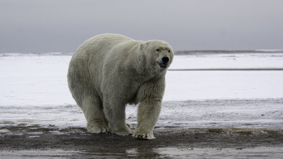
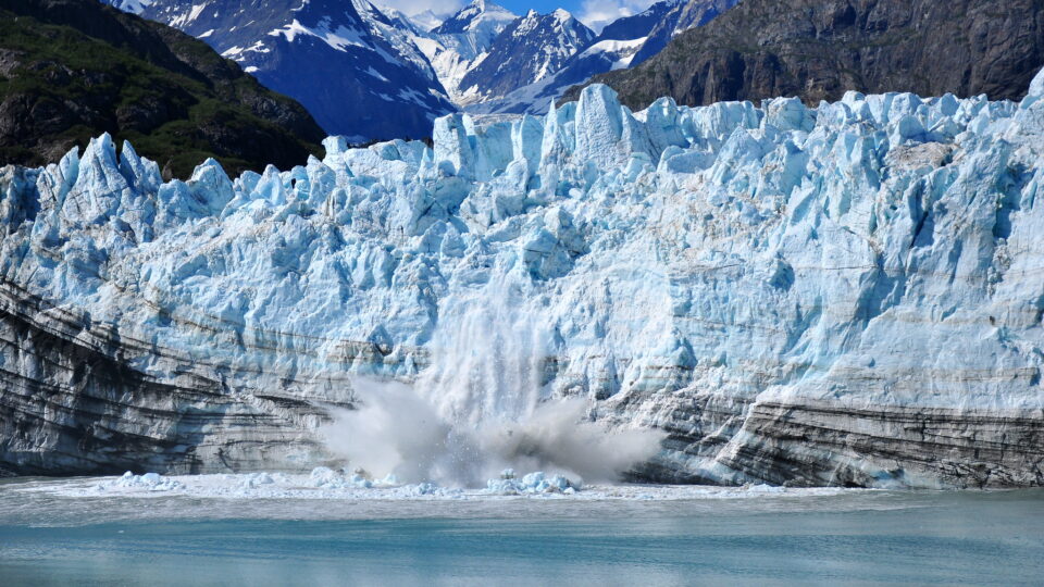
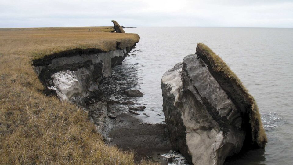
About 15% of the Northern Hemisphere is covered by permafrost.  Permafrost is soil and sediment that has remained frozen for long periods of time, in some cases as much as 700,000 years.  It contains large amounts of dead biomass that has accumulated over millennia and hasn’t fully decomposed.  Therefore, permafrost is an immense carbon sink.

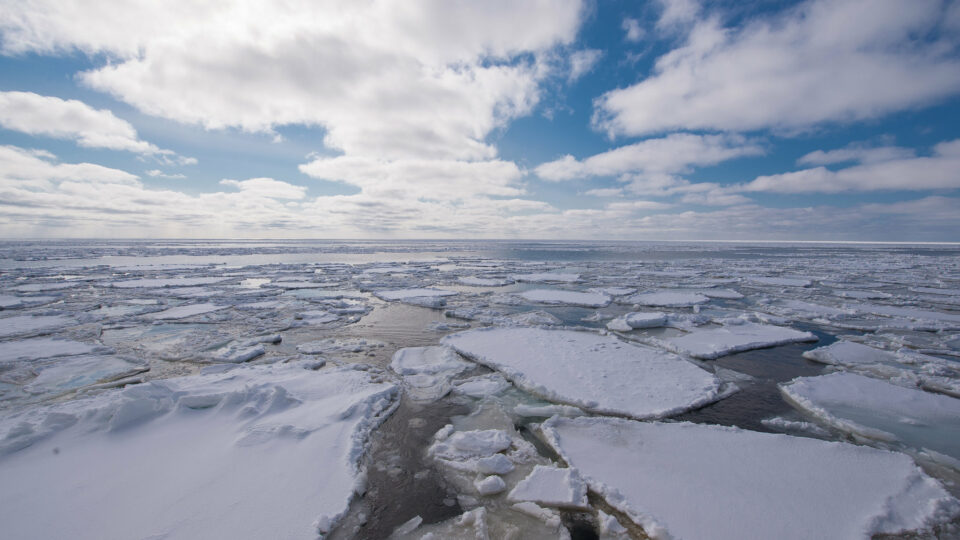
The Arctic is warming four times faster than the rest of the planet and, as a result, thawing permafrost is becoming a carbon source.  As warming continues, ice is melting, and vegetation is spreading.    A new study, published in Nature Climate Change, looked at the state of the Arctic and boreal north from the period 1990 until 2020.  The study found that although half of the Arctic region has been growing greener, only 12% of those green areas are actually taking up more carbon.  For one thing, the growth of forests means that there is more fuel for wildfires which are increasingly common.

A study of lakes in West Greenland found that thousands of crystal blue lakes have turned brown during record heat spells.  Runoff from melting permafrost made the lakes opaque killing off plankton that absorb carbon dioxide.  Meanwhile, plankton that release carbon dioxide multiplied.  So, these lakes went from being carbon sinks to being carbon sources.

As the northern latitudes warm, ice and permafrost are melting, vegetation is spreading, and the region is becoming a source of heat-trapping gas after having been a place where carbon has been locked away for thousands of years.  According to the Nature Climate Change study, roughly 40% of the Arctic is now a source of carbon dioxide.

**********

Web Links

Warmer, Greener Arctic Becoming a Source of Heat-Trapping Gas

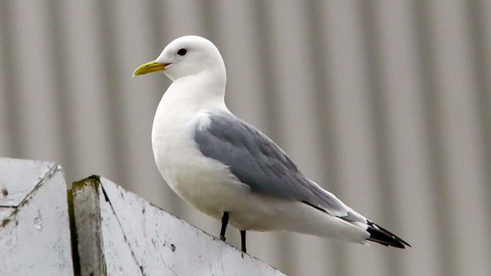
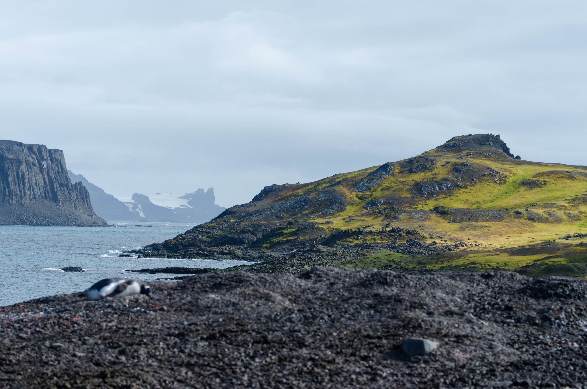
Photo, posted October 14, 2024, courtesy of Christoph Strässler via Flickr.

Earth Wise is a production of WAMC Northeast Public Radio

Polar bear population decline

March 13, 2025 By EarthWise Leave a Comment

Researchers from the University of Toronto have directly linked the population decline in polar bears living in Canada’s Western Hudson Bay to climate change.  Between 1979 and 2021, the polar bear population in this region has declined by nearly 50%.

The monitoring data over this period shows that the average size of polar bears has declined, the size of cub litters has dropped, and cub survival rates are reduced.

The primary factor is the declining amount and duration of sea ice.  When there is less ice, bears have less feeding time and less energy overall.  The loss of sea ice means that bears spend less time hunting seals and more time fasting on land.  The lack of food leads to reduced reproduction, cub survival, and, ultimately, population decline. 

The average body mass of adult females has dropped by 86 pounds and of cubs by 47 pounds.  With shorter hunting periods and less food, mothers produce less milk.  Not only have cub litter sizes dropped over the monitoring period, but mothers are keeping their cubs longer because they are not strong enough to live on their own.  The bottom line is that the survival of cubs directly impacts the survival of the population.

Western Hudson Bay is considered to be a bellwether for polar bear populations globally.  It is one of the southernmost populations of polar bears and it has been monitored for a long time.  With the Arctic warming at a rate four times faster than the global average, polar bear populations in other Arctic regions are likely to be experiencing similar declines. 

**********

Web Links

Polar bear population decline the direct result of extended ‘energy deficit’ due to lack of food

Photo, posted October 23, 2015, courtesy of Anita Ritenour via Flickr.

Earth Wise is a production of WAMC Northeast Public Radio

Lithium in Arkansas

November 28, 2024 By EarthWise Leave a Comment

Exploring lithium in Arkansas

Lithium is the critical raw material in the batteries that power electric cars as well as cell phones, computers, and other gadgets.  The stuff has been nicknamed “white gold” for good reason.  Chile and Australia are the world’s largest producers of the metal, which is mostly extracted from brine in evaporation ponds.  The majority of it is then processed in China.  The energy industry has been increasingly working to produce the raw materials needed to produce lithium-ion batteries in the United States and process those materials domestically.  There are multiple projects at various stages across the country.

Researchers at the US Geological Survey and the Arkansas state government recently announced that they have discovered a vast trove of lithium in an underground brine reservoir in Arkansas.

With a combination of water testing and machine learning, the researchers determined that there could be 5 to as much as 19 million tons of lithium in the geological area called the Smackover Formation.  This is more than enough to meet all the world’s demand for it.

Several companies – including Exxon Mobil, which is covering its bets on the future of oil as an energy source – are developing projects in Arkansas to produce lithium.  If these companies can develop and scale up economical new ways to extract lithium from salty water, the region in Arkansas could become the lithium capital of the world.

Energy and mining companies have produced oil, gas, and other natural resources in the Smackover Formation, which extends from Texas to Florida.  The same brines have long been the source of other valuable substances. 

**********

Web Links

Arkansas May Have Vast Lithium Reserves, Researchers Say

Photo, posted May 22, 2020, courtesy of the European Space Agency via Flickr.

Earth Wise is a production of WAMC Northeast Public Radio

Threats to the Amazon Rainforest

August 1, 2024 By EarthWise Leave a Comment

Brazil has made great progress in reducing deforestation in its Amazon Rainforest.  In 2023, the rate of deforestation in Brazil dropped by 50% over the previous year. This was the result of the efforts by conservation-minded President Luiz da Silva, who replaced Jair Bolsonaro, a big proponent of deforestation.  Da Silva’s government has cracked down on land clearing by farmers and ranchers.

In the first quarter of this year, deforestation decreased by 40% over the previous year’s quarter.   Deforestation levels are the lowest they’ve been in six years, although the amount of forest cleared in the period was still nearly 200 square miles.

Unfortunately, the Amazon Rainforest is facing another growing threat:  climate change.  Because of pervasive drought and increasing temperatures, the number of wildfires in the region have hit a 20-year high.

According to satellite data from the national space agency, from January through June, Brazil recorded 13,489 wildfires in the Amazon.  That is 61% more fires than during the same period last year.  And the wildfire season has yet to reach its peak, which usually is in August or September.

Many of these fires begin in pastures or recently cleared rainforest, but then spread into the surrounding rainforest areas.  Many are huge fires.  Hundreds of square miles of rainforest have been consumed by fire, comparable in size to the areas deforested by farmers and ranchers.

Going forward, worsening wildfires could reverse the gains being made by the government’s deforestation policies.  This could not only threaten forest protection, but also weaken public support for the government’s commitment to protecting the region.

**********

Web Links

Brazil Is Seeing a Record Number of Wildfires This Year

Photo, posted January 26, 2018, courtesy of Chris Parker via Flickr.

Earth Wise is a production of WAMC Northeast Public Radio

Air pollution in India

February 19, 2024 By EarthWise Leave a Comment

India is one of the world’s most polluted countries.  In fact, of the 30 cities with the worst air pollution around the globe, 21 of them can be found in India. 

India’s capital city, New Delhi, is the most polluted city in the world.  Concentrations of fine particulate matter (known as PM2.5) in Delhi, which is the name of the larger city that includes the capital New Delhi, are nearly 10 times greater than the World Health Organization guidelines. 

To reduce air pollution in Delhi, officials have focused on measures within the city limits, including boosting public transportation and regulating pollution from industry. 

But according to a review carried out by the University of Surrey and regional government officials in Delhi, the city will also need the help of its neighbors to tackle its killer smog problem.  Some of the pollution plaguing Delhi comes from rural areas in the region –  from things like crop burning, wood stoves, and power plants.  The review, which was part of a paper recently published in the journal Sustainable Horizons, also recommends drafting regional air quality plans, producing smog forecasts, and creating airshed councils to help improve coordination. 

Exposure to air pollution can cause all sorts of major health problems, including asthma, respiratory inflammation, as well as  jeopardize lung function, and even promote cancer.  Long-term exposure to PM2.5 is linked to premature death.  In fact, air pollution causes an estimated 670,000 deaths every year in India. 

Since air pollution doesn’t respect boundaries or borders, solutions require collaboration and the need to focus efforts more broadly in order to achieve emissions reduction goals. 

**********

Web Links

Delhi smog: India’s cities must look beyond their limits to clean up air pollution

Photo, posted December 27, 2019, courtesy of Ninara via Flickr.

Earth Wise is a production of WAMC Northeast Public Radio

Water For Arizona | Earth Wise

July 17, 2023 By EarthWise Leave a Comment

Arizona looking for creative solutions to solve its water crisis

The Phoenix area is the fastest growing region in the country.  Arizona’s two major sources of water – groundwater and the Colorado River – are dwindling from drought, climate change, and overuse.  Officials in the state are considering a radical plan to construct a desalination plant off the Mexican coast that will take the salt out of seawater, and then pipe that water hundreds of miles, much of it uphill, to Phoenix.

The project is the brainchild of the Israeli company, IDE, which is one of the world’s largest desalination companies.  IDE has asked Arizona to sign a 100-year contract to buy water from the project. 

There are multiple complications surrounding the plan.  Desalination plants are common in California, Texas, and Florida, and in more than 100 other countries.  But the Arizona project is unusual because of the distance involved and because the state is landlocked.  The water would have to travel 200 miles and climb 2,000 feet along the way.

There is also the issue of waste brine, which is a major output of desalination plants.  In this case, the brine would flood the northern Gulf of California, potentially threatening a productive fishery.  In addition, the pipeline, as well as electrical transmission lines, would have to go through the Organ Pipe Cactus National Monument, a UNESCO biosphere reserve.

The plant would be located in Puerto Peñasco, a struggling town with its own water problems.

With booming home construction going on in the Phoenix area, the need for more water continues to grow.  Whether this plan will be approved by Arizona and by Mexico remains to be seen.

**********

Web Links

Arizona, Low on Water, Weighs Taking It From the Sea. In Mexico.

Photo, posted September 26, 2008, courtesy of Dan via Flickr.

Earth Wise is a production of WAMC Northeast Public Radio

Disappearing Glaciers | Earth Wise

February 20, 2023 By EarthWise Leave a Comment

Glaciers are disappearing at a rapid rate

Glaciers are massive bodies of slowly moving ice.  Glaciers form on land, and represent the snows of centuries compressed over time.  They move slowly downward under the influence of their own weight and gravity. 

Most of the glaciers on the planet are found in the polar regions, including Antarctica, the Canadian Arctic, and Greenland.  Glaciers can also be found closer to the equator in mountain ranges, such as the Andes Mountain range in South America.  Glaciers are always changing, accumulating snow in the winter and losing ice to melting in the summer.  But in recent times, the melting has been outpacing the accumulation.

A new international study led by researchers at Carnegie Mellon University’s College of Engineering has produced new projections of glacier loss through the century under different emissions scenarios.  According to the projections, the world could lose as much as 41% of its total glacier mass this century – or as little as 26% – depending on climate change mitigation efforts. 

In a future with continued investments in fossil fuels (sometimes referred to as the “business as usual” scenario), more than 40% of the glacial mass will be gone by 2100, and more than 80% of glaciers by number could disappear.  Even in a best case scenario where the increase in global mean temperature is limited to 1.5° degrees Celsius relative to pre-industrial levels, more than 25% of glacial mass will be gone, and nearly 50% of glaciers by number will disappear.

Glaciers take a long time to respond to changes in climate.  A complete halt to emissions today would take anywhere from 30 to 100 years to be reflected in glacier mass loss rates.

**********

Web Links

Team projects two out of three glaciers could be lost by 2100

Ice, Snow, and Glaciers and the Water Cycle

Photo, posted August 13, 2010, courtesy of Kimberly Vardeman via Flickr.

Earth Wise is a production of WAMC Northeast Public Radio

El Paso’s Water Future | Earth Wise

November 21, 2022 By EarthWise Leave a Comment

The water future of El Paso uncertain as the Rio Grande river dries up

El Paso, Texas is part of the Paso del Norte region, which includes Ciudad Juarez in Mexico and Las Cruces, New Mexico.  The population on both sides of the border is booming, approaching 3 million people.  The region’s primary water source is the Rio Grande River.  But that river is declining.

Rising temperatures and decreasing rainfall have led to diminishing flow in the river.  Eighty percent of the river’s flow has historically been diverted to agriculture, but the reduced flow of the Rio Grande has forced many farmers to reduce planting or change to less water-hungry crops.  The river is expected to continue to decrease its flow as time goes by.

The city of El Paso gets 40% of its water supply directly from the Rio Grande.  Urban water authorities in the region are scrambling to find ways to provide cities with alternative supplies of water.

El Paso now gets some of its water from a desalination plant, which is the world’s largest inland municipal desalination plant.  The water comes from brackish groundwater rather than from the sea.  The briny waste from the plant is piped to an injection well many miles way and is permanently stored 4,000 feet underground.

El Paso continues to seek new water sources and reduce its water use.  It gets much of its water from wells drilled in nearby aquifers.  It is working to make this use of groundwater more sustainable.  The city recycles used residential water through its so-called purple pipe system, which cleans up waste water and delivers it for non-potable use on golf courses and park lawns. 

Like many places in the increasingly dry west, El Paso’s water future is uncertain. 

**********

Web Links

As Rio Grande Shrinks, El Paso Plans for Uncertain Water Future

Photo, posted April 29, 2018, courtesy of R. Baire via Flickr.

Earth Wise is a production of WAMC Northeast Public Radio

Vanishing Arctic Lakes | Earth Wise

September 28, 2022 By EarthWise Leave a Comment

Lakes in the Arctic are vanishing

In recent decades, the warming in the Arctic has been much faster than in the rest of the world.  The phenomenon is known as Arctic amplification.  A study by the Finnish Meteorological Institute published in August in Communications Earth & Environment determined that during the past 43 years, the Arctic has been warming nearly four times faster than the rest of the globe.  The result of this amplified warming has been that glaciers are collapsing, wildlife is struggling, and habitats continue to disappear at a record pace.

Research published by the University of Florida has identified a new threat associated with Arctic amplification: lakes in the Arctic are drying up.

Over the past 20 years, many Arctic lakes have shrunk or dried up completely across the entire pan-Arctic region, which spans the northern parts of Canada, Russia, Greenland, Scandinavia, and Alaska.

Arctic lakes are essential elements of the Arctic ecosystem and for the indigenous communities that live in the region.  They provide a critical source of fresh water for those communities and local industries. 

The rapid decline of Arctic lakes is unexpected.  Earlier predictions were that climate change would first actually expand lakes in the region as ground ice melted.  Lakes drying out was not expected until much later in this century or even in the 22nd century.  Instead, it appears that thawing permafrost may drain lakes and overwhelm the expansion effect caused by melting ice.  The theory is that thawing permafrost decreases lake area by creating drainage channels and increasing soil erosion.

The finding suggest that permafrost thawing is occurring faster than anticipated, which presents many additional problems.

**********

Web Links

As the climate crisis intensifies, lakes across the Arctic are vanishing

Photo, posted June 20, 2014, courtesy of Bob Wick / Bureau of Land Management via Flickr.

Earth Wise is a production of WAMC Northeast Public Radio

Climate Change And Hurricanes In The Northeast | Earth Wise

February 9, 2022 By EarthWise Leave a Comment

Climate change making hurricanes in the Northeast more likely

According to a new study led by Yale University, more hurricanes are likely to hit Connecticut and the northeastern U.S. as global warming continues to increase temperatures in the region.

Hurricane Henri made landfall in August as a tropical storm on the Connecticut/Rhode Island border.  In September 2020, subtropical storm Alpha made landfall in Portugal, the first subtropical or tropical cyclone ever observed to make landfall in the mainland of that country.

Tropical cyclones, hurricanes, and typhoons are typically intense and destructive in the lower latitudes. 

The study concludes that violent storms could migrate northward in our hemisphere and southward in the southern hemisphere as a result of warming caused by greenhouse gas emissions.

The research predicts that tropical cyclones will likely occur over a wider range of latitudes than has been the case on Earth for the last 3 million years.

In Connecticut, Hurricane Henri was not the only tropical storm to affect the region in 2021.  The remnants of Hurricane Ida brought damaging winds and torrential rain that felled trees and flooded streets and basements.

The northern expansion of such violent storms is going on as water levels in the Atlantic Ocean and Long Island Sound keep rising.  Because of melting glaciers thousands of miles away, water levels in Long Island Sound could rise by as much as 20 inches by 2050, enough to submerge parts of Groton’s shore and cause regular flooding in roads and neighborhoods.

Future hurricane prediction is an inexact science, but the ongoing trends do not bode well for the region.

**********

Web Links

More hurricanes likely to slam Connecticut and region due to climate change, says study

Photo, posted October 29, 2012, courtesy of Rachel via Flickr.

Earth Wise is a production of WAMC Northeast Public Radio.

Animals And Wildfires | Earth Wise

December 8, 2021 By EarthWise Leave a Comment

How animals cope with wildfires

More than a century of fire suppression strategies coupled with climate change has led to wildfires that are much larger and more frequent than those of the past.  A question that arises is what happens to the animals in a region when a massive wildfire sweeps through the landscape?

For the most part, we don’t have much information on what animals do when the flames are burning or in the immediate days after the fire has ended.  By chance, a group of researchers from the University of California, Berkeley, the University of California, Santa Barbara, and the University of Washington had the opportunity to get that kind of information.

The researchers had been studying a group of black-tailed deer where the 2018 Mendocino Complex Fire occurred.  That megafire torched more than 450,000 acres in Northern California, including the site where the researchers were studying the movements and feeding patterns of the deer.

The researchers had to evacuate the area during the fire, but their cameras, tracking collars, and other equipment continued to function.  They learned that of the 18 deer studied, all survived.  Deer that had to flee the flames returned home, even though many areas were completely burned and devoid of vegetation to eat.  In fact, most of the deer returned within hours of the fire’s end while trees were still smoldering.   The researchers continue to monitor the deer to look at the long-term effects of the fire.

The researchers speculate that loyalty to home is a tactic that likely helped the species survive past wildfires.  Smaller fires encourage new vegetation growth, a tasty treat for deer.  Whether the strategy will pay off as fires get more intense and more frequent remains to be seen. 

**********

Web Links

After California’s 3rd-largest wildfire, deer returned home while trees were ‘still smoldering’

Photo, posted July 17, 2017, courtesy of C Watts via Flickr.

Earth Wise is a production of WAMC Northeast Public Radio.

Global Warming And Sea Turtle Births | Earth Wise

January 11, 2021 By EarthWise Leave a Comment

Climate change poses a serious threat to sea turtles

Climate change is a serious threat to species whose sex is determined by temperature.  Among these are sea turtles.  Whether marine turtles are born male or female turns out to depend on the temperature of their nest during incubation.

Sea turtle nests need to be around 84.6 degrees Fahrenheit on average to produce a 50:50 sex ratio for embryos developing in eggs.  If temperatures are higher, embryos predominantly become female.  There is a transitional range of temperatures over which both males and females are produced.  Below that range, only males are produced; above that range, only females are produced.

According to recent research published in the journal Conservation Science and Practice, sand temperatures along the Red Sea exceeded the 84.6-degree threshold in all but one of the sites studied.  Some sites measured nearly 96 degrees.  The Red Sea region is home to five of the world’s seven species of sea turtles, including endangered green turtles and critically endangered hawksbill turtles.

Skewing the sex distribution of a species is a serious threat to the future survival of the population.

The Red Sea findings are similar to observations around the world.  In Florida, sea turtle hatchlings were born 100% female in seven out the past 10 years, and in the other three years, males only made up 10-20% of the brood.  In Australia’s Raine Island, the largest green turtle nesting ground in the Pacific Ocean, the ratio of female to male turtle hatchlings in 2018 was 116:1.

Marine turtles have been around since the late Triassic period and have adapted to previous climate shifts.  But the rapid pace of human-driven climate change is threatening the future survival of these creatures.

**********

Web Links

Rising Temperatures Driving a Shift to All-Female Sea Turtle Populations

Photo, posted in October, 2005, courtesy of Frank_am_Main via Flickr.

Earth Wise is a production of WAMC Northeast Public Radio.

Return Of The Blue Whales | Earth Wise

December 21, 2020 By EarthWise Leave a Comment

Blue whales making a comeback

An international research team has revealed that critically endangered Antarctic blue whales have returned to the sub-Antarctic island of South Georgia, 50 years after whaling just about wiped them out.  Other recent research has found that humpback whales are also returning to the region.

Blue whales were commonplace off South Georgia before 20th century industrial whaling taking place between 1904 and 1971 killed over 42,000 of them there.  Most of that number were killed before the mid-1930s.  As a result, blue whales essentially vanished from the region.  Whale survey ships sighted only a single blue whale between 1998 and 2018.

But things have changed in recent years.  A survey this past February resulted in 58 blue whale sightings and numerous acoustic detections.  Although commercial whaling was banned in the area in the 1960s, it has taken a long time for the whales to make a comeback.

Researchers are not sure why blue whales have taken so long to return to the area.  It may be that so many were killed over the years that the remaining population had little or no cultural memory of South Georgia Island as a foraging ground, and that it is only now being rediscovered.

In total, 41 individual blue whales have been photo-identified from South Georgia over the past 10 years, although none of those matched the 517 whales in the current Antarctic blue whale photographic catalogue.  Dedicated whale surveys are difficult in a region known for its harsh weather and inaccessibility but are crucial to the future management of South Georgia’s seas.  In any case, researchers see the recent sightings as a very positive step forward for conservation of the Antarctic blue whale. 

*********

Web Links

Blue whales return to South Georgia after near extinction

Photo, posted September 7, 2007, courtesy of the NOAA Office of National Marine Sanctuaries via Flickr. Photo credit: NOAA.

Earth Wise is a production of WAMC Northeast Public Radio.

Shrinking Ice In The Bering Sea | Earth Wise

October 19, 2020 By EarthWise Leave a Comment

Bering Sea ice continues to shrink

The Bering Sea forms the divide between the two largest landmasses on Earth:  Eurasia and the Americas.  Recent analysis of vegetation from a Bering Sea island has determined that the extent of sea ice in the region is the lowest it has been for over 5,000 years.

St. Matthew Island, a small island in the middle of the Bering Sea, has essentially been recording what is happening in the ocean and atmosphere around it, in the form of the composition of peat layers on the island.  By analyzing the chemical composition of peat core samples, scientists can estimate how sea ice in the region has changed over the course of time.

Changes in the relative amounts of two oxygen isotopes in the sediment and plant debris trapped in the peat on the island reflect the nature of precipitation during the period when the peat layers formed.  That ratio is correlated with the amount of sea ice in the region.  Satellite data acquired over the past 40 years confirms this correlation.

Analysis of the data shows that the current ice levels are unprecedented in the last 5,500 years.  These long-term findings affirm that reductions in Bering Sea ice are due to more than recent higher temperatures associated with global warming.  Atmospheric and ocean currents, which have also been altered by climate change, play a large role in the presence of sea ice.

Summertime sea ice in the Arctic was expected to reach its second-lowest extent in September in 40 years of observation.  Sea ice typically builds up again each winter, but the changes in ice extents actually lag behind changes in greenhouse gas level by decades.  Future ice loss is already built into the system.

**********

Web Links

Bering Sea ice extent is at most reduced state in last 5,500 years

Photo, posted December 2, 2012, courtesy of Bering Land Bridge National Preserve via Flickr.

Earth Wise is a production of WAMC Northeast Public Radio.

Boutique Hotels For Birds | Earth Wise

April 28, 2020 By EarthWise Leave a Comment

building boutique hotels for threatened birds

The changing Arctic climate has had a drastic effect on its seabirds.  In fact, seabirds worldwide are in crisis, with global populations plummeting nearly 70% over the past 70 years as a result of climate change, over-fishing, habitat loss, and other human impacts on their environment.

Above the Arctic circle in Norway, seabird behavior has changed dramatically.  Black-legged kittiwakes – which are the most seafaring member of the gull family – used to nest in cliffs over the ocean and seldom ventured inland.  But in recent years, that has changed.  Because of a warming ocean, increased storminess and other changes that are decimating chick populations in their normal habitat, the birds have been setting up housekeeping in places like shopping centers and office buildings in Tromsø and other towns along Norway’s north coast.

Tromsø, Hammerfest and other towns at the very north end of Norway have become very popular with tourists seeking the Northern Lights and wanting to see glaciers before they disappear.  The booming tourism has been put on hold for the moment as it has elsewhere, but when it returns, the regions growing hotels and shopping areas are facing a problem.

The birds taking up residence on these buildings are unpleasant neighbors.  They are especially noisy during the breeding season and people are having to put up nets or spikes on buildings to discourage the kittiwakes from settling there.

Local ecologists are now building boutique hotels just for kittiwakes. Using abandoned buildings on piers, they are adding ledges for nesting, materials for nest-building, and electronic speakers that croon kittiwake songs.  The hope is that the birds will stay in their own hotels and leave the other ones for the human tourists.

**********

Web Links

Norwegians are building boutique hotels for threatened Arctic birds

Photo, posted April 14, 2018, courtesy of Charlie Jackson via Flickr.

Earth Wise is a production of WAMC Northeast Public Radio.

An Ecological Trap For Polar Bears | Earth Wise

March 17, 2020 By EarthWise Leave a Comment

shrinking sea creates ecological trap

Climate change has been shrinking Arctic sea ice and this is causing changes in the behavior of polar bears.   The Southern Beaufort Sea, located where the northern edges of Alaska and Canada meet, is home to one of the 19 population groups of polar bears.  Historically, the polar bears in this region remained on sea ice year-round.  But in recent decades, about a quarter of them have chosen to come on land instead of staying on the shrinking summer ice platform.

A recent study by San Diego Zoo Global, the U.S. Geological Survey, and Polar Bears International looked at the energetic consequences of the bears’ behavior.  The decision of each individual bear to stay on the ice or move to land appears to be linked to the energetic cost or benefit of the choice.

Bears who moved to land expended more energy during the summer than bears that remained on the sea ice.  In late summer, as the ice became even more restricted, a greater amount of energy was expended by bears swimming to land.  So, the immediate energy cost of moving to land is much greater than remaining on the receding pack ice.

On the other hand, bears on land in this region have access to whale carcasses in the summer while bears on the sea ice appear to be fasting.  As a result, it may be the case that the declining population of bears in this region is in part caused by the ecological trap of bears staying on the ice to avoid expending all the energy needed to move to land.  The shrinking polar ice is a real problem for polar bears.

**********

Web Links

Energetics Study Indicates that Shrinking Sea Ice Is Creating an Ecological Trap for Polar Bears

Photo, posted October 30, 2011, courtesy of Martin Lopatka via Flickr.

Earth Wise is a production of WAMC Northeast Public Radio.

Melting Permafrost | Earth Wise

February 26, 2020 By EarthWise Leave a Comment

Thawing Permafrost Is Transforming the Arctic

The Arctic is warming faster than any region on Earth and mostly we’ve been hearing about the rapid disappearance of Arctic sea ice.  But the land in the Arctic is also undergoing major changes, especially to the permafrost that has been there for millennia.

Permafrost occurs in areas where the temperature of the ground remains below freezing for two years or more.  About a quarter of the Northern Hemisphere’s landscape meets this criterion.  Most of the world’s permafrost is found in northern Russia, Canada, Alaska, Iceland, and Scandinavia.

Permafrost regions previously carpeted in cranberries, blueberries, shrubs, sedges, and lichen are now being transformed into nothing but mud, silt, and peat.  So-called regressive thaw slumps – essentially landslides – are creating large craters in the landscape.  (The Batagaika Crater in the Yana River Basin of Siberia is a kilometer long and 100 meters deep).

Apart from the violence being done to the Arctic landscape, the greatest concern is that the permafrost has locked in huge stores of greenhouse gases, including methane, carbon dioxide, and nitrous oxide.  It is estimated that the permafrost contains twice as much carbon as is currently contained in the atmosphere.  As the permafrost thaws, these gases will be released.  With them will be pathogens from bygone millennia whose impact cannot be predicted.  Climatologists estimate that 40% of the permafrost could be gone by the end of the century.

As the permafrost thaws, the region’s ecosystems are changing, making it increasingly difficult for subsistence indigenous people and Arctic animals to find food.  Landslides are causing stream flows to change, lakes to suddenly drain, seashores to collapse, and water chemistry to be altered.

The warming Arctic is about much more than disappearing sea ice.

**********

Web Links

How Thawing Permafrost Is Beginning to Transform the Arctic

Photo, posted February 9, 2017, courtesy of the U.S. Geological Survey via Flickr.

Earth Wise is a production of WAMC Northeast Public Radio.

Record Low Ice In The Bering Sea | Earth Wise

January 30, 2020 By EarthWise Leave a Comment

ice melts global warming

The Bering Sea is the area of the far northern Pacific Ocean that separates Alaska from Russia.  Sea ice in the Bering Sea shrank to its lowest levels in recorded history in 2018, an event with profound effects on northwest Alaska residents who depend on marine resources for food, cash, and culture.

The loss of ice is indicative of very rapid change in the entire northern Bering Sea ecosystem with ramifications for everyone in the region.  A new peer-reviewed study published in the Bulletin of the American Meteorological Society examined the details and consequences of the drastic changes in the Bering Sea.

The study found that the maximum daily Bering Sea ice was the lowest on record, and the widespread impacts of that fact include unprecedented weather effects, marine wildlife die-offs, and sightings of animals outside of their normal range.  Ecological changes included the first documented mass strandings of ice-associated seals, a redistribution of thermally sensitive fish, and a multispecies die-off of seabirds due to starvation.

Persistent and anomalous warm winter weather contributed to poor ice conditions that resulted in a fatal accident on an ice road and retreating and fractured sea ice led to ice-laden flooding that caused power outages and infrastructure damage.  In addition, there have been more than 50 reports of unusual events related to weather and marine wildlife.

The record-low sea ice is a consequence of the warming climate resulting in a warmer ocean, later arrival of sea ice, and more frequent storms than in the pre-industrial era.  These conditions are continuing to increase in occurrence.

**********

Web Links

Record low level of Bering Sea ice causes profound, widespread impacts

Photo, posted April 7, 2014, courtesy of Allen Smith via Flickr.

Earth Wise is a production of WAMC Northeast Public Radio.

Powering Africa With The Sun

December 3, 2018 By EarthWise Leave a Comment

https://earthwiseradio.org/wp-content/uploads/2018/12/EW-12-03-18-Powering-Africa-With-The-Sun.mp3

There are roughly 600 million people in sub-Saharan Africa who currently live without electric power.  Putting in the infrastructure to supply power to these people in their various countries has been a major economic and logistical challenge.

[Read more…] about Powering Africa With The Sun

Antarctica Is Getting Greener

June 29, 2017 By EarthWise

https://earthwiseradio.org/wp-content/uploads/2017/06/EW-06-29-17-Antarctica-is-Getting-Greener-1.mp3

The frozen landscape of Antarctica is getting greener.  Researchers drilling into layers of moss that have been accumulating in Antarctica over the last 150 years have found that the growth rate of the moss has been speeding up over the past 50 years.

[Read more…] about Antarctica Is Getting Greener

Primary Sidebar

Recent Episodes

  • An uninsurable future
  • Clean energy and jobs
  • Insect declines in remote regions
  • Fossil fuel producing nations ignoring climate goals
  • Trouble for clownfishes

WAMC Northeast Public Radio

WAMC/Northeast Public Radio is a regional public radio network serving parts of seven northeastern states (more...)

Copyright © 2026 ·