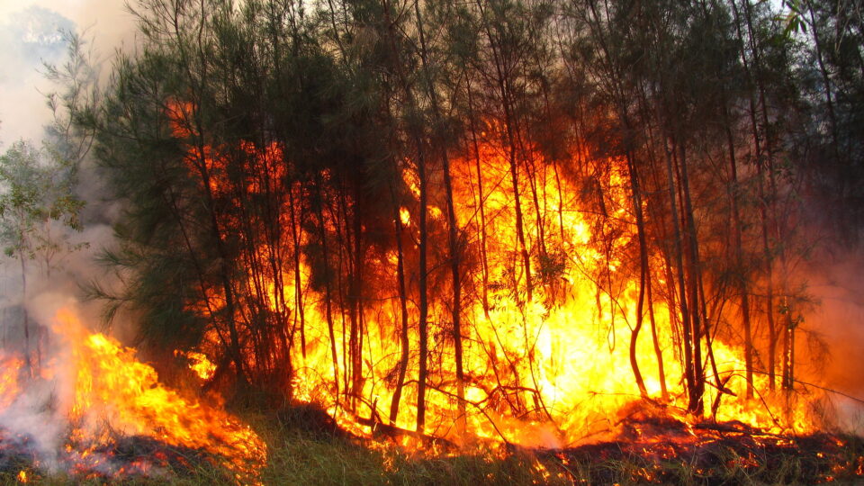
• Skip to main content
  • Skip to primary sidebar

Earth Wise

A look at our changing environment.

Hide Search
You are here: Home / Archives for floods

floods

California Flooding | Earth Wise

February 2, 2023 By EarthWise Leave a Comment

Devastating flooding kicks off the new year in California

Starting in December, a series of “atmospheric rivers” brought record storms to California producing as much rain in three weeks in some areas as they normally have in an entire year.  The historic levels of rain (and snow in the mountains) have swollen rivers, flooded roads and homes, forced evacuations, knocked out electric power for millions of people, and resulted in more than 20 deaths.

Atmospheric rivers are air currents that carry large amounts of water vapor through the sky.  They are not unusual for California but recurrent waves of them like those that have happened recently are very infrequent.  Studies by the U.S. Geological Survey have shown that such a phenomenon recurs in California every 250 years.  There were a series of storms causing disastrous floods in California in 1861-62.

The atmospheric rivers are born in the warm waters of the tropical Pacific.  During La Nina phases, the atmospheric rivers typically make landfall on the northern West Coast. During El Nino phases, atmospheric rivers are more likely to end up in Southern and Central California. During transitions between the phases, as is happening now, the storms can cover large parts of the state.

Modern forecasting is pretty good at predicting the forthcoming occurrence of these storms and has led to some helpful actions, such as reservoir operators preventing dams from overflowing or bursting.  But there is a gap between science and decision-making.  It is pretty clear what needs to be done when tornados or hurricanes are on the way.  It is less clear what actions are appropriate when there are going to be repeated heavy rainstorms.

These storms will have an effect on California’s megadrought, but just how much of an effect remains to be seen.

**********

Web Links

Flooding in California: What Went Wrong, and What Comes Next

Photo, posted January 5, 2023, courtesy of Sarah Stierch via Flickr.

Earth Wise is a production of WAMC Northeast Public Radio

Triple La Niña | Earth Wise

January 16, 2023 By EarthWise Leave a Comment

La Niña is an oceanic phenomenon consisting of cooler than normal sea-surface temperatures in the central and eastern tropic Pacific.  It is essentially the opposite of the better-known El Niño.   These sea-surface phenomena affect weather across the globe.  As one oceanographer put it:  when the Pacific speaks, the whole world listens.

There is currently a La Niña underway, and it is the third consecutive northern hemisphere winter that has had one.  This so-called triple-dip event is rather rare.  The only other times they have been recorded over the past 70 years were in 1954-56, 1973-76, and 1998-2001.

La Niñas appear when strong easterly trade winds increase the upwelling of cooler water from the depths of the eastern tropical Pacific Ocean near the equator.  This causes large-scale cooling of the ocean surface.  The cooler ocean surface modifies the moisture content of the atmosphere across the Pacific and can cause shifts in the path of jet streams that intensifies rainfall in some places and causes droughts in others.

These weather effects tend to include floods in northern Australia, Indonesia, and southeast Asia and, in contrast, drought in the American southwest.  In North America, cooler and stormier conditions often occur across the Pacific Northwest while the weather becomes warmer across the southern US and northern Mexico.

In the spring, the tropic Pacific essentially resets itself and starts building toward whatever condition will happen in the following winter, be it another La Niña or possibly an El Niño.   For the time being, forecasters expect the current La Niña to persist through February.

**********

Web Links

La Niña Times Three

Photo, posted March 10, 2007, courtesy of Gail via Flickr.

Earth Wise is a production of WAMC Northeast Public Radio

Carbon Storage In Harvested Wood | Earth Wise

September 26, 2022 By EarthWise Leave a Comment

Carbon storage in harvested wood

Trees are an exceedingly important carbon sink on our planet.  For this reason, deforestation is a major contributor to climate change.  But when trees are harvested for wood products like lumber, much of the carbon in that wood continues to be stored.  Even when a wood product is discarded at the end of its useful life, it can keep storing carbon.

Over 90% of new single-family homes in the U.S. are built with wood.  Each year, about 400,000 homes, apartment buildings, and other housing units are lost to floods and other natural disasters.  Others fall apart from decay or are torn down to be replaced with newer structures.  Given how much carbon is stored in houses, it is important to understand what the future trajectory of residential structures will be.

A new study by the USDA Forest Service published in the journal PLOS ONE looks at the future of harvested wood products in residential structures.  According to the study, wood products in these structures will continue to increase the country’s carbon storage for the next 50 years. 

Even after residential structures reach the end of their useful life and much of the materials end up in landfills (which is typical in this country), the wood products do not immediately release their carbon.  It may take decades for that to happen.

The study looked at various scenarios for future home construction.  Although housing starts are projected to decline in the future, residential housing and the need to maintain existing structures are projected to continue to increase carbon storage in wood products for the next several decades.

The role of trees as a carbon sink does not end when they are harvested for their wood.

**********

Web Links

Carbon Storage in Harvested Wood Products

Photo, posted January 27, 2022, courtesy of Luke McKernan via Flickr.

Earth Wise is a production of WAMC Northeast Public Radio

Climate-Related Disasters | Earth Wise

January 27, 2022 By EarthWise Leave a Comment

Preparing communities for climate-related disasters

In early December, a series of tornadoes struck multiple states, killing nearly 100 people and producing widespread damage in whole communities.  These storms were at least the 19th weather or climate disaster that caused more than $1 billion in damage during 2021.  The year suffered from droughts, wildfires, severe cold snaps, hurricanes, and other severe weather incidents.

The Wharton Risk Management and Decision Processes Center at the University of Pennsylvania has been studying how communities can prepare for and bounce back from such disasters.

A key issue is that the location and timing of disasters continues to shift.  Homeowners along the Gulf and Atlantic coasts know that they need to prepare for and deal with hurricanes.  People who live in places like Oklahoma and Kansas are aware that tornadoes are a frequent threat.  But in recent years, strong storms are happening in areas where historically they haven’t.

Places need to start implementing changes to their infrastructure now in order to have an impact on risk reduction.

Presidential disaster declarations are just one part of recovery from disasters.  Other issues to grapple with are the role of government support and how it isn’t just the financial costs of disaster recovery but all the impact on human and other resources that are often not covered by governmental funds.  There is also the issue that low- and moderate-income households are disproportionately harmed and locked out of financial resources for recovery.

The Wharton study points out that innovative approaches will be needed to effectively prepare communities and individuals for disasters to come. 

**********

Web Links

Preparing, and paying for, climate change-induced disasters

Photo, posted December 12, 2021, courtesy of State Farm via Flickr.

Earth Wise is a production of WAMC Northeast Public Radio.

Floating Homes In The Netherlands | Earth Wise

January 24, 2022 By EarthWise Leave a Comment

The Netherlands is a country that is largely built on reclaimed land and a third of it remains below sea level.  The Dutch have long experience with dealing with rising waters.  The city of Amsterdam has almost 3,000 houseboats in its canals.

As sea levels continue to rise across the globe, it is no surprise that the Dutch have taken the lead in creating communities composed of floating houses and buildings.

A floating house is a structure fixed to the shore, often resting on steel poles, and usually connected to the local sewer system and power grid.  They are much like ordinary houses except that instead of a basement, they have a concrete hull that acts as a counterweight, allowing them to remain stable in the water.

The ones in the Netherlands are often prefabricated, square-shaped, three-story townhouses.  Rotterdam, which is 90% below sea level, is home to the world’s largest floating office building as well as a floating farm.

Floating buildings have their challenges, not the least of which are the effects of severe wind and rainstorms, or even the passing of large ships which can make the buildings rock.  Infrastructure like electricity and sewer service is not that simple to implement for the buildings.  But the benefits of floating buildings may outweigh the costs.

For cities facing worsening floods and a shortage of buildable land, floating homes are a potential solution for expanding urban housing in the age of climate change.  Dutch engineers are spearheading floating building projects in Britain, France, and Norway, as well as in threatened island locations like French Polynesia and the Maldives.

**********

Web Links

Embracing a Wetter Future, the Dutch Turn to Floating Homes

Photo, posted May 23, 2007, courtesy of Jeff Hutchison via Flickr.

Earth Wise is a production of WAMC Northeast Public Radio.

Climate Change And Heat-Related Deaths | Earth Wise

July 14, 2021 By EarthWise Leave a Comment

Climate change is killing people

According to a new study recently published in the journal Nature Climate Change, more than one-third of the world’s heat-related deaths each year are attributable to human-induced climate change. 

Researchers from the London School of Hygiene and Tropical Medicine in the UK  and the University of Bern in Switzerland analyzed data from 732 locations in 43 countries.  They took observed temperatures and compared them with 10 computer models simulating a world without climate change.  By applying this technique to their data, the researchers were able to calculate for the first time the actual contribution of anthropogenic climate change in increasing mortality risks due to heat.

The research team found that 37% of all heat-related deaths between 1991 and 2018 were attributable to the warming of the planet due to human activities.  This percentage was highest in South America, Central America, and South-East Asia. 

In the United States, 35% of heat deaths were found to be a result of climate change.  New York had the most heat-related deaths at 141, and Honolulu had the highest percentage of heat deaths attributable to climate change at 82%.

But scientists caution that this is only a small portion of the climate’s overall impact. Many more people die from other extreme weather amplified by climate change, including severe storms, floods, and droughts.  Heat-related death figures will grow exponentially as temperatures rise.

According to the research team, the study’s findings highlight the need to adopt stronger climate change mitigation strategies, and to implement interventions to protect people from the adverse consequences of heat exposure.    

**********

Web Links

Global warming already responsible for one in three heat-related deaths

Photo, posted April 14, 2017, courtesy of Karim Bench via Flickr.

Earth Wise is a production of WAMC Northeast Public Radio.

Radar Satellites And Hazard Mitigation | Earth Wise

May 26, 2021 By EarthWise Leave a Comment

Using satellites to keep tabs on natural disasters

Scientists have concluded that the changing climate is primarily the result of increased human-caused greenhouse gas emissions.  Some of the effects of global climate change include melting glaciers, warming oceans, intensifying storms, and rising seas.

Another consequence of global climate change is natural disasters like floods and wildfires.  Climate change is increasing the frequency and severity of wildfires and increasing the odds of record-breaking floods in many parts of the United States and all around the world.

As a result, scientists in Australia have turned to technology for better assistance in keeping tabs on these climate change-driven natural disasters.  Researchers from Curtin University in Perth, Australia have found that satellites can improve the ability to detect, monitor, prepare for, and withstand natural disasters, including floods, wildfires, and earthquakes.

The research team used Synthetic Aperture Radar (SAR) data, which was acquired by the European Space Agency Sentinel-1 satellite.  The researchers also used data acquired by other satellites to evaluate these Australia-specific case studies.

According to the researchers, SAR data provides remote monitoring capabilities of Earth’s surface around the clock and in all weather, which is something that traditional optical Earth Observation (EO) imagery cannot do. The ability to function through fog, clouds, rainfall, and smoke is what makes SAR so valuable.

The research team says that the data can be used to improve how people track and respond to natural disasters, by precisely mapping topography, tracking movements of the ground, and mapping damage to infrastructure. 

As the climate continues to change, the ability to mitigate hazards like floods and wildfires will be increasingly important. 

**********

Web Links

Radar satellites can better protect against bushfires and floods

Photo, posted May 11, 2007, courtesy of Bert Knottenbeld via Flickr.

Earth Wise is a production of WAMC Northeast Public Radio.

Saving The Giant Sequoia | Earth Wise

April 22, 2021 By EarthWise Leave a Comment

Forest managers working to save the sequoias

Giant sequoia trees are some of the most remarkable living things on earth.  They can live up to 3,000 years.  The tallest specimens tower over 300 feet, but it is their girth that really sets them apart.  They are usually 20 feet in diameter, and some are up to 35 feet across at the widest.  The largest tree in the world by volume is the General Sherman tree, which has a volume of 52,508 cubic feet. At 2,100 years old, it weighs 2.7 million pounds and is not only the largest living tree, but also the largest living organism by volume on the planet.

Giant sequoias are incredibly hardy.  To have survived thousands of years, the oldest of these trees have endured hungry animals, diseases, fires, snowstorms, El Niño events, years-long droughts, and the efforts of loggers during the 19th and 20th centuries.

In February, unusually high winds knocked down 15 giant sequoias in Yosemite National Park.  While sequoias are amazingly adapted to their narrow range in California’s Western Sierras, it appears as though climate change is altering their habitat faster than the species can migrate or adapt.  Shorter cold seasons have meant more rain instead of snow, leading to floods and mudslides in the winter.  Fires are more likely with less snowpack.  Hotter, drier summers put sequoias under greater stress.

Forest managers work to preserve existing groves through fire mitigation, supplementary water, and careful stewardship of young trees in existing groves.  If these efforts are successful through the ensuing decades, climate change may be just one more thing the sequoias outlasted.  But at least some conservationists are now considering planting a new generation of sequoias in colder, nearby habitats. 

**********

Web Links

To Save Giant Sequoia Trees, Maybe It’s Time to Plant Backups

Photo, posted June 8, 2008, courtesy of Joi Ito via Flickr.

Earth Wise is a production of WAMC Northeast Public Radio.

A New Carbon Capture Technique | Earth Wise

August 25, 2020 By EarthWise Leave a Comment

Reducing carbon dioxide emissions using carbon capture

Carbon dioxide emissions by electricity generating plants, fossil-fuel burning vehicles, and industry produce about 2/3 of the greenhouse gases driving climate change.  Without decreasing these emissions, the earth will continue to get warmer, sea levels will continue to rise, and the world will face more droughts, floods, wildfires, famine and conflict.

Electrification of vehicles and reliance upon renewable energy sources will ultimately drastically reduce the use of fossil fuels and the resultant emissions, but that transition may take too long to reverse the direction of climate change.  In the meantime, there is a great need to find effective and efficient ways to capture emissions from fossil fuel plants. 

Recent research at the University of California, Berkeley, Lawrence Berkeley National Laboratory, and ExxonMobil has developed a new technique for carbon capture.  The technique makes use of metal-organic framework (or MOF) technology.  An MOF, modified with nitrogen-containing amine molecules, captures CO2 and then low-temperature steam is used to flush out the CO2 either to be used or sequestered underground.

Experiments demonstrated the technique to have a six-times greater capacity for removing CO2 from the flue gas of a refinery than current amine-based technology.  It selectively removed 90% of the emitted CO2. 

There is a relatively limited market for captured CO2, so power plants using the capture technology would likely pump the CO2 into the ground, or otherwise sequester it.  The cost of doing this sort of emission scrubbing would have to be facilitated by government policies, such as carbon trading or a carbon tax, which would provide the necessary economic incentive for doing carbon capture and sequestration.

**********

Web Links

New technique to capture CO2 could reduce power plant greenhouse gases

Photo courtesy of UC Berkeley.

Earth Wise is a production of WAMC Northeast Public Radio.

The Rising Threat Of Rising Seas | Earth Wise

February 3, 2020 By EarthWise Leave a Comment

global sea level rising

Global sea level rose by about 6 inches during the 20th century.  It is currently rising more than twice as fast and accelerating.  The rate of rise was 2.5 times faster from 2006 to 2016 than it was for nearly all of the 20th century.

Sea level rise occurs when glaciers and ice sheets lose mass.  Much of that meltwater comes from Greenland and Antarctica.  But levels also rise because, as water warms, it expands.  Added to that are the effects of human activities such as groundwater depletion and a geological phenomenon called isostatic adjustment that is going on in parts of the East Coast where the land is actually sinking.

In Atlantic Canada, sea level rise is outpacing the global average and has already led to boardwalks swamped by swelling tides, drowned forests, submerged wharfs, and threatened historic shoreline buildings.

Recent research suggests that globally, land now occupied by 300 million people could be affected by floods at least once a year by 2050 unless carbon emissions are significantly reduced, and coastal defenses strengthened.  (This new figure is more than three times higher than earlier estimates).

Researchers at Dalhousie University in Nova Scotia are studying nature-based strategies for mitigating the effects of the rising seas.  These include conserving or restoring coastal ecosystems like dunes, wetlands, and reefs which could provide protection at a lower cost than building seawalls and other man-made obstacles.  Wetlands, for example, can reduce the force of waves and act as obstacles to storm surges, while also trapping sediment and stemming erosion.  Wetlands also serve as important carbon stores, but it is estimated that roughly half of the world’s coastal wetlands have been lost over the past 100 years to human activity and extreme weather events.

**********

Web Links

The Looming Threat of Rising Sea Levels – And What We Can Do About it

Photo, posted February 14, 2015, courtesy of Flickr.

Earth Wise is a production of WAMC Northeast Public Radio.

Climate Change And El Niño

December 2, 2019 By EarthWise Leave a Comment

The term El Niño refers to a large-scale ocean-atmosphere climate interaction linked to a periodic warming in sea surface temperature across the central and east-central equatorial Pacific Ocean.  Amazingly, the phenomenon was originally recognized by fishermen off the coast of South America in the 1600s, with the appearance of unusually warm water in the Pacific Ocean.

According to a new study published in the Proceedings of the National Academy of Sciences, climate change is increasing the frequency of extreme El Niño events, leading to intensifying droughts, worsening floods, and shifting hurricane patterns.

The study, led by scientists in China and the US, looked at data from 33 El Niños dating back to 1901.  Since the 1970s, El Niños have been forming farther to the west in the Pacific Ocean, where temperatures are warmer.  Strong El Niños can cause severe drought in dry climates such as Australia and India, intense flooding in wetter climates such as the US Pacific Northwest and Peru, and more hurricanes to form in the Pacific and fewer in the Atlantic.

Before 1978, 12 out of 14 El Niños formed east of the International Dateline.  Since 1978, all 11 have formed in the central or western Pacific Ocean a shift of hundreds of miles.  There have been three so-called super El Niños since the shift – in 1982, 1997, and 2015.  These have set new average temperature records and triggered catastrophic natural disasters.

With rising global temperatures, El Niños are likely to continue to intensify, with major impacts on human societies around the world.

**********

Web Links

Climate Change is Making El Niños More Intense, Study Finds

Photo, posted January 20, 2016, courtesy of Los Angeles District via Flickr.

Earth Wise is a production of WAMC Northeast Public Radio.

Displaced By Extreme Weather

November 11, 2019 By EarthWise Leave a Comment

The Internal Displacement Monitoring Centre is the world’s authoritative source of data and analysis on internal displacement.  Internal displacement refers to people being forced to flee their homes or places of habitual residence but who remain within their country’s borders.  Such displacements can be the result of conflict, violence, development projects, natural disasters, or climate change.  As of the end of 2018, over 41 million people were living in internal displacement because of conflict and violence alone.

This year, natural disasters are causing a record number of internal displacements.  In the first half of the year, 7 million people were displaced by disasters, accounting for nearly two-thirds of all the internal displacements worldwide.  The IDMC estimates that this number could hit 22 million by the end of the year.

The vast majority of displacement has been associated with storms and floods.  Cyclone Fani alone in May displaced more than 3.4 million people in India and Bangladesh.  In March, Cyclone Idai displaced 617,000 people in Mozambique, Malawi, and Zimbabwe.  In total, 950 extreme weather events in 102 countries and territories displaced 7 million people from January to June.

Technically speaking, internally displaced people are not considered to be refugees because they remain in their home countries.  But the growing millions of people represent a global crisis that continues to worsen with the changing climate.  The international community cannot ignore the plight of these people.  Governments around the world have to redouble their efforts to protect and assist their displaced citizens as well as to invest in sustainable development and climate change adaptation.

**********

Web Links

Extreme Weather Displaced 7 Million People in First Half of 2019

Photo, posted August 5, 2012, courtesy of the U.S. Embassy, Jakarta via Flickr.

Earth Wise is a production of WAMC Northeast Public Radio.

Hundred-Year Floods Becoming One-Year Floods

September 26, 2019 By EarthWise Leave a Comment

By definition, 100-year floods are intense flooding events that historically tend to happen once every 100 years.  Put another way, a 100-year flood has a 1 percent chance of happening in any given year.

According to new research published in the journal Nature Communications, rising global temperatures may turn 100-year floods into annual occurrences in parts of the United States.  The increase in severe coastal flooding events by the end of this century will be a result of rising sea levels and stronger, more frequent tropical storms and hurricanes.

The study, led by researchers at Princeton University and MIT, examined flood risk for 171 counties along the US East Coast and the Gulf of Mexico.  Their analysis concluded that 100-year floods will become annual events in New England.  In the US Southeast and Gulf of Mexico, counties could experience such floods as often as every year up to as seldom as every 30 years.

Previously, most analysis of coastal flooding has looked only at the impact of sea level rise on flood risk.  This new research combined the risk of rising seas with projected changes in coastal storms over the course of this century.  Data from the Gulf of Mexico revealed that the effect of stronger storms is comparable with or even more significant than the effect of sea level change for 40% of the counties studied.  So, neglecting the effects of storm climatology change is likely to significantly underestimate the impact of climate change in many places.

The hope is that more comprehensive flood risk data can be used to create more effective climate resiliency strategies all the way down to the county level.

**********

Web Links

100-Year Floods Could Soon Happen Annually in Parts of U.S., Study Finds

Photo, posted August 31, 2017, courtesy of the U.S. Department of Agriculture via Flickr.

Earth Wise is a production of WAMC Northeast Public Radio.

Another Bad Year For Bees

August 6, 2019 By EarthWise Leave a Comment

The latest annual nationwide survey of beekeepers in the US revealed that honeybees are still dying off at an alarming rate.  According to the survey, beekeepers across the country lost 40.7% of their honey bee colonies from April 2018 to April 2019. 

This annual loss represents a slight increase over the average annual loss of 38.7%.  Of greater concern is that winter losses of 37.7% were the highest reported since these annual surveys began 13 years ago and are almost 9% higher than the survey average.

These results are very troubling considering that the elevated losses are continuing even after a decade of intense work trying to understand and reduce colony loss.  Evidently, there has not been much progress.

The number one concern among beekeepers is varroa mites, which are lethal parasites that can readily spread from colony to colony.  These mites have been decimating bee colonies for years.  Products developed to remove mites seem to be getting less and less effective.

But mites are not the only problem for bees.  Land use changes have resulted in reduced availability of pollen sources for bees.  Add to that pesticide exposures, environmental factors, and even problems with beekeeping practices.   In addition, extreme weather conditions such as wildfires and floods are only adding to the problems facing bees.

The tools that used to work for beekeepers seem to be failing and they are already stretched to their limits trying to keep their bees alive. Honey bees pollinate $15 billion worth of food crops in the United States each year. The problems facing bees are a problem for all of us.

**********

Web Links

U.S. Beekeepers Suffered Higher than Average Colony Loss Last Year, with Winter Losses the Highest Recorded, According to UMD-Led Annual Survey

Photo, posted June 3, 2009, courtesy of Jennifer C via Flickr.

Earth Wise is a production of WAMC Northeast Public Radio.

Protecting Vulnerable Shorelines

May 21, 2019 By EarthWise Leave a Comment

Global climate change is having noticeable effects on the environment. For example, glaciers are shrinking.  Plant and animal ranges are shifting and populations decreasing.  And droughts, floods, and wildfires are becoming more frequent and more intense.  According to the Intergovernmental Panel on Climate Change, the evidence indicates that the net damage costs of climate change are likely to be significant and to increase over time. 

Our coastal shorelines, which are already stressed by human activity, pollution, storms, and invasive species, are one of many areas expected to be further threatened by climate change.  Sea level rise and more intense and frequent storms are expected to erode and inundate coastal ecosystems and eliminate wetlands.  Ocean acidification is also projected to disrupt marine environments. 

But according to scientists at the Massachusetts Institute of Technology, seagrasses could play a key role in protecting these vulnerable shorelines from this onslaught.  The MIT research team demonstrated how the ubiquitous marine plants dissipate wave energy and help protect against erosion, which could help mitigate damage from rising seas. 

Using mathematical modelling and experiments, the MIT researchers were able to quantify for the first time how large and dense a continuous meadow of seagrass must be in order to provide adequate damping of waves in a given setting.  They also found that seagrasses offer significant environmental benefits, including preventing beach erosion, protecting seawalls and coastal structures, improving water quality, and sequestering carbon. 

Submerged aquatic vegetation, including seagrasses, provides an ecosystem service exceeding $4 trillion annually.  Hopefully these findings can help provide useful guidance for seagrass restoration efforts.

**********

Web Links

Seagrass’ strong potential for curbing erosion

The Effects of Climate Change

Photo, posted October 13, 2010, courtesy of the NOAA Photo Library via Flickr.

Earth Wise is a production of WAMC Northeast Public Radio.

High-Tide Flooding And Pollution

April 30, 2019 By EarthWise Leave a Comment

Global sea levels are steadily rising.  They are up 8 inches in the past century and now increasing at an average of 1.3 inches per decade.  As a result, the incidence of high-tide “sunny day” flooding is on the rise, especially along the U.S. East Coast.

Norfolk Virginia experienced fewer than 2 days of high-tide flooding a year in the 1960s; it had 14 in 2017.  Up and down the East Coast, flood days have increased by factors of 5 and more.

This has led to a form of pollution that hasn’t gathered much attention in the past:  when these floodwaters recede, they can carry debris, toxic pollutants and excess nutrients into rivers, bays, and oceans.

In the aftermath of high-tide flooding in Norfolk, Chesapeake Bay was littered with tipped-over garbage cans, tossed-away hamburgers, oil, dirty diapers, pet waste and all manner of other things.  Water that comes up on the landscape takes everything back into the river or ocean with it.

Analysis of tidal flooding along the Lafayette River in Norfolk indicated that just one morning of tidal flooding poured nearly the entire EPA annual allocation of nitrogen runoff for the river – nearly 2,000 pounds – into Chesapeake Bay.  The effects of excess nitrogen in the water are well-known and responsible for the toxic algal blooms that endanger aquatic life as well as human health.

According to the National Oceanic and Atmospheric Administration, high-tide flooding frequency along the southeastern coast of the U.S. rose 160% since 2000.  With the expected continuing rises in sea level, NOAA projects that as many as 85 days of high-tide flooding will occur along the coast by the year 2050.  It’s a big problem.

**********

Web Links

As High-Tide Flooding Worsens, More Pollution Is Washing to the Sea

Photo, posted September 20, 2018, courtesy of SC National Guard via Flickr.

Earth Wise is a production of WAMC Northeast Public Radio.

Glaciers And Water Supply

March 25, 2019 By EarthWise Leave a Comment

The world has roughly 150,000 glaciers covering about 200,000 square miles of the earth’s surface.  Over the last 40 years they’ve lost the equivalent of a layer of ice 70 feet thick.  Most of them are getting shorter as well.  Some have shrunk to nothing; many smaller glaciers in places like the Rockies and the Andes have disappeared entirely.

Glaciers represent the snows of centuries, compressed over time to form flowing rivers of ice.  They always change over time, accumulating snow in winter and losing ice to melting in summer.  But in recent times, the warming climate has allowed the melting to outpace the accumulation.

Much of the discussion about the retreating glaciers relates to sea level rise, catastrophic floods, debris flow, and the effects on rivers and ecosystems.

But in some places, the biggest impact of the loss of glaciers is on the supply of water for people and agriculture.  In Kazakhstan, Almaty, the country’s largest city depends on glacier-fed rivers for drinking water for its 2 million people and for irrigation water for crops.  All across the Tibetan Plateau and the Himalayan and Karakmoram mountain ranges, hundreds of millions of people rely on glacier-fed rivers for their water supplies. 

A melting glacier can at first increase stream flow but eventually reaches a tipping point and meltwater begins to taper.  In the short term, the melting glaciers may provide increased amounts of water coming down from the mountains, but eventually the flow in the rivers will begin to decline and populations will face a crisis.

It will be essential for people in many places to carefully plan for their future water needs in a changing world.

**********

Web Links

Glaciers Are Retreating. Millions Rely on Their Water.

Photo, posted September 16, 2011, courtesy of Flickr.

Earth Wise is a production of WAMC Northeast Public Radio.

Climate Change And Infertility

March 8, 2019 By EarthWise Leave a Comment

Many of us are all too familiar with the effects of climate change.  Our changing climate, as a result of our actions, is leading to rising global temperatures, biodiversity loss, ocean acidification, wildfires, more weather extremes like floods and droughts. But a lesser known effect of climate change could lead to frightening consequences: infertility.

According to researchers at the University of Liverpool, rising temperatures could make some species sterile and lead them to succumb to the effects of climate change far earlier than currently thought. Their work was recently published in the journal Trends in Ecology and Evolution, and it was produced in collaboration with scientists from the University of Leeds, University of Melbourne, and Stockholm University.

Biologists and conservationists are trying to predict where species will be lost due to climate change so that suitable reserves can be established in other locations.  But the problem is that most data on when temperature will make an area unlivable for a species is based on its ‘critical thermal limit’ or CTL.  This is the temperature at which a species would collapse, stop moving, or die. 

The authors of the article fear that the impact of climate change on species survival is being underestimated.  Because rather than zeroing in on lethal temperatures, the scientists argue the focus should be on the temperatures at which organisms can no longer breed.  Extensive plant and animal data suggest organisms lose fertility at a lower temperature than their CTL.

The scientists have proposed a new fertility-based metric to gauge how organisms function as temperatures climb: Thermal Fertility Limit or TFL.  Understanding when a species will cease to reproduce will certainly help conservation measures. 

**********

Web Links

Climate change and infertility — a ticking time bomb?

Photo, posted August 11, 2013, courtesy of Mike Lewinski via Flickr.

Earth Wise is a production of WAMC Northeast Public Radio.

Greenhouses Adapt To Climate Change

August 2, 2018 By EarthWise Leave a Comment

https://earthwiseradio.org/wp-content/uploads/2018/06/EW-08-02-18-Greenhouses-Adapt-to-Climate-Change.mp3

The Telangana region of India has struggled with extreme weather patterns attributed to climate change.  Extended periods of drought, heatwaves, and unpredictable heavy rainfalls have led to crop failures, mounting debt, and a heavy human toll.  More than 3,000 farmers committed suicide in Telangana during a three-year drought.

[Read more…] about Greenhouses Adapt To Climate Change

Traffic Jams In The Jet Stream

July 13, 2018 By EarthWise Leave a Comment

https://earthwiseradio.org/wp-content/uploads/2018/07/EW-07-13-18-Traffic-Jams-in-the-Jet-Stream.mp3

Many extreme weather events are associated with unusual behavior by the jet stream.   Jet streams are the global air currents that circle the earth.  The meandering and speed changes in the jet stream affect weather and also play a big role in how long it takes aircraft to make their way across the country.  The behavior that leads to extreme weather events is known as “blocking” in which the meandering jet stream stops weather systems from moving eastward.

[Read more…] about Traffic Jams In The Jet Stream

  • Go to page 1
  • Go to page 2
  • Go to Next Page »

Primary Sidebar

Recent Episodes

  • Energy From Rice Straw | Earth Wise
  • California Flooding | Earth Wise
  • The Race For EV Batteries | Earth Wise
  • Turning Carbon Into Stone | Earth Wise
  • Tracking Global Forest Changes | Earth Wise

WAMC Northeast Public Radio

WAMC/Northeast Public Radio is a regional public radio network serving parts of seven northeastern states (more...)

Copyright © 2023 ·