• Skip to primary navigation
  • Skip to main content
  • Skip to primary sidebar

Earth Wise

A look at our changing environment.

  • Home
  • About Earth Wise
  • Where to Listen
  • All Articles
  • Show Search
Hide Search
You are here: Home / Archives for conditions

conditions

Fire And Ice | Earth Wise

January 17, 2022 By EarthWise Leave a Comment

As the climate changes, fire and ice are related

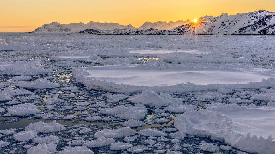
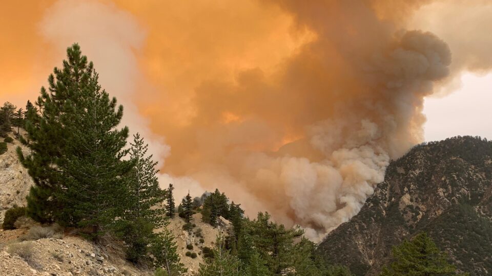
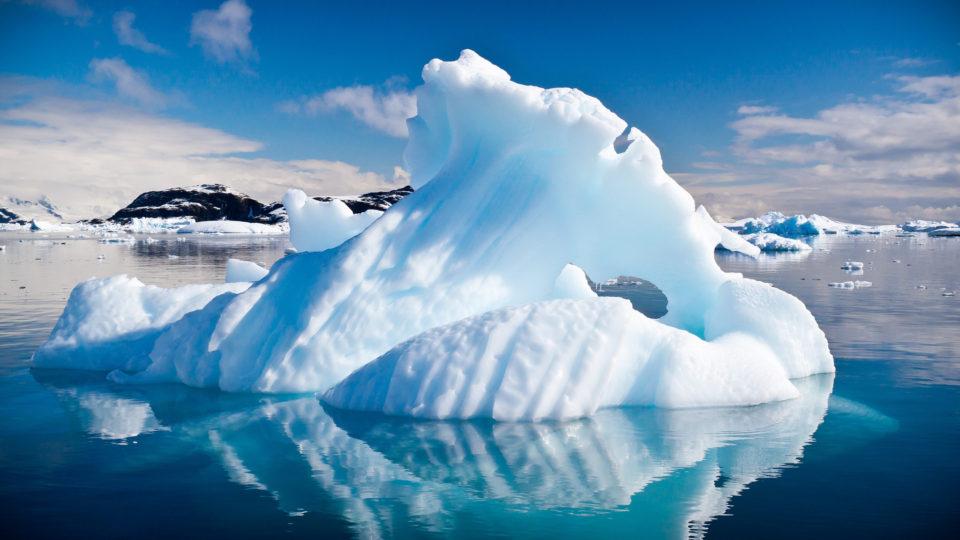
In recent years, there have been countless stories about the effects of the changing climate.  Many of those stories have been about the dwindling sea ice in the Arctic and many others have been about the worsening wildfires in the western United States.   According to a recent study published by the Pacific Northwest National Laboratory, those two things are very much related.

As sea ice in the Arctic melts from July to October, sunlight warms the surrounding land and sea surfaces.  The resulting differences in air pressure create and strengthens a vortex in the atmosphere above the heated area which spins counterclockwise like a cyclone.

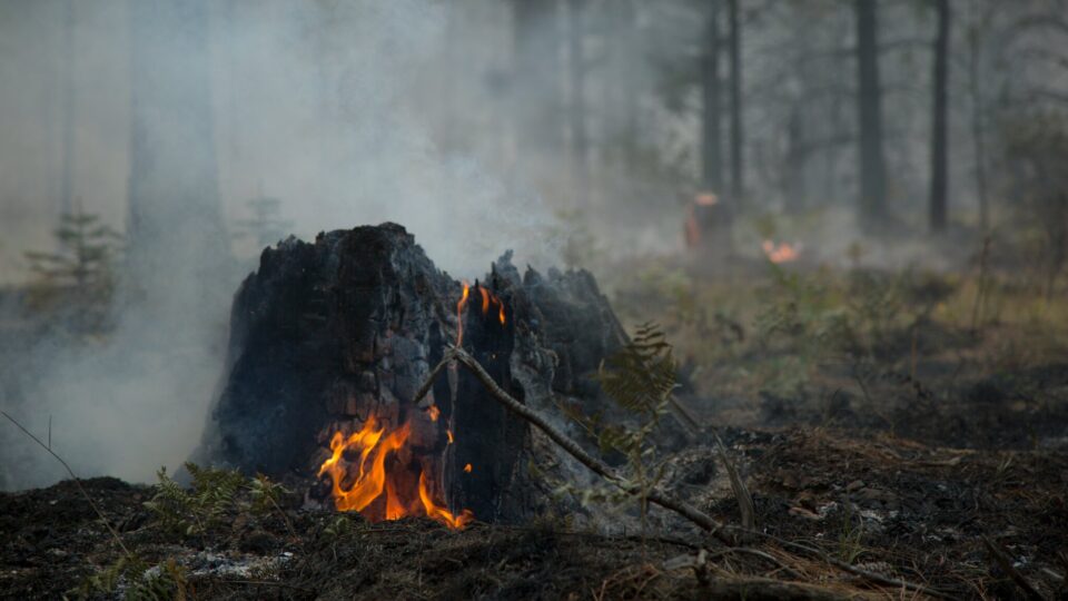
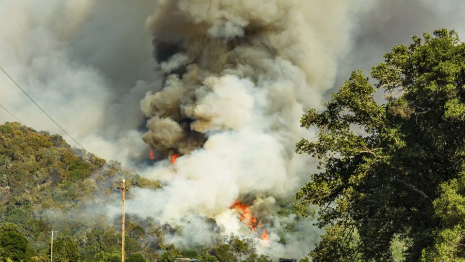
The powerful vortex pushes the polar jet stream out of its typical pattern and diverts moist air away from the western United States.  With the jet stream moved off its usual course, a second vortex, this time spinning clockwise, forms under the ridge of the polar jet stream above the Western U.S.  This second vortex brings with it clear skies and dry conditions:  fire-favorable weather.

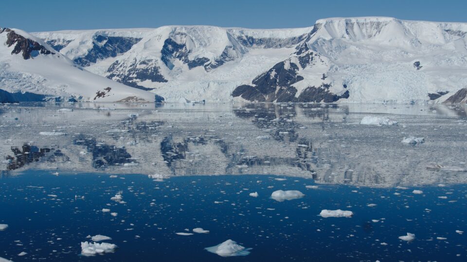
Arctic sea ice has continually declined at least since the late 1970s.  It is predicted that there will be periods of entirely iceless Arctic waters before the 2050s.  In turn, conditions in the already fire-ravaged West are likely to be further exacerbated.  More than three million acres have burned across California alone during the 2021 wildfire season.

Climate conditions in one part of the world can, over time, influence climate outcomes thousands of miles away.  The research at Pacific Northwest Laboratory reveals how regional land and sea surface warming caused by Arctic ice melting can trigger hotter and drier conditions in the West later in the year.

**********

Web Links

Fire and Ice: The Puzzling Link Between Western Wildfires and Arctic Sea Ice

Photo, posted July 28, 2018, courtesy of Bob Dass via Flickr.

Earth Wise is a production of WAMC Northeast Public Radio.

Global Flood Risk From Melting Ice | Earth Wise

December 13, 2021 By EarthWise Leave a Comment

Melting ice is posing a global flood risk

Approximately 10% of the land area on Earth is covered by ice.  This includes glaciers, ice caps, and the ice sheets of Antarctica and Greenland.  Nearly 70% of all fresh water on earth is locked away in ice.  If all this land ice were to melt, global sea levels would rise by more than 200 feet. 

According to new research led by researchers at the University of Leeds in the U.K., global warming is causing extreme ice melting events in Greenland to become more frequent and more intense over the past 40 years, leading to an increased risk of flooding worldwide.   

According to the findings, which were recently published in the journal Nature Communications, approximately 3.85 trillion tons of ice has melted from the surface of Greenland and into the ocean during the past decade alone.  That’s enough melted ice to cover all of New York City with nearly 15,000 feet of water. 

Rising sea levels threaten the lives and livelihoods of those living in coastal communities around the world.  Beyond the obvious risk of flooding in low-lying areas, rising seas also disrupt marine ecosystems that many coastal communities rely on for food and work.       

Rising sea levels can also alter patterns of ocean and atmospheric circulation, which in turn affect weather conditions around the planet.

Estimates from models suggest that melting ice from Greenland will contribute between 1 inch and 9 inches to global sea level rise by 2100. 

These findings are just another reminder of how we need to act urgently to mitigate climate change if we want to prevent the worst-case scenarios from becoming reality. 

**********

Web Links

Increased frequency of extreme ice melting in Greenland raises global flood risk

Photo, posted April 21, 2017, courtesy of Markus Trienke via Flickr.

Earth Wise is a production of WAMC Northeast Public Radio.

Deadly Urban Heat On The Rise | Earth Wise

November 9, 2021 By EarthWise Leave a Comment

Exposure to deadly urban heat is on the rise

According to a new study by the Columbia Climate School, exposure to deadly urban heat has tripled since the 1980s.  The increase is the combined result of both rising global temperatures and booming urban population growth.

The study looked at more than 13,000 cities worldwide and found that incidents of extreme heat and humidity have increased dramatically.   It defined extreme heat as 30 degrees Celsius on the wet-bulb temperature scale that takes into account the effect of high humidity.  In 1983, there were 40 billion person-days under such conditions.  By 2016, the number was 119 billion.  More specifically, in 2016 1.7 billion people were subjected to such conditions on multiple days.

Sheer urban population growth accounted for two-thirds of the increase, while actual warming contributed a third.  Over recent decades, hundreds of millions of people have moved from rural areas to cities, which now hold more than half the world’s population.  And because of the urban heat island effect, temperatures in cities are generally higher than in the countryside.

In the United States, about 40 sizable cities have seen rapidly growing exposure to extreme heat, mainly clustered in Texas and the Gulf Coast.  Globally, nearly a quarter of the world’s population is affected by the increased incidence of extreme temperatures.

A study last year showed that combinations of heat and humidity literally beyond the limits of outdoor human survival have been popping up around the world.  A wet-bulb temperature reading of 30 – equivalent to 106 degrees Fahrenheit on the “real feel” heat index – is the point at which even most healthy people find it hard to function outside for long, and the unhealthy might become very ill or even die.

**********

Web Links

Exposure to Deadly Urban Heat Worldwide Has Tripled in Recent Decades, Says Study

Photo, posted March 5, 2007, courtesy of Michael Phillips via Flickr.

Earth Wise is a production of WAMC Northeast Public Radio.

A Record Low For Lake Mead | Earth Wise

October 4, 2021 By EarthWise Leave a Comment

The low water level of Lake Mead is causing regional water shortages

Lake Mead is the reservoir that was formed by the Hoover Dam on the Colorado River.  The lake spans the Arizona-Nevada border.  It is the largest reservoir in the United States in terms of water capacity.  The lake is part of a system that supplies water to at least 40 million people in seven states and in Northern Mexico.

As of August 22, this year, Lake Mead was filled to just 35% of its capacity.  This low water level is happening while 95% of the land in nine Western states is under some level of drought conditions and 64% of the land is under extreme drought conditions.  A so-called megadrought has been going on for 22 years and may be the worst dry spell in the region in twelve centuries.

As of the end of July, the water elevation at the Hoover Dam was 1,067 feet above sea level, the lowest it has been since April 1937 when the lake was still being filled after dam construction.  The level has dropped by 132 feet since July 2000.  At maximum capacity, Lake Mead reaches an elevation of 1,220 feet and holds 9.3 trillion gallons of water.

With Lake Mead at 35% of capacity, Lake Powell on the Colorado at 31%, and the entire Lower Colorado system at 40%, water allocations for the coming water year are being cut back. Mexico will see a 5% reduction, Nevada will be cut 7%, and Arizona will lose 18% of its apportionment.   This unprecedented official declaration of a water shortage demonstrates the severity of the drought and low reservoir conditions.

**********

Web Links

Lake Mead Drops to a Record Low

Photo, posted August 7, 2018, courtesy of Renee Grayson via Flickr.

Earth Wise is a production of WAMC Northeast Public Radio.

Overwintering Fires | Earth Wise

July 6, 2021 By EarthWise Leave a Comment

Early detection of overwintering fires could help with fire management

Fires that go on for long periods of time, surviving the snow and rain of winter to reemerge in the spring, are becoming more common in high northern latitudes as the climate warms.  Such fires are called holdover fires, hibernating fires, overwintering fires, or even zombie fires.  Whatever people choose to call them, this type of wildfire is occurring more often.

These smoldering fires start out as flaming fires but then enter an energy-saver mode.  They start above ground but then smolder in the soil or under tree roots through the winter.  They barely survive based on the oxygen and fuel resources that they have but can transition back into flaming fires once conditions are more favorable.

Dutch researchers used ground-based data with fire detection data from NASA’s Moderate Resolution Imaging Spectroradiometer instruments on the Terra and Aqua satellites to study fires in the boreal forests of Alaska and Canada’s Northwest Territories.  They found a way to identify overwintering fires based on their unique characteristics.  

Their data indicates that overwintering fires tend to be linked to high summer temperatures and large fire seasons.  Between 2002 and 2018, overwintering fires generally accounted for a small amount of the total burned area in the region but in individual years with hot and severe fire seasons, the number can escalate.  In 2008 in Alaska, for example, overwintering fires accounted for nearly 40% of the burned area.

Early detection of these overwintering fires could help with fire management and reduce the amount of carbon – which is stored in large amounts in the region’s organic soils – that gets released to the atmosphere during fires.

**********

Web Links

Overwintering Fires on the Rise

Photo, posted September 14, 2017, courtesy of Andrew R. Mitchell/USDA via Flickr.

Earth Wise is a production of WAMC Northeast Public Radio.

A Dangerous Fire Season | Earth Wise

June 9, 2021 By EarthWise Leave a Comment

Drought conditions expected to cause worse fire season

The western United States is entering the fire season under much worse drought conditions than last year.  Last year, 15,800 square miles burned in the U.S., mostly in the West.

The western U.S. is in the midst of a 20-year mega-drought.  Rainfall in the Rocky Mountains and farther west was the second lowest on record this April.  The soil in the western half of the country is the driest it has been since 1895.

The situation is particularly bad in California and the Southwest.  In March, less than a third of California was experiencing extreme or exceptional drought.  Now, 73% of the state is.  A year ago, a record-breaking fire season burned 4% of the state and, at that time, only 3% of California was in a state of extreme drought.

A year ago, no parts of Arizona, Nevada, or Utah were in extreme or exceptional drought.  Now, more than 90% of Utah, 86% of Arizona, and 75% of Nevada face severe drought conditions.  At this time last year, only 4% of New Mexico faced extreme drought but 77% does now.

These extreme drought conditions, which are believed to be linked to climate change, are causing increased tree mortality among many species, ranging from junipers in the Southwest even to drought-tolerant blue oaks in the San Francisco Bay Area.

Conditions are extremely ripe for a lot of forest fire this year.  Last year was a terrible year for wildfires in the West and we are heading into a fire season with much drier fuels than there were last year.  The risks of great damage from wildfires are higher than ever.

**********

Web Links

US West Enters Fire Season Facing Extremely Dry Conditions

Photo, posted September 18, 2020, courtesy of USFS/National Interagency Fire Center via Flickr.

Earth Wise is a production of WAMC Northeast Public Radio.

Improved Radar For Cars | Earth Wise

December 31, 2020 By EarthWise Leave a Comment

Improving radar technology for cars

Self-driving cars require a variety of sensor systems in order for the cars to safely navigate roads and deal with the wide range of objects and conditions that they encounter.  Two competing technologies that cars use to identify and locate objects on the scene are radar and LiDAR. 

Radar uses transmitted radio waves to locate objects and LiDAR bounces laser beams off of objects.   Each has its shortcomings.   Radar has the problem that only a small fraction of the transmitted signals gets reflected back to the sensor, so that there is frequently insufficient data to fully characterize a scene.  LiDAR has the problem that it is an optical system that does not work well in fog, dust, rain, or snow.  It is also much more expensive than radar.

Researchers at the University of California San Diego have developed a new system that they describe as a LiDAR-like radar. The system consists of two radar sensors placed on a car’s hood and spaced about 1.5 meters apart.  This configuration enables the system to see more space and detail than a single radar sensor.

Having two radars at different vantage points with an overlapping field of view creates a region of high-resolution with a high probability of detecting the objects that are present.  The system also overcomes noise problems of conventional radar systems.

The researchers developed new algorithms that can fuse the information from two different radar sensors and produce a new image free of noise.

Self-driving cars have to combine detection technologies like radar with cameras and ultrasonic sensors.  Duplicating the capabilities that people use in order to safely drive a car is a complex problem requiring a combination of multiple sensors and sophisticated software.

**********

Web Links

Upgraded radar can enable self-driving cars to see clearly no matter the weather

Photo, posted January 2, 2014, courtesy of Bradley Gordon via Flickr.

Earth Wise is a production of WAMC Northeast Public Radio.

Fitness Trackers For Lobsters | Earth Wise

October 20, 2020 By EarthWise Leave a Comment

improving the lobster supply chain

The lobster industry is somewhat unique, at least in this country, in that it involves an animal food that is kept alive until it has reached the destination where it will be consumed or used.  As a result, the industry has to deal with a problem they call “shrink”, which is the mortality lobsters experience as they change hands from capture to kitchen.

Maine’s lobster industry has reached out to the University of Maine Lobster Institute along with collaborators at other institutions to help quantify and mitigate stress points in the lobster supply chain that reduce survival and profitability.

A 2-year project was funded by the National Oceanic and Atmospheric Administration to create miniature sensory devices – crustacean heart and activity trackers (called C-HATs).  These are essentially Fitbits for lobsters.  The noninvasive devices strapped on a lobster monitor its heart rate and movement as it passes from trap to on-board live tank to live storage crate to truck to wholesaler to retailer or processor.

A separate sensor-equipped device called the MockLobster travels along with the lobsters to log environmental conditions experienced, including temperature, light and dissolved oxygen levels.

The hope is to be able to get a good handle on the conditions lobsters experience from trap to market and learn where problems are likely to arise.  The researchers are also working to develop economical, standardized protocols to monitor water quality and the heath of lobsters during their movement through the supply chain.

The goal is to produce big improvements in the bottom lines of everyone along the supply chain along with big improvements in the health of the lobsters destined for market.

**********

Web Links

Fitness trackers, environmental sensors prototyped to improve survival in the lobster supply chain 

Photo, posted August 29, 2015, courtesy of Adam Grimes via Flickr.

Earth Wise is a production of WAMC Northeast Public Radio.

Conserving The Colorado River | Earth Wise

August 13, 2020 By EarthWise Leave a Comment

Colorado River Water and Climate Adaptation

Last year, we talked about the troubles facing the Colorado River.  Nearly two decades of drought conditions have reduced the water levels of the two largest reservoirs of Colorado River water and have threatened the water supply of millions of people in the region.  Clear scientific evidence shows that climate change is constricting the iconic river and will do further damage as temperatures rise.

Faced with these facts, water resource managers have been implementing conservation policies in the region and the results so far are very encouraging.

The use of Colorado River water in the three states of the river’s lower basin – Arizona, California, and Nevada – fell to a 33-year low in 2019.  The three states consumed just over 6.5 million acre-feet for the year, which is about 1 million acre-feet less than the three states are entitled to use under the legal agreement that allocates Colorado River water.

The last time water consumption from the river was that low was in 1986, which is the year that Arizona opened a large canal that extracts river water for its entitlement. 

A key indicator of river health is the depth of Lake Mead, the largest reservoir of Colorado River water.  It has been steadily dropping in recent years, but last year, with the reduced consumption, the water level actually increased by 12 feet.

According to water managers, the steady drop in water consumption in recent years is a sign that conservation efforts are working and that there are strategies that can deal with chronic shortages on the river in the future.  It represents an important demonstration that it is possible to use less water in a region that irrigates 5 million acres of farmland and has 40 million people in 2 countries and 29 tribal nations.

**********

Web Links

Remarkable Drop in Colorado River Water Use a Sign of Climate Adaptation

Photo, posted July 7, 2015, courtesy of Flickr.

Earth Wise is a production of WAMC Northeast Public Radio.

Extreme Heat And Humidity | Earth Wise

June 15, 2020 By EarthWise Leave a Comment

heat and humidity

On hot, sticky summer days, one often hears the expression “it’s not the heat, it’s the humidity.” That isn’t just an old saw; it is a recognition of what might be the most underestimated direct, local danger of climate change.   Extreme humid heat events represent a major health risk.

There is an index called “wet-bulb temperature” that is calculated from a combination of temperature and humidity data.  The reading, which is taken from a thermometer covered in a wet cloth, is related to how muggy it feels and indicates how effectively a person sheds heat by sweating.  When the wet-bulb temperature surpasses 95o Fahrenheit, evaporation of sweat is no longer enough for our bodies to regulate their internal temperature.  When people are exposed to these conditions for multiple hours, organ failure and death can result. 

Climate models project that combinations of heat and humidity could reach deadly thresholds for anyone spending several hours outdoors by the end of this century. 

Dangerous extremes only a few degrees below the human tolerance limits – including in parts of the southwestern and southeastern US – have more than doubled in frequency since 1979.  Since then, there have been more than 7,000 occurrences of wet-bulb temperatures above 88o, 250 above 91o, and multiple reading above 95o.  Even at lower wet-bulb temperatures around 80o, people with pre-existing health conditions, the elderly, as well as those performing strenuous outdoor labor and athletic activities, are at high risk.

More research is needed on the factors that generate extreme wet-bulb temperatures as well as the potential impacts on energy, food systems, and human security.

**********

Web Links

Dangerous Humid Heat Extremes Occurring Decades Before Expected

Photo, posted April 16, 2012, courtesy of Flickr.

Earth Wise is a production of WAMC Northeast Public Radio.

The Earth Itself Is Quieter | Earth Wise

May 15, 2020 By EarthWise Leave a Comment

Coronavirus quiets the earth

Our stories often discuss how human activities change the natural environment.  With most of us confined to our homes, the lack of human activities is having profound effects on the environment.  We are talking about some of these this week.

With about a third of the world’s population sheltering in place, our planet is much quieter these days.  It isn’t just our machines, vehicles, and factories that are making less noise.  The earth itself is quieter.  There has been a reduction in the earth’s seismic vibrations.

According to the journal Nature, various human-powered movements contribute to the persistent vibration of the earth’s crust.  Things like engines firing up in factories, trains pulling into stations, and trucks barreling down highways all make contributions to seismic activity.  Taken individually, such things are insignificant, but taken together, they produce a background of seismic noise that makes it difficult for seismologists to detect natural signals such as volcanic activity and earthquake aftershocks.

With much human activity on pause during the coronavirus outbreak, seismologists across the globe are seeing significant reductions in background seismic noise levels.

This respite in seismic noise, for as long as it lasts, represents an opportunity for scientists to better study the natural activity in the earth’s crust. Researchers studying the impact of ocean waves to predict volcanic activity and those who triangulate the location of earthquake epicenters may be able to make more sensitive measurements than under normal conditions.

There are very few positive things one can say about the coronavirus crisis, but it is providing opportunities to study and observe aspects of the natural world that are ordinarily drowned out by the bustle of humanity.

**********

Web Links

Coronavirus lockdowns across the globe are actually causing the Earth to move less

Photo, posted March 9, 2020, courtesy of Jeremy Segrottvia Flickr.

Earth Wise is a production of WAMC Northeast Public Radio.

A Record Antarctic Temperature | Earth Wise

March 5, 2020 By EarthWise Leave a Comment

warmest temperatures ever recorded

It is still early in the year, but extreme weather events are already piling up.  January was the warmest month on record globally and there have been many records shattered in Europe and Asia.  A number of places in Eastern Europe, including parts of Russia, have seen temperatures 12 to 13 degrees above average.

While the warming of the Arctic has been in the news with increasing frequency, the Antarctic is also seeing rising temperatures and is one of the fastest-warming regions in the world. 

On February 6th, Esperanza Base along Antarctica’s Trinity Peninsula measured a temperature of 65 degrees Fahrenheit, which is the highest temperature ever recorded on that continent.   This rather balmy temperature narrowly beat out the previous record of 63.5 degrees, which occurred in March of 2015.

This one-time reading is certainly anomalous, and scientists say it is associated with a ridge of high pressure that was lingering over the region for several days.  Local wind conditions led to additional warming.

However, the conditions leading to record-breaking high temperatures are not one-time anomalous events. Over the past 50 years, temperatures in the Antarctic have surged by an extraordinary 5 degrees in response to the Earth’s rapidly warming climate.  A rise of five degrees in day-to-day weather is no big deal. A five-degree rise in a region’s average temperature is enormous.

About 87% of the glaciers along the west coast of Antarctica’s Trinity Peninsula have retreated over that 50-year period, most of which doing so during just the past 12 years.

Some researchers claim that the new temperature record is an extreme event that doesn’t tell us anything about the changing climate.  Many others are convinced that there will be many more high temperature records to follow.

**********

Web Links

Antarctica just hit 65 degrees, its warmest temperature ever recorded

Photo, posted February 24, 2019, courtesy of Mike via Flickr.

Earth Wise is a production of WAMC Northeast Public Radio.

Road Salt Pollution

January 8, 2020 By EarthWise 1 Comment

Road salt pollution mirror lake

Mirror Lake is a popular recreational lake located in the Village of Lake Placid.  It is the most developed lake within the Adirondack Park, which is a publicly protected area that is actually larger than Yellowstone, Yosemite, Glacier, and Grand Canyon National Parks combined.

New research has revealed that road salt runoff into Mirror Lake is preventing natural water turnover which poses a risk to the balance of its ecology.  The study, which was published in Lake and Reservoir Management, found that road salt runoff is preventing spring mixing of the water column.    This creates more anoxic water conditions, meaning there is less oxygen in the water, and limits the ability of the habitat to support the native lake trout. 

Mirror Lake is the first lake in the Adirondack Park to show an interruption in lake turnover due to road salt.  Many lakes in northern climes experience so-called “dimictic turnover”, which is a natural process where wind and less stratified water conditions of spring and fall allow mixing of the water column that redistribute oxygen and nutrients throughout the lake.  High levels of surface-water chloride introduced into the lake from road salt runoff inhibit the mixing of the water column.

The lack of mixing and oxygenation is bad news for fish species such as lake trout, which require cold, oxygenated water to survive.  It may also put the lake at a greater risk of algal blooms.

Mirror Lake is small, surrounded by concentrated development, and receives the direct discharge of stormwater.  So, it is particularly vulnerable to road salt contamination.  Other lakes elsewhere in New York may experience similar conditions.  The researchers are confident that natural turnover conditions could be restored to the lake if road salt application in the watershed is reduced.

**********

Web Links

Road salt pollutes lake in one of the largest US protected areas, new study shows

Photo, posted January 5, 2018, courtesy of MTA of the State of NY via Flickr.

Earth Wise is a production of WAMC Northeast Public Radio.

Predicting Lightning Strikes

November 19, 2019 By EarthWise Leave a Comment

Lightning is one of the most unpredictable phenomena in nature.  Approximately 100 lightning bolts strike earth’s surface every second, and each lightning bolt can contain up to one billion volts of electricity.  Lightning regularly kills both people and animals and sets homes and forests on fire.  It’s also been known to ground airplanes. 

Researchers at EPFL – a research institute and university in Switzerland – have developed a novel way to predict where and when lightning will strike.  The system relies on a combination of standard data from weather stations and artificial intelligence to predict lightning strikes to the nearest 10 to 30 minutes and within a radius of less than 20 miles.  The simple and inexpensive system was outlined in a research paper recently published in Climate and Atmospheric Science, a Nature partner journal.   

According to researchers, the current systems for predicting lightning strikes are slow, expensive, and complex, relying on external data acquired by satellite and radar.  The new inexpensive system from EPFL uses real time data that can be obtained from any weather station, meaning it can cover remote regions that are out of radar and satellite range and where communication networks are lacking.  The quick predictions from the system allow alerts to be issued before a storm has even formed. 

The system uses a machine-learning algorithm that’s been trained to recognize conditions that lead to lightning.  The researchers took into account atmospheric pressure, air temperature, relative humidity, and wind speed, among other things.  After training the algorithm, the system was able to predict lightning strikes accurately nearly 80% of the time.

This system is a simple way to predict a complex phenomenon. 

**********

Web Links

Using AI to predict where and when lightning will strike

Photo, posted December 14, 2018, courtesy of Flickr.

Earth Wise is a production of WAMC Northeast Public Radio.

Agrivoltaics

September 24, 2019 By EarthWise Leave a Comment

A new study by Oregon State University has found that the most productive places on Earth for solar power are farmlands.   In fact, if less than 1% of agricultural land was converted to solar panels, it would be sufficient to fulfill global electricity demand.

The concept of co-developing the same area of land for both solar photovoltaic power and conventional agriculture is known as agrivoltaics.

The synergy between agriculture and solar power is not surprising.   People have been growing crops around the planet for at least 8,000 years and, long ago, farmers found the best places to grow them which turn out to also the best places to harvest solar energy.  The needs for solar panels are pretty similar to those of food crops.  The efficiency of the panels decreases if they get too hot.  Barren land is hotter than cropland, so the productivity of solar panels is less in such places.

The Oregon State Study analyzed power production data collected by Tesla, which had installed five large grid-tied, ground-mounted solar electric arrays owned by Oregon State.  The researchers monitored air temperature, relative humidity, wind speed, wind direction, soil moisture, and incoming solar energy.  With the data, they developed a model for the best conditions for solar panel productivity and they coincide with excellent conditions for agriculture.  Solar panels are kind of like people with regard to the weather:  they are happier when it is cool and breezy and dry.

Previously-published research shows that solar panels actually increase crop yields on pasture or agricultural fields.

These new results have implications for the current practice of constructing large solar arrays in deserts.  Agricultural lands may be a much better option for both solar production and crop production.

**********

Web Links

Installing solar panels on agricultural lands maximizes their efficiency, new study shows

Photo, posted April 20, 2011, courtesy of U.S. Department of Agriculture via Flickr.

Earth Wise is a production of WAMC Northeast Public Radio.

Off-The-Charts Heat

August 9, 2019 By EarthWise Leave a Comment

There have been some blistering heatwaves this summer – in Europe, in the Middle East, and here in the United States.  A new report by the Union of Concerned Scientists projects that within the next 20 years, millions of people in the United States could be exposed to dangerous “off-the-charts” heat index conditions of 127 degrees Fahrenheit or more.  Within 60 years, over one-third of the population could be exposed to such conditions.

Extreme heat kills hundreds of people every year across the U.S.  Our bodies’ natural cooling process is affected by humidity and the combined heat index measures the impact of high temperature and high humidity.  When the combined heat index reaches 90 degrees, it is considered to be a “dangerous day”, when many groups of people are at serious risk.

Because of the warming climate, the number of dangerous days has been increasing in many parts of the country.  Unless there is success in limiting the effects of climate change, by 2050, even relatively temperate cities like Detroit, Minneapolis, New York, and Chicago will have 50 or more dangerous days a year.  Places like Dallas, Houston, Phoenix and Miami will experience dangerous days for half of the year.

The National Weather Service’s heat index goes up to 127 degrees Fahrenheit.  But in as soon as 20 years, the Southeast, Southern Great Plains, and Midwest will begin to experience days that are so hot that they are “off the charts.”

These extreme conditions could still be avoided with steep, rapid carbon emission reductions.  But however successful we are going forward, the US will still be significantly warmer than today with 85 urban areas exposed to 30 or more days with a heat index above 105 degrees, compared with just three urban areas historically.

**********

Web Links

‘Off-the-charts’ heat to affect millions in U.S. in coming decades

Photo, posted August 8, 2008, courtesy of Flickr.

Earth Wise is a production of WAMC Northeast Public Radio.

A Squid Skin Blanket

June 25, 2019 By EarthWise Leave a Comment

Ultra-lightweight space blankets have been around for a long time.  Marathon runners wrap themselves in them to avoid losing body heat after a race.  They are very effective, but the amount of heat that they trap is fixed.  There is no way to regulate how much heat is trapped or released using a space blanket.

Researchers at the University of California, Irvine have developed a next-generation, adaptive space blanket that allows users to control their temperature.  The inspiration for the design was the skins of various species of squids, octopi and cuttlefish.  The ability of these aquatic creatures to camouflage themselves by rapidly changing color is due, in part, to skin cells called chromatophores that can instantly change from tiny points to flattened disks.

The Irvine researchers have developed a material that contains a layer of tiny metal islands that border each other.  In the relaxed state, the islands are bunched together, and the material reflects and traps heat, much like a conventional Mylar space blanket.  But when the material is stretched, the islands spread apart, which allows infrared radiation to go through and heat to escape.

The researchers envision many other applications for the novel material, including adaptable insulation for buildings and tents that can be adapted to different weather conditions.  There is even the possibility of clothing that can be adjusted to suit the comfort of each person.

The new material is lightweight, easy and inexpensive to manufacture, and is durable.  It can be stretched and returned to its original state thousands of times.  Some day we might all be wrapping ourselves in imitation squid skins.

**********

Web Links

Squid skin inspires creation of next-generation space blanket

Photo, posted May 29, 2005, courtesy of Flickr.

Earth Wise is a production of WAMC Northeast Public Radio.

Cleaning Up Mount Everest

May 31, 2019 By EarthWise Leave a Comment

Mount Everest is the highest mountain above sea level with an elevation over 29,000 feet.  As such, it is a prime attraction for mountain climbers seeking that ultimate achievement.  The summit was first reached in 1953 and for a long time, only major expeditions by the best mountaineers sought to repeat the feat.

In recent years, climbing Everest has become much more common.  In fact, since 1953, more than 4,000 people have reached the summit of the world’s highest mountain.  A record 807 accomplished the feat last year alone.  Thousands more visit lower elevations.

But climbing Everest is neither safe nor easy.  Ice and snow, powerful winds, and generally harsh conditions make Everest a treacherous place.  Over the decades, hundreds of climbers have died on its slopes and many of their bodies are still up there.  Apart from human remains, there are decades worth of garbage left behind by hikers and tourists.

The government of Nepal has mounted an ambitious project to clean up the refuse on Mount Everest.  In just the first two weeks, volunteers removed more than three tons of trash from the mountain. Among the rubbish removed from Everest are tents, climbing equipment, bottles, cans, empty oxygen containers, and human waste.  They also discovered the bodies of four climbers that had emerged from melting snow and ice.

Helicopters carried a third of the garbage to Kathmandu for recycling.  The rest was taken to a local district for disposal in landfills.  The initial work started at Everest’s base camp.  They are next moving to sites higher on the mountain.  They hope to remove at least 10 tons of trash this year.

Nepal would like to make the world’s tallest mountain clean.

**********

Web Links

Volunteers Remove 3 Tons of Trash From Mount Everest in Two Weeks

Photo, posted May 23, 2012, courtesy of Gunther Hagleitner via Flickr.

Earth Wise is a production of WAMC Northeast Public Radio.

Glacial Engineering

October 24, 2018 By EarthWise Leave a Comment

https://earthwiseradio.org/wp-content/uploads/2018/10/EW-10-24-18-Glacial-Engineering.mp3

As the world struggles with trying to limit carbon emissions and slow the pace of global warming, there is increasing analysis of various forms of geoengineering.   Often, these consist of nearly unthinkable efforts to intervene in the climate on a global scale with unpredictable and possibly catastrophic consequences.

[Read more…] about Glacial Engineering

Better Sell-By Dates For Milk

October 2, 2018 By EarthWise Leave a Comment

https://earthwiseradio.org/wp-content/uploads/2018/10/EW-10-02-18-Better-Sell-By-Dates.mp3

The sell-by and best-by dates on milk cartons are ones we tend to pay close attention to.  Many of us automatically discard milk if it is past one of those dates.  However, those dates are not really scientifically established but rather are guesses based on experience.

[Read more…] about Better Sell-By Dates For Milk

  • « Go to Previous Page
  • Page 1
  • Page 2
  • Page 3
  • Go to Next Page »

Primary Sidebar

Recent Episodes

  • An uninsurable future
  • Clean energy and jobs
  • Insect declines in remote regions
  • Fossil fuel producing nations ignoring climate goals
  • Trouble for clownfishes

WAMC Northeast Public Radio

WAMC/Northeast Public Radio is a regional public radio network serving parts of seven northeastern states (more...)

Copyright © 2026 ·