• Skip to primary navigation
  • Skip to main content
  • Skip to primary sidebar

Earth Wise

A look at our changing environment.

  • Home
  • About Earth Wise
  • Where to Listen
  • All Articles
  • Show Search
Hide Search
You are here: Home / Archives for mountains

mountains

Removing microplastics from water

April 23, 2025 By EarthWise Leave a Comment

A new way to remove microplastics from water

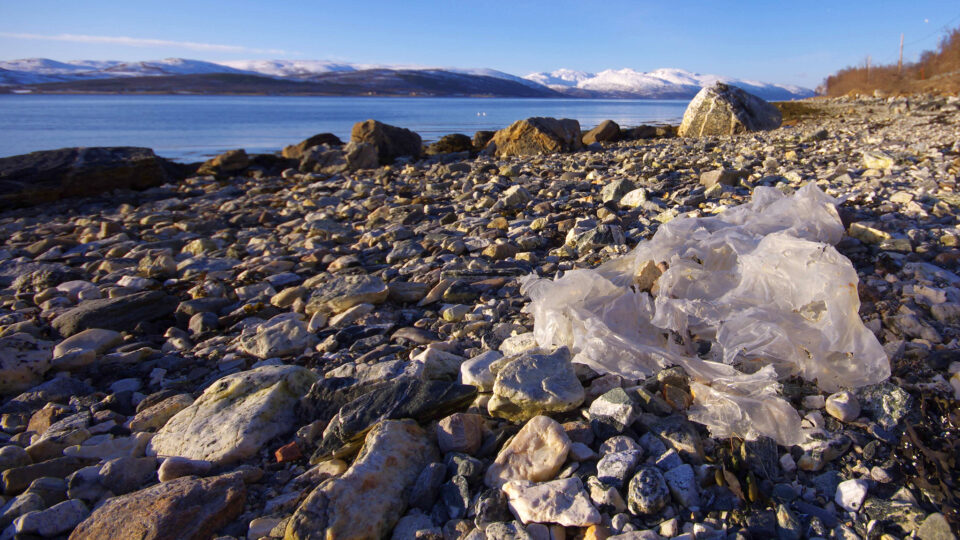
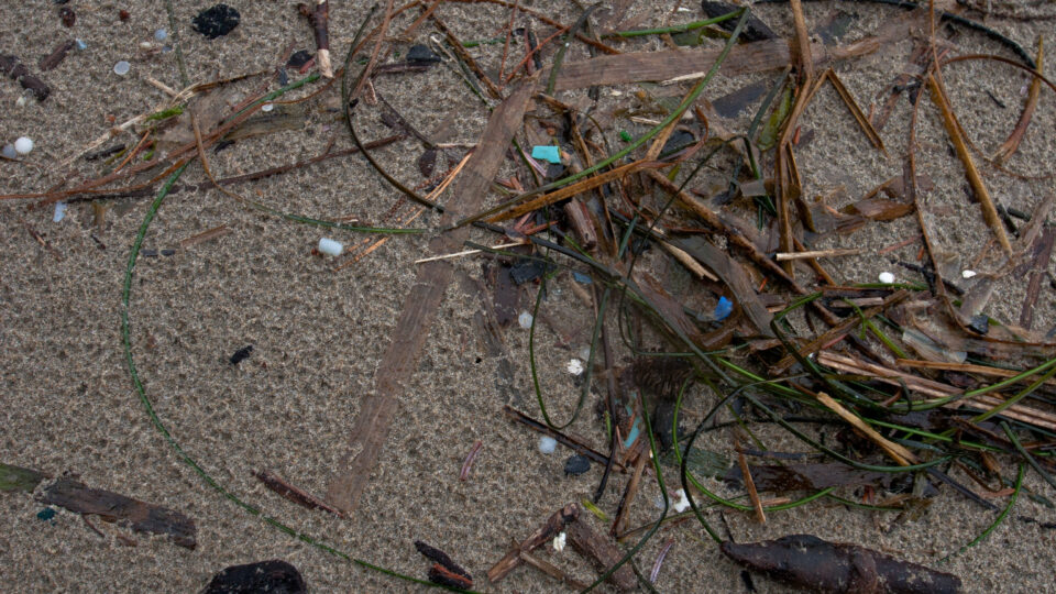
Microplastics come from the breakdown of larger plastics in the environment as well as from direct use in various products such as certain cosmetics.  They are found everywhere, from oceans and mountain peaks to the air and water, and alarmingly, in our bodies.  They are ingested by all sorts of organisms, from tiny plankton to fish and marine mammals.  Microplastics just don’t go away.  They don’t biodegrade so they simply accumulate in the environment.

Researchers at North Carolina State University have recently demonstrated proof of concept for a system that actively removes microplastics from water.  Such a system has the potential for helping to cleanse oceans and other bodies of water from the tiny plastic particles.

The system makes use of soft dendritic colloids, which are tiny particles that have the ability to stick to just about any surface.  These sticky particles can attract microplastics and grab them, even in wet and salty conditions.  The colloids are made from chitosan, a harmless and biodegradable polymer made from processed shellfish waste.

The researchers produced small pellets of the colloids that also contain small amounts of magnesium, which makes them bubble up and rise to the surface of water.  The pellets are coated with a gelatin layer, which blocks the magnesium.  As the gelatin gradually dissolves away, the pellets collect microplastics.  Eventually, the result is a microplastic-laden scum that rises to the surface where it can be skimmed away.

The scum itself can be bioprocessed into more chitosan that can create more of these microcleaner pellets to then capture more microplastics.  The researchers are investigating how the process can be scaled up to become a valuable tool in dealing with the microplastics problem.

**********

Web Links

New Water Microcleaners Self-Disperse, Capture Microplastics and Float Up for Removal

Photo, posted January 17, 2018, courtesy of Bo Eide via Flickr.

Earth Wise is a production of WAMC Northeast Public Radio

Microplastics and antibiotic resistance

April 14, 2025 By EarthWise Leave a Comment

Microplastics are a real problem.  They are pretty much everywhere.  They are in our food, in the oceans, on mountains, up in the clouds, and most alarmingly, in our bodies.  All of that is already bad news, but researchers at Boston University have found that microplastics may also be contributing to antibiotic resistance in dangerous bacteria.

The researchers observed that bacteria exposed to microplastics become resistant to multiple types of antibiotics commonly used to treat infections.  Bacteria can become resistant to antibiotics for a number of reasons, including misuse and overprescribing of medications.  However, a major factor influencing antibiotic resistance is the microenvironment – the immediate surroundings of a microbe – which is where bacteria and viruses replicate.

The Boston University study tested how the common bacterium E. coli reacted to being in a closed environment with microplastics.  The plastics provide a surface that the bacteria can attach to and colonize.  When attached to a surface, bacteria create a sticky substance called a biofilm that acts like a shield, protecting the bacteria and keeping them affixed securely.  The tests showed that microplastics supercharged the biofilms so much that when antibiotics were introduced, they were unable to penetrate the shield.

Microplastics are everywhere, but they are especially prevalent in impoverished places where sanitation may be limited.  Refugees, asylum seekers, and forcibly displaced populations are already at increased risk of contracting drug-resistant infections.  The prevalence of microplastics adds another risk to the already difficult lives of these people.

**********

Web Links

Microplastics Could Be Fueling Antibiotic Resistance, BU Study Finds

Photo, posted May 15, 2021, courtesy of Felton Davis via Flickr.

Earth Wise is a production of WAMC Northeast Public Radio

Slow-moving landslides

October 17, 2024 By EarthWise Leave a Comment

Landslides are mass movements of rock, earth, or debris down a slope.  They can be initiated by rainfall, snowmelt, changes in water level, erosion by streams, earthquakes, volcanic activity, or by various human activities.  Most landslides we hear about are sudden events that can cause all sorts of calamities.  But not all landslides are rapid occurrences.  There are also slow-moving landslides.

A new study by the University of Potsdam in Germany has found that as urban centers in mountainous regions grow, more people are building homes on steeper slopes prone to slow-moving landslides.  Slow-moving landslides can move as little as one millimeter a year and up to as much as three meters per year.  Locations with slow-moving landslides can seem safe to settle on; in some cases, the movement itself can be inconspicuous or even completely undetected.

Slow slides can gradually produce damage in houses and other infrastructure and there can also be sudden acceleration from heavy rain or other influences.

The study compiled a new database of nearly 8,000 slow-moving landslides with areas of at least 25 acres located in regions classified as “mountain risk.”  Of the landslides documented, 563 are inhabited by hundreds of thousands of people.  The densest settlements on slow-moving landslides are in northwestern South America and southeastern Africa. 

In all regions of the study, urban center expansion was associated with an increase in exposure to slow-moving landslides.  As cities expand in mountainous areas, people are moving into unsafe areas, but poorer populations may have few other options.

**********

Web Links

Slow-moving landslides a growing, but ignored, threat to mountain communities

Photo, posted March 4, 2015, courtesy of Flickr.

Earth Wise is a production of WAMC Northeast Public Radio

Glaciers in Venezuela

June 24, 2024 By EarthWise Leave a Comment

There are nearly 200,000 glaciers in the world.  About 91% of them are in Antarctica and 8% in Greenland.  The rest are scattered across nearly 50 countries.  The non-polar country with the most glaciers is actually Pakistan, which has over 7,200 of them.  But as the world continues to warm, glaciers are shrinking back, and many are disappearing altogether.

Venezuela, once home to six glaciers, has become the first country in the Americas to lose all of its glaciers.  Slovenia is considered to be the first country to lose its glaciers in modern times, perhaps as long as 30 years ago.  Glacial thawing has been worsening over the past decade throughout the Andes, which cover parts of Colombia, Venezuela, Bolivia, Ecuador, Peru, Chile, and Argentina.

Five of Venezuela’s glaciers had largely melted away by 2011.  The Humboldt glacier, which is on the highest peak in the Cordillera de Mérida mountain range in Venezuela, has now been declared as too small to be classified as a glacier.  It once covered over a thousand acres; it now has less than 5 acres of ice.  The US Geological Survey defines glaciers as ice bodies extending 25 acres or more.

The loss of glaciers in the Andes has serious consequences for communities that live on their slopes and depend upon glacial melt for water and for energy and food production. 

At least 80% of glaciers worldwide are on track to mostly disappear by the year 2100 because of global warming.  Given that previous forecasts estimated that the Humboldt glacier might last another decade, the prospects for the world’s remaining glaciers are not good.

**********

Web Links

Venezuela becomes first nation in the Americas to lose all glaciers

Photo, posted November 11, 2012, courtesy of Tim Snell via Flickr.

Earth Wise is a production of WAMC Northeast Public Radio

Oases and desertification

May 21, 2024 By EarthWise Leave a Comment

Oases are important sources of water for people, plants, and animals in the world’s desert areas.  In fact, oases sustain 10% of the world’s population despite taking up only about 1.5% of land area.  They form when groundwater flows and settles into low-lying areas or when surface meltwater flows down from nearby mountains and pools.

New research from the Chinese Academy of Sciences has found that oases added 85,000 square miles of new area from 1995 to 2020, mostly from artificial expansion projects, but over the same period lost 52,000 square miles from desertification and water scarcity.  The net gain of 33,000 square miles is not considered to be sustainable given that it was mostly due to artificial causes.  The oasis expansion projects were in Asia but losses due to desertification were also mostly in Asia.

Today, oases are found in 37 countries.  Increases in oases mostly come from people intentionally converting desert land into oases using runoff water and groundwater pumping, creating grasslands and croplands. This mostly has taken place in China.

Human over-exploitation of dwindling groundwater can limit the sustainability of oases as can the long-term loss of glaciers.

The study highlighted ways to sustain healthy oases, including suggestions for improving water resource management, promoting sustainable land use and management, and encouraging water conservation and efficient water use.  As the climate continues to change, these efforts will be increasingly important for a significant portion of the world’s population.

**********

Web Links

World’s Oases Threatened By Desertification, Even As Humans Expand Them

Photo, posted August 3, 2008, courtesy of Paul Williams via Flickr.

Earth Wise is a production of WAMC Northeast Public Radio

Sequoias in Britain

April 16, 2024 By EarthWise Leave a Comment

Giant sequoias are the most massive trees on earth.  They can grow as tall as nearly 300 feet and have trunk diameters from 20 to 26 feet.  They are also among the oldest living organisms on Earth; some of them are well over 3,000 years old.  The trees are native to the western slopes of the Sierra Nevada mountain range in California.

Lengthy droughts and wildfires have been pushing giant sequoias in California into decline.  Up to 20% of all large giant sequoias in California died in wildfires in 2020 and 2021.  There are estimated to be only about 80,000 remaining in the native groves in the Sierra Nevada.  These old-growth forests are very much in jeopardy and represent rare ecosystems of considerable ecological and historical value.

Giant sequoias have been planted in many places around the world.  They were introduced to country estates in Britain during the 19th century.  They were seen as symbols of wealth and power.  Over time, they have been widely planted in parks and woodlands.   As a result, there are now half a million giant sequoias growing in Britain and they are thriving there.

The British sequoias are rather young by sequoia standards, so they are relatively squat in stature.  The tallest of them measures about 180 feet.  But recent research, published in the journal Royal Society Science, found that in Britain’s cool and mild climate, the trees are growing nearly as fast as they do in California. 

The British sequoias are probably more important for their aesthetic and historical interest than their impact on the environment, but it is good to know they are there.

**********

Web Links

Under Threat in Their Native California, Giant Sequoias Are Thriving in Britain

Photo, posted November 4, 2010, courtesy of John Buie via Flickr.

Earth Wise is a production of WAMC Northeast Public Radio

Biodegradable microplastics

April 10, 2024 By EarthWise Leave a Comment

Researchers are developing biodegradable microplastics

Ordinary plastics are not biodegradable, but they are also not indestructible.  Plastics in the environment can break down into tiny fragments – microplastics – and those, unfortunately, are nearly indestructible.  Microplastics have been documented in the oceans and in soil virtually everywhere on Earth including remote frozen wastelands and on top of high mountains.  More recently, they have been found in our own arteries, lungs, and even in placentas.  Microplastic pollution is a very serious problem.

There is considerable ongoing effort to develop biodegradable plastics from non-petroleum sources.  There has been progress but it has not necessarily been aimed at creating bioplastics that do not create microplastic when they break down.

Researchers at the University of California San Diego have developed algae-based polymers that they have shown to degrade when composted.  Recently, in work published in the journal Nature Scientific Reports, they have shown that even fine microparticles of their bioplastic are digested by microbes when placed in a compost.  What remains are the starting plant materials from which the plastic was made.  Products made from this sort of plastic would not only be sustainable beyond their useful lifetime but would also not represent a potential danger to human life.

Creating this eco-friendly alternative to petroleum-based plastic is only the first step toward creating a viable replacement for existing plastics.  It is necessary to be able to use the new material on existing manufacturing equipment and for it to have the same mechanical and thermal properties as the materials it is replacing.  But the researchers are optimistic that this could be a potential solution to an increasingly serious problem.

**********

Web Links

Say Hello to Biodegradable Microplastics

Photo, posted January 17, 2018, courtesy of Bo Eide via Flickr.

Earth Wise is a production of WAMC Northeast Public Radio

Shrinking African glaciers

March 27, 2024 By EarthWise Leave a Comment

We don’t usually associate Africa with glaciers, but the continent has had glaciers on its highest peaks for the past 10,000 to 15,000 years.  Africa’s glaciers are found in three regions:  the Rwenzori Mountains along the border between Uganda and the Democratic Republic of the Congo, Mount Kilimanjaro, and Mount Kenya.  At the turn of the 20th century, there were 43 glaciers scattered across 6 peaks within the Rwenzori Mountains.  In the intervening years, things have greatly changed.

 Since the early 20th century, Africa’s glaciers have shrunk by 90%.  Because all these glaciers are close to the equator, they are especially vulnerable to warming.  According to a new study published in the journal Environmental Research: Climate, in the last two decades, Africa’s glaciers have lost roughly half their area.

This rapid decrease is alarming to climate scientists because they represent a clear indicator of the impact of climate change.  A major factor in the decline of the glaciers is the reduction in cloud cover over the mountains.  Sunshine is melting glaciers and turning ice directly into water vapor even when temperatures are below freezing.  Reductions in snowfall at the same time means that the melting glaciers are not being replenished.

Scientists believe that the tropical glaciers of Africa may all but disappear over the next 25 years.

Roughly three-quarters of the Earth’s freshwater is stored in the world’s more than 200,000 glaciers.  According to scientists, if the world reaches but maintains 1.5 degrees of warming, half of the world’s glaciers could be gone by the end of this century.  If the world continues to warm as it has been without slowing down, more than 80% of the glaciers will disappear.

**********

Web Links

Africa’s Tropical Glaciers Have Shrunk by 90 Percent, Research Shows

Photo, posted February 26, 2022, courtesy of Ray in Manila via Flickr.

Earth Wise is a production of WAMC Northeast Public Radio

A lake in Death Valley

March 14, 2024 By EarthWise Leave a Comment

A lake has formed in Death Valley

Death Valley in California is the driest place in North America, averaging only 2 inches of rain each year.  Badwater Basin in Death Valley is the lowest point in North America with a depth of 282 feet below sea level.  Currently, Badwater Basin is the site of an ephemeral lake called Lake Manley.

The lake formed again last August after Hurricane Hilary drenched the California desert.  Water levels in the lake dropped throughout the fall, but it never quite dried up.  But then the relentless rains of early February filled the lake once again.

Water that gathers in Badwater Basin usually evaporates faster than it can be replenished, leaving the lakebed dry.  But between the hurricane and the February storm, nearly 4 inches of rain have fallen, and the lake has stayed alive.  There is a river that feeds the lake – the Amargosa – that is really flowing in the aftermath of the storms.

The lake is nearly 7 miles long and 4 miles wide, but the water is only about a foot deep.  This is not the first time it has formed but it is an unusual occurrence.  It formed in 2005, but only lasted about a week.  Death Valley National Park officials expected that the lake would be gone by October, but it persisted into the new year which then brought the atmospheric river-driven California rainstorms.

At this point, it is unclear how long the lake in the driest place in America will be around.  While it is there, visitors to the national park can enjoy beautiful views of the nearby mountains reflected in its waters.

**********

Web Links

Deep in Death Valley, a Sprawling Lake Takes Form

Photo, posted February 19, 2024, courtesy of Tom Hilton via Flickr.

Earth Wise is a production of WAMC Northeast Public Radio

California: Drought Or No Drought? | Earth Wise

April 26, 2023 By EarthWise Leave a Comment

Despite heavy rains, California is still experiencing a drought

Just a few months ago, millions of people in California were living under challenging water conservation rules.  The past three years were the driest on record and reservoirs were depleted, landscapes dried up, and the snowpack in the Sierras at very low levels.

But in recent months, a dozen atmospheric river storms have brought huge amounts of rain and snow to the state.  Twelve out of 17 major reservoirs in the state have been replenished, the snowpack is over 240% of normal, and brown hills are blooming once again.

So, is the California drought over?  According to the experts, the answer is:  sort of.

The record snowpack and heavy rains have erased the most severe aspects of the drought in many parts of the state.  Only 9% of the state is now experiencing “severe” or “exceptional” drought, down from 55% last fall.

But the changes are basically all at the surface.  Groundwater in the state is still extremely low and the state’s cities and farms are still using more of it than is appropriate.  The state has been unwisely overusing its groundwater aquifers because of the drought and this one year of heavy rains cannot replenish levels that have been dropping for years.

California has been rolling back many of the most severe drought restrictions that had been imposed but has not entirely lifted the drought emergency status.  Meanwhile, the massive snowpack in the mountains will begin to melt as the weather warms and, in many areas, Californians will face flooding.  Water is a complicated business in California.

**********

Web Links

Drought or no drought? California left pondering after record winter deluge

Photo, posted August 28, 2019, courtesy of Joyce Cory via Flickr.

Earth Wise is a production of WAMC Northeast Public Radio

California Storms And The Megadrought | Earth Wise

February 22, 2023 By EarthWise Leave a Comment

California experienced its wettest 10-day period in 25 years as a result of a series of storms driven by atmospheric rivers in January.  The Rocky Mountains got buried in snow from the same weather pattern.   For the drought-stricken West, the storms were good news.  But they are not the cure for what’s been ailing the region.

In California, the snowpack in the Sierra Nevada mountains has been greatly enhanced, containing twice as much snow as is considered average for this time of year.  Without a doubt, it will reduce the impact of the drought that has plagued the state for 23 years.  But one big storm or even a series of them is not enough to undo years of minimal precipitation and rising temperatures.  Many of the states’ largest reservoirs remain well below historical averages despite the record-breaking rain.  It would take several wet years to really allow the state to recover from the drought.

The snowfall in the Rockies is crucial because it is the source of more than two-thirds of the water in the Colorado River.  The Colorado River is the water lifeline for 40 million people from Wyoming to Mexico.

The ongoing shrinking of the Colorado River is a crisis that has created massive problems for the multibillion-dollar agriculture industry and for many large cities, including Denver, Phoenix, Salt Lake City, Las Vegas, and Los Angeles.  Two of the nation’s largest reservoirs – Lake Mead and Lake Powell – are filled by the Colorado River.  The historic low levels of these reservoirs have threatened the functioning of hydropower facilities that provide electricity to millions of people.

The January storms were good news for the West, but its problems are not over.

**********

Web Links

This Winter’s Rain and Snow Won’t be Enough to Pull the West Out of Drought

Photo, posted September 18, 2022, courtesy of Sarah Stierch via Flickr.

Earth Wise is a production of WAMC Northeast Public Radio

California Flooding | Earth Wise

February 2, 2023 By EarthWise Leave a Comment

Devastating flooding kicks off the new year in California

Starting in December, a series of “atmospheric rivers” brought record storms to California producing as much rain in three weeks in some areas as they normally have in an entire year.  The historic levels of rain (and snow in the mountains) have swollen rivers, flooded roads and homes, forced evacuations, knocked out electric power for millions of people, and resulted in more than 20 deaths.

Atmospheric rivers are air currents that carry large amounts of water vapor through the sky.  They are not unusual for California but recurrent waves of them like those that have happened recently are very infrequent.  Studies by the U.S. Geological Survey have shown that such a phenomenon recurs in California every 250 years.  There were a series of storms causing disastrous floods in California in 1861-62.

The atmospheric rivers are born in the warm waters of the tropical Pacific.  During La Nina phases, the atmospheric rivers typically make landfall on the northern West Coast. During El Nino phases, atmospheric rivers are more likely to end up in Southern and Central California. During transitions between the phases, as is happening now, the storms can cover large parts of the state.

Modern forecasting is pretty good at predicting the forthcoming occurrence of these storms and has led to some helpful actions, such as reservoir operators preventing dams from overflowing or bursting.  But there is a gap between science and decision-making.  It is pretty clear what needs to be done when tornados or hurricanes are on the way.  It is less clear what actions are appropriate when there are going to be repeated heavy rainstorms.

These storms will have an effect on California’s megadrought, but just how much of an effect remains to be seen.

**********

Web Links

Flooding in California: What Went Wrong, and What Comes Next

Photo, posted January 5, 2023, courtesy of Sarah Stierch via Flickr.

Earth Wise is a production of WAMC Northeast Public Radio

The Race For EV Batteries | Earth Wise

February 1, 2023 By EarthWise Leave a Comment

The race for electric vehicle batteries is on

Lithium-ion batteries have been the power source for electric vehicles since 2008, when the Tesla Roadster was introduced.  They took over for nickel-metal hydride batteries that powered most hybrid electric cars such as the Prius.  Lithium-ion batteries store much more energy for a battery of a given weight, which leads to greater driving range.

But lithium-ion is not an ideal solution.  The batteries depend on critical materials that are obtained by hacking into mountains, utilizing scarce desert groundwater, and in some cases, making use of child labor. Many materials depend on countries with whom economic ties have complicated geopolitical consequences.

State and federal mandates and incentives are pushing auto companies to prioritize electric vehicles in their future plans.  The Inflation Reduction Act in particular provides credits and other incentives for both consumers and manufacturers to electrify. So, sources for EV batteries are a key issue.

The Department of Energy is funding 20 different companies with $2.8 billion to bolster the production and processing of critical minerals in the U.S.  The goal is to bring the electric vehicle supply chain onshore to the greatest extent possible.  Some of the work involves redesigning lithium-ion batteries to reduce or eliminate problematic materials such as cobalt.  Other efforts seek to find domestic sources of critical materials such as lithium without causing serious environmental problems.

Given all this, it is no surprise that academic and industrial researchers are also exploring a wide variety of alternative battery technologies. 

The future of transportation is electrification and the race for EV batteries is on.

**********

Web Links

For U.S. Companies, the Race for the New EV Battery Is On

Photo, posted August 27, 2021, courtesy of Ron Frazier via Flickr.

Earth Wise is a production of WAMC Northeast Public Radio

Turning Carbon Into Stone | Earth Wise

January 31, 2023 By EarthWise Leave a Comment

Start-up plans to turn carbon into stone

A start-up company in Oman called 44.01 was recently awarded a $1.2 million Earthshot Prize by Prince William of the U.K.  The company, whose name corresponds to the molecular weight of carbon dioxide, is working on speeding up natural chemical reactions that take carbon from the air and lock it into solid mineral form.

The company’s location in Oman is no random occurrence.  The mountains of northern Oman and along the coast of the United Arab Emirates are the site of a huge block of oceanic crust and upper mantle that was thrust upward some 96 million years ago.  The tilted mass of rock is over 200 miles long and is the largest surface exposure of the Earth’s mantle in the world.

This type of rock, called peridotite, is rich in olivine and pyroxene, which react with water and carbon dioxide to form calcium-based minerals like serpentine and calcite that permanently lock in carbon. Other kinds of rock also are capable of carbon-storing mineralization, but this mantle rock is the most effective for the purpose. It only exists at the Earth’s surface in a few places, including Papua New Guinea and some spots in California and Oregon.

The 44.1 company is planning to use solar-powered direct air capture devices to remove CO2 from the air, use it to produce carbonated water, and inject the water into the reactive rocks.  The company will operate a couple of pilot systems during 2023.  Ultimately, the company believes it can scale up the process to be able to permanently sequester as much as a billion tons of CO2 a year by the year 2040 without needing to inject the gas into deep caverns or find other places to store it.

**********

Web Links

With Major Prize, a Project to Turn Carbon Emissions to Stone Gains Momentum

Photo, posted August 10, 2018, courtesy of JM McBeth via Flickr.

Earth Wise is a production of WAMC Northeast Public Radio

Death Valley Flooding | Earth Wise

September 13, 2022 By EarthWise Leave a Comment

Flooding in Death Valley

Furnace Creek in Death Valley is the driest place in North America.  Its average annual rainfall is under two inches.  On August 5th, a thousand-year rainfall event dropped 1.46 inches of rain – about three-quarters of a year’s precipitation.  The all-time record for a single day is 1.47 inches, set in April 1988.  The storm did break the record for the most rain ever recorded in August, which averages just over a tenth of an inch of rain for the entire month.

The flash flood washed debris over roads, swept away and buried cars, knocked a water facility offline, damaged buildings, and stranded about a thousand visitors and staff in Death Valley National Park. By the next day, the flood water had mostly receded, and stranded visitors could be escorted out of the park by National Park personnel.

Death Valley sits at 282 feet below sea level.  If it were not for the extremely arid climate there, Death Valley would likely be filled with water.  However, humid air masses traveling east from the Pacific Ocean have to cross four mountain ranges before they reach the desert valley.  Those air masses lose their moisture in the form of rain on the western slopes of the mountain, leaving a dry area, or rain shadow, on the eastern sides.  By the time the air masses reach Death Valley, they are bone dry.  On rare occasions, the lowest spot in the valley fills with water forming a wide, shallow lake, known as Lake Badwater. 

The extreme heat and aridity of Death Valley evaporates the temporary lake quickly, returning the valley to its usual state.  Furnace Creek still holds the record for the highest air temperature ever recorded:  134 degrees Fahrenheit.

**********

Web Links

Death Valley Flash Flooding

Photo, posted April 7, 2021, courtesy of Matthew Dillon via Flickr.

Earth Wise is a production of WAMC Northeast Public Radio.

California Trees Are Dying | Earth Wise

August 19, 2022 By EarthWise Leave a Comment

Climate change is killing California trees

California relies on extensive forests to help reduce the amount of carbon dioxide entering the atmosphere.  But extensive drought and increasingly frequent wildfires have been reducing the state’s tree population for the past three decades.

A comprehensive study by a team of scientists from the University of California Irvine used satellite data to study vegetation changes between 1985 and 2021.  Across the entire state, tree cover area has declined 6.7% over that time period.  The results varied from region to region across the state.

Southern California exhibited the sharpest decline, where 14% of the tree population in local mountain ranges vanished, potentially permanently.  In the Sierra Nevada mountains, tree populations were relatively stable until about 2010.  After that, a severe drought followed by historically large wildfires resulted in a 8.8% die-off of trees.  The northern parts of the state, with higher rainfall and cooler temperatures, fared better, being able to more easily recover from wildfires.

The study goes beyond measuring the tree population of the state and its effects on carbon storage.  The data is also important for understanding how changes in forest cover affects water resources and fire behavior in the state.

The decline of trees in California is affecting the carbon storage abilities of the state.  The satellite survey showed that as the tree populations have dropped, the state’s coverage of shrubs and grasses has risen, possibly indicating that permanent ecosystem shifts are occurring.  The forces contributing to the decline of trees in California are not going away any time soon.  As a result, the threat to California’s ability to mitigate the effects of climate change continues to grow.

**********

Web Links

UCI study: California’s trees are dying, and might not be coming back

Photo, posted March 24, 2016, courtesy of David Fulmer via Flickr.

Earth Wise is a production of WAMC Northeast Public Radio.

River Of Dust | Earth Wise               

April 25, 2022 By EarthWise Leave a Comment

Every year, more than 100 million tons of dust blow out of North Africa.  Strong seasonal winds lift the dust from the Sahara Desert northward.  A few times a year, the winds from the south are strong and persistent enough to drive the dust all the way to Europe.

On March 15, a large plume of Saharan dust blew out of North Africa and crossed the Mediterranean into Western Europe.  European cities were blanketed with the dust, degrading their air quality, and turning skies orange.  Alpine ski slopes were stained with the dust.

These dust events are associated with so-called atmospheric rivers that arise from storms.  Such rivers usually bring extreme moisture but can also carry dust.  Over the past 40 years, nearly 80% of atmospheric rivers over northwestern Africa have led to extreme dust events over Europe.  The March 15 event was associated with Storm Celia, a powerful system that brought strong winds, rain, sleet, hail, and snow to the Canary Islands.

Atmospheric dust plays a major role in climate and biological systems.  The dust absorbs and reflects solar energy and also fertilizes ocean ecosystems with iron and other minerals.

The climate effects of dust are complicated.  Dust can decrease the amount of sunlight reaching the surface, affect cloud formation, and decrease temperatures.  But dust also darkens the snowpack, leading to more rapid snowmelt.  A 2021 dust event resulted in a rapid melt of Alpine snow, reducing its depth by half in less than a month.

The effects of this year’s dust event are not yet known, but this atmospheric river associated with Storm Celia appeared to carry less water and more dust compared with the 2021 event.

**********

Web Links

An Atmospheric River of Dust

Photo, posted December 2, 2019, courtesy of Catherine Poh Huay Tan via Flickr.

Earth Wise is a production of WAMC Northeast Public Radio.

Humans And Microplastics | Earth Wise

April 13, 2022 By EarthWise Leave a Comment

Microplastics impact on human health

While plastic comes in all different shapes and sizes, those that are less than five millimeters in length are called microplastics.  Primary sources of microplastics include microfibers from clothing, microbeads, and plastic pellets (known as nurdles).  Secondary sources of microplastics come from larger plastic debris, like bottles and bags, that degrades into smaller bits over time. 

Microplastic pollution can be found everywhere on earth, from the top of the tallest mountains to the bottom of the deepest oceans.  Microplastics are in the food we eat, the water we drink, and the air we breathe. 

According to research recently published in the journal Exposure & Health, humans ingest an average of five grams of plastic particles per week. This is roughly equivalent to the weight of a credit card.  The plastic particles are trafficked in via food, such as seafood and salt in particular, as well as water.  In fact, those who rely on plastic bottled water for their drinking needs ingest an additional 1,700 plastic particles each week.   

Microplastics have also been detected in human blood for the first time.  According to new research recently published in the journal Environment International, scientists detected microplastics in nearly 80% of the people they tested. 

Half of the blood samples contained PET plastic, which is commonly used for drinking bottles.  One third of the blood samples contained polystyrene plastic, which is often used for food packaging.  One quarter of the blood samples contained polyethylene plastic, which is used to make things like shopping bags and detergent bottles. 

With plastic production predicted to double by 2040, more research is urgently needed to understand how ingesting microplastics affects human health.

**********

Web Links

Health risk due to micro- and nanoplastics in food

Microplastics found in human blood for first time

Discovery and quantification of plastic particle pollution in human blood

Photo, posted November 3, 2012, courtesy of Laura via Flickr.

Earth Wise is a production of WAMC Northeast Public Radio.

Melting Himalayan Glaciers | Earth Wise

February 1, 2022 By EarthWise Leave a Comment

Accelerating melting of Himalayan glaciers poses a massive threat to regional water supply

The great mountain ranges of central Asia, including the Himalayas, contain the third-largest deposit of ice and snow in the world, trailing only Antarctica and the Arctic.  The Himalayan range contains about 15,000 glaciers, and is part of a region widely referred to as the Third Pole due to its extraordinary reserves of freshwater.

But in recent years, scientists have observed an increase in the rate of Himalayan glacier loss.  According to a new study led by researchers from the University of Leeds in the UK, the accelerating melting of the Himalayan glaciers threatens the water supply of millions of people in Asia. 

In the study, researchers reconstructed the reach of the Himalayan glaciers during the Little Ice Age, which was the last major glacier expansion 400-700 years ago. They found that these glaciers began losing ice 10 times faster during the modern era.  In fact, the glaciers have shrunk from a peak of nearly 11,000 square miles to around 7,500 square miles today.   

This exceptional acceleration of melting of the Himalayan glaciers could have significant implications.  Hundreds of millions of people rely on Asia’s major river systems for food and energy, and depend on these glaciers to feed rivers during the dry seasons.  These rivers include the Brahmaputra, Ganges, and Indus.  The changing global climate could disastrously impact water resources and livelihoods of the Greater Himalayan region.

According to the research team, people living in these regions have already seen changes that are unlike anything witnessed for centuries.  This study is the latest to confirm that these changes are accelerating and pose a significant threat to entire nations and regions. 

**********

Web Links

Himalayan glaciers melting at ‘exceptional rate’

Photo, posted March 13, 2018, courtesy of Sarunas Burdulis via Flickr.

Earth Wise is a production of WAMC Northeast Public Radio.

Alaskan Icemageddon | Earth Wise

January 25, 2022 By EarthWise 1 Comment

Wild weather in Alaska

December saw some wild weather in Alaska.  A combination of record high temperatures and torrential rainstorms resulted in the coining of the term “Icemageddon” to describe what was going on with the weather.

Kodiak Island in southern Alaska saw a high temperature of 67 degrees on December 26, which was warmer than it was in Southern California that same day.  This set an all-time record for the warmest December day in Alaska.  Such a high temperature is amazing considering how little sunlight Alaska gets at this time of year.  And with warmer air comes wetter air, as the atmosphere is capable of holding more water vapor as temperatures increase.

As a result, that same day saw the interior of the state get an inch of rain in just a few hours, something that hadn’t happened for decades.  But then, when temperatures plummeted again, all that rainwater froze.

Huge sheets of ice blocked roads and choked traffic in Fairbanks, Alaska’s second largest city.  Indeed, it was the state’s transportation department that came up with the term icemageddon to describe the situation.

The extreme warmth in December is related to the same weather pattern that brought cold, wintry weather to the Pacific Northwest and Northern California.  Those weather conditions resulted in hundreds of cancelled flights in Seattle, where temperatures dropped into the 20s, and in massive amounts of snowfall in the Sierra Nevada mountains in California.  A strong area of high pressure anchored in the Northern Pacific resulted in a clockwise flow around it drawing warmer, more tropical air from the Pacific up to Alaska.

Climate change continues to push the envelope on what sort of weather is possible all over the world.

**********

Web Links

Alaska faces ‘Icemageddon’ as temperatures swing wildly

Photo, posted April 30, 2015, courtesy of Naql via Flickr.

Earth Wise is a production of WAMC Northeast Public Radio.

  • Page 1
  • Page 2
  • Go to Next Page »

Primary Sidebar

Recent Episodes

  • An uninsurable future
  • Clean energy and jobs
  • Insect declines in remote regions
  • Fossil fuel producing nations ignoring climate goals
  • Trouble for clownfishes

WAMC Northeast Public Radio

WAMC/Northeast Public Radio is a regional public radio network serving parts of seven northeastern states (more...)

Copyright © 2026 ·