• Skip to primary navigation
  • Skip to main content
  • Skip to primary sidebar

Earth Wise

A look at our changing environment.

  • Home
  • About Earth Wise
  • Where to Listen
  • All Articles
  • Show Search
Hide Search
You are here: Home / Archives for sea level rise

sea level rise

An uninsurable future

October 31, 2025 By EarthWise Leave a Comment

Climate change could cause some regions of the United States to be uninsurable

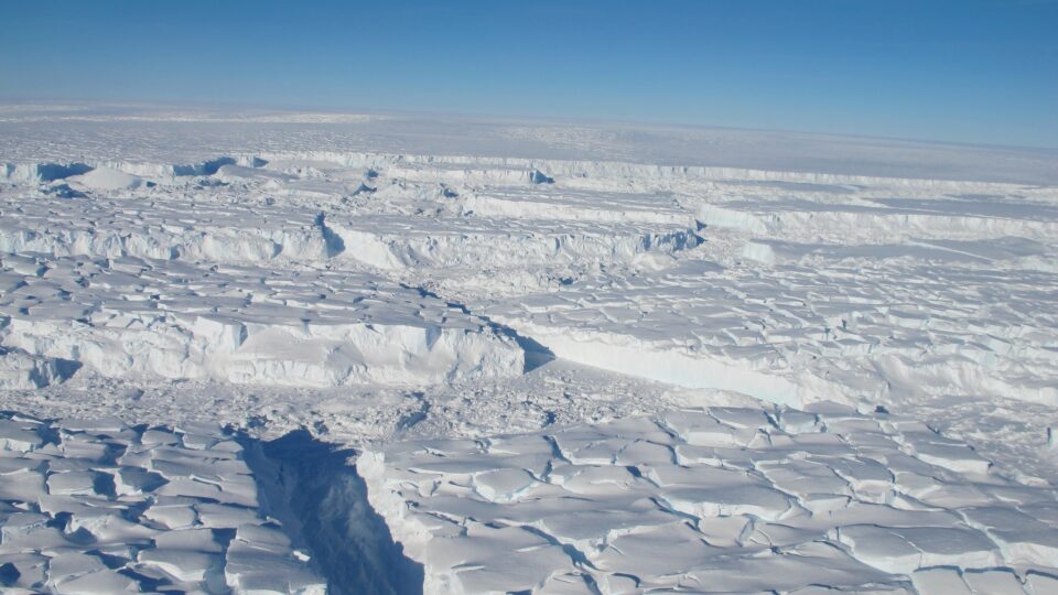
The U.S. home insurance industry is in turmoil.  For years it has underestimated the risks posed by climate change intensified storms, wildfires, and other natural disasters.  The increased costs associated with rising sea levels, powerful hurricanes, drenching rainstorms, massive wildfires, and more have pushed insurers to the limit.

According to the director of the Climate Risk Initiative at the Center for Law, Energy, and the Environment at UC Berkeley, the world is marching toward an uninsurable future.  Federal Reserve Chairman Jerome Powell predicts that in 10 or 15 years, there will be regions of the country where you can’t get a mortgage because home insurance is unavailable.

Dozens of insurance companies have collapsed or have been declared insolvent in Florida, Louisiana, Texas, and California.  In the period 2018-2023, insurers canceled nearly 2 million homeowner’s policies in response to rising climate risks.   Premiums have skyrocketed in many places, making them unaffordable for many homeowners.

More than 30 states have created Fair Access to Insurance Requirements (FAIR) Plans, which are state-managed programs that provide a last resort homeowners insurance option.  In these plans risks are distributed among multiple participating insurers. 

Some analysts believe that the federal government may have to step in to prop up the precarious home insurance market, much as it did in 1968 when the National Flood Insurance Program was created.  Now that the Trump administration is aggressively rolling back climate initiatives and encouraging more fossil fuel use, we are all going to have to foot the bill.

**********

Web Links

How Climate Risks Are Putting Home Insurance Out of Reach

Photo, posted May 13, 2023, courtesy of Kevin Dooley via Flickr.

Earth Wise is a production of WAMC Northeast Public Radio

The human impact on oceans

October 21, 2025 By EarthWise Leave a Comment

Vast and powerful, the oceans have sustained human life around the world for millennia. They provide food, natural resources, and livelihoods, supporting countless communities and economies. But despite their size and resilience, the oceans are under increasing pressure from climate change and human activity, pushing them toward a dangerous threshold.

According to a new study led by researchers from UC Santa Barbara, the cumulative human impact on the oceans is forecasted to double by 2050, which is just 25 years from now.  These impacts include ocean warming, fisheries losses, sea level rise, acidification, and pollution.

The research team, which includes collaborators from Nelson Mandela University in South Africa, found that the tropics and poles will experience the fastest rate of change.  And coastal regions, where most human activity takes place, will bear the heaviest consequences of those changes. 

The research team calls the findings sobering – not only because the impacts are increasing, but because they’re increasing so quickly. 

The study, which was recently published in the journal Science, shows that ocean warming from climate change and reductions in marine biomass from overfishing are expected to be the two largest contributors to future ocean impacts.  If ecosystems cannot cope with these pressures, human societies will also feel the consequences.

But the research team stresses that it’s not too late. Stronger climate policies, better fisheries management, and protections for vulnerable habitats like salt marshes and mangroves could help slow or even reduce human impacts.

The research serves as both a warning, and a chance to act before it’s too late.

**********

Web Links

Human impact on the ocean will double by 2050, UCSB scientists warn

Photo, posted July 11, 2018, courtesy of Ed Dunens via Flickr.

Earth Wise is a production of WAMC Northeast Public Radio

Melting in Svalbard

September 16, 2025 By EarthWise Leave a Comment

Melting in Svalbard threatens global sea level rise

Svalbard is a Norwegian archipelago north of the mainland.  It is known for its glaciers, tundra, and wildlife – especially polar bears, Arctic foxes, and reindeer.  It is home to the Svalbard Global Seed Vault, a place to safeguard critical seeds for the world’s food supply.  The location was chosen for its remoteness and perpetual deep freeze.

A recent study investigated the record glacial ice melt on the Svalbard islands in the summer of 2024, considering it to be a cautionary tale about the future of other Arctic ice masses.

The amount of ice that melted on Svalbard made it one of the most significant contributors to global sea level rise last year.  An extreme and long Arctic heat wave, intensified by changing weather patterns, led to unprecedented melting.  But what seemed like a once-in-1000-year event may well become normal in the future.

Most of the 2024 glacial melt occurred during six weeks of record-high temperatures.  The influx of fresh water from the islands most likely had an impact on marine ecosystems in the surrounding sea, beginning at the bottom of the food chain with plankton, which are very sensitive to water temperature and salinity. 

Research has linked surges of fresh water into the North Atlantic with extreme weather in Europe and possibly even North America.  Of great concern is that cold fresh water flowing out of the Arctic may be contributing to the weakening of the Atlantic Meridional Overturning Circulation, which is a key ocean current that carries warm water towards northwestern Europe and greatly impacts the climate in Europe.

**********

Web Links

Melting on the Arctic’s Svalbard Islands Shows the Climate Future Is Now

Photo, posted September 21, 2016, courtesy of Christopher Michel via Flickr.

Earth Wise is a production of WAMC Northeast Public Radio

A hidden global water crisis

September 10, 2025 By EarthWise Leave a Comment

The globe is losing groundwater at an alarming rate

A major crisis is unfolding beneath our feet: Earth’s continents are losing freshwater at unprecedented rates.  Recent satellite data has uncovered a hidden global water crisis, suggesting the problem is more urgent than previously thought. 

The study, which was led by researchers from Arizona State University, found that since 2002, climate change, unsustainable groundwater use, and extreme droughts have driven dramatic declines in the planet’s freshwater reserves.

The research team found that drying areas on land are expanding at a rate roughly twice the size of California every year.  Additionally, the rate at which dry areas are getting drier now outpaces the rate at which wet areas are getting wetter, reversing long-standing hydrological patterns.   

Approximately 75% of the world’s population lives in countries that have been losing freshwater for more than two decades.  As the availability of freshwater dramatically shrinks, the global population continues to expand. 

The study, which was recently published in the journal Science Advances, identifies four continental-scale “mega-drying” regions, all located in the northern hemisphere, and warns of severe consequences for water security, agriculture, sea level rise, and global stability. 

The researchers identified the type of water loss on land, and for the first time, found that 68% came from groundwater.  Groundwater loss alone now contributes more to sea level rise than melting ice sheets. 

The findings stress the urgent need for sustainable water management, international cooperation, and global policies to slow groundwater loss.

**********

Web Links

Satellites just revealed a hidden global water crisis—and it’s worse than melting ice

Unprecedented continental drying, shrinking freshwater availability, and increasing land contributions to sea level rise

Photo, posted January 16, 2012, courtesy of Kecko via Flickr.

Earth Wise is a production of WAMC Northeast Public Radio

Carbon levies for shipping

November 27, 2024 By EarthWise Leave a Comment

The global shipping industry is responsible for 90 percent of world trade.  The ships crossing the world’s oceans emit nearly 3% of the global greenhouse gas emissions caused by human activity that are contributing to climate change.  Among the effects of climate change are sea level rise, which is threatening the very existence of small island nations.

One such nation is Tuvalu, which is a group of islands in the South Pacific.  Tuvalu has a total landmass of just 10 square miles, and sea level there is rising 1.5 times faster than the global average.  Predictions are that within 50 to 100 years, low-lying islands like those of Tuvalu could be fully submerged by the ocean.

Representatives from six Pacific Island states and a growing number of Caribbean nations known as the 6Pac+ Alliance are urgently calling upon the International Marine Organization to enact a mandatory universal levy of $150 per ton of shipping emissions from large commercial vessels. 

Most marine vessels typically run on highly polluting heavy fuel oil.  Burning really filthy fuel is the cheapest way to cross the oceans.  There are alternatives including entirely carbon-free technologies, but they will be expensive to implement and utilize.  The cost of shipping would undoubtedly go up and be especially felt by small island nations and in developing countries where most food is imported.

The idea behind putting a price on ships’ carbon emissions is to both provide a financial incentive for the shipping industry to reduce its emissions and provide revenue for countries that incur costs from dealing with rising seas.

**********

Web Links

Pacific and Caribbean Island Nations Call for the First Universal Carbon Levy on International Shipping Emissions

Photo, posted November 23, 2006, courtesy of Stefan Lins via Flickr.

Earth Wise is a production of WAMC Northeast Public Radio

The doomsday glacier

October 9, 2024 By EarthWise Leave a Comment

The doomsday glacier is melting

The Thwaites Glacier is an enormous Antarctic Glacier.  Its area is larger than that of Florida – in fact, larger than 30 other U.S. states – and it is melting.  It has been retreating for 80 years but has accelerated its pace in the past 30.  Its shedding of ice into the ocean already contributes 4% of global sea level rise.  If it collapsed entirely, it would raise sea levels by more than 2 feet.  For this reason, it has been dubbed the Doomsday Glacier.

A team of scientists has been studying it since 2018 in order to better understand what is happening within the glacier. They sent a torpedo-shaped robot to the glacier’s grounding line, which is the point at which the ice rises up from the seabed and starts to float.  The underside of Thwaites is insulated by a thin layer of cold water.  However, at the grounding line, tidal action is pumping warmer sea water at high pressure as far as six miles under the ice.  This is disrupting the insulating layer and is speeding up the retreat of the glacier.

The potential collapse of the glacier is not even the only massive risk it poses.  It also acts like a cork, holding back the vast Antarctic ice sheet.  If that ice sheet were ever to collapse, sea levels could rise 10 feet.

A critical unanswered question is whether the ultimate collapse of Thwaites Glacier is already irreversible.  There are regular heavy snowfalls that occur in the Antarctic which help replenish ice loss.  Whether nations’ progress in slowing climate change can change the balance between ice accumulation and ice loss on the glacier remains to be seen.

**********

Web Links

‘Doomsday’ glacier set to melt faster and swell seas as world heats up, say scientists

Photo, posted January 3, 2022, courtesy of Felton Davis via Flickr.

Earth Wise is a production of WAMC Northeast Public Radio

Last chance tourism

October 3, 2024 By EarthWise Leave a Comment

Glaciers around the world are shrinking or disappearing.  Melting glaciers and ice sheets are the biggest contributors to global sea level rise and ice loss rates are continuing to increase.  Even if the world somehow manages to meet the climate goal of limiting warming to no more than 1.5 degrees Celsius, the world will still lose a quarter of its glacial mass by the year 2100.  At higher levels of warming, most of the world’s glaciers could be gone.

One result of this situation is that people are rushing to see glaciers before they melt.  Places like Iceland are experiencing a booming tourism economy.  Half a million people now visit Iceland for glacier tours every year.  The shrinking and disappearance of glaciers has popularized a new kind of adventure travel called ‘last chance tourism.’

Like other types of adventure travel, glacier tours are not without dangers.  An American tourist visiting a glacial ice cave in an Icelandic national park in August was killed when a frozen arch collapsed.  Ice caves, formed by glacial meltwater, are known for their brilliant blue walls.  Increasing meltwater can make these formations more prone to collapse. 

Glacial tours in Canada’s Jasper National Park are quite popular.  Tour operators have had to reroute trails to the foot of the Athabasca Glacier several times every season because of glacial melt. 

Glacier tourism is a goldmine for the tourist industry but conducting and managing it is increasingly challenging.  Meanwhile, people feel like it’s important to bring their kids to see glaciers because they may be the last generation that can go stand on a glacier.

**********

Web Links

Climate Change Is Making ‘Last Chance Tourism’ More Popular, and Riskier

Photo, posted January 25, 2020, courtesy of Ron Cogswell via Flickr.

Earth Wise is a production of WAMC Northeast Public Radio

Natural solutions for coastal defense

May 30, 2024 By EarthWise Leave a Comment

Nature-based coastal defense systems have a role to play

Protecting coastal cities and towns from the dangers of tsunamis, storm surges, and sea-level rise has become an ever-increasing challenge.  There are so-called hard coastal defenses as well as nature-based solutions.  A new study by the University of Tokyo has found that combining the two types of defenses may be the most effective way to protect, support, and enrich coastal communities.

Sea walls, dikes, dams, and breakwaters are the traditional hard measures.  They are popular and have proven track records but are facing challenges to keep pace with increasing climate risks.  They are expensive to build and require continuous upgrades and repairs.  While they do provide protection from many disaster risks, they also can cause significant disruption to coastal ecosystems as well as to coastal communities.

Nature-based coastal defenses include such things as mangroves and coral reefs.  So-called soft measures involve restoring, rehabilitating, reforesting, and nourishing natural ecosystems that protect coastal areas.

The Tokyo researchers analyzed the defense strategies in terms of risk reduction, climate change mitigation, and cost-effectiveness over a 20-year period. The results of the study were that among all coastal defense options in lower-risk areas, hybrid measures provide the highest risk reduction and can harness the advantages of both hard and soft measures. 

The findings provide strong evidence for integrating nature-based components into coastal defenses, but these approaches have not yet been adequately tested in circumstances of extreme events and high-risk urgency.  Research in this area has important implications for policy makers, coastal planners, and communities looking to make evidence-based decisions.

**********

Web Links

A natural touch for coastal defense

Photo, posted October 22, 2021, courtesy of Kevin Dooley via Flickr.

Earth Wise is a production of WAMC Northeast Public Radio

The East Coast is sinking

March 11, 2024 By EarthWise Leave a Comment

Most of the world’s largest cities are located in coastal regions and coastal regions are on the front lines of the climate crisis.  Human populations continue to migrate towards low-elevation coastal areas at the same time that sea level rise is accelerating.  Coastal communities worldwide are increasingly vulnerable to the dangers of flooding and erosion.  With these hazards occupying a great deal of attention, there has been less attention paid to the dangers of land subsidence.

A recent study by researchers at Virginia Tech and the US Geological Survey using satellite data shows that parts of America’s east coast are sinking, and the culprit is the withdrawal of too much water from the aquifers beneath these coastal areas.

A series of overlapping aquifers extends all the way from New Jersey to Florida along the coast, providing a reliable source of water for drinking, irrigation, and industrial uses.  Even though these areas get regular rainfall, the deeper aquifers can take hundreds or even thousands of years to refill once water is pumped out.  Once water is removed, soils can compress and collapse, causing the land surface to sink.

Cities that were built on drained marshland or on fill soil are especially vulnerable to compaction. 

Seal level rise is slow, but it is insidious and continuous.  Add land subsidence to the mix and effects multiply.  Places like Boston, New York, Washington DC, Roanoke, Savannah, Jacksonville, and Miami, among others, all are increasingly vulnerable to these coastal hazards.  The combined effects of sea level rise and subsidence may even triple the prospects for flooding areas over the next few decades.

**********

Web Links

As Aquifers Are Depleted, Areas Along The East Coast Of The US Are Sinking

Photo, posted August 7, 2015, courtesy of Tracy Robillard / NRCS Oregon via Flickr.

Earth Wise is a production of WAMC Northeast Public Radio

New York is raising its shoreline

January 18, 2024 By EarthWise Leave a Comment

Superstorm Sandy in 2012 flooded 17% of New York City and caused $19 billion in damage.  In its aftermath, plans emerged to create floodwalls, raised elevations, high-capacity drainage, and other infrastructure to protect the city from future Sandy-like events.

Like all large infrastructure projects in densely populated places, the remaking of New York’s shoreline has only moved along in fits and starts.  But there has been significant progress.

The East Side Coastal Resiliency (ESCR) project is the largest urban resiliency project currently underway in the United States.  The first piece of it – the Asser Levy renovation – was completed in 2022.  Over the next three years, the $1.8 billion ESCR will reshape two-and-a-half miles of Lower Manhattan’s shoreline.  The ESCR is just one part of a much larger $2.7 billion initiative called the BIG U, which is a series of contiguous flood resilience projects that will create 5.5 miles of new park space specifically designed to protect over 60,000 residents and billions of dollars in real estate against sea level rise and storm surges. 

In a time of rising seas and increasingly powerful storms, flood-prone coastal U.S. cities – including Boston, Norfolk, Charleston, Miami, and San Francisco – are moving toward embracing the long-held Dutch concept of “living with water”, which emphasizes infrastructure that can both repel and absorb water while also providing recreational and open space.

**********

Web Links

After a Decade of Planning, New York City Is Raising Its Shoreline

Photo, posted November 1, 2012, courtesy of Rachel via Flickr.

Earth Wise is a production of WAMC Northeast Public Radio

Record Polar Ice Melting | Earth Wise

May 30, 2023 By EarthWise Leave a Comment

A record amount of polar ice has melted

Sea levels are rising and ocean warming is responsible for the bulk of that rise.  As water heats up, it expands, which drives up sea levels.  But on top of that, global warming is melting the polar ice sheets, and that is leading to about a quarter of the world’s sea level rise. So far, polar melting has fueled about an inch of sea level rise, two-thirds from Greenland and one third from Antarctica.   According to scientists, by the end of this century, melting polar ice caps could raise sea levels between 6 and 10 inches.

The seven worst years for polar ice sheet melting have occurred during the past decade.  The worst year on record was 2019.  The loss in 2019 was driven by an Arctic summer heatwave, which resulted in record melting from Greenland, amounting to nearly 500 billion tons melted that year.  Antarctica lost 180 billion tons of ice that year, mostly due to melting glaciers and record melting from the Antarctic Peninsula.

Ice losses from Greenland and Antarctica can now be reliably measured by satellites in space.  A team of researchers led by Northumbria University in the UK has combined 50 satellite surveys taken between 1992 and 2020.

They have found that the Earth’s polar ice sheets have lost over 8,000 billion tons of ice over that time period.  That much ice corresponds to an ice cube roughly 12 miles high.

The satellite technology is now at the stage where the ice sheet status can be continuously updated.  Such monitoring is critical to predict the future behavior of the ice sheets and provide risk warnings of the dangers that coastal communities around the world will face.

**********

Web Links

Polar ice sheet melting records have toppled during the past decade

Photo, posted December 19, 2017, courtesy of Jasmine Nears via Flickr.

Earth Wise is a production of WAMC Northeast Public Radio

Salt Marshes And Climate Change | Earth Wise

May 5, 2023 By EarthWise Leave a Comment

Salt marshes are coastal wetlands that are flooded and drained by salt water brought in and out by the tides. These low-lying wetlands are also sometimes called tidal marshes because they occur in the zone between low and high tides. These wetlands are some of the most biologically productive ecosystems on Earth.

Cape Cod’s beautiful salt marshes are as important as they are iconic.  They act as carbon sinks, protect coastal development from storm surge, play an outsized role in nitrogen cycling, and provide critical habitats for many fish, shellfish, and coastal birds.

According to scientists from the Marine Biological Laboratory in Woods Hole, Massachusetts, more than 90% of salt marshes around the world are likely to be underwater by the end of the century. 

Since 1971, scientists from the Marine Biological Laboratory have mapped vegetative cover in Great Sippewissett Marsh in Falmouth, Massachusetts, to examine whether increased nitrogen in the environment would impact species of marsh grass.  Because of the length of the study, the researchers were also able to investigate the impacts of climate change on the ecosystem, especially those driven by accelerating sea level rise. 

The research team found that increased nitrogen favored higher levels of vegetation and accretion of the marsh surface.  However, the researchers found that salt marshes will not be able to outpace the submergence from global sea level rise – no matter how much nitrogen is applied.

Sea level rise is the biggest threat to salt marshes around the world.  Mitigating some of these projected losses is critical in order for salt marshes to continue to provide their important ecosystem services for people and the planet.  

**********

Web Links

Most of the World’s Salt Marshes Could Succumb to Sea Level Rise by Turn of Century

Photo, posted September 27, 2011, courtesy of Chris M Morris via Flickr.

Earth Wise is a production of WAMC Northeast Public Radio

Coastal Land Reclamation | Earth Wise

April 3, 2023 By EarthWise Leave a Comment

People are artificially expanding the coastlines of cities by extending industrial ports and creating luxury residential waterfronts.  Major cities have added 900 square miles to their coastlines just since 2000. 

A recent study published in the journal Earth’s Future made use of satellite imagery to analyze land changes in 135 cities with populations of at least 1 million.  But population growth is not the only driver of coastal land reclamation.  It is popular in places that are eager to enhance their reputation and promote revenue growth.

At present, coastal land reclamation is most common in the Global South, where many economies are growing. In the past, the Global North dominated the use of coastal land construction.

The largest additions to land area occurred in China, Indonesia, and the United Arab Emirates.  Port extension is the most common reason for development.  Shanghai alone has added 135 square miles of land.

New land is typically created by piling sediments in the ocean, building cement sea walls and structures to contain sediments or cement, or sometimes filling in wetlands and other shallow areas of water near the coast.  The ecological impacts of reclamation are immense and, unfortunately, are not always considered.  Projects affect both the local ecosystems as well as those of the places where fill materials are obtained.

Industrialization and the need for urban space have driven much coastal reclamation.  Some projects, such as the palm-tree-shaped artificial islands of Dubai, are essentially for prestige.  Some cities, including Shanghai, are building new land in consideration of future sea level rise.

**********

Web Links

New Land Creation on Waterfronts Increasing, Study Finds

Photo, posted October 15, 2010, courtesy of Werner Bayer via Flickr.

Earth Wise is a production of WAMC Northeast Public Radio

Sea Level Rise And Global Security | Earth Wise

March 22, 2023 By EarthWise Leave a Comment

Recently, United Nations General Secretary Antonio Guterres addressed the U.N. Security Council on the issue of the security threats created by rising sea levels. In the past, some members of the Security Council – notably Brazil, China, Russia, and at times, India – have argued that the U.N.’s climate program should address such issues and that the Security Council doesn’t have a mandate or the expertise to consider the issue.   The underlying problem is that by addressing the security issues created by rising seas, other sensitive geopolitical issues might come to the forefront.

Guterres’ speech focused on the real possibility that rising seas could disrupt and destabilize global societies unless there is an organized international effort to get ahead of the problem.  Major cities facing serious impacts from rising seas include Cairo, Lagos, Bangkok, Jakarta, Mumbai, Shanghai, Copenhagen, London, Los Angeles, New York, and Buenos Aires, among others.

In all, Guterres said that the danger is most acute for about 900 million people living in low-lying coastal areas.  Some countries, particularly small island developing countries, could disappear entirely.

The world is already facing refugee crises related to politics, warfare, and extreme weather.  The flood of refugees created by rising seas could be biblical in magnitude.

The confluence of climate change and global security is growing steadily.  As the global body primarily responsible for maintaining international peace and security, the U.N. Security Council cannot duck this issue much longer.  It has a critical role to play in building the political will required to address the security challenges looming from rising seas.

**********

Web Links

Sea Level Rise Could Drive 1 in 10 People from Their Homes, with Dangerous Implications for International Peace, UN Secretary General Warns

Photo, posted July 19, 2021, courtesy of Face of the World via Flickr.

Earth Wise is a production of WAMC Northeast Public Radio

Glacial Loss In The Swiss Alps | Earth Wise

December 14, 2022 By EarthWise Leave a Comment

Record glacial loss in the Swiss Alps

In 2022, glaciers in the Swiss Alps melted more than in any year on record.   This is the latest piece of bad news for the country’s glaciers, which have lost more than half of their volume of ice since the 1930s.

The melting season for Switzerland’s snow and ice typically starts in May and ends in early October.  This year’s melting season caused glaciers in the Diablerets mountain group to thin by an average of 13 feet, which is 3 times the amount of thinning observed over the past decade.   The Tsanfleuron pass between two of the glaciers is now exposed as bare rock for the first time in several thousand years. Across Switzerland, glaciers lost about 6% of their remaining volume just this year.  The previous worst year for glaciers was 2003, when losses were nearly 4%. 

There was significant melting this year in part because of the small amount of snowfall over the winter.  That snow melted quickly, being sped up by the warming effect of dust from the Sahara Desert falling on the snow.  By early summer, there was no longer a protective blanket of snow on the glaciers, exposing them to summer heat.

The loss of glaciers is far more serious than the disappearance of aesthetically pleasing landscape features.   Glaciers act as reservoirs of water that persist through the summer months.  Melt from glaciers provides water to ecosystems and creates habitats for plants and animals.  Cold runoff from glaciers affects downstream water temperatures which have a major impact on insects, fish, and other creatures.  Globally, melting glaciers contribute more than 20% of the observed ongoing sea-level rise.

**********

Web Links

Rocky Road for Swiss Glaciers

Photo, posted June 22, 2015, courtesy of Dennis Jarvis via Flickr.

Earth Wise is a production of WAMC Northeast Public Radio

Sinking Cities | Earth Wise

October 24, 2022 By EarthWise Leave a Comment

Coastal cities are sinking

Sea levels across the globe are rising as a result of the changing climate.  Two factors are largely responsible: the melting of ice sheets in the polar regions and the fact that as the oceans get warmer, the water in them expands.  

Estimates are that by 2050, there will be over 800 million people living in 570 cities that will be at risk from rising sea levels.   The rising waters can drown neighborhoods, put people’s lives at risk, and wreck entire economies.  Unless global emissions can be reduced sufficiently, sea levels will continue to rise.

A new study, published in the journal Nature Sustainability by Nanyang Technical University in Singapore in collaboration with the University of New Mexico, ETH Zurich, and NASA’s Jet Propulsion Lab, has focused on yet another aspect of the threat to coastal cities.  They have found that many densely populated coastal cities worldwide are even more vulnerable to sea level rise because much of their land is sinking. 

The researchers processed satellite images of 48 cities from 2014 to 2020 using a system called Interferometric Synthetic Aperture Radar.  They found that land subsidence varied on a neighborhood and even individual block level but across all the cities studied, there was a median sinking speed of 6/10” a year.  Some places had land that is sinking at 1.7” per year.  Meanwhile, the global mean sea-level rise is about .15” per year.

The increasing prevalence of industrial processes such as the extraction of groundwater, and oil and gas, along with the rapid construction of buildings and other urban infrastructure are leading to the sinking of the urban areas. 

**********

Web Links

Rapid land sinking leaves global cities vulnerable to rising seas

Photo, posted October 24, 2015, courtesy of Jeffrey via Flickr.

Earth Wise is a production of WAMC Northeast Public Radio

Antarctic Ice Collapse | Earth Wise

March 2, 2022 By EarthWise Leave a Comment

Warming temperatures are causing Antarctic ice collapse

In Antarctica, a huge chunk of the Larsen B Ice Shelf collapsed suddenly and spectacularly in January.

The Larsen Ice Shelf is located on the northeastern side of the Antarctic Peninsula on the Weddell Sea.  It was formed over the course of more than 12,000 years.  The Weddell Sea used to be a completely frozen body of water.  The famous Ernest Shackleton expedition in 1915 was trapped in its ice.  But the Antarctic Peninsula has been steadily warming in recent decades.

The Larsen A Ice shelf collapsed in 1995 and the 1,250-square-mile Larsen B Ice Shelf collapsed in 2002.  After that event, a portion of the detached ice shelf refroze in 2011 and was attached to the Scar Inlet Ice Shelf.  The refrozen ice was called the Larsen B embayment.

In January, the embayment broke apart, taking with it a portion of the Scar Inlet Ice Shelf.  It disintegrated within a matter of days.  The combined Larsen Ice Shelves – called A, B, C, and D – once extended along a 1000-mile stretch of the eastern Antarctic Peninsula.  Since 1995, it has shrunk from 33,000 square miles to 26,000 square miles.

These ice shelves float on the ocean, so their loss does not actually increase global sea levels.   However, the shelves act as dams that hold back glaciers located on the land behind them.  The loss of Antarctic ice shelves dramatically increases the rate at which glaciers flow into the sea, and that does increase global sea levels. 

Now that the sea ice from the Larsen B embayment is gone, it is likely that there will be additional inland ice losses from the newly exposed glaciers.

**********

Web Links

Remnant of Antarctica’s Larsen B Ice Shelf Disintegrates

Photo, posted February 13, 2018, courtesy of NASA/Nathan Kurtz via Flickr.

Earth Wise is a production of WAMC Northeast Public Radio.

The Threat From Thwaites | Earth Wise

January 20, 2022 By EarthWise Leave a Comment

The Thwaites Glacier is melting

The Thwaites Glacier in Antarctica is the widest glacier in the world. It is about 80 miles across and in places extends to a depth of about 2,600 to 3,900 feet.  The glacier is roughly the size of Florida, and it currently contributes 4% of annual global sea level rise as it continues to retreat from a warming ocean.

The International Thwaites Glacier Collaboration is a team of nearly 100 scientists dedicated to studying the glacier.  According to the scientists, Thwaites has doubled its outflow speed within the last 30 years.  The glacier in its entirety holds enough water to raise global sea levels by over two feet, which would be catastrophic.

A third of the glacier flows more slowly than the rest because it is braced by a floating ice shelf that is held in place by an underwater mountain.  The concern is that the brace of ice slowing the glacier may not last for long.

Beneath the surface, warmer ocean water is attacking the glacier from all angles.  The water is melting the ice directly beneath the glacier causing it to lose its grip on the underwater mountain.  Massive fractures have formed and are growing.

Warm water is also a threat for what is called the grounding zone, which is the area where the glacier lifts off the seabed. There are many possible scenarios under which there could be a major ice loss from the glacier.  It is unclear how quickly it could occur.  It might take decades, or it could be centuries.  The threat is large enough and real enough that continued observation and research is essential.

**********

Web Links

The Threat from Thwaites: The Retreat of Antarctica’s Riskiest Glacier

Photo, posted October 16, 2012, courtesy of J. Yungel / NASA Ice via Flickr.

Earth Wise is a production of WAMC Northeast Public Radio.

Global Flood Risk From Melting Ice | Earth Wise

December 13, 2021 By EarthWise Leave a Comment

Melting ice is posing a global flood risk

Approximately 10% of the land area on Earth is covered by ice.  This includes glaciers, ice caps, and the ice sheets of Antarctica and Greenland.  Nearly 70% of all fresh water on earth is locked away in ice.  If all this land ice were to melt, global sea levels would rise by more than 200 feet. 

According to new research led by researchers at the University of Leeds in the U.K., global warming is causing extreme ice melting events in Greenland to become more frequent and more intense over the past 40 years, leading to an increased risk of flooding worldwide.   

According to the findings, which were recently published in the journal Nature Communications, approximately 3.85 trillion tons of ice has melted from the surface of Greenland and into the ocean during the past decade alone.  That’s enough melted ice to cover all of New York City with nearly 15,000 feet of water. 

Rising sea levels threaten the lives and livelihoods of those living in coastal communities around the world.  Beyond the obvious risk of flooding in low-lying areas, rising seas also disrupt marine ecosystems that many coastal communities rely on for food and work.       

Rising sea levels can also alter patterns of ocean and atmospheric circulation, which in turn affect weather conditions around the planet.

Estimates from models suggest that melting ice from Greenland will contribute between 1 inch and 9 inches to global sea level rise by 2100. 

These findings are just another reminder of how we need to act urgently to mitigate climate change if we want to prevent the worst-case scenarios from becoming reality. 

**********

Web Links

Increased frequency of extreme ice melting in Greenland raises global flood risk

Photo, posted April 21, 2017, courtesy of Markus Trienke via Flickr.

Earth Wise is a production of WAMC Northeast Public Radio.

The Coastal Northeast Is A Hotspot | Earth Wise

November 16, 2021 By EarthWise Leave a Comment

Temperatures rising fast in the Coastal Northeast

Global warming is, obviously, a world-wide phenomenon.  When the concept of a 2 degrees Celsius temperature rise is discussed, it refers to the average global temperature and the effects that would have on such things as sea level rise and weather patterns.  But the effects of the changing climate are not homogeneous.  Very different things can happen and are happening in different places.

One such place is the coastal northeastern United States, which is a global warming hotspot.  The region is heating faster than most regions of North America and, indeed, 2 degrees of summer warming has already happened in the Northeast.

New research led by the University of Massachusetts Amherst has determined that this heating is linked to significant alterations in the ocean and atmospheric conditions over the North Atlantic.

Several studies have found that the Atlantic Meridional Circulation is slowing down.  The AMOC conveys warm, salty water from the tropics north towards Greenland, where it cools and sinks.  The cooled water than flows back south as deep-water currents.  As the warming climate melts glaciers in Greenland, the circulation slows down, less cooled water arrives in the south, and there is more heating of the ocean off the Northeastern coast.

At the same time, the North Atlantic Oscillation, a weather phenomenon that governs the strength and position of the winds that blow from the U.S. over the Atlantic, has tended to settle into a pattern that enhances the influence of ocean air on the eastern seaboard climate.  Warmer ocean air being blown over the region has led to rising temperatures in Boston, New York, and Providence, Rhode Island.

As the average temperature of the world rises, some places will warm more quickly and others more slowly.

**********

Web Links

The Coastal Northeastern U.S. Is A Global Warming Hotspot

Photo, posted August 8, 2010, courtesy of Doug Kerr via Flickr.

Earth Wise is a production of WAMC Northeast Public Radio.

  • Page 1
  • Page 2
  • Page 3
  • Go to Next Page »

Primary Sidebar

Recent Episodes

  • An uninsurable future
  • Clean energy and jobs
  • Insect declines in remote regions
  • Fossil fuel producing nations ignoring climate goals
  • Trouble for clownfishes

WAMC Northeast Public Radio

WAMC/Northeast Public Radio is a regional public radio network serving parts of seven northeastern states (more...)

Copyright © 2026 ·