• Skip to primary navigation
  • Skip to main content
  • Skip to primary sidebar

Earth Wise

A look at our changing environment.

  • Home
  • About Earth Wise
  • Where to Listen
  • All Articles
  • Show Search
Hide Search
You are here: Home / Archives for regions

regions

Climate change and hunger

July 14, 2025 By EarthWise Leave a Comment

Climate change is harder and more expensive to produce food

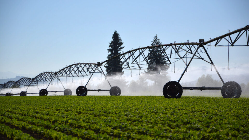
Worldwide, people are producing more food than ever, but most of that production is concentrated into only a handful of places.  For example, fully one third of the world’s wheat and barley exports come from Ukraine and Russia.  Across the globe, several major crop-growing regions, including some in the United States, are heading towards sharp drops in harvests as a result of climate change.

These forthcoming changes are not only bad news for farmers, but they are also bad news for everyone who eats.  According to a new study published in the journal Nature, it is going to become harder and more expensive to feed a more crowded and hungrier world.

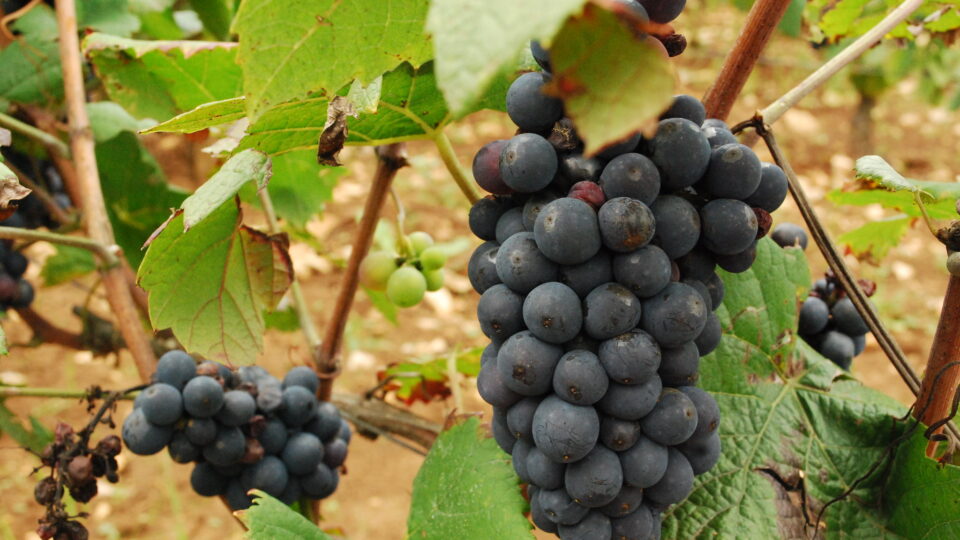
Specifically, under a moderate greenhouse gas emissions scenario, six key staple crops will see an 11.2% decline by the end of the century, compared to a world without warming.  The largest drops won’t be in the poorer, more marginal farmlands, but rather in places that are major food producers.  These are places like the US Midwest that has long benefited by having both good soil and ideal weather for raising crops like corn and soy.

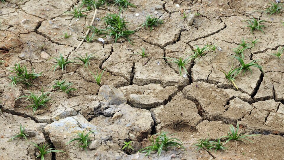
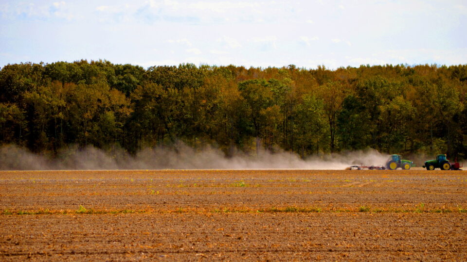
When the weather is not ideal, it can drastically reduce agricultural productivity.  Extreme weather in many places has already damaged crops.  Flooding has destroyed rice in Tajikistan, cucumbers in Spain, and bananas in Australia.  Severe storms in the US this spring caused millions of dollars’ worth of damage to crops.

As the climate changes, rising average temperatures and changing rainfall patterns are likely to diminish yields and extreme weather events like droughts and floods could wipe out harvests more often.  As climate change intensifies, agriculture is the most weather-affected sector of the economy.

**********

Web Links

How climate change will worsen hunger

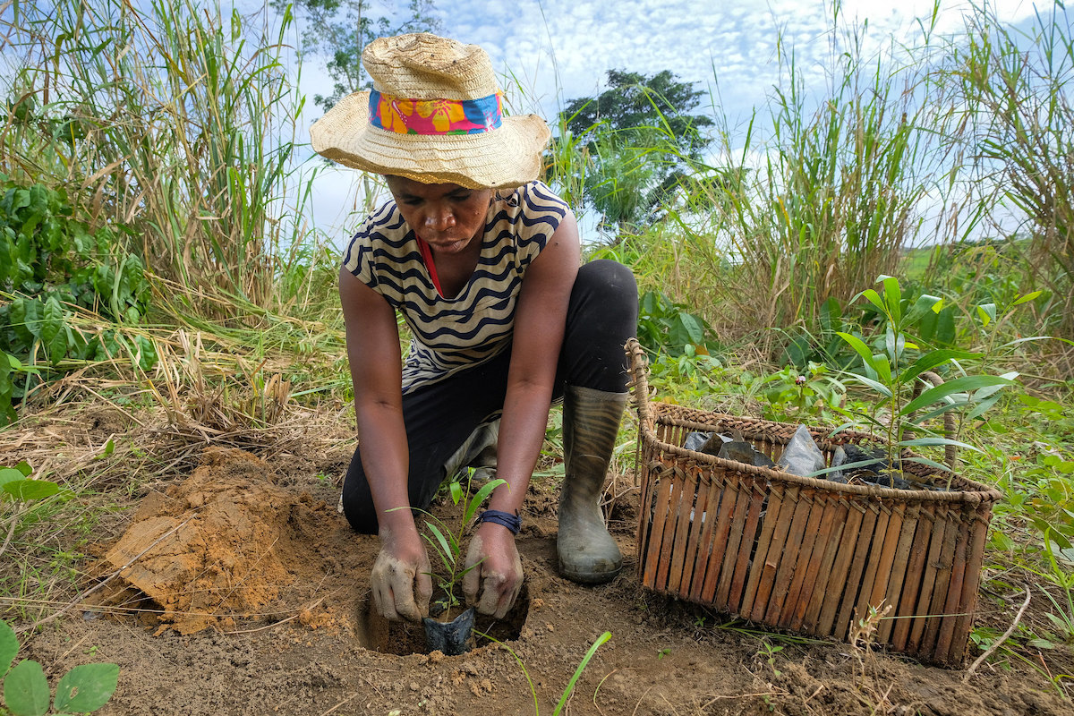
Photo, posted may 20, 2011, courtesy of Lance Cheung / USDA via Flickr.

Earth Wise is a production of WAMC Northeast Public Radio

Green grout for stabilizing buildings

March 31, 2025 By EarthWise Leave a Comment

Developing a green grout for buildings

We are all familiar with the grout that is used for tiles in our homes. We are less familiar with grout that is used to stabilize the soil beneath buildings.  Grouting is a process of ground improvement by injecting materials that can fill voids and cracks, strengthen and increase the bearing capacity of soil, and reduce permeability.

Traditional grouting methods have environmental downsides.  Most often, silica-based chemical grouts are used, and they are produced through energy-intensive processes that contribute substantially to carbon dioxide emissions.  As is the case for all materials and practices of the construction industry, developing sustainable, low-emission alternatives to conventional grouting materials has become an important priority.

Researchers from the Shibaura Institute of Technology in Japan have developed an innovative new grout material called Colloidal Silica Recovered from Geothermal Fluids.  This grout material enhances soil stabilization and simultaneously reduces the environmental impact of geothermal energy harvesting.

Geothermal energy production generates large amounts of silica-rich waste fluids which creates challenges for its maintenance and disposal.  The new grout repurposes this waste material thereby transforming an industrial byproduct into a valuable construction material.

The new grout material is particularly valuable in earthquake-prone regions, where soil stabilization is essential in preventing structural damage during seismic events.  In addition, the grout’s superior water-sealing properties makes it ideal for underground construction projects like tunnels, subways, and basements.  The new grout in an important step for the construction industry’s efforts to achieve carbon neutrality.

**********

Web Links

From Waste to Wonder: Revolutionary Green Grout for Sustainable Construction Practices

Photo, posted July 8, 2011, courtesy of MTA Construction & Development Mega Projects via Flickr.

Earth Wise is a production of WAMC Northeast Public Radio

Climate risks for apple-growing areas

January 31, 2025 By EarthWise 2 Comments

The changing climate is creating challenges for some of the most productive apple growing regions in America.  A study by Washington State University analyzed over 40 years of climate conditions that impact the growth cycle of apple trees.

Many growing areas face increased climate risk, but the top three apple-producing counties are among the most impacted.  Yakima County in Washington is the country’s largest apple producer with more than 48,000 acres of apple orchards.  Kent County in Michigan and Wayne County in New York (located east of Rochester) are the next two largest.

The study looked at six metrics that affect apple production.  Two of these metrics relate to extremes:  extreme heat days (with temperatures above 93 degrees) that can cause multiple problems and warm nights (with minimum temperatures above 59 degrees) that adversely affect coloration.

Other metrics included the number of cold days, the last day of spring frost, and the number of growing degree days, which are the number of days above a certain temperature that are conducive for apples to grow.

Changes to these metrics can impact apple production, change the time when apple flowers bloom, increase risk of sunburn on apples, and affect apple appearance and quality.  In many places, nearly all of these metrics are changing in an undesirable direction.

Apples are the most consumed fruit in the United States.  27,000 American producers supply an industry with a downstream value of $23 billion.  Apples are a big deal.

**********

Web Links

Prime apple-growing areas in US face increasing climate risks

Photo, posted August 8, 2020, courtesy of Sue Thompson via Flickr.

Earth Wise is a production of WAMC Northeast Public Radio

Approaching critical global temperature thresholds

January 21, 2025 By EarthWise Leave a Comment

The globe is approaching critical temperature thresholds

The Paris Climate Agreement is a global treaty adopted in 2015 to combat climate change by limiting global warming to well below 2°C above pre-industrial levels, while striving to keep it below 1.5°C.  But according to recent research, the planet is quickly approaching these critical thresholds. 

An international research team led by scientists from Colorado State University, Stanford University, and ETH-Zurich in Switzerland combined insights from 10 global climate models, and – with the help of artificial intelligence – found that regional warming thresholds are likely to be reached faster than previously thought.

In fact, the researchers found that most land regions will likely surpass the critical 1.5°C threshold by 2040 or even earlier.  Additionally, several regions are on track to exceed the 3.0°C threshold by 2060.  Regions including Central Europe, the Mediterranean, South Asia, and parts of sub-Saharan Africa are expected to reach these thresholds faster. 

The research team relied on transfer learning, a cutting-edge machine learning technique that leverages pre-trained models to tackle new, related tasks.

The research, which was recently published in the journal Environmental Research Letters, found that 34 regions are likely to exceed 1.5°C of warming by 2040.  Of those 34 regions, 31 of them are expected to reach 2°C of warming by 2040, and 26 of these 34 regions are projected to surpass 3°C of warming by 2060.

**********

Web Links

AI predicts that most of the world will see temperatures rise to 3C much faster than previously expected

Photo, posted February 23, 2011, courtesy of 2011 CIAT / Neil Palmer via Flickr.

Earth Wise is a production of WAMC Northeast Public Radio

Unexplained heat wave hotspots

December 27, 2024 By EarthWise Leave a Comment

2023 and 2024 have been the hottest years since records have been kept.  But above and beyond the upward march of average temperatures around the globe, there has been the phenomenon of distinct regions across the globe experiencing repeated heatwaves that are so extreme that they cannot be accounted for in any models of global warming.

A new study by Columbia University’s Climate School has provided the first worldwide map of such regions, which have emerged on every continent except Antarctica.  Heatwaves in these regions have killed thousands of people, withered crops and forests, and triggered devastating wildfires.

These recent regional-scale record-breaking temperature extremes have raised questions about whether current climate models can provide adequate estimates of the relationship between global mean temperature changes and regional climate risks.

Some of these regional events in recent years include a nine-day heatwave in the U.S. Pacific Northwest and southwestern Canada in June 2021 that broke daily records in some places by 54 degrees Fahrenheit.  Across Germany, France, the UK, the Netherlands, and other countries, the hottest days of the year are warming twice as fast as the summer mean temperatures. 

There is yet little understanding of the phenomenon.  Some theories related to destabilization of the jet stream don’t really explain all the temperature extremes observed.  But regardless of the underlying causes, the health impacts of these heat waves are severe, as are the effects on agriculture, vegetation, and infrastructure.  Society is not built to quickly adapt to them.

**********

Web Links

Unexplained Heat Wave ‘Hotspots’ Are Popping Up Across the Globe

Photo, posted August 16, 2022, courtesy of Alisdare Hickson via Flickr.

Earth Wise is a production of WAMC Northeast Public Radio

The last coal plant in Britain

October 31, 2024 By EarthWise Leave a Comment

The last coal plant in Britain has closed

The Industrial Revolution, which basically got underway in the mid-19th century, was largely enabled by coal, which fueled iron manufacturing, railroads, steam engines, and more.  Most of these things got their start in Britain, which inspired the rest of the world to follow suit.

The world’s first coal-burning power plant began producing electricity at the Holborn Viaduct in London in 1882.  This September, Britain – the birthplace of coal power – shut down its last coal-burning power station when the 2,000-megawatt Ratcliffe-on-Soar facility ceased operations.  Uniper, the company that operated the plant, will be converting the 750-acre site to a low-carbon energy hub.

Shutting down coal plants is not a simple matter, as they are the lifeblood of entire towns and regions where they are located.  Finding fair transitions for workers is an uphill battle that has to take place in many locations.

Coal is the dirtiest fossil fuel, producing more greenhouse gas than others, but historically was the cheapest and most abundant source of power in many countries.  In recent decades, it has been replaced by gas, nuclear power, and most recently, renewables like wind and solar.

The coal era has ended in much of the world. The United States still gets 16% of its electricity from coal, but that number keeps getting smaller.  Unfortunately, the great majority of coal use is in the world’s two most populous countries:  India and China.  Both are adding renewable energy sources, but both have rapidly climbing energy demand.  China’s coal consumption is expected to peak this year and flatten out.  But there is still work to be done to bring an end to coal power.

**********

Web Links

Britain Shuts Down Last Coal Plant, ‘Turning Its Back on Coal Forever’

Photo, posted March 13, 2016, courtesy of Arran Bee via Flickr.

Earth Wise is a production of WAMC Northeast Public Radio

Slow-moving landslides

October 17, 2024 By EarthWise Leave a Comment

Landslides are mass movements of rock, earth, or debris down a slope.  They can be initiated by rainfall, snowmelt, changes in water level, erosion by streams, earthquakes, volcanic activity, or by various human activities.  Most landslides we hear about are sudden events that can cause all sorts of calamities.  But not all landslides are rapid occurrences.  There are also slow-moving landslides.

A new study by the University of Potsdam in Germany has found that as urban centers in mountainous regions grow, more people are building homes on steeper slopes prone to slow-moving landslides.  Slow-moving landslides can move as little as one millimeter a year and up to as much as three meters per year.  Locations with slow-moving landslides can seem safe to settle on; in some cases, the movement itself can be inconspicuous or even completely undetected.

Slow slides can gradually produce damage in houses and other infrastructure and there can also be sudden acceleration from heavy rain or other influences.

The study compiled a new database of nearly 8,000 slow-moving landslides with areas of at least 25 acres located in regions classified as “mountain risk.”  Of the landslides documented, 563 are inhabited by hundreds of thousands of people.  The densest settlements on slow-moving landslides are in northwestern South America and southeastern Africa. 

In all regions of the study, urban center expansion was associated with an increase in exposure to slow-moving landslides.  As cities expand in mountainous areas, people are moving into unsafe areas, but poorer populations may have few other options.

**********

Web Links

Slow-moving landslides a growing, but ignored, threat to mountain communities

Photo, posted March 4, 2015, courtesy of Flickr.

Earth Wise is a production of WAMC Northeast Public Radio

Food, timber, and climate change

October 1, 2024 By EarthWise Leave a Comment

Food and timber production will increasing be in conflict with one another as the climate warms

The sights of coffee plantations in California and vineyards in Britain are becoming more common as the climate changes. But behind what sounds like a success story is a sobering one: climate change is shifting the regions suitable for growing food all around the world. 

According to a new study by researchers from the University of Cambridge, as crop growing shifts northwards, a squeeze will be put on the land needed to produce timber.  The timber these trees produce is used to make everything from paper and cardboard to furniture and buildings.

According to the study, which was recently published in the journal Nature Climate Change, more than 25% of existing forestry land – an area equivalent in size to India – will become more suitable for agriculture by the end of the century if climate change continues unabated.  Approximately 90% of this current forestry land is located in Canada, China, Russia, and the United States.    

Global timber production is worth more than $1.5 trillion every year.  Recent heat waves and wildfires have caused huge losses of timber forests around the world. 

According to the World Bank, the value of the global food system is estimated to be roughly $8 trillion annually.  Scientists expect climate change to cause some areas to become too hot for growing food, particularly in the tropics and southern Europe. 

With the global demand for food and the global demand for wood both projected to double by 2050, the increasing climate change-driven competition between the two is set to be an emerging issue in the coming decades. 

**********

Web Links

Global timber supply threatened as climate change pushes cropland northwards

Do the costs of the global food system outweigh its monetary value?

Photo, posted October 24, 2018, courtesy of Bill Smith via Flickr.

Earth Wise is a production of WAMC Northeast Public Radio

Mixed news for the Great Barrier Reef

August 27, 2024 By EarthWise Leave a Comment

Mixed news about the Great Barrier Reef

A prolonged and widespread coral bleaching event in Australia’s Great Barrier Reef has taken place this year.  It is the fifth such event over the past eight years and appears to be one of the worst ever.  According to preliminary analysis, 97% of corals in some areas of the northern part of the reef died as a result of the bleaching.  Over the entire length of the reef – which is more than 1,200 miles long – bleaching was observed on 74% of the more than 1,000 individual reefs that make up the Great Barrier Reef.  Half of those observed recorded high or very high levels of bleaching, although less than 10% had extreme levels of bleaching.

Prior to this mass bleaching event, an extensive survey of the reef was conducted, and it provided some good news.  Coral cover had increased in all three regions on the Great Barrier Reef and was actually at regional highs in two of the three regions.  The surveys were completed before the passage of Tropic Cyclone Jasper in December 2023.

Bleached corals are very stressed, but they still remain alive for at least some period of time.  Some types of corals can remain bleached for months, hanging on like a hospital patient in critical condition, but then recover.  Depending upon water conditions going forward, it remains to be seen how much of the reef will survive the latest bleaching event.  The next survey season by the Australian Institute of Marine Science will commence in September.

In many ways, the reef has had some lucky escapes in recent years.  As marine heatwaves become increasingly common, its luck may eventually run out.

**********

Web Links

New report on Great Barrier Reef shows coral cover increases before onset of serious bleaching, cyclones

Photo, posted 8, 2023, courtesy of Chris Hoare via Flickr.

Earth Wise is a production of WAMC Northeast Public Radio

Declining pollinator populations

June 28, 2024 By EarthWise Leave a Comment

Declining pollinator populations in North America

Scientists have been sounding the alarm on the global struggle of pollinators for decades.  Many recent studies have highlighted alarming declines in pollinator populations, sparking concern about the potential negative impacts on ecosystems and agriculture.  Habitat loss, invasive species, and climate change are some of the factors linked to the population declines. But most pollinator research has focused on well-studied species in easily-accessible regions.

In a new study recently published in the journal PLOS One, a research team led by Northern Arizona University compiled data on four major families of bees and butterflies to create species distribution models, allowing them to assess changes over time and space across North America.

The researchers confirmed that bee and butterfly populations are declining in major regions of North America due to ongoing environmental changes, and found that significant gaps in pollinator research limit the ability to protect these species. 

The highest species richness was found along North America’s West Coast –  especially in California. But the models showed a decline in species richness over the past century in western North America.  In contrast, the research team found disproportionate increases in eastern North America.

Comparisons with climate data indicate that the pollinator population changes are at least partly due to the impacts of climate change, including prolonged drought and habitat degradation. 

The study identifies regions of declining populations where officials can prioritize conservation efforts, and highlights how improved monitoring methods could address the knowledge gaps on pollinator populations.

**********

Web Links

Bee and butterfly records indicate diversity losses in western and southern North America, but extensive knowledge gaps remain

Bees and butterflies on the decline in western and southern North America

Photo, posted April 3, 2017, courtesy of Tracie Hall via Flickr.

Earth Wise is a production of WAMC Northeast Public Radio

Where not to plant trees

May 10, 2024 By EarthWise Leave a Comment

Tree plantings are not always a good thing

Planting huge numbers of trees is often proposed as a way to reduce the severity of climate change.  Studies have looked at the potential for Earth‘s ecosystems to support large additional areas of forest and have found that it would be possible to have at least 25% more forested area than we do now.  This in turn could capture large amounts of carbon and substantially reduce the amount in the atmosphere.

A recent study by researchers at Clark University in Massachusetts and The Nature Conservancy mapped the climate impact of tree planting across the globe, identifying where it would be most and also least beneficial.  The study, published in Nature Communications, found that trees planted in arid, desert regions or in snowy places like the Arctic would, on balance, worsen warming rather than reduce it.

Trees take up carbon dioxide from the atmosphere, which helps to keep warming in check.  But trees with dark, green leaves also absorb heat from sunlight.   Snow and desert sand, on the other hand, are light-colored and reflect more sunlight back into space.  For this reason, trees planted in snowy areas or in the desert will absorb more sunlight than their surroundings.  This can negate the climate benefits of soaking up carbon dioxide.

Previous studies only looked at how much carbon dioxide would be removed by planting trees in order to determine how much warming would be prevented.  The new study finds that it matters where the trees are planted.

Fortunately, the new study also shows that tree planting projects that are currently underway or that are in the pipeline are largely concentrated in regions where they will indeed help slow global warming.

**********

Web Links

This Map Shows Where Planting Trees Would Make Climate Change Worse

Photo, posted April 5, 2022, courtesy of UC Davis Arboretum and Public Garden via Flickr.

Earth Wise is a production of WAMC Northeast Public Radio

Winegrowing regions and climate change

April 29, 2024 By EarthWise Leave a Comment

Climate change will impact winegrowing regions around the world

Grapes grown to make wine are sensitive to climate conditions including temperatures and amount of rainfall.  The warming climate is already having visible effects on yields, grape composition, and the quality of wine.  This has significant consequences on the geography of wine production and is of major concern for the $350 billion global industry.

Winegrowing regions are mostly at the mid-latitudes where temperatures are warm enough to allow grapes to ripen but not excessively hot.  The climates are relatively dry so that fungal diseases are not rampant.

Because of the warming climate, harvesting in most vineyards now begins two or three weeks earlier than it did 40 years ago and this affects the grapes and the resultant wines.  Temperature changes affect acidity, wine alcohol, and aromatic signatures.

If global temperature rise crosses the 2-degree level, 90% of all traditional winegrowing areas throughout Spain, Italy, Greece, and southern California may become unable to produce high-quality wines.  Conversely, areas of northern France, the states of Washington and Oregon, British Columbia, and Tasmania will see improved conditions for producing quality wines. 

As the climate warms, winegrowers face new challenges such as the emergence of new diseases and pests as well as an increasing number of extreme weather events.  Wine producers are using more drought-resistant grape varieties and are adopting management methods that better preserve soil water.

The changing climate poses many threats to the quality of wines produced in traditional vineyards.  In the future, the wine industry may look very different in terms of where and how the best wines are produced. 

**********

Web Links

A global map of how climate change is changing winegrowing regions

Photo, posted November 14, 2008, courtesy of Curtis Foreman via Flickr.

Earth Wise is a production of WAMC Northeast Public Radio

Why are bees making less honey?

February 8, 2024 By EarthWise Leave a Comment

Honey bees are making less honey in the United States

Scientists have been sounding the alarm on the global struggle of pollinators for a long time.  According to the United Nations, nearly 35% of the invertebrate pollinator species, such as bees and butterflies, are facing extinction. And since 75% of the world’s food crops depend on pollination to some extent, the decline of pollinators poses a major threat to global food security.

Honey bees are among the struggling pollinators.  Honey bee colonies in the United States have experienced annual population declines since 2006.  But in addition to there being fewer bees, the bees that remain are also making less honey.  In fact, honey yields in the United States have been declining since the 1990s. 

A new study by researchers from Penn State University has solved some of the mystery.  Using five decades of data across the United States, the research team analyzed the factors that could be affecting the number of flowers growing in different regions, which, in turn, affects the amount of honey produced by bees. 

In the study, which was recently published in the journal Environmental Research, the scientists found that climate conditions and soil productivity were two of the biggest factors in estimating honey yields.  States in both warm and cool regions produced higher honey yields when they had productive soils.  These two factors set a baseline production level of honey, while herbicide use, weather, and land use changes influenced how much honey was produced in a given year. 

The study’s findings  provide valuable insights that should help beekeepers, growers, and land managers better support honey bees.

**********

Web Links

Why are bees making less honey? Study reveals clues in five decades of data

Photo, posted August 30, 2021, courtesy of Brandon O’Connor / NRCS via Flickr.

Earth Wise is a production of WAMC Northeast Public Radio

Groundwater loss

December 21, 2023 By EarthWise Leave a Comment

Groundwater is the water found underground in the cracks and spaces in soil, sand, and rock.  It is held in aquifers and bubbles up naturally into springs, streams, and rivers, but also is pumped out for use by people.  Groundwater provides almost half the drinking water in the U.S. and is a main source of water for agriculture.

The world’s supply of groundwater is steadily declining.  The combination of climate change and human population growth is increasingly diminishing groundwater.

A study by the Desert Research Institute published in the journal Nature Communications has mapped the global permanent loss of aquifer storage capacity for the first time.  Computer modeling with advanced machine learning techniques has provided a detailed picture of the world’s groundwater situation.

The study found that global aquifer storage capacity is disappearing at a rate of 10 miles a year, about the size of 7,000 Great Pyramids of Giza.  The loss of groundwater storage is permanent, forever reducing the amount of water that can be captured and stored because the pumping of groundwater can cause the ground surface above to sink, collapsing the space where water can be stored.

About 75% of this subsidence is occurring over cropland and urban regions.  The United States, China, and Iran account for most of the global groundwater storage loss but many other places in the Middle East and Asia are experiencing significant groundwater withdrawal as well.

Most regions of the world do not have monitoring programs for groundwater pumping.  The study underscores the need to better understand this issue on a global scale and take appropriate action before it is too late.

**********

Web Links

Scientists Map Loss of Groundwater Storage Around the World

Photo, posted August 7, 2015, courtesy of NRCS Oregon via Flickr.

Earth Wise is a production of WAMC Northeast Public Radio

cancun airport to tulum private transfer cost

Trouble For Emperor Penguins | Earth Wise

September 18, 2023 By EarthWise Leave a Comment

Emperor penguins are in trouble

Emperor penguins are the tallest and heaviest of all living penguin species.  The loss of sea ice in Antarctica last year has led to unprecedented breeding failure in some emperor penguin colonies.

In a study published by the British Antarctic Survey, researchers found that no chicks survived from four of the five known emperor penguin colonies in the central and eastern Bellinhausen Sea.   Satellite images showed the loss of sea ice at breeding sites, well before chicks would have developed waterproof feathers.

Emperor penguins are dependent on stable sea ice that is firmly attached to the shore from April through the end of the year.  Arctic sea ice reached an all-time low in December 2022 with the most extreme loss seen in the central and eastern Bellinghausen Sea where there was a 100% loss of sea ice late the year.

This year, the sea ice extent in Antarctica is still far below all previous records for this time of year.  As of August, when oceans normally are freezing up, there were still areas that were ice-free.

Emperor penguin populations have not had to contend with large-scale hunting, habitat loss, overfishing, or other human-caused problems in the modern era, but climate change may be their undoing.  They have previously responded to incidents of sea ice loss by moving to more stable sites in the following year.  But this strategy will not be successful if the sea ice habitat is affected across entire regions of Antarctica.

Scientists are predicting that 90% of emperor penguin colonies will be quasi-extinct by the end of the century, assuming current global warming trends continue.

**********

Web Links

Loss of sea ice causes catastrophic breeding failure for emperor penguins

Photo, posted October 7, 2017, courtesy of Christopher Michel via Flickr.

Earth Wise is a production of WAMC Northeast Public Radio

The Upper Atmosphere Is Cooling | Earth Wise

June 26, 2023 By EarthWise Leave a Comment

The upper atmosphere is cooling

The part of the atmosphere closest to the Earth’s surface has been warming since the Industrial Revolution.  This warming is associated with increasing amounts of carbon dioxide as well as other human-made chemicals that have been changing the makeup of the atmosphere. Climate change is generally thought about in terms of the lowest regions of the atmosphere – known as the troposphere – where our weather happens.

But climate models also predict that another result of the changes to the makeup of the atmosphere is that most of the atmosphere up higher will get dramatically colder.  The same gases that are warming the bottom few miles of air are cooling the much greater expanses above that extend to the edge of space.

Recent satellite data has confirmed the accuracy of these models and provide further confirmation of the human fingerprint of climate change. The natural variability of weather that complicates climate models does not play a role in the upper atmosphere.

In the higher levels of the atmosphere, the effects of increasing levels of carbon dioxide are quite different.  In the thinner air up there, the heat trapped and re-emitted by CO2 does not bump into other molecules creating warming.  Instead, it escapes to space.  Combined with the trapping of heat at lower levels, the result is a rapid cooling of the upper atmosphere.

There are potential problems associated with the cooling upper atmosphere including that it is contracting.  The result is that the crowd of manmade objects in low orbit remains there longer, and there is a potential increased degradation of the ozone layer. 

The changes we are making to the atmosphere are having significant effects from the surface of the earth to the edge of space.

**********

Web Links

The Upper Atmosphere Is Cooling, Prompting New Climate Concerns

Photo, posted August 18, 2021, courtesy of Arek Socha via Flickr.

Earth Wise is a production of WAMC Northeast Public Radio

Protecting Wetlands | Earth Wise

March 28, 2023 By EarthWise Leave a Comment

Wetlands are distinct ecosystems that are flooded or saturated by water, either permanently or seasonally.  They include mangroves, marshes, swamps, forested wetlands, bogs, wet prairies, and vernal pools.   The feature that most wetlands share is soil or substrate that is at least periodically saturated with or covered by water.

Wetlands are some of the most threatened ecosystems in the world.  While wetlands can be affected by a variety of natural stressors, including erosion, droughts, and storms, human activities have been the major driver of wetland decline. 

But according to a new study by researchers from McGill University in Canada, the global loss of wetland areas since 1700 has likely been overestimated.  The research team calculated that the area of wetland ecosystems around the world has declined 21-35% since 1700 as a result of human activities – far less than the 50-87% decline estimated in other studies.  The study’s focus beyond regions with historically high wetland losses and its avoidance of possibly misleading extrapolations likely resulted in the lower estimate.      

According to the study, which was published in the journal Nature, more than 2.1 million square miles of wetlands have been lost during the past 300 years – an area roughly the size of India.  The five countries with the highest wetland losses are the United States, China, India, Russia and Indonesia. 

But discovering that fewer wetlands have been historically lost than previously thought gives researchers a second chance to protect wetlands.  The findings of the study will help researchers prioritize global conservation and restoration actions.

**********

Web Links

A second chance to protect wetlands

Photo, posted February 2, 2005, courtesy of Jan Tik via Flickr.

Earth Wise is a production of WAMC Northeast Public Radio

Distributed Wind Energy | Earth Wise

March 17, 2023 By EarthWise 1 Comment

When we think about wind power, we are usually talking about increasingly giant windfarms – either on land or offshore – that produce power on a utility scale.  But there is also distributed wind energy, which refers to wind technologies in locations that directly support individuals, communities, and businesses.  

Distributed wind can be so-called behind-the-meter applications that directly offset retail electricity usage much as rooftop solar installations do.  It can also be front-of-the-meter applications where the wind turbines are connected to the electricity distribution system and supplies energy on a community scale.  Distributed wind installations can range from a several-hundred-watt little turbine that powers telecommunications equipment to a 10-megawatt community-scale energy facility. As of 2020, there were nearly 90,000 distributed wind turbines in the U.S. with a total capacity of about 1 GW.

A study by the National Renewable Energy Laboratory has estimated the potential for distributed wind energy in the U.S.   According to the new analysis, the country has the ability to profitably provide nearly 1,400 GW of distributed wind energy capacity. 

Entire regions of the country have abundant potential. The regions with the best economic prospects have a combination of high-quality wind, relatively high electricity rates, and good siting availability.  Overall, the Midwest and Heartland regions had the highest potential especially within agricultural land.

Realizing this outcome for distributed wind will require improved financing and performance to lower costs, relaxation of siting requirement to open up more land for wind development, and continued investment tax credits and the use of net metering.

**********

Web Links

U.S. has potential for 1,400 GW distributed wind energy, NREL finds

Photo, posted January 3, 2009, courtesy of skyseeker via Flickr.

Earth Wise is a production of WAMC Northeast Public Radio

Lithium Mining And Andes Ecosystems | Earth Wise

October 28, 2022 By EarthWise Leave a Comment

The global demand for lithium could be an ecological disaster

A remote region in the high Andes straddling the borders between Argentina, Bolivia, and Chile has become known as the Lithium Triangle.   The area has become the focus of a global rush for lithium to make batteries for electric cars.  The global demand for lithium is expected to quadruple by 2030 to 2.6 million tons a year.

According to the U.S. Geological Survey, more than half of the world’s lithium reserves are dissolved in ancient underground water within the Lithium Triangle.  The cheapest way to extract the lithium is to pump the underground water to the surface and evaporate it in the sun to concentrate the lithium carbonate contained in it.

Every ton of lithium carbonate extracted using this cheap, low-tech method dissipates into the air about half a million gallons of water that is vital to the arid high Andes.  The process lowers water tables and has the potential to dry up lakes, wetlands, springs, and rivers.  Hydrologists and conservationists say the lithium rush in Argentina is likely to turn the region’s delicate ecosystems to deserts.

The global drive for green vehicles to fight climate change has the potential to be an ecological disaster in this remote region of South America and for the indigenous people who live there.

The environmental impacts are not an inevitable price for the transition to electric vehicles.  First of all, there are alternatives to lithium.  Both zinc and nickel are potential substitutes in rechargeable batteries.  But, there are also ways of obtaining lithium that are less destructive than evaporating the metal from saline ecosystems.  It is up to battery manufacturers, automakers, and financiers to start demanding lithium from sources that are less environmentally destructive.

**********

Web Links

Why the Rush to Mine Lithium Could Dry Up the High Andes

Photo, posted September 25, 2015, courtesy of Nuno Luciano via Flickr.

Earth Wise is a production of WAMC Northeast Public Radio

Building Resilient Food Systems | Earth Wise

August 12, 2022 By EarthWise Leave a Comment

Building resilient food systems are critical

According to the United Nations and The World Bank, global hunger levels in 2021 surpassed the previous record set in 2020.  The organizations also found that acute food insecurity – defined as when a person’s inability to consume adequate food puts their lives or livelihoods in immediate danger – could continue to worsen this year in many countries around the world. 

According to a new study led by researchers from the University of Colorado Boulder, increased demand for water will be the biggest threat to food security during the next 20 years, followed closely by heat waves, droughts, income inequality, and political instability.  

The report, which was recently published in the journal One Earth, calls for increased collaboration to build a more resilient global food supply.  The impacts of conflict and climate change are already measured and studied around the world.  While these pressing threats are not new, the researchers found that better collaboration between these areas of research could fortify and strengthen global food security. 

In 2019, before the COVID-19 pandemic, the researchers surveyed 69 experts in various fields related to food security.  They found that many effects of climate change – such as unpredictable weather changes – could have the greatest negative impacts on food security.  The researchers also found that threats to food security from income inequality, global price shocks, and political instability and migration are highly likely during the next two decades.  More than half of the world’s food insecure populations also live in conflict-prone regions.

According to the research team, food security has never been a problem of production.  It’s a problem of distribution, access, and poverty, and can be exacerbated by conflict.   

**********

Web Links

Amid climate change and conflict, more resilient food systems a must, report shows

Photo, posted July 19, 2009, courtesy of Danumurthi Mahendra via Flickr.

Earth Wise is a production of WAMC Northeast Public Radio.

  • Page 1
  • Page 2
  • Go to Next Page »

Primary Sidebar

Recent Episodes

  • An uninsurable future
  • Clean energy and jobs
  • Insect declines in remote regions
  • Fossil fuel producing nations ignoring climate goals
  • Trouble for clownfishes

WAMC Northeast Public Radio

WAMC/Northeast Public Radio is a regional public radio network serving parts of seven northeastern states (more...)

Copyright © 2026 ·