• Skip to primary navigation
  • Skip to main content
  • Skip to primary sidebar

Earth Wise

A look at our changing environment.

  • Home
  • About Earth Wise
  • Where to Listen
  • All Articles
  • Show Search
Hide Search
You are here: Home / Archives for rivers

rivers

Wildfires and water quality

August 11, 2025 By EarthWise Leave a Comment

Wildfires affect water quality long after the flames are out

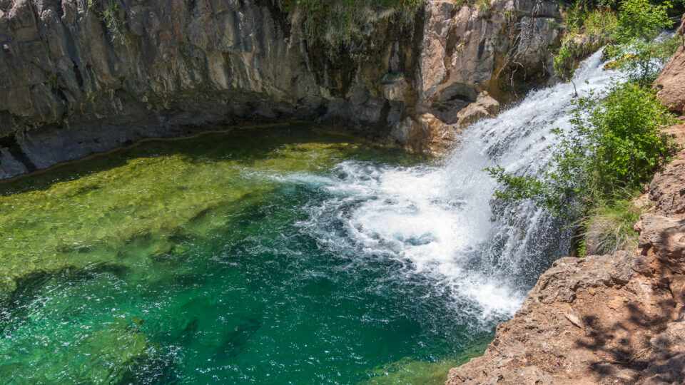
Hotter and drier conditions driven by climate change are leading to an increasing number of wildfires in North America and around the world. The damage wildfires cause – to forests, homes, and communities – is well-known. But long after the flames are gone, the effects can linger, especially in rivers and streams, where water quality may suffer for years.

A new study by scientists at the CIRES institute at the University of Colorado Boulder analyzed more than 100,000 water samples from more than 500 sites across the Western U.S. and found that wildfires can degrade water quality for up to eight years after a fire. The research, which was recently published in the journal Nature Communications Earth & Environment, found elevated levels of organic carbon, nitrogen, phosphorus, sediment, and turbidity – the cloudiness of water – in basins affected by fire.

This large-scale analysis reveals watersheds take longer to recover from wildfires than previously thought, with widespread, long-lasting impacts often going undetected for years.

Organic carbon, phosphorus, and turbidity remain elevated for one to five years after a fire. Nitrogen and sediment levels stay notably high for up to eight years. Fire-driven impacts are worse in more forested areas.

Each watershed in the study responded differently depending on local conditions.  In some places, sediment levels surged to as much as 2,000 times normal levels, while others remained relatively unchanged.

The research team hopes its findings can help guide future planning efforts to improve wildfire resilience.

**********

Web Links

Wildfires threaten water quality for years after they burn

Photo, posted April 6, 2017, courtesy of Bonnie Moreland via Flickr.

Earth Wise is a production of WAMC Northeast Public Radio

Microplastics and birds

March 19, 2025 By EarthWise Leave a Comment

Microplastics are tiny plastic particles, less than 5 millimeters in size, that come from the breakdown of larger plastics, synthetic fibers, microbeads, and tire wear.  Microplastics are found in oceans, rivers, soil, and even the air we breathe. These particles can take hundreds of years to degrade, spreading across ecosystems and accumulating in unexpected places, such as deep-sea sediments and Arctic sea ice.

According to a new study by researchers from the University of Texas at Arlington, microscopic plastic pollutants drifting through the air are lodging in the lungs of birds.  These findings raise  significant concerns about the impact on their respiratory health, but also raise alarms about potential risks to human health.

Birds were chosen for the study because they are found in almost every corner of the world and often share environments with humans. 

In the study, the research team examined 56 different wild birds from 51 distinct species, all sampled from the Tianfu airport in western China.  The researchers found high concentrations of microplastics in bird lungs, with an average of 221 particles per species.  The most common types identified were chlorinated polyethylene, which is used for insulating pipes and wires, and butadiene rubber, which is a synthetic material in tires.

Although there is no established “safe” level of plastic particles in lung tissue, high levels of microplastics have been linked to serious health risks, including heart disease, cancer, respiratory issues, and fertility problems.

The study highlights an urgent need to tackle plastic pollution in the environment because of its far-reaching impact on ecosystems and human health.  

**********

Web Links

Birds breathe in dangerous plastics—and so do we

Photo, posted January 28, 2017, courtesy of Pete Richman via Flickr.

Earth Wise is a production of WAMC Northeast Public Radio

Sand mining and the environment

March 18, 2025 By EarthWise Leave a Comment

Sand mining is the world’s largest mining endeavor.  It is responsible for 85% of all mineral extraction.  It is also the least regulated, possibly the most corrupt, and likely the most environmentally destructive.  Sand is the second-most exploited natural resource in the world after water.  Its global use has tripled in the past two decades.  More than 50 billion tons of sand is extracted from the environment each year.

Sand plays a critical role in much of human development around the world.  It is a key ingredient of concrete, asphalt, glass, and electronics.  It is relatively cheap and relatively easy to extract.  But we use enormous amounts of it.

Sand mining is a major threat to rivers and marine ecosystems.  It is linked to coastal erosion, habitat destruction, the spread of invasive species, and damage to fisheries. 

The harm from sand mining is only beginning to attract widespread attention.  A recent study by an international group of scientists published in the journal One Earth identifies        threats posed by sand mining.  Sand extraction in marine environments remains largely overlooked, despite sand and sediment dredging being the second most widespread human activity in coastal areas after fishing.

Sand is generally seen as an inert, abundant material, but it is an essential resource that shapes coastal and marine ecosystems, protects shorelines, and sustains both ecosystems and coastal communities.  Sand extraction near populated coastlines is particularly problematic as climate change makes coastlines increasingly fragile.

Like all other resources on our planet, even sand cannot be taken for granted.  It must be responsibly managed.

**********

Web Links

The rising tide of sand mining: a growing threat to marine life

Photo, posted February 7, 2013, courtesy of Pamela Spaugy / U.S. Army Corps of Engineers via Flickr.

Earth Wise is a production of WAMC Northeast Public Radio

Drying rivers and hydropower

February 7, 2025 By EarthWise Leave a Comment

Drying rivers threaten hydropower around the world

A decade ago, Ecuador began a major transition to using hydroelectric power.  Like in many other South American countries, the presence of abundant rivers could supply large amounts of energy and drive economic expansion and lead to a new era of prosperity.

This ambitious plan has run into the impacts of climate change.  An extraordinary drought has engulfed much of South America, drying rivers and reservoirs, and has put Ecuador’s power grid on the brink of collapse. 

Since September, daily energy cuts in Ecuador have lasted as long as 14 hours.  An industry group says that the nation is losing $12 million in productivity and sales for every hour the power is out.  Just a few years ago, Ecuador was making great strides in reducing poverty.  Now, as the energy crisis has increased its grip on the country, much of what was achieved is being lost.

Ecuador’s situation is not unique.  In recent years, abnormally dry weather in multiple places has resulted in extreme low water levels in rivers, reducing hydropower resources in Norway, Canada, Turkey, and even rainforest-rich Costa Rica.

Overall, more than one billion people live in countries where more than half of their energy comes from hydroelectric plants.  With a warming climate and increasing incidence of extreme weather events like drought, it is likely that hydropower will become a less reliable energy source.  More than a quarter of all hydroelectric dams are in places with a medium to high risk of water scarcity by 2050. 

**********

Web Links

The Rivers Run Dry and the Lights Go Out: A Warming Nation’s Doom Loop

Photo, posted January 15, 2020, courtesy of Pedro Szekely via Flickr.

Earth Wise is a production of WAMC Northeast Public Radio

The human footprint on Earth

February 6, 2025 By EarthWise Leave a Comment

The Earth is a pretty big place, and it is easy to think that humans and their activities occupy very little of it.  But the impact of human activities on our planet continues to grow.  Recent satellite images from NASA’s Earth Observatory show the staggering extent of the human footprint on Earth.

Agriculture is a major part of it.  Farms and pastures take up almost half of the world’s habitable land – land not covered by ice or desert.  Greenhouses have recently proliferated tremendously and now cover 3.2 million acres, an area the size of Connecticut, and they even have effects on local climates.

More than half of the world’s population now lives in cities, which are expanding rapidly.  Enormous cities in Asia are changing the landscape in places like Thailand and Indonesia.  Apart from taking up lots of land, many of the world’s cities are immersed in clouds of air pollution that they generate.

Greenhouse gas emissions continue to grow, and temperatures continue to rise.  The effects of this on the planet are increasingly evident.  Seas are rising, ice is melting, glaciers shrink away, and wildfires continue to burn.  The massive wildfires in and around Los Angeles have made major changes in the local landscape.  Rising seas have flooded coastal wetlands and elsewhere, rivers and lakes have shrunk.

There are also human impacts visible from space that represent positive signs.  Large solar arrays supply the cheapest form of energy in most parts of the world and the number and size of solar installations are at a record high.   These solar installations provide some hope that global warming can be slowed.

**********

Web Links

The Growing Human Footprint on Earth, as Seen from Space

Photo, posted July 28, 2012, courtesy of Beth Scupham via Flickr.

Earth Wise is a production of WAMC Northeast Public Radio

Saving the Great Salt Lake

January 27, 2025 By EarthWise Leave a Comment

For many years, scientists have warned that the Great Salt Lake in Utah is headed toward a catastrophic decline.  While the size of the Great Salt Lake fluctuates naturally with seasonal and long-term weather patterns, the lake has been experiencing significant and steady declines for decades.  In fact, the Great Salt Lake has lost more than 15 billion cubic yards of water over the past three decades, and it’s getting shallower at the rate of four inches a year. 

This reduction is primarily due to excessive water diversions from rivers and streams that feed into the lake for agricultural, industrial, and municipal use. These diversions, combined with prolonged drought and rising temperatures due to climate change, have significantly reduced the lake’s water level. 

According to a new study led by researchers from Oregon State University, 62% of the river water bound for the Great Salt Lake is diverted for human use, with agricultural activities responsible for nearly three-quarters of that percentage.  The analysis, which was recently published in the journal Environmental Challenges, found that reducing irrigation is necessary to save the lake. 

In order to stabilize and begin refilling the lake, the research team proposes cutting human water consumption in the Great Salt Lake’s watershed by 35%.  The researchers emphasize that farmers and ranchers facing income losses from using less water would require taxpayer-funded compensation.

The Great Salt Lake is a biodiversity hotspot, sustaining more than 10 million migratory birds.  The lake also directly supports 9,000 jobs and fuels $2.5 billion in economic activity annually. 

**********

Web Links

Reducing irrigation for livestock feed crops is needed to save Great Salt Lake, study argues

Photo, posted January 14, 2024, courtesy of Olaf Zerbock via Flickr.

Earth Wise is a production of WAMC Northeast Public Radio

South American drought

November 13, 2024 By EarthWise Leave a Comment

Vast areas of South America have been gripped in drought conditions for months.  Rivers in the Amazon basin fell to record-low levels in October.  The drought has amplified wildfires, parched crops, disrupted transportation networks, and interrupted hydroelectric power generation in parts of Brazil, Bolivia, Colombia, Ecuador, Peru, and Venezuela.

The drought is related to the impact of the El Niño that was present for the latter part of 2023 and the first half of this year.  El Niño typically shifts rainfall patterns in such a way that there is reduced rainfall in the Amazon.  This is especially true during the dry season months of July, August, and September.

Forecasts earlier in the year warned that there would be extreme fire conditions during the dry season.  Indeed, the Pantanal region that spans parts of southern Brazil, Paraguay, and Bolivia has experienced one of its worst fire seasons in decades.  The lack of rainfall, low soil moisture, and drawdowns of groundwater helped to amplify fires and caused them to spread faster and farther.

The drought has strained power supplies in Brazil and Ecuador because hydroelectric power stations are producing less electricity.   Snarled transportation networks with impassible rivers have left some communities struggling to get supplies. 

Brazil’s National Center for Monitoring and Early Warning of Natural Disasters has called the current drought the most intense and widespread Brazil has ever experienced.  Late October saw 293 Brazilian municipalities facing extreme drought.

**********

Web Links

Intense, Widespread Drought Grips South America

Photo, posted August 13, 2010, courtesy of Colm Britton via Flickr.

Earth Wise is a production of WAMC Northeast Public Radio

Rivers are drying up

November 4, 2024 By EarthWise Leave a Comment

Rivers are drying up around the world

According to a new U.N. report, the world’s rivers had their driest year in at least three decades.  Record heat and droughts in many places contributed to low levels of water in many of the world’s rivers.

The world faces problems of either too much or too little water. The warming climate has fueled both powerful storms with heavy rainfall and intense droughts around the globe. 

Last year was the hottest year on record, and it’s a record that is unlikely to last long.  The Mississippi River and Amazon River basins were at all-time lows.  Major rivers with headwaters in the Himalayas – the Ganges, Brahmaputra, and Mekong Rivers – were all unusually dry.

According to the World Meteorological Organizations State of Global Water Resources Report, nearly half of the nearly 1,000 rivers tracked around the world had below-normal levels of water.  Only 17% had above-average levels.  Over the past 32 years, on average only a quarter of the rivers monitored had below-normal water levels and last-year’s 45% was the largest ever.

Last year’s severe heat shrank glaciers that are a crucial source of meltwater that feeds rivers.  Glaciers lost more ice last year than they have in at least 50 years.

More than half of the world’s population lives within a couple of miles of a body of fresh water.  The places with the highest population densities around the world are almost all near large rivers.  Rivers provide freshwater for irrigation, consumption, and transportation and are an important source of energy. Historically, they have played an important role in the development of human society.  The shrinking of rivers is a big deal.

**********

Web Links

World’s Rivers Are Driest They Have Been in Decades

Photo, posted August 22, 2023, courtesy of Radek Kucharski via Flickr.

Earth Wise is a production of WAMC Northeast Public Radio

Ocean geoengineering

October 24, 2024 By EarthWise Leave a Comment

A start-up company is exploring ocean geoengineering

As greenhouse gas emissions continue to be dangerously large and the perils of climate change are increasingly apparent, the world is increasingly exploring ways to deliberately intervene in climate systems.  A number of these ideas involve introducing substances into the atmosphere, but there are also ways to tinker with the oceans.

The oceans naturally absorb about a third of the carbon dioxide that humans pump into the atmosphere, mostly by burning coal, gas, and oil.  People are exploring ways to get the ocean to take up even more of the carbon dioxide.  One approach that is gaining traction is known as alkalinity enhancement.  By adding limestone, magnesium oxide, or other alkaline substances to rivers and oceans, it changes their chemistry and makes them soak up more carbon dioxide.

This approach has been around for a while as a way to mitigate acid rain in rivers and has been very successful.  A start-up company in Canada called CarbonRun is building a machine that grinds up limestone and will release the powder it produces into a local river in Nova Scotia.  The limestone in the river will be naturally converted into a stable molecule that will eventually be washed into the seas, where it should remain for thousands of years.

Expanding this approach to oceans faces many challenges including the costs and complexities of obtaining, processing, and transporting vast amounts of limestone to where it is to be released.  There are also potential environmental issues to grapple with.  But CarbonRun and others are moving forward with testing the approach.

In any event, the biggest barrier to ocean alkalinity enhancement is proving that it works.  That effort is underway.

**********

Web Links

They’ve Got a Plan to Fight Global Warming. It Could Alter the Oceans.

Photo, posted May 27, 2007, courtesy of John Loo via Flickr.

Earth Wise is a production of WAMC Northeast Public Radio

Cities and rainwater

September 24, 2024 By EarthWise Leave a Comment

Cities across the country are grappling with the problem that bigger, more frequent rainstorms occurring as a result of climate change are overtaxing the systems put in place to handle stormwater.  Cities use a combination of so-called green infrastructure – such as rain gardens and porous pavements – and traditional gray infrastructure, such as pipes, tunnels, and pump stations.

In 2011, Philadelphia drew national attention for its Green City, Clean Waters program that was designed to manage the increasing amount of storm water using mostly green infrastructure.  Thirteen years later, the city is experiencing billions of gallons of polluted stormwater overflowing its sewage outfall pipes each year.  Green infrastructure is cheaper and faster to build, but it is not coping with increasing rainfall.

About 700 U.S. municipalities, mostly in the Northeast and around the Great Lakes, rely on these combined sewer systems.  Based on updated climate projections, many are having to greatly increase gray infrastructure projects that include concrete holding tanks, tunnels, and pipes that can divert and hold onto flows until the rain stops, and water treatment plants can recover.  These projects can take decades to implement and cost billions of dollars.

All across the country, cities are going to need to bite the bullet and make large-scale investments in conventional sewage infrastructure and repairs to stop billions of gallons of raw sewage from running into rivers.  The increased storms present a daunting challenge for America’s cities.

**********

Web Links

Faced With Heavier Rains, Cities Scramble to Control Polluted Runoff

Photo, posted August 29, 2011, courtesy of Reggie via Flickr.

Earth Wise is a production of WAMC Northeast Public Radio

Warming estuaries

September 13, 2024 By EarthWise Leave a Comment

Estuaries in South Florida are rapidly warming

Estuaries and their surrounding wetlands are bodies of water where freshwater from rivers and streams mixes with salt water from the ocean to create brackish water.  These brackish ecosystems support many unique plant and animal communities around the world. 

But ocean water temperature around the world continues to warm.  In fact, from 1901 to 2023, the average sea surface temperature has increased by 0.14°F per decade, and 2023 was the warmest year on record.

While sea surface temperatures are on the rise, the problem is more pronounced in South Florida’s estuaries.  According to a new study by researchers from the University of South Florida College of Marine Science and the National Park Service, estuaries have experienced rapid warming over the past two decades. 

In fact, the research team found that sea surface temperature in four estuaries in South Florida – Florida Bay, Tampa Bay, St. Lucie Estuary and Caloosahatchee River Estuary- has risen around 70% faster than the Gulf of Mexico, and 500% faster than the global oceans. 

Their findings, which were recently published in the journals Environmental Research Letters and Estuaries and Coasts, paint a troubling picture for the marine life that calls South Florida’s estuaries home.

The research team has speculated about the possible causes of the rapid rate of warming, including evaporation, water capacity, and residence time, but no single factor has been revealed as dominant. 

The researchers hope to partner with colleagues at the Florida Fish and Wildlife Conservation Commission and NOAA to explore the potential impacts of water temperatures on seagrass and coral populations in South Florida.

**********

Web Links

Estuaries in South Florida are warming faster than the Gulf of Mexico and global ocean

What is an estuary?

Photo, posted August 18, 2016, courtesy of City of St. Pete via Flickr.

Earth Wise is a production of WAMC Northeast Public Radio

Emissions and the Great Salt Lake

September 4, 2024 By EarthWise Leave a Comment

Emissions and the Great Salt Lake

The Great Salt Lake in Utah has been described as a puddle of its former self.  The lake’s size fluctuates naturally with seasonal and long-term weather patterns, but the lake has been experiencing decline for decades as Utahans take water out of the rivers and streams that once fed the lake.  Over recent decades, the lake has lost 73% of its water and 60% of its surface area.

For years, scientists and environmental leaders have warned that the Great Salt Lake is headed toward a catastrophic decline.  Recent research has found that the lake’s desiccating shores are becoming a significant source of greenhouse gas emissions.  Scientists have calculated that the dried-out portions of the lakebed released about 4.1 million tons of carbon dioxide and other greenhouse gases in 2020.

The recent study, published in the journal One Earth, suggests that the Great Salt Lake – which is largest saltwater lake in the Western Hemisphere – as well as other shrinking saline lakes around the world could become major contributors of climate-warming emissions.

The shrinking back of the water has exposed a dusty lakebed that is laced with arsenic, mercury, lead, and other toxic substances.  Some are naturally occurring, and others are the residue of mining activity in the region.  These substances threaten to increase rates of respiratory conditions, heart and lung disease, and cancers.

As the lake shrinks, it is becoming saltier and uninhabitable to native flies and brine shrimp and may increasingly become unable to support the 10 million migratory birds and wildlife that frequent it.

The new research about greenhouse gas emissions just adds to a dire list of environmental consequences brought on by the lake’s steep decline.

**********

Web Links

Shrinking Great Salt Lake Becoming Source of Heat-Trapping Gas

Photo, posted January 20, 2020, courtesy of Matthew Dillon via Flickr.

Earth Wise is a production of WAMC Northeast Public Radio

Greenhouses and the environment

July 25, 2024 By EarthWise Leave a Comment

The use of greenhouses around the world has been growing dramatically.  A new satellite mapping exercise estimated the total land area covered with permanent greenhouses at 3.2 million acres, which is an area the size of Connecticut.  More than half of this is in China, where the growth of greenhouses has been driven by the rapid urbanization of the country and by a more prosperous population increasingly consuming produce like tomatoes, cucumbers, peppers, and eggplants.

The intensive agricultural methods employed within greenhouses can be harmful to local environments because of overtaxing water supplies and by polluting rivers and soils with nutrients, pesticides, and plastic waste.  But the effects of vast areas of plastic coverings on local temperatures can be even more dramatic, and often beneficial.

There are so many plastic and glass roofs in many areas that they are reflecting sufficient amounts of solar radiation to cool local temperatures.  Greenhouse roofs increase the albedo – the reflectivity – of the land surface typically by a tenth.

All these greenhouses are just the tip of the albedo iceberg.  Many farms now temporarily cover crops with reflective plastic sheets.  If these coverings are included in the satellite survey, the total reflective area would be about ten times greater – roughly the size of New York State.

A study in Almeria, on the Mediterranean coast of Spain, which grows about 3 million tons of fruit and vegetables annually, determined the cooling effects of greenhouses.  Weather stations amid the greenhouses showed an average cooling of 1.3 degrees Fahrenheit compared with the surrounding area.

Greenhouses are an accidental and benign form of climate engineering. The cooling provided by greenhouses is similar to the effect of white roofs in urban areas. 

**********

Web Links

Could the Global Boom in Greenhouses Help Cool the Planet?

Photo, posted September 6, 2017, courtesy of Lance Cheung / USDA via Flickr.

Earth Wise is a production of WAMC Northeast Public Radio

Beware of the blob

June 20, 2024 By EarthWise Leave a Comment

For the past 10 years, there have been several occurrences of a vast expanse of ocean stretching from Alaska to California in which water temperatures are as much as 7 degrees Fahrenheit warmer than normal.  Known jocularly as “the Blob,” the phenomenon can last for several years and decimates fish stocks, starves seabirds, creates blooms of toxic algae, prevents salmon from returning to rivers, and displaces sea lions and whales.

Until recently, there was no accepted explanation for this abrupt ocean heating.  Climate change, even combined with natural cycles like El Niños, is not enough to account for it.

In depth analysis by an international team of researchers has found that the extraordinary heating is the result of a dramatic cleanup of Chinese air pollution.  The decline of smog particles, which to some extent shield the planet from the sun’s rays, has accelerated warming and set off a chain of atmospheric events across the Pacific, essentially cooking the ocean.

This is an example of what can be called the pollution paradox in which global warming is actually increased when air pollution is reduced.  Reduced air pollution on the US West Coast has even been identified as a factor contributing to increased wildfires.  However, air pollution causes more than 4 million premature deaths from cancers and respiratory and cardiovascular diseases each year. 

Nobody thinks that we should stop cleaning up the air to slow down global warming.  The only viable solution is to reduce greenhouse gas emissions as rapidly as possible.

**********

Web Links

Pollution Paradox: How Cleaning Up Smog Drives Ocean Warming

Photo, posted December 18, 2017, courtesy of SGUP via Flickr.

Earth Wise is a production of WAMC Northeast Public Radio

Forever chemicals in water

April 23, 2024 By EarthWise Leave a Comment

So-called forever chemicals are pervasive in a wide range of products.  These are man-made substances called per- and polyfluoroalkyls or PFAS.  They get their unfortunate nickname because the chemical bonds in them are so strong that the compounds don’t break down for hundreds or even thousands of years.

PFAS compounds are used in makeup, dental floss, nonstick pans, food wrappers, pesticides, stain-resistant fabrics and carpets, firefighting foams, and more.  High level exposure to some of these chemicals has been linked to a variety of health problems include high cholesterol, liver and immune system damage, pregnancy problems, and kidney and testicular cancer.

A recent study published in the journal Nature Geoscience has found that PFAS chemicals are showing up in water around the world.  The study looked at more than 45,000 water samples and found that about 31% of ground water tested that wasn’t even near any obvious source of PFAS contamination had levels of the chemicals that are considered harmful to human health by the EPA.  About 16% of surface water samples – streams, rivers, ponds, and lakes – also not near any known source, had similar hazardous PFAS levels.

The EPA has now imposed strict new drinking water limits for six types of PFAS.  Going forward, water systems are required to monitor for these chemicals and remove them if they are found above allowable levels.  The new rules make the United States one of the strictest countries in the world in terms of regulating PFAS in water.

**********

Web Links

EPA puts limits on ‘forever chemicals’ in drinking water

Photo, posted May 5, 2020, courtesy of Brandon Shaw via Flickr.

Earth Wise is a production of WAMC Northeast Public Radio

Greenland is greening

March 21, 2024 By EarthWise Leave a Comment

Greenland is greening

Despite their names, Iceland is very green, and Greenland is very icy.  But in Greenland, that is changing.  Temperatures in the world’s largest island are rising twice as fast as they are in the rest of the world and, as a result, the icy rocky landscape is turning increasingly green.

Satellite records reveal that over the last three decades Greenland has lost 11,000 square miles of ice, which is an area about the size of Massachusetts.  As the ice melts off, tundra and shrublands takes its place.  The ice melt moves sediment and silt and eventually wetlands and fenlands are formed.

Between the late 1980s and the late 2010s, the areas of Greenland covered by vegetation have more than doubled.  The new green areas cover roughly 33,000 square miles, which is an area the size of Maine.

Greenland’s dramatic changes are the result of the warming climate, but in turn, those changes are accelerating climate change.  Land covered with dark green vegetation absorbs more energy from the sun thereby warming the air whereas ice-covered landscapes reflect much of the sun’s energy back into space.  In addition, the rapidly expanding wetlands are a significant source of methane, which traps even more heat in the atmosphere.

Greenland is a poster child for the effects of climate change.  Its glaciers and icecaps are shrinking, glacier-fed lakes are expanding, permafrost lakes are draining, and rivers are transporting vast amounts of sediment and widening.  All of this is going on as its vegetation cover and species diversity is expanding.

**********

Web Links

In Icy Greenland, Area Covered by Vegetation Has More Than Doubled in Size

Photo, posted September 20, 2019, courtesy of Amanda via Flickr.

Earth Wise is a production of WAMC Northeast Public Radio

Global groundwater depletion

March 4, 2024 By EarthWise Leave a Comment

Groundwater is found underground in aquifers and it bubbles up naturally into springs, streams, and rivers.  It’s also often pumped out for use by people. 

Researchers from UC Santa Barbara have conducted the largest assessment of groundwater levels across the globe, spanning 170,000 wells and nearly 1,700 aquifers across more than 40 countries. The team compiled and analyzed data, including 300 million water level measurements taken over the past 100 years.

In the study, which was recently published in the journal Nature, the researchers found that groundwater is rapidly declining across the globe, often at accelerating rates.  In fact, they found that groundwater is dropping in 71% of the aquifers studied.  The rates of groundwater decline observed in the 1980s and ’90s sped up from 2000 to the present, highlighting how a bad problem became even worse. 

But there are some reasons to be optimistic.  That’s because in 16% of the aquifers studied, the researchers found that the rate at which groundwater levels are falling in the 21st century had slowed down compared to the 1980s and ‘90s.  The research team highlighted specific success stories in Thailand, Arizona, and New Mexico, where groundwater has begun to recover after interventions to better regulate water use or redirect water to replenish depleted aquifers.

While groundwater depletion isn’t inevitable, the researchers stress that aquifer recovery will require interventions.  They hope this study will help scientists, policy makers, and resource managers better understand the global dynamics of groundwater. 

**********

Web Links

Global groundwater depletion is accelerating, but is not inevitable

Photo, posted October 4, 2016, courtesy of Deborah Lee Soltesz / Coconino National Forest via Flickr.

Earth Wise is a production of WAMC Northeast Public Radio

Groundwater and climate change

February 22, 2024 By EarthWise Leave a Comment

Groundwater is the vast reserve of water beneath Earth’s surface.  It’s an essential resource for humans, plants, animals, and other living organisms.  According to the United States Geological Survey, about 30% of all readily available freshwater in the world is groundwater.  In areas lacking sufficient surface water supply from rivers and reservoirs,  groundwater is critical for meeting the region’s drinking water and food production needs.

But climate change, as well as global population growth, is stressing groundwater resources.  As precipitation becomes less reliable due to climate change, surface water bodies can drop too low to provide the needed water.  As a result, people turn to groundwater. Depletion of groundwater is already a significant problem, and over-pumping will only increase further as climate change makes traditional sources of water less reliable.

According to a new study led by researchers from the University of Michigan, farmers in India have adapted to warming temperatures by intensifying the withdrawal of groundwater used for irrigation.  The study, which was published in the journal Science Advances, found that the rate of groundwater loss could triple by 2080 if this trend continues, further threatening India’s food and water security. 

India is the second-largest global producer of common cereal grains such as rice and wheat, and recently passed China as the world’s most populous nation. Without interventions to conserve groundwater, the research team finds that warming temperatures will likely amplify India’s groundwater depletion problem, further threatening the country’s food and water security.  

********** 

Web Links

Groundwater depletion rates in India could triple in coming decades as climate warms, study shows

Where is Earth’s Water?

Photo, posted August 2, 2013, courtesy of Rajarshi MITRA via Flickr.

Earth Wise is a production of WAMC Northeast Public Radio

Groundwater loss

December 21, 2023 By EarthWise Leave a Comment

Groundwater is the water found underground in the cracks and spaces in soil, sand, and rock.  It is held in aquifers and bubbles up naturally into springs, streams, and rivers, but also is pumped out for use by people.  Groundwater provides almost half the drinking water in the U.S. and is a main source of water for agriculture.

The world’s supply of groundwater is steadily declining.  The combination of climate change and human population growth is increasingly diminishing groundwater.

A study by the Desert Research Institute published in the journal Nature Communications has mapped the global permanent loss of aquifer storage capacity for the first time.  Computer modeling with advanced machine learning techniques has provided a detailed picture of the world’s groundwater situation.

The study found that global aquifer storage capacity is disappearing at a rate of 10 miles a year, about the size of 7,000 Great Pyramids of Giza.  The loss of groundwater storage is permanent, forever reducing the amount of water that can be captured and stored because the pumping of groundwater can cause the ground surface above to sink, collapsing the space where water can be stored.

About 75% of this subsidence is occurring over cropland and urban regions.  The United States, China, and Iran account for most of the global groundwater storage loss but many other places in the Middle East and Asia are experiencing significant groundwater withdrawal as well.

Most regions of the world do not have monitoring programs for groundwater pumping.  The study underscores the need to better understand this issue on a global scale and take appropriate action before it is too late.

**********

Web Links

Scientists Map Loss of Groundwater Storage Around the World

Photo, posted August 7, 2015, courtesy of NRCS Oregon via Flickr.

Earth Wise is a production of WAMC Northeast Public Radio

Mississippi River Running Dry | Earth Wise

October 27, 2023 By EarthWise Leave a Comment

The Mississippi River is losing water

Water levels in the lower Mississippi River are running very low.  During September, the readings in Memphis, Tennessee were within inches of the all-time low.  The situation is causing real problems for the grain export industry.

The water levels of the lower Mississippi are determined by the amount of rainfall in the upper Midwest.  At the point where the Ohio and Mississippi Rivers come together, about 90% of the water headed for the lower Mississippi has been accumulated.

Almost 400 miles of the Mississippi have experienced water levels at or below critical levels for shipping.  During September, parts of the Mississippi have been closed to ship traffic more than 20 times.  At least 36 vessels were reported to have run aground.

The low water levels on the river have caused shippers of soybean and corn exports to lighten their loads to keep the vessels from running aground.  They have also reduced how many barges they pull at once in order to be able to navigate shipping channels that have narrowed because of the reduced water levels.

Fall is the busiest grain export season for the region.  About 60% of grain exports from the Midwest leave the U.S. through terminals on the Gulf Coast.  The low levels of the Mississippi River threaten gridlock for this vital industry.  It has caused freight costs to be the highest since historic river lows last year caused U.S. grain to be less competitive globally.

Unfortunately, October is not normally a strong precipitation month, but the hope is that the El Niño now underway may lead to increased precipitation in the Southern U.S.

**********

Web Links

Mississippi River Nears Historic Lows, Putting Grain Exports at Risk

Photo, posted March 8, 2023, courtesy of Errol Sandler via Flickr.

Earth Wise is a production of WAMC Northeast Public Radio

  • Page 1
  • Page 2
  • Page 3
  • Page 4
  • Go to Next Page »

Primary Sidebar

Recent Episodes

  • An uninsurable future
  • Clean energy and jobs
  • Insect declines in remote regions
  • Fossil fuel producing nations ignoring climate goals
  • Trouble for clownfishes

WAMC Northeast Public Radio

WAMC/Northeast Public Radio is a regional public radio network serving parts of seven northeastern states (more...)

Copyright © 2025 ·