• Skip to primary navigation
  • Skip to main content
  • Skip to primary sidebar

Earth Wise

A look at our changing environment.

  • Home
  • About Earth Wise
  • Where to Listen
  • All Articles
  • Show Search
Hide Search
You are here: Home / Archives for jet stream

jet stream

Cold spells and global warming

February 10, 2025 By EarthWise Leave a Comment

Global warming and cold spells

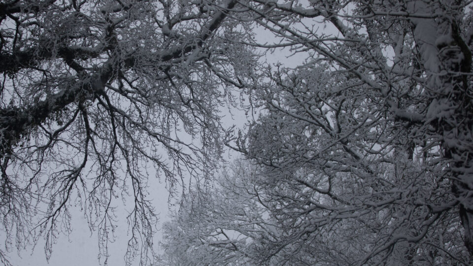
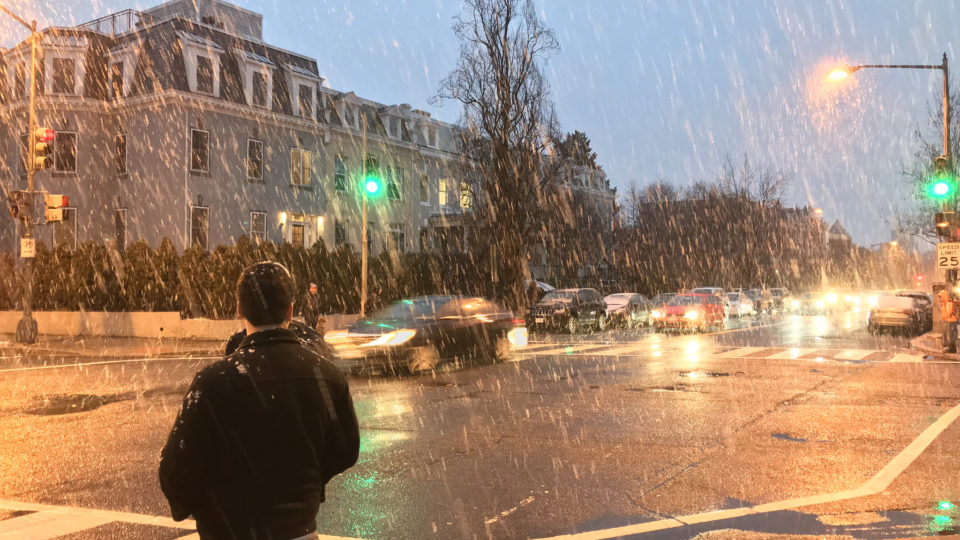
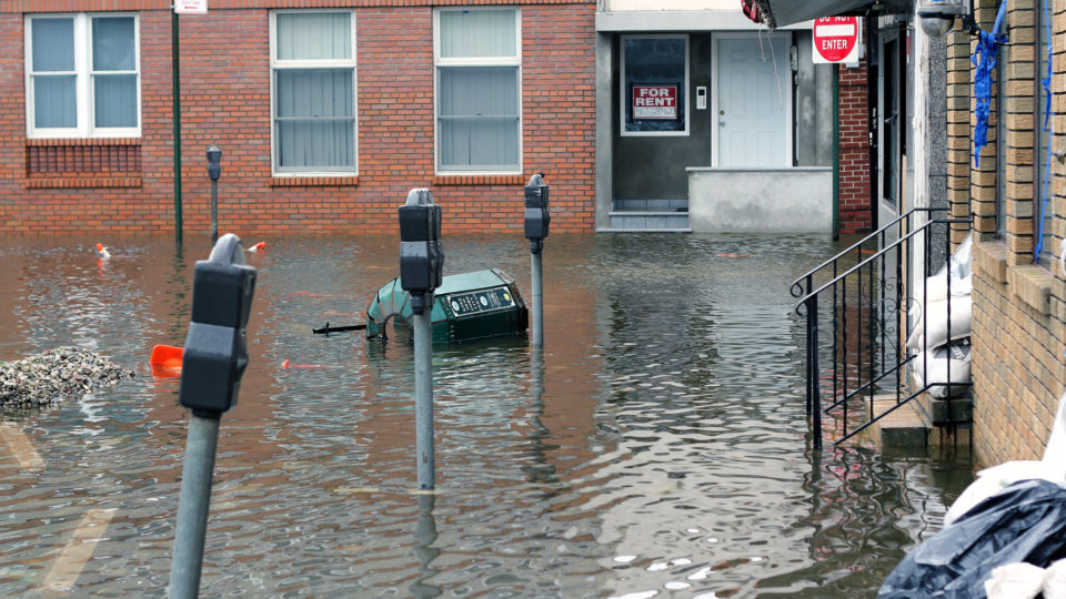
January saw some major bouts of subfreezing temperatures across much of North America and significant snowfall in places like Pensacola, Florida and New Orleans.  This spate of frigid weather undoubtedly prompted many people to question whether global warming is really happening.  But such cold spells quite likely are not happening in spite of global warming, but actually as a result of it.

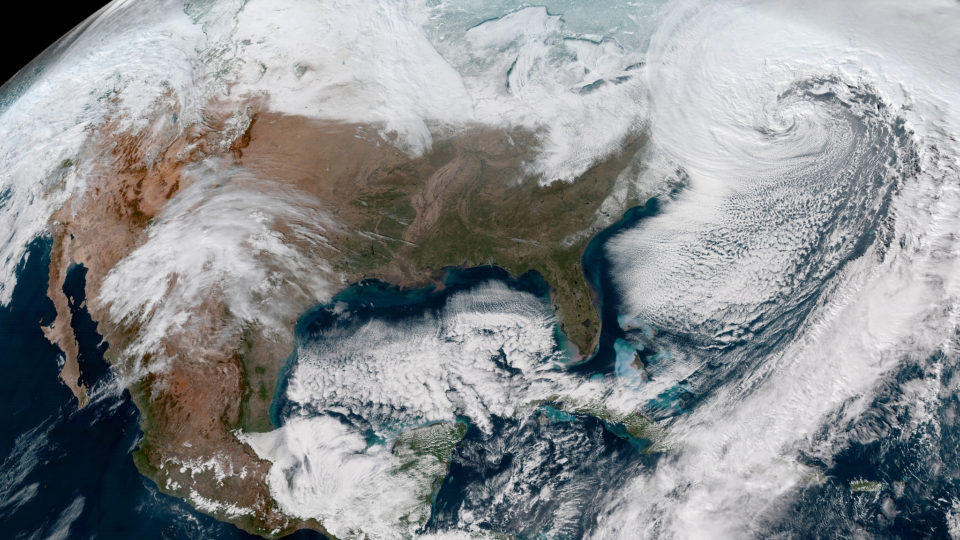
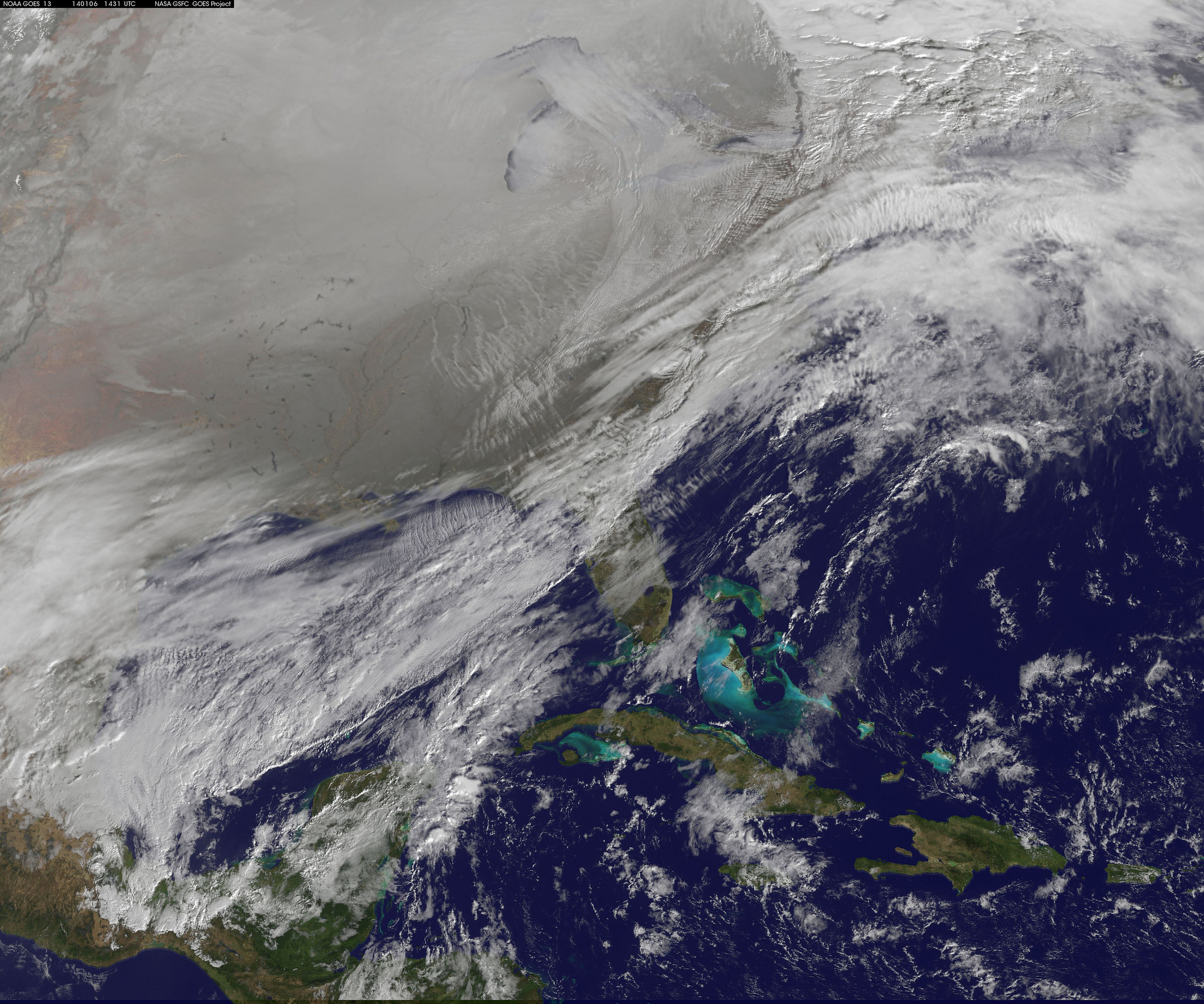
The polar jet stream is a slim band of westerly winds that circles the Arctic.  It is formed where cold air from the north meets warmer air to the south.  As the planet warms, the Arctic has been heating up nearly four times faster than the rest of the planet, which narrows the difference in temperature between the northern air and southern air.  The result is that the jet stream is weaker and more meandering, which allows frigid air to reach further south.

The polar vortex is a whirling mass of cold air that extends across the Arctic.  It is stronger in the winter when the Northern Hemisphere leans away from the sun.  The polar jet stream normally holds on to the vortex and keeps it far to the north.  But when the jet stream gets wobbly, this mass of cold air can break out and travel south, even to places like Florida, Louisiana, and Texas.

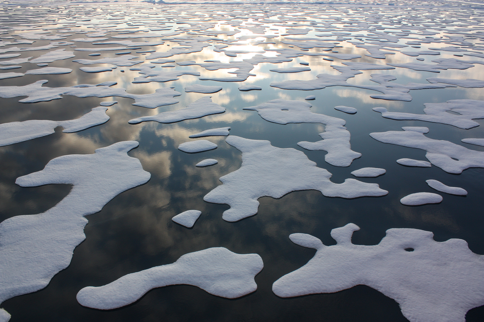
The planet as a whole is warming, and the Arctic is warming even faster.  But there will still be plenty of ice, snow, and frigid air in the Arctic winter for decades to come.  As the behavior of the polar jet stream gets increasingly erratic, there may well be more frequent episodes of plunging temperatures in areas unaccustomed to them.

**********

Web Links

Severe Cold Spells May Persist Because of Warming, Not in Spite of It

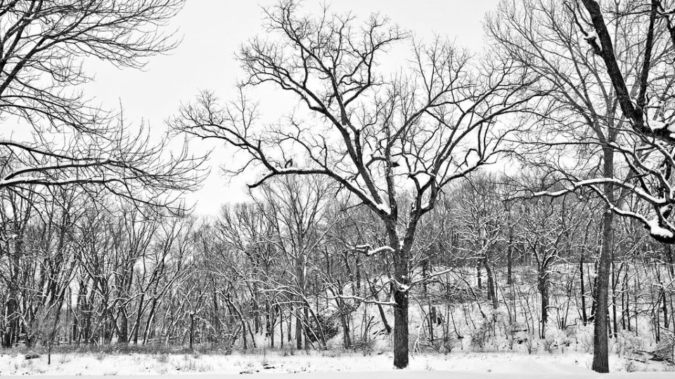
Photo, posted January 5, 2025, courtesy of Dermot O’Halloran via Flickr.

Earth Wise is a production of WAMC Northeast Public Radio

Unexplained heat wave hotspots

December 27, 2024 By EarthWise Leave a Comment

2023 and 2024 have been the hottest years since records have been kept.  But above and beyond the upward march of average temperatures around the globe, there has been the phenomenon of distinct regions across the globe experiencing repeated heatwaves that are so extreme that they cannot be accounted for in any models of global warming.

A new study by Columbia University’s Climate School has provided the first worldwide map of such regions, which have emerged on every continent except Antarctica.  Heatwaves in these regions have killed thousands of people, withered crops and forests, and triggered devastating wildfires.

These recent regional-scale record-breaking temperature extremes have raised questions about whether current climate models can provide adequate estimates of the relationship between global mean temperature changes and regional climate risks.

Some of these regional events in recent years include a nine-day heatwave in the U.S. Pacific Northwest and southwestern Canada in June 2021 that broke daily records in some places by 54 degrees Fahrenheit.  Across Germany, France, the UK, the Netherlands, and other countries, the hottest days of the year are warming twice as fast as the summer mean temperatures. 

There is yet little understanding of the phenomenon.  Some theories related to destabilization of the jet stream don’t really explain all the temperature extremes observed.  But regardless of the underlying causes, the health impacts of these heat waves are severe, as are the effects on agriculture, vegetation, and infrastructure.  Society is not built to quickly adapt to them.

**********

Web Links

Unexplained Heat Wave ‘Hotspots’ Are Popping Up Across the Globe

Photo, posted August 16, 2022, courtesy of Alisdare Hickson via Flickr.

Earth Wise is a production of WAMC Northeast Public Radio

Missing Antarctic Sea Ice | Earth Wise

August 30, 2023 By EarthWise Leave a Comment

It is summer here in the United States, but it is winter in Antarctica.  Antarctic sea ice is water that forms and melts entirely in the ocean and it has a pattern of growth and reduction that has been monitored by satellites for the past 44 years.  The area of sea ice that surrounds the continent of Antarctica is known as the sea ice ‘extent’ and it had been quite stable for much of those years.

In 2016, the sea ice extent began to decline.  Since then, there have been several record summer lows with both the summers of 2021/22 and 2022/23 setting new minimum records.

This August, the deviation from all previous records intensified.  This winter’s sea ice extent is over 900,000 square miles below the long-term average, an area about the size of Greenland or, for example, Texas and Alaska combined.

Climate models have long predicted that Antarctic sea ice would reduce as a result of global warming but the current change to sea-ice extent is so dramatic that it is difficult to explain.  Sea ice extent is affected by multiple factors including the El Niño Southern Oscillation, the strength of the southern hemisphere jet stream, and regional low-pressure systems.  The warming climate is certainly the overall force that is changing Antarctic sea ice extent over time.

Antarctic sea ice extent is important because it covers a vast area of the dark Southern Sea with a bright white surface that reflects the sun’s energy back into space, helping to reduce temperatures at the pole and protecting glaciers and polar ice sheets. 

**********

Web Links

The mystery of the missing Antarctic sea ice

Photo, posted November 7, 2016, courtesy of Rob Oo via Flickr.

Earth Wise is a production of WAMC Northeast Public Radio

Airplane Turbulence And Climate Change | Earth Wise

July 4, 2023 By EarthWise Leave a Comment

If you’ve ever been on an airplane, chances are pretty good that you’ve experienced turbulence.  As the busy summer travel season kicks off, travelers are being encouraged to brace themselves for a bumpier-than-usual ride. 

There has been a major increase in the number of severe turbulence cases on both domestic and international flights.  According to a new study by researchers from the University of Reading in the U.K., climate change is leading to this increase in turbulence, driving up costs (via wear and tear on aircrafts), and increasing the risks for passengers and flight attendants.  In the United States alone, turbulence costs the airline industry $150-$500 million annually. 

The study, which was recently published in the journal Geophysical Research Letters, found that warmer air, caused by carbon emissions, is creating bumpier flights around the world.  In fact, the study found that severe turbulence in the North Atlantic is up by 55% since 1979. 

The changing climate is affecting air travel in other ways as well.  A faster jet stream across the Atlantic is altering travel times.  Rising temperatures are reducing the weight that aircraft can carry.  Rising seas are threatening low-lying coastal airports around the world. 

But carbon emissions from aviation are also a significant driver of the climate crisis.  Air travel accounts for approximately 3% of global greenhouse gas emissions, and is one of the fastest growing sources of emissions. According to the International Civil Aviation Organization, emissions from international air travel are expected to triple by 2050.

The future is shaping up to be a bumpy ride.

**********

Web Links

Climate crisis leading to more turbulence during flights, says study

Evidence for Large Increases in Clear-Air Turbulence Over the Past Four Decades

Climate Scientist Explains Increase In Airplane Turbulence

Airports and Rising Seas

Photo, posted May 9, 2018, courtesy of Steve Lynes via Flickr.

Earth Wise is a production of WAMC Northeast Public Radio

Arctic Warming And Weather At Mid-Latitudes | Earth Wise

May 18, 2023 By EarthWise Leave a Comment

Arctic warming and how it impacts weather

Some of the most striking images of climate change are those of melting glaciers in the Arctic and polar bears stranded on shrinking sea ice. The Arctic has been warming at a rate twice as fast as the global average.  In recent years, there has been growing recognition of the Arctic’s role in driving extreme weather events in other parts of the world.

Winters in the midlatitude regions have seen more extreme weather events.  The past winter saw record-breaking cold temperatures and snowfall in Japan, China, and Korea.   Many parts of Eurasia and North America experienced severe cold snaps, with heavy snowfall and prolonged periods of subzero temperature.  On the other hand, Europe saw its second warmest winter on record with record high temperatures in many places, much drier than normal conditions, and the closure of many ski resorts.

A study published in the journal Climate and Atmospheric Science by scientists from South Korea and the U.S. looked at various climate projection models as well as historic climate data to assess what is likely to happen to weather in the mid-latitudes as the Arctic continues to warm.  Warmer Arctic Sea temperatures usually result in lower winter temperatures in East Asia and North America as ocean currents and the jet streams are altered.

The study shows that Arctic warming-triggered cold waves in the mid-latitudes are likely to persist in a warmer future, but that such events will become more difficult to predict.  The study highlights the importance of continued efforts to better understand the interactions between Arctic warming and the climate of the midlatitudes.   There need to be better ways to predict the extreme weather events that are likely to come.

**********

Web Links

Gwangju Institute of Science and Technology Researchers Correlate Arctic Warming to Extreme Winter Weather in Midlatitude and Its Future

Photo, posted August 31, 2006, courtesy of Hillebrand / USFWS via Flickr.

Earth Wise is a production of WAMC Northeast Public Radio

Triple La Niña | Earth Wise

January 16, 2023 By EarthWise Leave a Comment

La Niña is an oceanic phenomenon consisting of cooler than normal sea-surface temperatures in the central and eastern tropic Pacific.  It is essentially the opposite of the better-known El Niño.   These sea-surface phenomena affect weather across the globe.  As one oceanographer put it:  when the Pacific speaks, the whole world listens.

There is currently a La Niña underway, and it is the third consecutive northern hemisphere winter that has had one.  This so-called triple-dip event is rather rare.  The only other times they have been recorded over the past 70 years were in 1954-56, 1973-76, and 1998-2001.

La Niñas appear when strong easterly trade winds increase the upwelling of cooler water from the depths of the eastern tropical Pacific Ocean near the equator.  This causes large-scale cooling of the ocean surface.  The cooler ocean surface modifies the moisture content of the atmosphere across the Pacific and can cause shifts in the path of jet streams that intensifies rainfall in some places and causes droughts in others.

These weather effects tend to include floods in northern Australia, Indonesia, and southeast Asia and, in contrast, drought in the American southwest.  In North America, cooler and stormier conditions often occur across the Pacific Northwest while the weather becomes warmer across the southern US and northern Mexico.

In the spring, the tropic Pacific essentially resets itself and starts building toward whatever condition will happen in the following winter, be it another La Niña or possibly an El Niño.   For the time being, forecasters expect the current La Niña to persist through February.

**********

Web Links

La Niña Times Three

Photo, posted March 10, 2007, courtesy of Gail via Flickr.

Earth Wise is a production of WAMC Northeast Public Radio

Fire And Ice | Earth Wise

January 17, 2022 By EarthWise Leave a Comment

As the climate changes, fire and ice are related

In recent years, there have been countless stories about the effects of the changing climate.  Many of those stories have been about the dwindling sea ice in the Arctic and many others have been about the worsening wildfires in the western United States.   According to a recent study published by the Pacific Northwest National Laboratory, those two things are very much related.

As sea ice in the Arctic melts from July to October, sunlight warms the surrounding land and sea surfaces.  The resulting differences in air pressure create and strengthens a vortex in the atmosphere above the heated area which spins counterclockwise like a cyclone.

The powerful vortex pushes the polar jet stream out of its typical pattern and diverts moist air away from the western United States.  With the jet stream moved off its usual course, a second vortex, this time spinning clockwise, forms under the ridge of the polar jet stream above the Western U.S.  This second vortex brings with it clear skies and dry conditions:  fire-favorable weather.

Arctic sea ice has continually declined at least since the late 1970s.  It is predicted that there will be periods of entirely iceless Arctic waters before the 2050s.  In turn, conditions in the already fire-ravaged West are likely to be further exacerbated.  More than three million acres have burned across California alone during the 2021 wildfire season.

Climate conditions in one part of the world can, over time, influence climate outcomes thousands of miles away.  The research at Pacific Northwest Laboratory reveals how regional land and sea surface warming caused by Arctic ice melting can trigger hotter and drier conditions in the West later in the year.

**********

Web Links

Fire and Ice: The Puzzling Link Between Western Wildfires and Arctic Sea Ice

Photo, posted July 28, 2018, courtesy of Bob Dass via Flickr.

Earth Wise is a production of WAMC Northeast Public Radio.

Record Heat Across the Globe | Earth Wise

August 4, 2021 By EarthWise Leave a Comment

Record high temperatures recorded across the globe

While the Pacific Northwest was setting new records for high temperatures in June, many other places across the globe also experienced unprecedented heat.  Places in Russia and Scandinavia, including locations above the Arctic Circle, set new records for temperature.

The heatwave in Europe was the result of a persistent northward bulge in the polar jet stream.  This blocking pattern in the jet stream has been prevalent over Scandinavia this year and has contributed to unusually warm conditions there.  Further east, similar conditions have created unusual warm temperatures in Siberia.

On June 23, Moscow reached a high of 94.6 degrees, the hottest June temperature on record.  Helsinki, Finland set a record at 89.1 degrees, and both Belarus at 96.3 degrees and Estonia at 94.3 degrees set new records.  The town of Saskylah, north of the Arctic Circle in Siberia, measured almost 90 degrees on June 20. 

High temperature records have been broken in many places.  The all-time record high for June for all of Mexico fell at Mexicali in Baja California on June 17 when the temperature reached 125 degrees.  Palm Springs, California, while known for its desert heat, nonetheless set a new all-time high temperature of 123 degrees and also set a new record for the warmest overnight low temperature for a June night anywhere in North America at an unbelievable 105 degrees.

Stories like this have become all-too common in recent years and are undoubtedly going to occur with greater frequency as the world’s climate continues to react to the growing buildup of greenhouse gases in the atmosphere.

**********

Web Links

A Scorcher in Siberia and Europe

Photo, posted June 8, 2007, courtesy of Niko Pettersen via Flickr.

Earth Wise is a production of WAMC Northeast Public Radio.

Widespread Drought | Earth Wise

September 7, 2020 By EarthWise Leave a Comment

united states drought

As the U.S. enters the last part of the summer, fully one-third of the country is experiencing at least a moderate level of drought.   Much of the West is reaching severe drought conditions and New England has been unusually dry and hot.  In total, over 50 million Americans are living in drought-affected areas.

According to the U.S. Drought Monitor program, more than 93% of Utah, Colorado, Nevada, and New Mexico are experiencing drought to some degree.  More than 60% of both Utah and Colorado are in severe drought.   More than three-quarters of Oregon, Arizona, and Wyoming are also in drought.  And most of these areas had no sign of drought this time last year.

Severe drought conditions result in stunted and browning crops, limited pasture yields, dust storms, reduced well water levels, and an increase in the number and severity of wildfires.

Warm air temperatures and minimal snowfall in spring set the stage for this summer’s drought conditions.  A ridge of high pressure over the northeastern Pacific Ocean pushed the jet stream farther north than usual.  And, once again, there has been a failure of the southwestern monsoon in Arizona and New Mexico and the Four Corners region.  Monsoon rains provide half of the year’s precipitation in many of those areas. 

Instead, there has been extreme heat in the region.  Phoenix has already smashed the record for the most days over 110oF in a calendar year (42 as of August 18), with five months to go.  Las Vegas hasn’t seen measurable rainfall since April, and Cedar City, Utah has recorded a record low of 0.05 inches of rain this summer.

Conditions are not expected to get better for a couple of months.

**********

Web Links

A Third of the U.S. Faces Drought

Photo, posted May 7, 2014, courtesy of Tyler Bell via Flickr.

Earth Wise is a production of WAMC Northeast Public Radio.

Climate Change And Harsh Winters

July 15, 2019 By EarthWise Leave a Comment

In recent years, there have been some unusually harsh winters in North America and Central Europe. This past January, the Midwestern US experienced extreme cold temperatures. We have all become familiar with the term ‘polar vortex’ and its role in sending cold air to middle latitudes and it is generally agreed that unusual behavior by the jet stream is the primary cause of the extreme winter weather.

For years, climate researchers around the world have been investigating the question as to whether the increasingly common wandering of the jet stream is a product of climate change or is a random phenomenon associated with natural variations in the climate system.

The jet stream is a powerful band of westerly winds over the middle latitudes that push major weather systems from west to east.  These days, the jet stream is increasingly faltering.  Instead of blowing along a straight course parallel to the equator, it sweeps across the Northern Hemisphere in massive waves, producing unusual intrusions of Arctic air into the middle latitudes.

Atmospheric researchers at the Alfred Wegener Institute in Germany have now developed a climate model that can accurately predict the frequently observed winding course of the jet stream.  The breakthrough combines their global climate model with a new machine learning algorithm on ozone chemistry.  Using their new combined model, they can now show that the jet stream’s wavelike course in winter and subsequent extreme weather outbreaks are the direct result of climate change.  The changes in the jet stream are to a great extent caused by the decline in Arctic sea ice, according to the results of the investigations.  The results are not surprising but there is now a detailed model to support the hypothesis.

**********

Web Links

A warming Arctic produces weather extremes in our latitudes

Photo, posted January 11, 2011, courtesy of Carl Wycoff via Flickr.

Earth Wise is a production of WAMC Northeast Public Radio.

California Fires And Precipitation

April 11, 2019 By EarthWise Leave a Comment

Two things we have heard a lot about in recent years have been the persistent drought in California and the terrible wildfires the state has experienced.  Along the way, the state has had some pretty wet and snowy winters.  This past winter, the California snow pack has seen incredible levels building up, which is great news for the state’s farmers.  But does that also mean that the next year should see some relief from severe wildfires?

The answer appears to be no.  A new study from an international team that includes the University of Arizona has comprehensively looked at the amount of winter precipitation in California and the severity of the subsequent wildfire season. 

The position of the North Pacific jetstream over California is strongly linked to the amount of winter precipitation.  This has been true for hundreds of years and continues to be the case.

From 1600 to 1903, the linkage between winter precipitation and wildfire severity was also very strong.  But after 1904, that connection weakened.  As a result, fire suppression policies were instituted.  When fires arose, they were put out as quickly as possible.  The result over time is fuel buildup, making larger fires far more likely.

According to the new study, after 1977, the connection between winter precipitation and wildfire severity disappeared entirely.  There no longer appears to be any relationship between jet stream dynamics and fire.  The warming climate and the results of fire suppression dominate the potential for wildfire.  California’s wet winter of 2016-2017 provides a good example.  That winter was followed by many large fires in 2017.

So, this very wet winter in California does not imply that this should be a year without severe wildfires.

**********

Web Links

Wildfire Risk in California No Longer Coupled to Winter Precipitation

Photo, posted July 26, 2018, courtesy of Bureau of Land Management California via Flickr.

Earth Wise is a production of WAMC Northeast Public Radio.

Climate Change And The Polar Vortex

February 20, 2019 By EarthWise Leave a Comment

This winter has seen some brutally-cold weather in many places, some of it record-breaking.  Predictably, some climate-change deniers point to this as evidence that the climate is not warming at all.  They are quite wrong.

For starters, it is essential to understand the difference between climate and weather.  Climate is the average weather patterns in a region over extended periods of time.  Weather is the short-term fluctuations in temperature, precipitation, barometric pressure, wind, and so forth.  There can be extremes in weather of many types in a given climate region including very cold weather in a warming climate.

The recent cold weather events in the U.S. stem from the flow of Arctic air into southern regions.  Such flows are impacted dramatically by the behavior of the jet stream.  These high-altitude east-to-west winds are driven by temperature differences between cold arctic air and warm tropical air and play a huge role in our weather. 

The Arctic has seen extremely unusual warming due to the changing climate, weakening and fracturing the polar vortex, which is a persistent low-pressure area near the pole.   The changing air flow from the Arctic causes the jet stream to take wild swings.  When it swings further south, it causes cold air to reach farther south.  These swings tend to hang around for a while, leading to extended periods of cold weather in the winter and, actually, extended periods of warm weather or even droughts in the summer.  Studies have predicted that extreme, deadly weather events could increase by as much as fifty percent by 2100.

As more Arctic air flows into southern regions, North America can expect to see harsher winters.  The warming climate doesn’t always lead to warmer weather.

**********

Web Links

Why cold weather doesn’t mean climate change is fake

Photo, posted January 30, 2019, courtesy of Kyle via Flickr.

Earth Wise is a production of WAMC Northeast Public Radio.

Traffic Jams In The Jet Stream

July 13, 2018 By EarthWise Leave a Comment

https://earthwiseradio.org/wp-content/uploads/2018/07/EW-07-13-18-Traffic-Jams-in-the-Jet-Stream.mp3

Many extreme weather events are associated with unusual behavior by the jet stream.   Jet streams are the global air currents that circle the earth.  The meandering and speed changes in the jet stream affect weather and also play a big role in how long it takes aircraft to make their way across the country.  The behavior that leads to extreme weather events is known as “blocking” in which the meandering jet stream stops weather systems from moving eastward.

[Read more…] about Traffic Jams In The Jet Stream

Cold And Snow From Global Warming

April 4, 2018 By EarthWise Leave a Comment

https://earthwiseradio.org/wp-content/uploads/2018/04/EW-04-04-18-Cold-from-Global-Warming.mp3

The Arctic has been experiencing record warm temperatures and record low sea ice levels.  During February, there were nine days in a row with temperatures averaging 27 degrees above normal and often above freezing.  Over the previous 20 years, there were only two previous readings above freezing in February – once in 2011 and once last year.

[Read more…] about Cold And Snow From Global Warming

The Arctic Is Getting Crazy

February 10, 2017 By EarthWise

https://earthwiseradio.org/wp-content/uploads/2017/02/EW-02-10-17-The-Arctic-is-Getting-Crazy.mp3

Unprecedented things have been happening with the weather up in the Arctic in recent times.   In fact, during the past year, the climate in the Arctic has at times bordered on the absurd.

[Read more…] about The Arctic Is Getting Crazy

Extreme Cold And Climate Change

December 26, 2016 By EarthWise

https://earthwiseradio.org/wp-content/uploads/2016/12/EW-12-26-16-Extreme-Cold-and-Climate-Change.mp3

Global climate change is typically referred to as global warming and that name implies that things are getting warmer all the time.   Well, the planet as a whole is, as measured by the planet-wide mean temperature, which continues to rise over time.

[Read more…] about Extreme Cold And Climate Change

Primary Sidebar

Recent Episodes

  • An uninsurable future
  • Clean energy and jobs
  • Insect declines in remote regions
  • Fossil fuel producing nations ignoring climate goals
  • Trouble for clownfishes

WAMC Northeast Public Radio

WAMC/Northeast Public Radio is a regional public radio network serving parts of seven northeastern states (more...)

Copyright © 2026 ·