• Skip to primary navigation
  • Skip to main content
  • Skip to primary sidebar

Earth Wise

A look at our changing environment.

  • Home
  • About Earth Wise
  • Where to Listen
  • All Articles
  • Show Search
Hide Search
You are here: Home / Archives for images

images

Penguin detectives

June 5, 2024 By EarthWise Leave a Comment

Researchers need aspiring conservationists to help them count emperor penguins

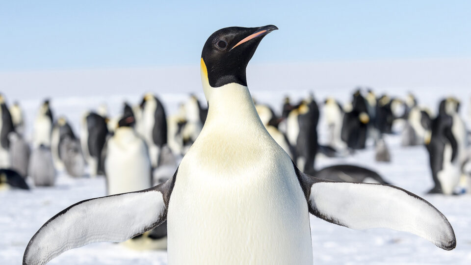
Emperor penguins, the tallest and heaviest of all living penguins, are also the most famous, being the subject of a very popular documentary film.  The ongoing loss of sea ice in Antarctica has led to unprecedented breeding failures in emperor penguin colonies. 

Since 2016, Antarctica has seen the four years with the lowest sea ice extent on record.  Between 2018 and 2022, 30% of the 62 known emperor penguin colonies were affected by partial or total sea ice loss.  Current predictions suggest that the population of emperor penguins will fall by 99% by the end of the century.

To monitor remote emperor penguin colonies, researchers use satellite images in which the brown stains of the birds’ guano stand out against the white ice and snow.

Researchers at the British Antarctic Survey have launched the ‘Polar Observatory’ on the online citizen science website Zooniverse to recruit ‘penguin detectives’ to help validate the accuracy of satellite images in assessing penguin populations.

The online app contains drone photos taken over the Snow Hill penguin colony.  The images have been split into more than 300 10-meter squares.  Volunteers are asked to identify any adult and chick penguins in a given picture.  The results will be fed into machine learning algorithms to train the AI systems in automatically counting penguins in future surveys.

The project is a fun opportunity for aspiring conservationists and penguin lovers in general to help learn more about the future of the species.  Interested people can learn more on the Zooniverse website.

**********

Web Links

‘Penguin detectives’ required for new counting app

Polar Observatory

Photo, posted October 7, 2017, courtesy of Christopher Michel via Flickr.

Earth Wise is a production of WAMC Northeast Public Radio

Counting Trees | Earth Wise

April 11, 2023 By EarthWise Leave a Comment

Researchers have developed a new method for counting trees

Scientists estimate that there are about 3 trillion trees on the earth.  A huge number but probably half as many as there were before people entered the picture.  And we’re losing about 10 billion trees a year to toilet paper, timber, farmland expansion, and other human activity.  Trees play a crucial role in taking carbon dioxide out of the atmosphere and storing it away.  For this reason, trees have become an integral part of the effort to mitigate climate change.

There are major initiatives underway around the world to plant more trees.  Part of this is driven by the increasing use of carbon credits by companies trying to offset their carbon emissions.   These credits are earned by either planting new trees or paying farmers or other landowners not to cut down existing trees.  But how many trees are actually planted and how many survive over time?

Whether these efforts are really resulting in more trees and more carbon storage is not easy to determine.  Current international inventories of global tree-sequestered carbon are subject to great uncertainty.

Researchers from the University of Copenhagen and NASA have developed a method for mapping large numbers of trees and determining their carbon content.  Using artificial intelligence techniques to analyze ultra-high-resolution satellite images, they can count trees, determine their individual species, and measure their carbon content.

A study of images from Africa’s Sahel region found that it is home to nearly 10 billion trees that are currently storing 840 million tons of carbon.

Now that the groundwork for this new methodology is complete, it is ready to be deployed by public agencies, NGOs, and other interested in monitoring the numbers of trees and their carbon content.

**********

Web Links

The counting of nine billion trees could help manage climate credits and nature restoration

Photo, posted October 27, 2018, courtesy of Ian Dick via Flickr.

Earth Wise is a production of WAMC Northeast Public Radio

A Giant Breakaway Iceberg | Earth Wise

April 7, 2021 By EarthWise Leave a Comment

A giant iceberg has broken free

Scientists have been closely monitoring multiple cracks and chasms that have formed in the 500-foot-thick Brunt Ice Shelf in Antarctica over the past few years.  In late 2019, a new crack was spotted in a portion of the shelf north of an area known as the McDonald Ice Rumples.  The rift was monitored by satellite imaging and was seen by February as moving about 15 feet a day.

In the early hours of February 26th, the crack widened rapidly before finally breaking free from the rest of the floating ice shelf.  News reports around the world have described the massive 500-square-mile iceberg by comparing it to the size of well-known cities:  1.5 times the size of greater Paris, 10 times the size of San Francisco, twice the size of Chicago, nearly the size of Greater London, and so on.

Antarctica is known for churning out some enormous bergs.  The new iceberg, which has been named A-74, is huge, but doesn’t compare to the iceberg A-68 that calved from the Larson C Ice Shelf in 2017.  That one was almost five times larger.

The calving of A-74 does not pose a threat to the presently unmanned British Antarctic Survey’s Halley VI Research Station, which was repositioned in 2017 to a more secure location after the ice shelf was deemed to be unsafe.  The section where the station now sits is still holding on, but when it eventually breaks, it will likely create a berg nearly 700 square miles in size.

It remains to be seen what will become of the new iceberg.  Most likely, it will eventually get caught up in the Weddell Gyre, a clockwise-rotating ocean flow in the Southern Ocean that covers an area more than half the size of the US.

**********

Web Links

Breakup at Brunt

Photo, posted October 27, 2016, courtesy of NASA/Nathan Kurtz via Flickr.

Earth Wise is a production of WAMC Northeast Public Radio.

Tracking Endangered Species From Space | Earth Wise

March 4, 2021 By EarthWise Leave a Comment

Using satellites to monitor endangered species

Scientists at the University of Bath and the University of Oxford in the UK have developed a technique for remotely surveying elephants and other wildlife using satellite images and deep learning.  The technique has the same accuracy as human counts done on the ground or from low-flying airplanes.

The new computer algorithm can analyze high-resolution satellite images and detect African elephants in both grasslands and forests.  Previous techniques for monitoring wildlife from space were limited to homogenous habitats, such as the case of tracking whales in the open ocean.

On-the-ground or airplane surveys to monitor animal numbers are expensive and time-consuming.  Satellites can collect nearly 2,000 square miles of imagery in a few minutes thereby eliminating the risk of double counting and reducing a process that previously took weeks to just a few days.  The use of satellites also eliminates the logistical problems of monitoring species populations that cross international borders.

Accurate monitoring is important for efforts to save endangered species.  There are only 40,000 – 50,000 African elephants left in the wild.  It is essential to know where the animals are and how many there are in various locations. The new method is able to count elephants in mixed ecosystems, such as savannah and forests, where tree cover would previously have made satellite tracking difficult.

With satellite imagery resolution increasing every few years, it should be possible to see ever-smaller things in greater detail.  The new algorithm works well for elephants; it may eventually become practical to track animals as small as an albatross from space.

**********

Web Links

A New Way to Track Endangered Wildlife Populations from Space

Photo, posted March 15, 2008, courtesy of Michelle Gadd/USFWS via Flickr.

Earth Wise is a production of WAMC Northeast Public Radio.

Rivers Changing Color | Earth Wise

February 10, 2021 By EarthWise Leave a Comment

Why do rivers change colors?

A recent study, published in Geophysical Research Letters, found that one-third of large American rivers have had significant changes of color over the past 30 years.  Rivers can appear to be shades of blue, green, and yellow and we tend to expect healthy rivers to have colors in shades of blue.  According to the new study, only 6% of American rivers are dominantly blue.

The study looked at 235,000 Landsat images taken from 1984 to 2018.  The results are that 56% of rivers studied were dominantly yellow, 38% dominantly green, and 6% blue.  Over the 34 years studied, 33% of the rivers had significant changes in color. About 21% became greener and 12% more yellow. 

The chief causes of color changes in rivers are farm fertilizer runoff, dams, efforts to fight soil erosion, and climate change.  Climate change increases water temperature and rain-related runoff.

Color changes are not necessarily a sign of poor river health, but dramatic changes could point to issues that need attention.  A river can change color based on the amount of sediment, algae, or dissolved organic carbon in the water.   If a river becomes greener, it can often mean large algae blooms are present that cause oxygen loss and can produce toxins.  On the other hand, rivers that are getting less yellow demonstrate the success of regulations to prevent soil erosion.

The study of river colors can pinpoint which rivers are undergoing rapid environmental change.  What the study does not provide is information on water quality.  Water quality measurements will be important to determine the health of many of the rapidly changing rivers.

**********

Web Links

One Third of U.S. Rivers Changed Their Color, Three Decades of Satellite Images Show

Photo, posted July 6, 2016, courtesy of Jeffrey Beall via Flickr.

Earth Wise is a production of WAMC Northeast Public Radio.

A Breakthrough In Animal Identification

December 25, 2018 By EarthWise Leave a Comment

Researchers from the University of Wyoming have developed a computer model that can identify wild animals in camera-trap photographs with remarkable accuracy and efficiency.

This breakthrough in artificial intelligence (AI), detailed in a paper recently published in the scientific journal Methods in Ecology and Evolution, represents a significant advancement in the study and conservation of wildlife. According to the paper’s authors, “the ability to rapidly identify millions of images from camera traps can fundamentally change the way ecologists design and implement wildlife studies.”

This study builds on previous research from the university in which a computer model analyzed 3.2 million images captured by camera traps in Africa.  The A-I technique called deep learning categorized animal images at a 96.6% accuracy rate.  This was the same accuracy rate as teams of human volunteers achieved, but the computer model worked at a much more rapid pace. 

In the latest study, UW researchers trained a deep neural network on a powerful computer cluster to classify wildlife species using 3.37 million camera-trap images of 27 different animal species.  The model was tested on nearly 375,000 images at a rate of about 2,000 images per minute. It achieved a 97.6% accuracy rate, which is likely the highest accuracy to date in using machine learning for wildlife image classification. 

Artificial intelligence has been used in environmental science in other ways as well. For example, AI has been used to increase agricultural yields in farm fields and to help predict extreme weather. 

Maybe artificial intelligence can prove to be a game changer for the environment.   


**********

Web Links

Researchers Successfully Train Computers to Identify Animals in Photos

Photo, posted January 8, 2012, courtesy of the U.S. Fish and Wildlife Service via Flickr. 

Earth Wise is a production of WAMC Northeast Public Radio.

Primary Sidebar

Recent Episodes

  • An uninsurable future
  • Clean energy and jobs
  • Insect declines in remote regions
  • Fossil fuel producing nations ignoring climate goals
  • Trouble for clownfishes

WAMC Northeast Public Radio

WAMC/Northeast Public Radio is a regional public radio network serving parts of seven northeastern states (more...)

Copyright © 2026 ·