• Skip to primary navigation
  • Skip to main content
  • Skip to primary sidebar

Earth Wise

A look at our changing environment.

  • Home
  • About Earth Wise
  • Where to Listen
  • All Articles
  • Show Search
Hide Search
You are here: Home / Archives for aquifers

aquifers

Our cities are sinking

June 24, 2025 By EarthWise Leave a Comment

A new study by the Columbia University Climate School has found that all of the 28 most populous cities in the United States are sinking to some extent.  This phenomenon of subsidence is not just taking place in cities on the coast, where relative sea level is an issue, but also in cities in the interior.

The primary cause of subsidence is large-scale groundwater extraction for human use.  When water is withdrawn from aquifers made up of fine-grained sediments, the pore spaces formerly occupied by water can eventually collapse, leading to compaction below and sinkage at the surface.

The fastest sinking city in the US is Houston, with more than 40% of its area subsiding more than 5 millimeters a year and 12% sinking at twice that rate.  Some local spots are going down as much as 5 centimeters a year.   These seem like very small numbers but the fact that the subsidence is often not uniform across an urban area means that there are stresses to building foundations and other infrastructure.  Parts of Las Vegas, Washington D.C., and San Francisco have particularly fast sinking zones.

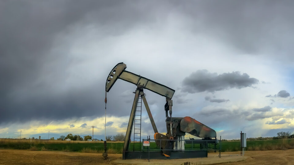
There are other causes of subsidence.  In Texas, pumping of oil and gas adds to the phenomenon.  A 2023 study found that New York City’s more than one million buildings are pressing down on the Earth so hard that they may be contributing to the city’s ongoing subsidence.  About 1% of the total area of the country’s 28 largest cities faces some danger from uneven subsidence.

Overall, some 34 million Americans live in cities affected by subsidence.  Global cities facing especially rapid subsidence include Jakarta, Venice, and here in the U.S., New Orleans.

**********

Web Links

All of the Biggest U.S. Cities Are Sinking

Photo, posted December 27, 2012, courtesy of Katie Haugland Bowen via Flickr.

Earth Wise is a production of WAMC Northeast Public Radio

Hot water in Boise

May 9, 2025 By EarthWise Leave a Comment

Geothermal water systems in Boise form the foundation of what is the largest municipally-run geothermal system in the country

Boise is the capital of Idaho, and the Idaho Statehouse is the only one in the United States to use geothermal heat.  Geothermal heating is possible in Boise because of fault lines that expose its groundwater to hot rocks.  The underground water supply in Boise is heated to around 170 degrees Fahrenheit.  It is the basis of the largest municipally-run geothermal system in the country.

People in Boise began using this natural resource to supply heat to buildings in the 1890s by drilling wells into aquifers that yielded hundreds of thousands of gallons of piping hot water a day.  The water heated pools and public baths, a Victorian mansion, and, eventually, hundreds of homes in what was called the Boise Warm Springs Water District.

The number of buildings that the city of Boise heats with its geothermal resource has grown more than sixfold over the past 40 years.  The water is drawn from wells in the nearby foothills and pumped into a closed-loop network of pipes that reach into buildings.  In each building, the geothermal heat is transferred to water in separate adjoining pipes that distribute the heat throughout the building.  The well water goes back to the aquifer to be heated again.

Today, there are four separately run geothermal water systems in Boise.  One is run by the city, another by the Boise Warm Springs District, and two others that serve the Capitol and Veterans Affairs Buildings.

In 2024, city officials calculated that using geothermal heat reduced annual carbon dioxide emissions by 7,000 tons, the equivalent of removing 1,500 gas-powered cars from the road each year.

**********

Web Links

They’re in Hot Water in Idaho. Here’s Why That’s a Good Thing.

Photo, posted May 26, 2010, courtesy of Jason W via Flickr.

Earth Wise is a production of WAMC Northeast Public Radio

Sponging up a river

March 20, 2024 By EarthWise Leave a Comment

During the first week of February, an atmospheric river dumped enormous amounts of rain on Southern California.  Over the course of four days, Los Angeles received 9 inches of rain.  The average annual rainfall in the city is only 14 inches.

But Los Angeles was not the site of a flooding disaster because the city has spent years preparing for this type of deluge by becoming a “sponge city.”   By installing lots of green spaces and shallow basins with porous soil, Los Angeles was able to soak up 8.6 billion gallons of water during the storm, enough to meet the water needs of 100,000 people for a year.

Cities covered with impermeable concrete sidewalks and paved areas make storm-related flooding worse because they are unable to absorb water.  Instead, the water flows into drains and overwhelms infrastructure.

Natural materials like dirt and plants take in water from storms and can filter it into underground aquifer that cities can then tap into, especially during droughts.  Adding green spaces to cities has many other benefits beyond the ability to absorb large amounts of rainwater.

The so-called sponge-city movement is catching on in many other places.  Philadelphia is revamping its water systems in a 25-year project that includes green spaces to absorb stormwater runoff.  In China, the government has spent more than a decade adding spongy elements to dozens of cities around the country.

Sponge cities are part of a broader effort to combine modern engineering techniques with natural systems.  This is known as green-gray infrastructure.  Nature knows what it is doing when it comes to flood control as well as to pollution control.

**********

Web Links

‘Spongy’ LA Soaked Up Tons of Water From Atmospheric River

Photo, posted December 28, 2011, courtesy of Ron Reiring via Flickr.

Earth Wise is a production of WAMC Northeast Public Radio

The East Coast is sinking

March 11, 2024 By EarthWise Leave a Comment

Most of the world’s largest cities are located in coastal regions and coastal regions are on the front lines of the climate crisis.  Human populations continue to migrate towards low-elevation coastal areas at the same time that sea level rise is accelerating.  Coastal communities worldwide are increasingly vulnerable to the dangers of flooding and erosion.  With these hazards occupying a great deal of attention, there has been less attention paid to the dangers of land subsidence.

A recent study by researchers at Virginia Tech and the US Geological Survey using satellite data shows that parts of America’s east coast are sinking, and the culprit is the withdrawal of too much water from the aquifers beneath these coastal areas.

A series of overlapping aquifers extends all the way from New Jersey to Florida along the coast, providing a reliable source of water for drinking, irrigation, and industrial uses.  Even though these areas get regular rainfall, the deeper aquifers can take hundreds or even thousands of years to refill once water is pumped out.  Once water is removed, soils can compress and collapse, causing the land surface to sink.

Cities that were built on drained marshland or on fill soil are especially vulnerable to compaction. 

Seal level rise is slow, but it is insidious and continuous.  Add land subsidence to the mix and effects multiply.  Places like Boston, New York, Washington DC, Roanoke, Savannah, Jacksonville, and Miami, among others, all are increasingly vulnerable to these coastal hazards.  The combined effects of sea level rise and subsidence may even triple the prospects for flooding areas over the next few decades.

**********

Web Links

As Aquifers Are Depleted, Areas Along The East Coast Of The US Are Sinking

Photo, posted August 7, 2015, courtesy of Tracy Robillard / NRCS Oregon via Flickr.

Earth Wise is a production of WAMC Northeast Public Radio

Groundwater loss

December 21, 2023 By EarthWise Leave a Comment

Groundwater is the water found underground in the cracks and spaces in soil, sand, and rock.  It is held in aquifers and bubbles up naturally into springs, streams, and rivers, but also is pumped out for use by people.  Groundwater provides almost half the drinking water in the U.S. and is a main source of water for agriculture.

The world’s supply of groundwater is steadily declining.  The combination of climate change and human population growth is increasingly diminishing groundwater.

A study by the Desert Research Institute published in the journal Nature Communications has mapped the global permanent loss of aquifer storage capacity for the first time.  Computer modeling with advanced machine learning techniques has provided a detailed picture of the world’s groundwater situation.

The study found that global aquifer storage capacity is disappearing at a rate of 10 miles a year, about the size of 7,000 Great Pyramids of Giza.  The loss of groundwater storage is permanent, forever reducing the amount of water that can be captured and stored because the pumping of groundwater can cause the ground surface above to sink, collapsing the space where water can be stored.

About 75% of this subsidence is occurring over cropland and urban regions.  The United States, China, and Iran account for most of the global groundwater storage loss but many other places in the Middle East and Asia are experiencing significant groundwater withdrawal as well.

Most regions of the world do not have monitoring programs for groundwater pumping.  The study underscores the need to better understand this issue on a global scale and take appropriate action before it is too late.

**********

Web Links

Scientists Map Loss of Groundwater Storage Around the World

Photo, posted August 7, 2015, courtesy of NRCS Oregon via Flickr.

Earth Wise is a production of WAMC Northeast Public Radio

For a wide selection of games and secure gameplay, check out https://onlinecasino6.com/. If you’re looking for the latest slot machines and game reviews, visit https://casinogamesmachines.com/.

A Groundwater Crisis | Earth Wise

September 22, 2023 By EarthWise Leave a Comment

A groundwater crisis is brewing

The majority of U.S. drinking water systems rely on groundwater, as do America’s farms.  Even though groundwater is a crucial resource for the country, there is no central oversight or even monitoring of its status across the country.  The health of the country’s aquifers is difficult to gauge.

The New York Times spent months amassing data from 80,000 wells across the country by reaching out to federal, state, and local agencies nationwide.

The survey found that 45% of the wells examined showed a statistically significant decline in water levels since 1980.  Forty percent of the sites reached record-low water levels over the past 10 years, with last year the worst yet.

Over pumping is the biggest problem.  State regulations tend to be weak and there is no federal oversight.  The warming climate reduces snowpack, which means less water in rivers, increasing the need to tap into groundwater.  Warmer weather means thirstier plants, increasing the demand for water.

It is a nationwide problem, not just one in the drought-ridden West.  Arkansas, which produces half of the country’s rice, is pumping groundwater twice as fast as nature can replace it.  Three-quarters of Maryland’s wells have seen substantial drops in water levels.

As groundwater is pumped out, the empty space can collapse under the weight of the rock and soil above it, permanently diminishing the capacity for future groundwater storage.

There are likely to be parts of the U.S. that run out of drinking water and groundwater depletion threatens America’s status as an agricultural superpower. Objectively, the status of American groundwater is a crisis that threatens the long-term survival of communities and industries that depend on it. 

**********

Web Links

Five Takeaways From Our Investigation Into America’s Groundwater Crisis

Photo, posted July 25, 2009, courtesy of Chris Happel via Flickr.

Earth Wise is a production of WAMC Northeast Public Radio

California: Drought Or No Drought? | Earth Wise

April 26, 2023 By EarthWise Leave a Comment

Despite heavy rains, California is still experiencing a drought

Just a few months ago, millions of people in California were living under challenging water conservation rules.  The past three years were the driest on record and reservoirs were depleted, landscapes dried up, and the snowpack in the Sierras at very low levels.

But in recent months, a dozen atmospheric river storms have brought huge amounts of rain and snow to the state.  Twelve out of 17 major reservoirs in the state have been replenished, the snowpack is over 240% of normal, and brown hills are blooming once again.

So, is the California drought over?  According to the experts, the answer is:  sort of.

The record snowpack and heavy rains have erased the most severe aspects of the drought in many parts of the state.  Only 9% of the state is now experiencing “severe” or “exceptional” drought, down from 55% last fall.

But the changes are basically all at the surface.  Groundwater in the state is still extremely low and the state’s cities and farms are still using more of it than is appropriate.  The state has been unwisely overusing its groundwater aquifers because of the drought and this one year of heavy rains cannot replenish levels that have been dropping for years.

California has been rolling back many of the most severe drought restrictions that had been imposed but has not entirely lifted the drought emergency status.  Meanwhile, the massive snowpack in the mountains will begin to melt as the weather warms and, in many areas, Californians will face flooding.  Water is a complicated business in California.

**********

Web Links

Drought or no drought? California left pondering after record winter deluge

Photo, posted August 28, 2019, courtesy of Joyce Cory via Flickr.

Earth Wise is a production of WAMC Northeast Public Radio

El Paso’s Water Future | Earth Wise

November 21, 2022 By EarthWise Leave a Comment

The water future of El Paso uncertain as the Rio Grande river dries up

El Paso, Texas is part of the Paso del Norte region, which includes Ciudad Juarez in Mexico and Las Cruces, New Mexico.  The population on both sides of the border is booming, approaching 3 million people.  The region’s primary water source is the Rio Grande River.  But that river is declining.

Rising temperatures and decreasing rainfall have led to diminishing flow in the river.  Eighty percent of the river’s flow has historically been diverted to agriculture, but the reduced flow of the Rio Grande has forced many farmers to reduce planting or change to less water-hungry crops.  The river is expected to continue to decrease its flow as time goes by.

The city of El Paso gets 40% of its water supply directly from the Rio Grande.  Urban water authorities in the region are scrambling to find ways to provide cities with alternative supplies of water.

El Paso now gets some of its water from a desalination plant, which is the world’s largest inland municipal desalination plant.  The water comes from brackish groundwater rather than from the sea.  The briny waste from the plant is piped to an injection well many miles way and is permanently stored 4,000 feet underground.

El Paso continues to seek new water sources and reduce its water use.  It gets much of its water from wells drilled in nearby aquifers.  It is working to make this use of groundwater more sustainable.  The city recycles used residential water through its so-called purple pipe system, which cleans up waste water and delivers it for non-potable use on golf courses and park lawns. 

Like many places in the increasingly dry west, El Paso’s water future is uncertain. 

**********

Web Links

As Rio Grande Shrinks, El Paso Plans for Uncertain Water Future

Photo, posted April 29, 2018, courtesy of R. Baire via Flickr.

Earth Wise is a production of WAMC Northeast Public Radio

The Atmosphere Is Thirstier | Earth Wise      

May 9, 2022 By EarthWise Leave a Comment

The American West is in the throes of a two-decade-long drought.  The climate there is getting warmer and drier, which has led to increasing demand for water resources from both humans and ecosystems.  According to a new study by the Desert Research Institute and collaborators, the atmosphere across much of the U.S. is also demanding a greater share of water than it used to.

Evaporative demand, which is also called atmospheric thirst, is a measure of the potential loss of water from the earth’s surface up to the atmosphere.  It is a function of temperature, humidity, wind speed, and solar radiation.  The study, published in the Journal of Hydrometeorology, assessed trends in evaporative demand during a 40-year period from 1980-2020.

The study’s findings showed substantial increases in atmospheric thirst across much of the Western U.S. over that period, with the largest increases centered around the Rio Grande and Lower Colorado rivers.  This is important because atmospheric thirst is a persistent force in pushing Western landscapes and water supplies toward drought.

The study found that, on average, increases in temperature were responsible for 57% of the changes observed in atmospheric thirst, humidity 26%, and the other factors playing lesser roles.

For farmers and other water users, increases in atmospheric thirst mean that, in the future, more water will be required to meet existing water needs.  Crops already require more water than they did in the past and can be expected to require more water in the future.  Over time, for every drop of precipitation that falls, less and less water is likely to drain into streams, wetlands, aquifers, or other water bodies.

**********

Web Links

New study shows robust increases in atmospheric thirst across much of U.S. during past 40 years

Photo, posted August 9, 2007, courtesy of William Clifford via Flickr.

Earth Wise is a production of WAMC Northeast Public Radio.

Safely Storing Carbon | Earth Wise

February 28, 2022 By EarthWise Leave a Comment

How to safely store carbon

As carbon dioxide levels continue to increase in the atmosphere and emissions reductions aren’t happening as fast as needed, there is growing interest in carbon capture and storage technologies.

The idea is to capture the CO2 emitted from industrial processes or from the burning of fossil fuels in power generation, and then permanently store it out of harm’s way.  There are several different types of sites where the CO2 might be stored.  Deep saline aquifers are particularly desirable for the purpose, but depleted hydrocarbon reservoirs are commonplace and relatively simple to use.  These are oil and gas wells that have been drained of their resources.

In many cases, CO2 has already been injected into these depleted wells as a means of enhanced oil recovery.  Therefore, such wells provide a unique opportunity to study what happens to carbon dioxide when it’s stored in these places.

Researchers from Oxford University recently published a paper in the journal Nature that compared the state of depleted wells with injected carbon dioxide to that of wells without the injected gas.  They found that nearly 3/4 of the CO2 was dissolved in the groundwater.  Unexpectedly, they also found that 13-19% of the carbon dioxide was converted into methane by methanogenic bacteria.  Methane is less soluble, less compressible, and less reactive than carbon dioxide.

Producing methane in these wells is therefore undesirable.  Deeper sites that have temperatures too high for the bacteria to thrive are much more suitable.  This research is important for identifying future carbon capture and storage sites and for designing long-term monitoring programs that are essential for low-risk, long-term carbon storage.

**********

Web Links

Safer carbon capture and storage

Photo, posted November 6, 2015, courtesy of CL Baker via Flickr.

Earth Wise is a production of WAMC Northeast Public Radio.

Solar And Wind Energy And Groundwater

December 30, 2019 By EarthWise Leave a Comment

The use of both solar and wind farms has been expanding all over the country as a way of lowering carbon emissions from the electric power sector.   According to a new study led by Princeton University, these renewable energy sources have another important benefit:  they keep more water in the ground.

The study focused on drought-prone California where both solar and wind power have been expanding dramatically.  California is the largest agricultural producer in the United States and has also experienced one of the most severe droughts on record between 2012 and 2017.

The study determined that increased solar and wind energy can reduce the reliance on hydropower, especially during times of drought. 

The study looked at multiple scenarios in order to determine how much solar and wind energy should be used to maximize economic revenue and to see how solar and wind power could ensure groundwater recovery.  They created a framework to quantify the optimal pathways for maximizing hydroelectricity and agricultural income while avoiding groundwater depletion.

During the long drought, California’s agriculture industry relied heavily on tapping into groundwater stores, which is an unsustainable practice.  With more droughts likely to occur in California as well as increasing water demand from the growing California population, the burden on the state’s groundwater supply will only grow.

According to the researchers, it is far more practical to impose further regulations on groundwater use if sufficient solar and wind power is deployed.   They caution that these resources need to be deployed long before groundwater aquifers are depleted, or it will be too late for them to do any good.

**********

Web Links

Solar and Wind Energy Preserve Groundwater for Drought, Agriculture

Photo, posted December 11, 2014, courtesy of Tony Webster via Flickr.

Earth Wise is a production of WAMC Northeast Public Radio.

Cleaning Up Storm Water

October 4, 2018 By EarthWise Leave a Comment

https://earthwiseradio.org/wp-content/uploads/2018/09/EW-10-04-18-Cleaning-Up-Storm-Water.mp3

Storm water reclamation is an important activity for cities with limited water resources, such as those in Southern California.   Many places have small-scale reclamation efforts using rain gardens and bioswales.  Collecting storm water on a large scale faces a number of problems.

[Read more…] about Cleaning Up Storm Water

Saving Saharan Oases

February 6, 2017 By EarthWise

https://earthwiseradio.org/wp-content/uploads/2017/02/EW-02-06-17-Saving-Saharan-Oases.mp3

An oasis is an isolated area of vegetation in a desert, typically surrounding a spring or similar water source such as a pond or a small lake.  Oases can provide habitat for animals as well as people.   Oases have long been essential for trade and transportation routes in desert areas; caravans typically travel via oases so that supplies of water and food can be replenished.

[Read more…] about Saving Saharan Oases

Primary Sidebar

Recent Episodes

  • Our cities are sinking
  • Coexisting birds and solar energy
  • Tracking emissions by satellite
  • Advantages of vertical farming
  • The cicadas are coming

WAMC Northeast Public Radio

WAMC/Northeast Public Radio is a regional public radio network serving parts of seven northeastern states (more...)

Copyright © 2025 ·