• Skip to primary navigation
  • Skip to main content
  • Skip to primary sidebar

Earth Wise

A look at our changing environment.

  • Home
  • About Earth Wise
  • Where to Listen
  • All Articles
  • Show Search
Hide Search
You are here: Home / Archives for phosphorus

phosphorus

Harmful algal blooms and climate change

September 5, 2025 By EarthWise Leave a Comment

Harmful algal blooms are occurring more frequently as the climate warms

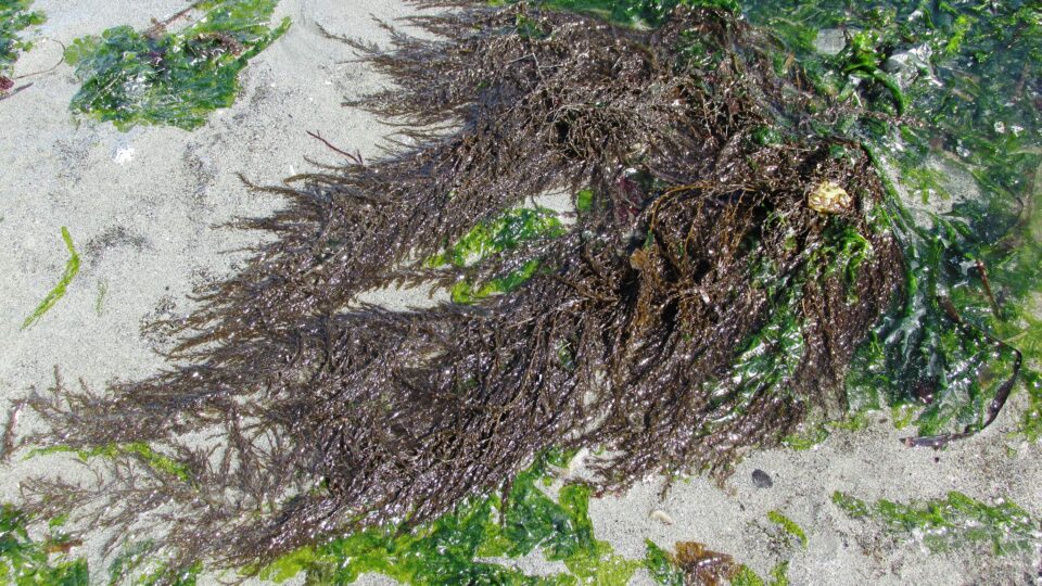
An algal bloom is a rapid increase in the density of algae in an aquatic system.  Harmful algal blooms occur when bodies of water get overloaded with nitrogen and phosphorus runoff from agriculture and other human activities. These excess nutrients can facilitate the out-of-control growth of cyanobacteria, also known as blue-green algae. 

Some species of blue-green algae produce a toxin called microcystin.  These toxins pose a serious health hazard to people, animals, and the environment.  Microcystin affects liver function and can cause death in animals, as well as humans in rare instances.  A notable incident occurred in the summer of 2014, when cyanobacteria contamination in Lake Erie left 500,000 residents in Ohio and Michigan without water for 72 hours and sickened more than 100 people. 

According to a study led by researchers from Carnegie Science, as climate change warms the earth, higher-latitude regions will be at a greater risk for microcystin produced by algal blooms.  The study found water temperatures of 68 to 77 degrees Fahrenheit as being at the greatest risk for developing dangerous levels of microcystin. 

In the study, which was published in the journal Nature Water, the research team also demonstrated that the areas most susceptible to high toxin concentrations will continue to move northward. And in some areas, researchers say the relative risk of exceeding water quality guidelines will increase by up to 50% in the coming decades.

The research team hopes its findings raise more awareness about water sustainability, and the need to focus on the quality of the water as much as the quantity of water. 

**********

Web Links

Geographic redistribution of microcystin hotspots in response to climate warming

Photo, posted October 27, 2010, courtesy of Nara Souza / Florida Fish and Wildlife Commission via Flickr.

Earth Wise is a production of WAMC Northeast Public Radio

Wildfires and water quality

August 11, 2025 By EarthWise Leave a Comment

Wildfires affect water quality long after the flames are out

Hotter and drier conditions driven by climate change are leading to an increasing number of wildfires in North America and around the world. The damage wildfires cause – to forests, homes, and communities – is well-known. But long after the flames are gone, the effects can linger, especially in rivers and streams, where water quality may suffer for years.

A new study by scientists at the CIRES institute at the University of Colorado Boulder analyzed more than 100,000 water samples from more than 500 sites across the Western U.S. and found that wildfires can degrade water quality for up to eight years after a fire. The research, which was recently published in the journal Nature Communications Earth & Environment, found elevated levels of organic carbon, nitrogen, phosphorus, sediment, and turbidity – the cloudiness of water – in basins affected by fire.

This large-scale analysis reveals watersheds take longer to recover from wildfires than previously thought, with widespread, long-lasting impacts often going undetected for years.

Organic carbon, phosphorus, and turbidity remain elevated for one to five years after a fire. Nitrogen and sediment levels stay notably high for up to eight years. Fire-driven impacts are worse in more forested areas.

Each watershed in the study responded differently depending on local conditions.  In some places, sediment levels surged to as much as 2,000 times normal levels, while others remained relatively unchanged.

The research team hopes its findings can help guide future planning efforts to improve wildfire resilience.

**********

Web Links

Wildfires threaten water quality for years after they burn

Photo, posted April 6, 2017, courtesy of Bonnie Moreland via Flickr.

Earth Wise is a production of WAMC Northeast Public Radio

The World’s Largest Harmful Algal Bloom | Earth Wise

July 1, 2021 By EarthWise Leave a Comment

Increase in nitrogen is leading to an explosion of brown sargassum seaweed

Brown sargassum seaweed floats in surface water in a bloom that stretches all the way from West Africa to the Gulf of Mexico.  Sargassum provides habitat for turtles, crabs, fish, and birds.

The stuff carpets beaches along the tropical Atlantic, the Caribbean Sea, the Gulf of Mexico, and the east coast of Florida disrupting tourism.  Florida’s Miami-Dade County alone spends $45 million a year cleaning up sargassum.  Annual Caribbean clean-up is in excess of $120 million.

A study by Florida Atlantic University has discovered dramatic changes in the chemistry and composition of sargassum which has transformed the so-called Great Atlantic Sargassum Belt into a toxic dead zone.

The findings of the study suggest that increased nitrogen availability from both natural and human-generated sources, including sewage, is supporting blooms of sargassum and turning a critical marine nursery habitat into harmful algal blooms with catastrophic impacts on coastal ecosystems, economies, and human health.

The study found that today’s sargassum tissues compared with those of the 1980s have 35% more nitrogen content and 42% less phosphorus.  Much of the nitrogen increase is a result of agricultural and industrial runoff from the Congo, Amazon, and Mississippi Rivers. 

The fact that the bloom itself has expanded so tremendously was already suspected to be the result of significant changes in the ocean’s chemistry.  Given the negative effect that the Great Atlantic Sargassum Belt is having on the coastal communities, additional research is essential to guide mitigation and adaptation efforts.

**********

Web Links

Sargassum now world’s largest harmful algal bloom due to nitrogen

Photo, posted June 5, 2016, courtesy of J Brew via Flickr.

Earth Wise is a production of WAMC Northeast Public Radio.

Working Forest Buffers | Earth Wise

April 15, 2020 By EarthWise Leave a Comment

Forest Buffer Zones on Farms

More than 100,000 miles of U.S. rivers and streams are polluted by nitrogen and phosphorus, mostly from agricultural runoff.  In the past, forests grew naturally alongside these waterways and helped stabilize stream banks and decrease flooding while trapping and filtering pollutants.  But most of these forests have been cut down to make way for towns, cities, livestock, and crops.

Farmers are reluctant to retire valuable farmland with non-productive buffer planting.  But in Pennsylvania, there is an innovative program that encourages farmers to plant cash crops in waterway buffer zones that can help stabilize stream banks and clean up the waterways.  These plantings are called working buffers.

Strips of streamside land are replanted with native floodplain trees and shrubs.  These are known as riparian forest buffers.  Pennsylvania has instituted a grant program under which farmers and landowners plant these buffers and turn a profit.

Many of these buffers have three zones.  A conventional forest buffer that can be just 15 feet wide is composed of native woodland and stabilizes the bank with tree roots and enhances wildlife habitat.  A second zone, some 20 feet wide, is planted with trees and shrubs that can tolerate periodic flooding.  Apart from slowing floodwater and taking up nutrients, this zone can provide profits by planting trees like black walnut, hazelnut, persimmon, and elderberry.  Only hand harvesting is allowed.  A third zone, adjacent to conventional crop, can contain blueberries, raspberries, and decorative woody florals.

How many farmers can be enticed to create these riparian buffers remains to be seen, but they do represent a way to help farmers to reduce pollution and turn a profit along the way.

**********

Web Links

A Movement Grows to Help Farmers Reduce Pollution and Turn a Profit

Photo, posted March 19, 2010, courtesy of the USDA via Flickr.

Earth Wise is a production of WAMC Northeast Public Radio.

Forecasting A Massive Dead Zone

June 18, 2019 By EarthWise Leave a Comment

The Gulf of Mexico dead zone occurs every summer, and is considered one of the largest dead zones in the world.  This cyclical event occurs where the Mississippi River empties into the Gulf of Mexico, just off the coast of Louisiana and Texas. 

This annual dead zone is primarily caused by excess nutrient pollution from human activities, such as urbanization and agriculture, occurring throughout the Mississippi River watershed.  Washed off the land by spring rains, these excess nutrients stimulate an overgrowth of algae once they reach the Gulf of Mexico.  The algae in the Gulf eventually die, and then sink and decompose in the water. The resulting area of the ocean ends up with a condition known as hypoxia, which is an insufficient amount of oxygen to support most marine life.  In hypoxic or dead zones, animals that can’t swim away will often suffocate and die. 

Scientists from the National Oceanic and Atmospheric Administration estimate that this year the dead zone in the Gulf of Mexico will be approximately 8,000 square miles, which is roughly the size of Massachusetts.  The research team uses U.S. Geological Survey river flow and nutrient data to make its forecast. 

According to NOAA, the abnormally high amount of spring rainfall is a major factor contributing to this year’s dead zone.  Last month, nitrate loads entering the Mississippi River watershed were 18% above the long-term average, and phosphorus loads were about 49% above the long-term average. 

While the 2019 forecast is slightly less than the record size of more than 8,700 square miles set in 2017, it’s still much larger than the five year average size of 5,700. 

**********

Web Links

Very large dead zone forecast for the Gulf of Mexico

Massive 8,000-mile ‘dead zone’ could be one of the gulf’s largest

Photo, posted May 22, 2009, courtesy of Michael McCarthy via Flickr.

Earth Wise is a production of WAMC Northeast Public Radio.

Primary Sidebar

Recent Episodes

  • An uninsurable future
  • Clean energy and jobs
  • Insect declines in remote regions
  • Fossil fuel producing nations ignoring climate goals
  • Trouble for clownfishes

WAMC Northeast Public Radio

WAMC/Northeast Public Radio is a regional public radio network serving parts of seven northeastern states (more...)

Copyright © 2026 ·