• Skip to primary navigation
  • Skip to main content
  • Skip to primary sidebar

Earth Wise

A look at our changing environment.

  • Home
  • About Earth Wise
  • Where to Listen
  • All Articles
  • Show Search
Hide Search
You are here: Home / Archives for meltwater

meltwater

Rivers are drying up

November 4, 2024 By EarthWise Leave a Comment

Rivers are drying up around the world

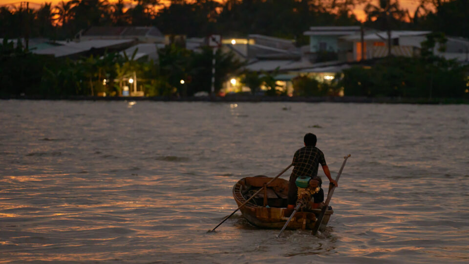
According to a new U.N. report, the world’s rivers had their driest year in at least three decades.  Record heat and droughts in many places contributed to low levels of water in many of the world’s rivers.

The world faces problems of either too much or too little water. The warming climate has fueled both powerful storms with heavy rainfall and intense droughts around the globe. 

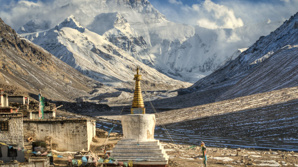
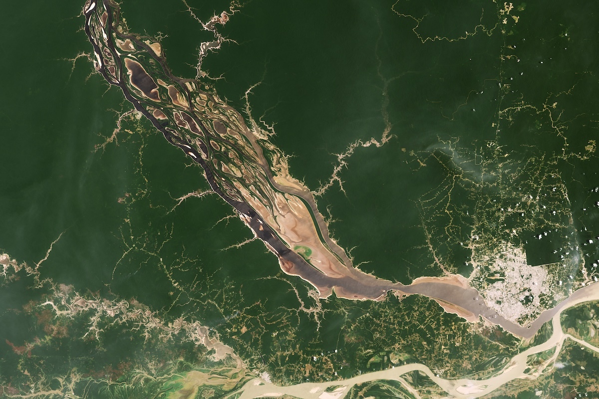
Last year was the hottest year on record, and it’s a record that is unlikely to last long.  The Mississippi River and Amazon River basins were at all-time lows.  Major rivers with headwaters in the Himalayas – the Ganges, Brahmaputra, and Mekong Rivers – were all unusually dry.

According to the World Meteorological Organizations State of Global Water Resources Report, nearly half of the nearly 1,000 rivers tracked around the world had below-normal levels of water.  Only 17% had above-average levels.  Over the past 32 years, on average only a quarter of the rivers monitored had below-normal water levels and last-year’s 45% was the largest ever.

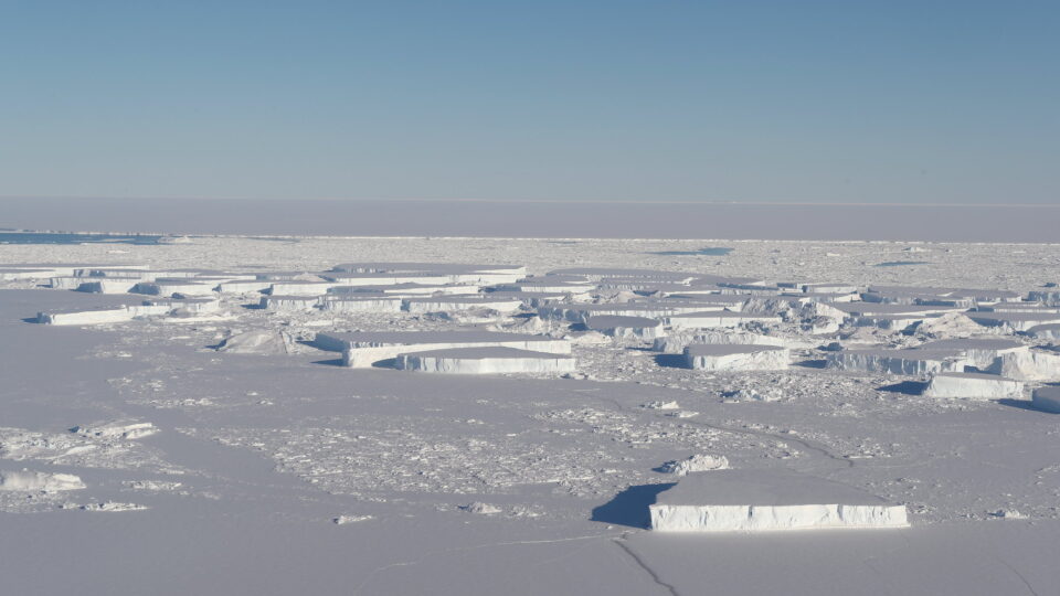
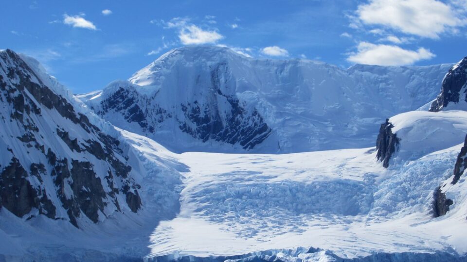
Last year’s severe heat shrank glaciers that are a crucial source of meltwater that feeds rivers.  Glaciers lost more ice last year than they have in at least 50 years.

More than half of the world’s population lives within a couple of miles of a body of fresh water.  The places with the highest population densities around the world are almost all near large rivers.  Rivers provide freshwater for irrigation, consumption, and transportation and are an important source of energy. Historically, they have played an important role in the development of human society.  The shrinking of rivers is a big deal.

**********

Web Links

World’s Rivers Are Driest They Have Been in Decades

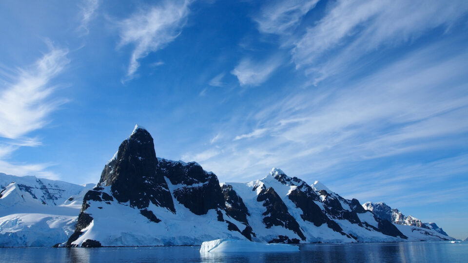
Photo, posted August 22, 2023, courtesy of Radek Kucharski via Flickr.

Earth Wise is a production of WAMC Northeast Public Radio

Last chance tourism

October 3, 2024 By EarthWise Leave a Comment

Glaciers around the world are shrinking or disappearing.  Melting glaciers and ice sheets are the biggest contributors to global sea level rise and ice loss rates are continuing to increase.  Even if the world somehow manages to meet the climate goal of limiting warming to no more than 1.5 degrees Celsius, the world will still lose a quarter of its glacial mass by the year 2100.  At higher levels of warming, most of the world’s glaciers could be gone.

One result of this situation is that people are rushing to see glaciers before they melt.  Places like Iceland are experiencing a booming tourism economy.  Half a million people now visit Iceland for glacier tours every year.  The shrinking and disappearance of glaciers has popularized a new kind of adventure travel called ‘last chance tourism.’

Like other types of adventure travel, glacier tours are not without dangers.  An American tourist visiting a glacial ice cave in an Icelandic national park in August was killed when a frozen arch collapsed.  Ice caves, formed by glacial meltwater, are known for their brilliant blue walls.  Increasing meltwater can make these formations more prone to collapse. 

Glacial tours in Canada’s Jasper National Park are quite popular.  Tour operators have had to reroute trails to the foot of the Athabasca Glacier several times every season because of glacial melt. 

Glacier tourism is a goldmine for the tourist industry but conducting and managing it is increasingly challenging.  Meanwhile, people feel like it’s important to bring their kids to see glaciers because they may be the last generation that can go stand on a glacier.

**********

Web Links

Climate Change Is Making ‘Last Chance Tourism’ More Popular, and Riskier

Photo, posted January 25, 2020, courtesy of Ron Cogswell via Flickr.

Earth Wise is a production of WAMC Northeast Public Radio

Oases and desertification

May 21, 2024 By EarthWise Leave a Comment

Oases are important sources of water for people, plants, and animals in the world’s desert areas.  In fact, oases sustain 10% of the world’s population despite taking up only about 1.5% of land area.  They form when groundwater flows and settles into low-lying areas or when surface meltwater flows down from nearby mountains and pools.

New research from the Chinese Academy of Sciences has found that oases added 85,000 square miles of new area from 1995 to 2020, mostly from artificial expansion projects, but over the same period lost 52,000 square miles from desertification and water scarcity.  The net gain of 33,000 square miles is not considered to be sustainable given that it was mostly due to artificial causes.  The oasis expansion projects were in Asia but losses due to desertification were also mostly in Asia.

Today, oases are found in 37 countries.  Increases in oases mostly come from people intentionally converting desert land into oases using runoff water and groundwater pumping, creating grasslands and croplands. This mostly has taken place in China.

Human over-exploitation of dwindling groundwater can limit the sustainability of oases as can the long-term loss of glaciers.

The study highlighted ways to sustain healthy oases, including suggestions for improving water resource management, promoting sustainable land use and management, and encouraging water conservation and efficient water use.  As the climate continues to change, these efforts will be increasingly important for a significant portion of the world’s population.

**********

Web Links

World’s Oases Threatened By Desertification, Even As Humans Expand Them

Photo, posted August 3, 2008, courtesy of Paul Williams via Flickr.

Earth Wise is a production of WAMC Northeast Public Radio

The end of a supergiant iceberg

November 16, 2023 By EarthWise Leave a Comment

In 2017, a supergiant iceberg known as A-68 calved from the Larsen C ice shelf in Antarctica. In 2020, it drifted close to South Georgia, a British island in the South Atlantic Ocean, and then began to break up.  This iceberg was enormous – nearly the size of Delaware.  When it started to break up, it released huge quantities of fresh, cold meltwater in a relatively small region.

Scientists from the British Antarctic Survey and the University of Sheffield have studied how the melting iceberg has affected the temperature and the salinity of the ocean surface in the area.  They found that the water near the surface was 8 degrees Fahrenheit colder than normal and the water only had about two-thirds of its normal saltiness.

The effects from the melted iceberg eventually extended well beyond South Georgia as the colder, less-salty water was carried by ocean currents to form a long plume that stretched more than 600 miles across the South Atlantic.  It also took several months to disappear.

The calving of this massive iceberg provided a unique opportunity for scientists to study the impact of iceberg melting on surface ocean conditions.  A-68 was one of the largest and most studied of all icebergs.  The study has shown that each individual melting giant iceberg can have widespread and long-lasting impacts on ocean conditions, which has consequences for the plant and animal life that lives there.

Climate change is likely to lead to more giant iceberg calving in the future.  It is important to monitor these events to assess their future impacts on ocean circulation, biology, and even seafloor geology.

**********

Web Links

Supergiant iceberg makes surrounding ocean surface colder and less salty

Photo, posted October 24, 2018, courtesy of Jefferson Beck / NASA via Flickr.

Earth Wise is a production of WAMC Northeast Public Radio

Dangers Of Melting Glaciers | Earth Wise

March 31, 2023 By EarthWise Leave a Comment

The dangers posed by melting glaciers

Some of most dramatic evidence that the Earth’s climate is warming is the retreat and even disappearance of mountain glaciers around the world.  2022 was the 35th year in a row that glaciers tracked by the World Glacier Monitoring Service lost rather than gained ice.  Glaciers gain mass through snowfall and lose mass through melting and sublimation (water evaporating directly from solid ice.)  Some glaciers that terminate in lakes or the ocean lose mass through iceberg calving.

In the warming climate, glaciers retreat and meltwater collects at the front of the glacier forming a lake.  Such lakes can suddenly burst and create a fast-flowing Glacier Lake Outburst Flood that can spread over a large distance from the original site – in some cases over 70 miles.  These floods can damage property, infrastructure, and agricultural land and can also be deadly.

The number of glacial lakes has grown rapidly since 1990 as a result of climate change.  According to research by an international team of scientists led by Newcastle University in the UK, the number of people living in glacial lake catchments has increased significantly.

According to the study, 15 million people live within 30 miles of a glacial lake.  The highest danger is in High Mountain Asia – which encompasses the Tibetan Plateau.  That area, which spans from Kyrgyzstan to parts of China, has 9.3 million people potentially at risk.  India and Pakistan have around 5 million exposed people.

Detailed analysis shows that it is not the areas with the largest number or most rapidly growing lakes that are most dangerous.  It is the number of people in proximity to the lakes and their ability to cope with potential floods.

**********

Web Links

Glacial flooding threatens millions globally

Photo, posted February 12, 2022, courtesy of David Stanley via Flickr.

Earth Wise is a production of WAMC Northeast Public Radio

Dangers Of Thawing Permafrost | Earth Wise

April 12, 2022 By EarthWise Leave a Comment

The danger thawing permafrost poses

The thawing of the permafrost in the Arctic is a major concern from the standpoint of the potential release of enormous amounts of carbon dioxide trapped in it.  There are nearly 2,000 billion tons of carbon there, which is as much as humanity releases into the atmosphere in 50 years.  But greenhouse gases are not the only danger posed by permafrost thawing.  There are also microbes, unknown viruses, and chemicals that could be very dangerous.

More than 100 diverse microorganisms in Siberia’s deep permafrost have been found to be antibiotic resistant.  The deep permafrost is one of the few environments on Earth that have not been exposed to modern antibiotics.  As the permafrost thaws, its bacteria could mix with meltwater and create new antibiotic-resistant strains.

By-products of fossil fuels – introduced into permafrost environments since the beginning of the industrial revolution – are present.  Metal deposits including arsenic, mercury, and nickel, have been mined for decades and have contaminated large areas.

Now-banned pollutants and chemicals – including DDT – came to the Arctic through the atmosphere and over time have become trapped in the permafrost.

There is now ongoing research further characterizing the microbes frozen in permafrost and providing more precise measurement of emissions hotspots in permafrost regions.  Scientists are increasingly turning to integrated Earth observations from the ground, the air, and space.

There are models that predict the gradual release of emissions from permafrost over the next century.  Other models say it could happen within just a few years.  The worst-case scenario would be utterly catastrophic but none of the scenarios portend anything good.

**********

Web Links

Thawing Permafrost Could Leach Microbes, Chemicals Into Environment

Photo, posted February 9, 2017, courtesy of Benjamin Jones/USGS via Flickr.

Earth Wise is a production of WAMC Northeast Public Radio.

Climate Change On Mount Everest | Earth Wise

March 21, 2022 By EarthWise Leave a Comment

Climate change has shown up in the highest place on Earth.  The highest glacier on Mount Everest is rapidly retreating with rising temperatures.

New research by an international team led by the University of Maine and published in the journal Climate and Atmospheric Science has determined that the South Col Glacier atop Mount Everest has shrunk by half since the 1990s.   Its ice mass has thinned by an estimated 180 feet.

The glacier used to be covered by snow, which reflected the sun’s light and insulated the mass of ice under the snow.  But warmer temperatures, lower humidity, and more severe winds have eliminated the snow cover, fueling the decline of the glacier.

The study of the South Col Glacier highlights the critical balance created by snow-covered surfaces and exposes the potential for loss throughout high mountain glacier systems as snow cover is depleted by warming temperatures.  When even the highest glacier on Mount Everest is impacted, it is clear that no place is safe from the warming climate.

The human significance of this development is substantial.  More than 200 million people in Asia depend on meltwater from glaciers in the high mountains of the continent for their freshwater needs.  But now glaciers in the mountains are melting faster than they can be replenished by snowfall.

As for Mount Everest itself, future expeditions on the mountain will face new challenges as glacier melting causes more avalanches and climbers accustomed to digging into ice and snow will need to scale more exposed bedrock.  Climate predictions for the Himalaya in general all anticipate continued warming and continued loss of glacier mass.

**********

Web Links

Climate Change Has Reached the Top of Mount Everest, Thinning Its Highest Glacier

Photo, posted October 27, 2011, courtesy of Goran Hogland via Flickr.

Earth Wise is a production of WAMC Northeast Public Radio.

The Caspian Sea And Climate Change | Earth Wise

January 22, 2021 By EarthWise Leave a Comment

Climate change will lower water levels in the Caspian Sea

According to the National Oceanic and Atmospheric Administration, global sea levels have been rising over the past century, and the rate has increased in recent decades.  Sea levels are currently rising about one-eighth of an inch every year.

Sea level rise is caused primarily by two factors related to climate change:  the added water from melting glaciers and ice sheets, and the expansion of seawater as it warms.  While climate change is causing global sea levels to rise, higher temperatures in other regions are having exactly the opposite effect.  The water levels are falling.

According to researchers from the University of Bremen in Germany, the Caspian Sea is a perfect example of how a body of water will change.  While it is named a sea due to its size and high salinity, the Caspian Sea is actually a lake.  In fact, it’s the largest lake in the world.  Its largest inflow is the Volga River and it has no natural connection to the ocean.  Its water level is determined by the proportional influences of inflow, precipitation, and evaporation.  Climate change is causing increased evaporation, which leads to a declining water level. 

According to the research team, the water level of the Caspian Sea could fall by 29 to 59 feet during this century.

The Caspian Sea is surrounded by Kazakhstan, Turkmenistan, Iran, Azerbaijan and Russia.  It’s an important regional water reservoir, and a biological and commercial center. 

The researchers hope the Caspian Sea will be used as an example in scientific research to assess the vulnerability of other regions to falling water levels.

********** 

Web Links

Climate crisis is causing lakes to shrink

Photo, posted October 31, 2016, courtesy of Amanderson2 via Flickr.

Earth Wise is a production of WAMC Northeast Public Radio.

Antarctica’s Hot Summer | Earth Wise

May 1, 2020 By EarthWise Leave a Comment

Extreme heat in Antarctica

The Southern Hemisphere’s recent summer brought drought, heatwaves and bush-fires that ravaged Australia.  At the same time, Antarctica experienced a summer of extreme weather.

In East Antarctica, the Casey research station in the Australian Antarctic Territory had its first heatwave event, recording extreme maximum and minimum temperatures over three consecutive days in January.  Record high temperatures were also reported at bases on the Antarctic Peninsula.

The Casey station recorded a record high maximum temperature of 49 degrees Fahrenheit and a record overnight low of 36 degrees.  In February, Brazilian scientists reported a high temperature of 69 degrees at Marambio, an all-time record for Antarctica.

Ecologists say that the hot summer would most likely lead to long-term disruption of local populations, communities, and the broader ecosystem.  That disruption could be both positive and negative.

Most life in Antarctica exists in small ice-free oases and depends on melting snow and ice for a water supply.  Melt water from the warming temperatures will lead to increased growth and reproduction of mosses, lichens, microbes and invertebrates.

However, excessive flooding can dislodge plants and alter the composition of communities of invertebrates and microbial mats. If the ice completely melts early in the season, then ecosystems will suffer drought for the rest of the season.

Extreme events often have impacts for years after the event.  There will be long-term studies of the areas affected by the recent Antarctic heat wave. Such extreme events associated with global climate change are predicted to increase in frequency and impact, and even the most remote areas of the planet are not immune to them.

**********

Web Links

Antarctica’s summer of extreme heat

Photo, posted January 30, 2014, courtesy of Andreas Kambanis via Flickr

Earth Wise is a production of WAMC Northeast Public Radio.

Ice Melt In Greenland

March 12, 2019 By EarthWise 1 Comment

A new study published in the Proceedings of the National Academy of Sciences warns that Greenland’s ice Is melting much faster than previously thought.  The ice loss rapidly accelerated around 2002-2003 and by 2012 the annual loss was nearly four times the rate in 2003.

Most of the new ice melt is in southwest Greenland, a part of the island that wasn’t known to be losing ice that rapidly and is not where most of the large glaciers are in Greenland.  The loss is coming from the land-fast ice sheet itself.

Data from NASA satellites and GPS stations scattered around Greenland’s coast shows that between 2002 and 2016, Greenland lost approximately 280 billion tons of ice per year.  That is enough melt to cover the entire states of Florida and New York hip deep in meltwater, as well as drowning Washington, D.C. and one or two other small states.

Global warming of just 1 degree Celsius is the main driver behind this massive meltdown of ice.  The temperature rise coupled with a negative phase of the North Atlantic Oscillation causes rapid surface melt of the ice sheet during summers.  The Oscillation is a natural, irregular change in atmospheric pressure that brings warm, sunny weather to the western side of Greenland during its negative phase.

The Greenland ice sheet is 2 miles thick in some places and contains enough ice to raise sea levels 23 feet if it all melted.  The melting Greenland ice is already slowing the Gulf Stream, which is wreaking havoc with European weather.  If we don’t get a handle on global temperature rise, things are only going to get worse.

**********

Web Links

Greenland’s ice is melting four times faster than thought—what it means

Photo, posted April 21, 2017, courtesy of Markus Trienke via Flickr.

Earth Wise is a production of WAMC Northeast Public Radio.

Primary Sidebar

Recent Episodes

  • An uninsurable future
  • Clean energy and jobs
  • Insect declines in remote regions
  • Fossil fuel producing nations ignoring climate goals
  • Trouble for clownfishes

WAMC Northeast Public Radio

WAMC/Northeast Public Radio is a regional public radio network serving parts of seven northeastern states (more...)

Copyright © 2026 ·