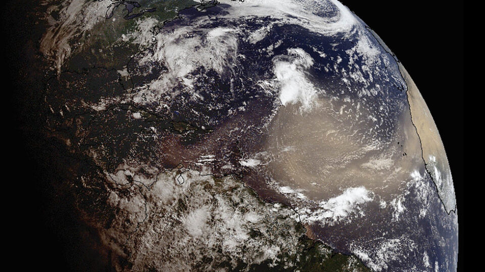
A vast cloud of dust from the Sahara Desert blanketed the Caribbean in late June before drifting across the southeastern U.S. The phenomenon is nothing new; only the magnitude of the occurrence this time around was unusual. According to experts, this is the most significant Sahara dust event in 50 years.
The Sahara Desert is the major source on Earth of mineral dust, with some 60-200 million tons of it per year being lifted into the atmosphere. Convection currents over hot desert areas lift the dust to very high altitudes. From there, it can be transported worldwide by winds. The dust, combined with the extremely hot, dry air of the Sahara Desert often forms an atmospheric layer called the Saharan Air Layer, which can have significant effects on tropical weather by interfering with the development of hurricanes. The Saharan Air Layer typically moves across the North Atlantic every three to five days from late spring to early fall, peaking in the middle of the summer. It can occupy a layer as much as two miles thick in the atmosphere.
The dust plume this summer was highly visible from space, covering thousands of miles of the Atlantic Ocean and the Caribbean Sea.
A common effect of Sahara dust is that normally blue skies can acquire a milky haze, but beyond that can lead to spectacular sunsets. But apart from the visual spectacle, the dust can aggravate the conditions of people with asthma, respiratory illnesses, and allergies. On the positive side, as long as the dust is around, it is much less likely that tropical storms and hurricanes will form.
**********
Web Links
Sahara dust blankets Caribbean, air quality hazardous
Photo, posted June 22, 2020, courtesy of Sagar Rana via Flickr.
Earth Wise is a production of WAMC Northeast Public Radio.
